The Moelwyns area of Snowdonia National Park - a fully detailed list of all the Mountains, Peaks, Tops and Hills
The Moelwyns area of Snowdonia National Park in Conwy and Gwynedd is enclosed by:
- The A498 via Llyn Gwynant, Nant Gwynant, Llyn Dinas & Dyffryn Mymbyr to the North West
- Capel Curig and Betws-y-Coed to the North
- Afon Machno to the East & South East
- The Vale of Ffestinog to the South
- The A4085 from Penrhyndeudraeth to Beddgelert to the West
If you include just the Mountains (Hewitts) and the Nuttalls there are 15 tops to climb, bag & conquer and the highest point is Carnedd Moel Siabod at 872m (2,861ft).
To see these Mountains, Peaks, Tops and Hills displayed in different ways - see the options in the left-hand column and towards the bottom of this page.
![]() Your Personal Bagging Record for The Moelwyns area of Snowdonia
Your Personal Bagging Record for The Moelwyns area of Snowdonia
LOG ON and RELOAD this page to show which Mountains, Peaks, Tops and Hills you have already climbed, bagged & conquered [. . . more details]
See this list in: Alphabetical Order‡
| Height Order
To reverse the order select the link again.
Mountain, Peak, Top or Hill:
Bagged

![]()
1. Allt-fawr (Moelwyns)
698m (2,291ft)
Allt-fawr (Moelwyns) is on interactive maps:
Allt-fawr (Moelwyns) is on downloadable PDF you can Print or Save to your Phone: |
![]()
2. Carnedd Moel Siabod
872m (2,861ft)
Carnedd Moel Siabod is on interactive maps:
Carnedd Moel Siabod is on downloadable PDF you can Print or Save to your Phone: |
![]()
3. Cnicht
689m (2,260ft)
Cnicht is on interactive maps:
Cnicht is on downloadable PDF you can Print or Save to your Phone: |

![]()
4. Cnicht (North Top)
688m (2,257ft)
Cnicht (North Top) is on interactive maps:
Cnicht (North Top) is on downloadable PDF you can Print or Save to your Phone: |
![]()
5. Craigysgafn
689m (2,263ft)
Craigysgafn is on interactive maps:
Craigysgafn is on downloadable PDF you can Print or Save to your Phone: |
![]()
6. Manod Mawr
661m (2,169ft)
Manod Mawr is on interactive maps:
Manod Mawr is on downloadable PDF you can Print or Save to your Phone: |
![]()
7. Manod Mawr (North Top)
658m (2,160ft)
Manod Mawr (North Top) is on interactive maps:
Manod Mawr (North Top) is on downloadable PDF you can Print or Save to your Phone: |
![]()
8. Moel Druman
676m (2,219ft)
Moel Druman is on interactive maps:
Moel Druman is on downloadable PDF you can Print or Save to your Phone: |
![]()
9. Moel Penamnen
628m (2,061ft)
Moel Penamnen is on interactive maps:
Moel Penamnen is on downloadable PDF you can Print or Save to your Phone: |
![]()
10. Moel-yr-hydd
648m (2,127ft)
Moel-yr-hydd is on interactive maps:
Moel-yr-hydd is on downloadable PDF you can Print or Save to your Phone: |
![]()
11. Moelwyn Bach
710m (2,330ft)
Moelwyn Bach is on interactive maps:
Moelwyn Bach is on downloadable PDF you can Print or Save to your Phone: |
![]()
12. Moelwyn Mawr
770m (2,527ft)
Moelwyn Mawr is on interactive maps:
Moelwyn Mawr is on downloadable PDF you can Print or Save to your Phone: |
![]()
13. Ysgafell Wen
672m (2,206ft)
Ysgafell Wen is on interactive maps:
Ysgafell Wen is on downloadable PDF you can Print or Save to your Phone: |
![]()
14. Ysgafell Wen (Far North Top)
659m (2,162ft)
Ysgafell Wen (Far North Top) is on interactive maps:
Ysgafell Wen (Far North Top) is on downloadable PDF you can Print or Save to your Phone: |
![]()
15. Ysgafell Wen (North Top)
669m (2,195ft)
Ysgafell Wen (North Top) is on interactive maps:
Ysgafell Wen (North Top) is on downloadable PDF you can Print or Save to your Phone: |
View these 15 Mountains, Peaks, Tops and Hills:
- On a Downloadable PDF you can Print or Save to your Phone#
- On an Interactive Google Map with a list of tops below it.
(makes it easier to locate a particular top) - On a Detailed List in:
Alphabetical Order | Height Order - On one page with 'yet-to-be-bagged' listed 1st
& then 'already-bagged' tops listed 2nd in:
Alphabetical Order | Height Order - On one page with 'already-bagged' tops listed 1st
& then 'yet-to-be-bagged' tops listed 2nd in:
Alphabetical Order | Height Order
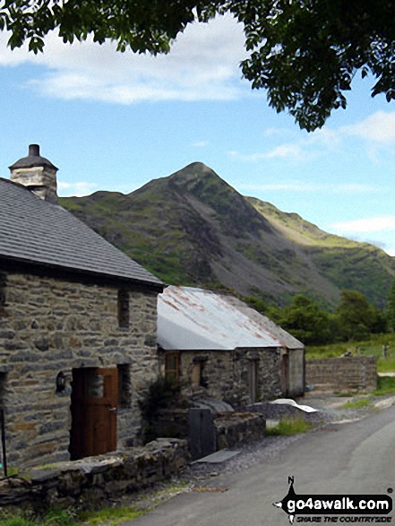
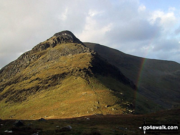
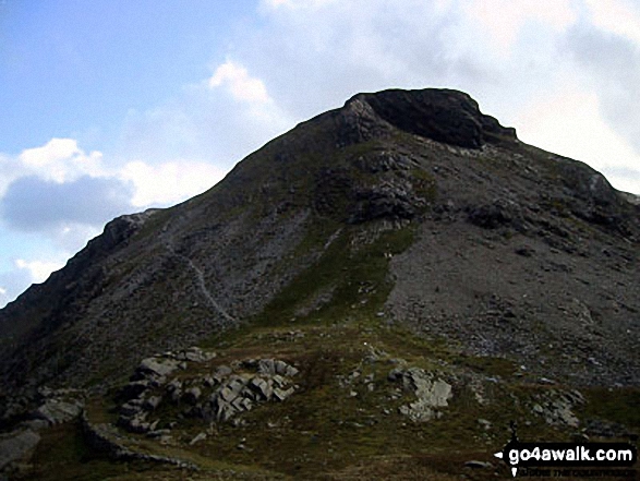
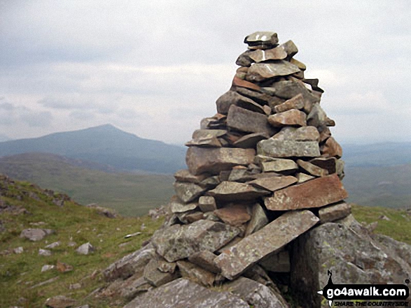
 Carnedd Moel Siabod in The Moelwyns area of Snowdonia
Photo: Davie Naylor
# Whether you print a copy or download it to your phone, this Peak Baggers' Map will prove incredibly useful if you want to know what's what when you are up in the mountains and cannot get a phone signal.
Is there a Mountain, Peak, Top or Hill missing from the above google map or list?
Let us know an we will add it to our database.

To contribute to go4awalk.com or to contact us about anything at all - see Talk To Us.
For help see Help.
go4awalk.com and go4awalk.co.uk are registered trademarks of TMDH Limited.
Copyright © 2000-2026 TMDH Limited. All rights reserved.
Copyright Terms & Conditions Privacy Statement
A - Z Walks Home Log On/Accounts Photo Gallery Walk Ideas and Collections Fell Facts Hill Skills Walking Questions and Answers Your Stories News Competitions Product Reviews/Gear Tests Walking Gear Guides Peaks and Mountains Peak Bagging Find New Walking Friends Camping GPS Waypoints for Walking Contents Walk Search Talk To Us go4awalk.com Help Free Example Walks Newsletter