The Mountains, Peaks, Tops and Hills in The Berwyns area of Snowdonia, Denbighshire, Gwynedd, Powys and Wrexham, with all the tops you have already bagged in first & then the ones you are yet to climb second.
The Berwyns area of Snowdonia National Park, Denbighshire, Gwynedd, Powys and Wrexham, is the area enclosed by:
- The A494 from Llanuwchllyn to Druid to the North West
- The A5 to Chirk (Y Waun) to the North
- The border between Wales and England to Llynclys to the East
- The A495 to Bwlch-y-cibau, the A490 to Llanfyllin, then the B4393 to Llyn Efymwy & then a minor road to Bwlch y Groes to the South
- Cwm Cynllwyd to Llanuwchllyn to the South West
If you count only the Mountains (Hewitts) there are 14 tops to climb, bag & conquer and the highest point is Cadair Berwyn at 832m (2,730ft).
To see these Mountains, Peaks, Tops and Hills displayed in different ways - see the options in the left-hand column and towards the bottom of this page.
![]() Your Personal Bagging Record for The Berwyns area of Snowdonia
Your Personal Bagging Record for The Berwyns area of Snowdonia
LOG ON and RELOAD this page to show which Mountains, Peaks, Tops and Hills you have already climbed, bagged & conquered [. . . more details]
Scroll down this list of mountains, peaks, tops & hills below and tap/click on each name (in blue) to locate it on the map above.
See this list in: Alphabetical Order‡ | Height Order
To reverse the order select the link again.
Mountain, Peak, Top or Hill already bagged:
Bagged
Top yet to be climbed, bagged & conquered:
Bagged

![]()
1. Cadair Berwyn
832m (2730ft)
Mountain (Hewitt)
See more details, photos, trip reports and easy-to-follow walks up Cadair Berwyn
![]()
2. Cadair Bronwen
783m (2570ft)
Mountain (Hewitt)
See more details, photos, trip reports and easy-to-follow walks up Cadair Bronwen
![]()
3. Foel Cedig
668m (2192ft)
Mountain (Hewitt)
See more details, photos, trip reports and easy-to-follow walks up Foel Cedig
![]()
4. Foel Cwm-Sian Llwyd
648m (2127ft)
Mountain (Hewitt)
See more details, photos, trip reports and easy-to-follow walks up Foel Cwm-Sian Llwyd
![]()
5. Foel Goch (Berwyns)
612m (2010ft)
Mountain (Hewitt)
See more details, photos, trip reports and easy-to-follow walks up Foel Goch (Berwyns)
![]()
6. Foel Wen
691m (2267ft)
Mountain (Hewitt)
See more details, photos, trip reports and easy-to-follow walks up Foel Wen
![]()
7. Foel y Geifr (Berwyns)
626m (2055ft)
Mountain (Hewitt)
See more details, photos, trip reports and easy-to-follow walks up Foel y Geifr (Berwyns)
![]()
8. Moel Fferna
630m (2067ft)
Mountain (Hewitt)
See more details, photos, trip reports and easy-to-follow walks up Moel Fferna
![]()
9. Moel Sych
827m (2712ft)
Mountain (Hewitt)
See more details, photos, trip reports and easy-to-follow walks up Moel Sych
![]()
10. Moel y Cerrig Duon
625m (2051ft)
Mountain (Hewitt)
See more details, photos, trip reports and easy-to-follow walks up Moel y Cerrig Duon
![]()
11. Mynydd Tarw
681m (2235ft)
Mountain (Hewitt)
See more details, photos, trip reports and easy-to-follow walks up Mynydd Tarw
![]()
12. Pen Bwlch Llandrillo Top
621m (2038ft)
Mountain (Hewitt)
See more details, photos, trip reports and easy-to-follow walks up Pen Bwlch Llandrillo Top
![]()
13. Pen y Boncyn Trefeilw
646m (2120ft)
Mountain (Hewitt)
See more details, photos, trip reports and easy-to-follow walks up Pen y Boncyn Trefeilw
![]()
14. Post Gwyn
665m (2182ft)
Mountain (Hewitt)
See more details, photos, trip reports and easy-to-follow walks up Post Gwyn
![]() Your Personal Bagging Record for The Berwyns area of Snowdonia
Your Personal Bagging Record for The Berwyns area of Snowdonia
LOG ON and RELOAD this page to show which Mountains, Peaks, Tops and Hills you have already climbed, bagged & conquered [. . . more details]
View these 14 Mountains, Peaks, Tops and Hills:
- On a Downloadable PDF you can Print or Save to your Phone#
- On an Interactive Google Map with a list of tops below it.
(makes it easier to locate a particular top) - On a Detailed List in:
Alphabetical Order | Height Order - On one page with 'yet-to-be-bagged' listed 1st
& then 'already-bagged' tops listed 2nd in:
Alphabetical Order | Height Order - On one page with 'already-bagged' tops listed 1st
& then 'yet-to-be-bagged' tops listed 2nd in:
Alphabetical Order | Height Order
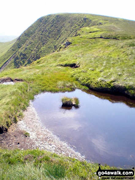 Cadair Berwyn in The Berwyns area of Snowdonia
Photo: John Greaves
# Whether you print a copy or download it to your phone, this Peak Baggers' Map will prove incredibly useful if you want to know what's what when you are up in the mountains and cannot get a phone signal.
Is there a Mountain, Peak, Top or Hill missing from the above google map or list?