All The Mountains, Peaks, Tops and Hills in the North West region of England as a detailed list (Page 13 of 16)

The North West region of England comprises the traditional counties of Cheshire, Cumbria, Greater Manchester, Lancashire and Mersyside and includes The Lake District National Park, The Forest of Bowland, parts of The Yorkshire Dales National Park and parts of the Peak District National Park.


If you include all the Mountains (Hewitts), the Deweys, the Nuttalls, the Marilyns, the Bridgets (Hills) and all the Mountains, Tops, Peaks and Hills with a Trig Point on them there are 464 tops to climb, bag & conquer and the highest point is Scafell Pike at 978m (3,210ft).


Wainwright
214/0
Wainwrights

Hewitt
143/0
English
Mountains
Dewey
87/0
English
Deweys
nuttall
210/0
English
Nuttalls
Wainwright Outlying Fell
116/0
Wainwright
Outlying Fells
marilyn
81/0
English
Marilyns
Bridget
123/0
English
Bridgets
Trig Point
154/0
Trig
Points


To see these Mountains, Peaks, Tops and Hills displayed in different ways - see the options in the left-hand column and towards the bottom of this page.


LOG ON and RELOAD this page to show which Mountains, Peaks, Tops and Hills you have already climbed, bagged & conquered [. . . more details]


Page 13 of 16   First Previous 11 12 13 14 15 16


See this list in: Alphabetical Order | Height Order
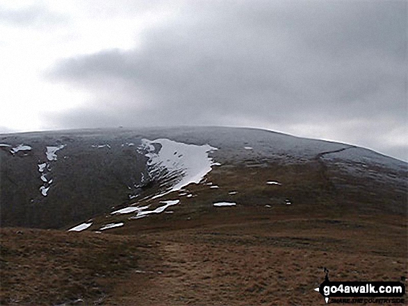
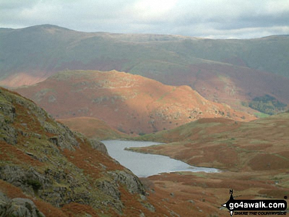
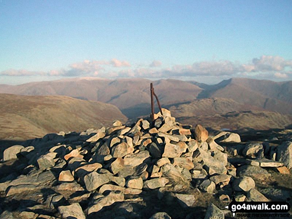
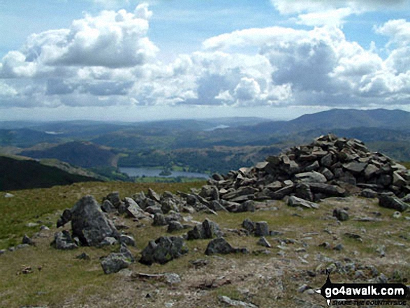
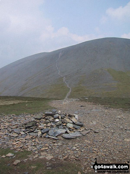
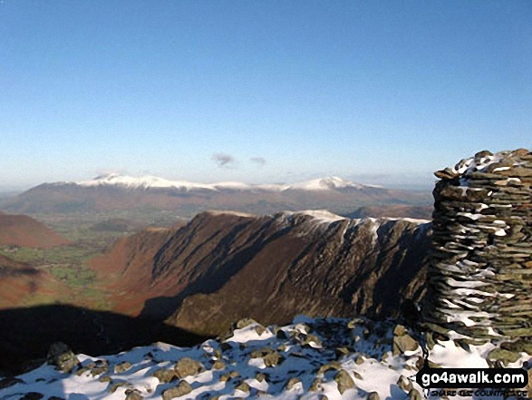
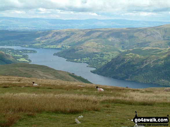
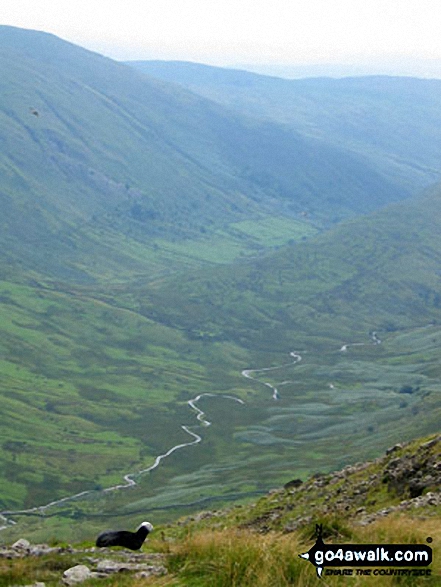
To reverse the order select the link again.


Mountain, Peak, Top or Hill:

Bagged


361. Randerside

722m (2,370ft)

  • Bridget

  • To walk, climb & bag Randerside use either of these easy-to-follow walks:

    Google Maps Icon
    See the location of Randerside and walks up it on a google Map

    Randerside is on interactive maps:

  • OS Explorer (Orange Covers): OL5
  • OS Landranger (Pink Covers): 90

  • Randerside is on downloadable PDF you can Print or Save to your Phone:

    *Version including the walk routes marked on it that you need to follow to Walk all 214 Wainwrights in just 59 walks.


    362. Ullscarf

    723m (2,372ft)

  • Wainwright (No. 74)
  • Mountain (84th in England, 145th in England & Wales)
  • Nuttall (106th in England, 180th in England & Wales)

  • To walk, climb & bag Ullscarf use any of these easy-to-follow walks:

    Google Maps Icon
    See the location of Ullscarf and walks up it on a google Map

    Ullscarf is on interactive maps:

  • OS Explorer (Orange Covers): OL4
  • OS Landranger (Pink Covers): 89 and 90

  • Ullscarf is on downloadable PDF you can Print or Save to your Phone:

    *Version including the walk routes marked on it that you need to follow to Walk all 214 Wainwrights in just 59 walks.


    363. Thunacar Knott

    723m (2,373ft)

  • Wainwright (No. 76)
  • Nuttall (105th in England, 179th in England & Wales)

  • To walk, climb & bag Thunacar Knott use any of these easy-to-follow walks:

    Google Maps Icon
    See the location of Thunacar Knott and walks up it on a google Map

    Thunacar Knott is on interactive maps:

  • OS Explorer (Orange Covers): OL6
  • OS Landranger (Pink Covers): 89 and 90

  • Thunacar Knott is on downloadable PDF you can Print or Save to your Phone:

    *Version including the walk routes marked on it that you need to follow to Walk all 214 Wainwrights in just 59 walks.


    364. Clough Head

    726m (2,383ft)

  • Wainwright (No. 75)
  • Mountain (82nd in England, 141st in England & Wales)
  • Nuttall (103rd in England, 175th in England & Wales)
  • OS Trig Point

  • To walk, climb & bag Clough Head use any of these easy-to-follow walks:

    Google Maps Icon
    See the location of Clough Head and walks up it on a google Map

    Clough Head is on interactive maps:

  • OS Explorer (Orange Covers): OL5
  • OS Landranger (Pink Covers): 90

  • Clough Head is on downloadable PDF you can Print or Save to your Phone:

    *Version including the walk routes marked on it that you need to follow to Walk all 214 Wainwrights in just 59 walks.


    365. Hindscarth

    727m (2,386ft)

  • Wainwright (No. 73)
  • Mountain (81st in England, 139th in England & Wales)
  • Nuttall (102nd in England, 173rd in England & Wales)

  • To walk, climb & bag Hindscarth use any of these easy-to-follow walks:

    Google Maps Icon
    See the location of Hindscarth and walks up it on a google Map

    Hindscarth is on interactive maps:

  • OS Explorer (Orange Covers): OL4
  • OS Landranger (Pink Covers): 89 and 90

  • Hindscarth is on downloadable PDF you can Print or Save to your Phone:

    *Version including the walk routes marked on it that you need to follow to Walk all 214 Wainwrights in just 59 walks.


    366. Kentmere Pike

    730m (2,396ft)

  • Wainwright (No. 72)
  • Mountain (80th in England, 138th in England & Wales)
  • Nuttall (101st in England, 172nd in England & Wales)
  • OS Trig Point

  • To walk, climb & bag Kentmere Pike use either of these easy-to-follow walks:

    Google Maps Icon
    See the location of Kentmere Pike and walks up it on a google Map

    Kentmere Pike is on interactive maps:

  • OS Explorer (Orange Covers): OL7
  • OS Landranger (Pink Covers): 90

  • Kentmere Pike is on downloadable PDF you can Print or Save to your Phone:

    *Version including the walk routes marked on it that you need to follow to Walk all 214 Wainwrights in just 59 walks.


    367. Codale Head

    732m (2,402ft)

  • Nuttall (100th in England, 171st in England & Wales)

  • To walk, climb & bag Codale Head use either of these easy-to-follow walks:

    Google Maps Icon
    See the location of Codale Head and walks up it on a google Map

    Codale Head is on interactive maps:

  • OS Explorer (Orange Covers): OL4 and OL6
  • OS Landranger (Pink Covers): 89 and 90

  • Codale Head is on downloadable PDF you can Print or Save to your Phone:

    *Version including the walk routes marked on it that you need to follow to Walk all 214 Wainwrights in just 59 walks.


    368. Little Gowder Crag

    733m (2,406ft)

  • Nuttall (99th in England, 170th in England & Wales)

  • To walk, climb & bag Little Gowder Crag use either of these easy-to-follow walks:

    Google Maps Icon
    See the location of Little Gowder Crag and walks up it on a google Map

    Little Gowder Crag is on interactive maps:

  • OS Explorer (Orange Covers): OL4
  • OS Landranger (Pink Covers): 89

  • Little Gowder Crag is on downloadable PDF you can Print or Save to your Phone:

    *Version including the walk routes marked on it that you need to follow to Walk all 214 Wainwrights in just 59 walks.


    369. Low White Stones

    733m (2,406ft)

  • Bridget

  • To walk, climb & bag Low White Stones use any of these easy-to-follow walks:

    Google Maps Icon
    See the location of Low White Stones and walks up it on a google Map

    Low White Stones is on interactive maps:

  • OS Explorer (Orange Covers): OL4 and OL6
  • OS Landranger (Pink Covers): 89 and 90

  • Low White Stones is on downloadable PDF you can Print or Save to your Phone:

    *Version including the walk routes marked on it that you need to follow to Walk all 214 Wainwrights in just 59 walks.


    370. Long Side

    734m (2,409ft)

  • Wainwright (No. 71)
  • Mountain (79th in England, 136th in England & Wales)
  • Nuttall (98th in England, 168th in England & Wales)

  • To walk, climb & bag Long Side use any of these easy-to-follow walks:

    Google Maps Icon
    See the location of Long Side and walks up it on a google Map

    Long Side is on interactive maps:

  • OS Explorer (Orange Covers): OL4
  • OS Landranger (Pink Covers): 89 and 90

  • Long Side is on downloadable PDF you can Print or Save to your Phone:

    *Version including the walk routes marked on it that you need to follow to Walk all 214 Wainwrights in just 59 walks.


    371. Combe Head

    735m (2,412ft)

  • Mountain (78th in England, 133rd in England & Wales)
  • Nuttall (97th in England, 164th in England & Wales)
  • Combe Head was reclassified as a Hewitt in January, 2020.


    To walk, climb & bag Combe Head use either of these easy-to-follow walks:

    Google Maps Icon
    See the location of Combe Head and walks up it on a google Map

    Combe Head is on interactive maps:

  • OS Explorer (Orange Covers): OL6
  • OS Landranger (Pink Covers): 89 and 90

  • Combe Head is on downloadable PDF you can Print or Save to your Phone:

    *Version including the walk routes marked on it that you need to follow to Walk all 214 Wainwrights in just 59 walks.


    372. Harrison Stickle

    736m (2,415ft)

  • Wainwright (No. 70)
  • Mountain (77th in England, 132nd in England & Wales)
  • Nuttall (96th in England, 163rd in England & Wales)

  • To walk, climb & bag Harrison Stickle use any of these easy-to-follow walks:

    Google Maps Icon
    See the location of Harrison Stickle and walks up it on a google Map

    Harrison Stickle is on interactive maps:

  • OS Explorer (Orange Covers): OL6
  • OS Landranger (Pink Covers): 89 and 90

  • Harrison Stickle is on downloadable PDF you can Print or Save to your Phone:

    *Version including the walk routes marked on it that you need to follow to Walk all 214 Wainwrights in just 59 walks.


    373. Seat Sandal

    736m (2,417ft)

  • Wainwright (No. 68)
  • Mountain (75th in England, 130th in England & Wales)
  • Nuttall (94th in England, 161st in England & Wales)
  • Marilyn (24th in England, 512th in GB)

  • To walk, climb & bag Seat Sandal use any of these easy-to-follow walks:

    Google Maps Icon
    See the location of Seat Sandal and walks up it on a google Map

    Seat Sandal is on interactive maps:

  • OS Explorer (Orange Covers): OL5
  • OS Landranger (Pink Covers): 90

  • Seat Sandal is on downloadable PDF you can Print or Save to your Phone:

    *Version including the walk routes marked on it that you need to follow to Walk all 214 Wainwrights in just 59 walks.


    374. Robinson

    737m (2,419ft)

  • Wainwright (No. 67)
  • Mountain (74th in England, 129th in England & Wales)
  • Nuttall (93rd in England, 160th in England & Wales)
  • Marilyn (23rd in England, 508th in GB)

  • To walk, climb & bag Robinson use any of these easy-to-follow walks:

    Google Maps Icon
    See the location of Robinson and walks up it on a google Map

    Robinson is on interactive maps:

  • OS Explorer (Orange Covers): OL4
  • OS Landranger (Pink Covers): 89 and 90

  • Robinson is on downloadable PDF you can Print or Save to your Phone:

    *Version including the walk routes marked on it that you need to follow to Walk all 214 Wainwrights in just 59 walks.


    375. Hobcarton Crag

    739m (2,425ft)

  • Mountain (73rd in England, 128th in England & Wales)
  • Nuttall (92nd in England, 159th in England & Wales)

  • To walk, climb & bag Hobcarton Crag use any of these easy-to-follow walks:

    Google Maps Icon
    See the location of Hobcarton Crag and walks up it on a google Map

    Hobcarton Crag is on interactive maps:

  • OS Explorer (Orange Covers): OL4
  • OS Landranger (Pink Covers): 89 and 90

  • Hobcarton Crag is on downloadable PDF you can Print or Save to your Phone:

    *Version including the walk routes marked on it that you need to follow to Walk all 214 Wainwrights in just 59 walks.


    376. Little Stand

    740m (2,429ft)

  • Nuttall (91st in England, 158th in England & Wales)

  • To walk, climb & bag Little Stand use this easy-to-follow walk:

    Google Maps Icon
    See the location of Little Stand and walks up it on a google Map

    Little Stand is on interactive maps:

  • OS Explorer (Orange Covers): OL6
  • OS Landranger (Pink Covers): 89 and 90

  • Little Stand is on downloadable PDF you can Print or Save to your Phone:

    *Version including the walk routes marked on it that you need to follow to Walk all 214 Wainwrights in just 59 walks.


    377. Round How (Scafell)

    741m (2,432ft)

  • Nuttall (90th in England, 155th in England & Wales)

  • To walk, climb & bag Round How (Scafell) use this easy-to-follow walk:

    Google Maps Icon
    See the location of Round How (Scafell) and walks up it on a google Map

    Round How (Scafell) is on interactive maps:

  • OS Explorer (Orange Covers): OL6
  • OS Landranger (Pink Covers): 89 and 90

  • Round How (Scafell) is on downloadable PDF you can Print or Save to your Phone:

    *Version including the walk routes marked on it that you need to follow to Walk all 214 Wainwrights in just 59 walks.


    378. High Crag (Buttermere)

    744m (2,442ft)

  • Wainwright (No. 65)
  • Mountain (72nd in England, 126th in England & Wales)
  • Nuttall (89th in England, 154th in England & Wales)

  • To walk, climb & bag High Crag (Buttermere) use any of these easy-to-follow walks:

    Google Maps Icon
    See the location of High Crag (Buttermere) and walks up it on a google Map

    High Crag (Buttermere) is on interactive maps:

  • OS Explorer (Orange Covers): OL4
  • OS Landranger (Pink Covers): 89 and 90

  • High Crag (Buttermere) is on downloadable PDF you can Print or Save to your Phone:

    *Version including the walk routes marked on it that you need to follow to Walk all 214 Wainwrights in just 59 walks.


    379. Black Sails

    745m (2,445ft)

  • Mountain (71st in England, 125th in England & Wales)
  • Nuttall (88th in England, 153rd in England & Wales)

  • To walk, climb & bag Black Sails use any of these easy-to-follow walks:

    Google Maps Icon
    See the location of Black Sails and walks up it on a google Map

    Black Sails is on interactive maps:

  • OS Explorer (Orange Covers): OL6
  • OS Landranger (Pink Covers): 89 and 90

  • Black Sails is on downloadable PDF you can Print or Save to your Phone:

    *Version including the walk routes marked on it that you need to follow to Walk all 214 Wainwrights in just 59 walks.


    380. Carl Side

    746m (2,448ft)

  • Wainwright (No. 64)
  • Nuttall (87th in England, 152nd in England & Wales)
  • Carl Side was demoted from Hewitt status in January, 2020.


    To walk, climb & bag Carl Side use any of these easy-to-follow walks:

    Google Maps Icon
    See the location of Carl Side and walks up it on a google Map

    Carl Side is on interactive maps:

  • OS Explorer (Orange Covers): OL4
  • OS Landranger (Pink Covers): 89 and 90

  • Carl Side is on downloadable PDF you can Print or Save to your Phone:

    *Version including the walk routes marked on it that you need to follow to Walk all 214 Wainwrights in just 59 walks.


    381. Burnhope Seat

    747m (2,452ft)

  • Mountain (70th in England, 123rd in England & Wales)
  • Nuttall (86th in England, 150th in England & Wales)
  • Marilyn (22nd in England, 487th in GB)
  • OS Trig Point

  • We hope to have walks that climb & bag Burnhope Seat very soon

    Google Maps Icon
    See the location of Burnhope Seat and walks up it on a google Map

    Burnhope Seat is on interactive maps:

  • OS Explorer (Orange Covers): OL31
  • OS Landranger (Pink Covers): 91

  • Burnhope Seat is on downloadable PDF you can Print or Save to your Phone:


    382. Little Fell (Burton Fell)

    748m (2,455ft)

  • Mountain (69th in England, 122nd in England & Wales)
  • Nuttall (85th in England, 149th in England & Wales)
  • OS Trig Point

  • To walk, climb & bag Little Fell (Burton Fell) use this easy-to-follow walk:

    Google Maps Icon
    See the location of Little Fell (Burton Fell) and walks up it on a google Map

    Little Fell (Burton Fell) is on interactive maps:

  • OS Explorer (Orange Covers): OL19
  • OS Landranger (Pink Covers): 91

  • Little Fell (Burton Fell) is on downloadable PDF you can Print or Save to your Phone:


    383. Dale Head (Newlands)

    753m (2,471ft)

  • Wainwright (No. 63)
  • Mountain (68th in England, 117th in England & Wales)
  • Nuttall (84th in England, 144th in England & Wales)
  • Marilyn (21st in England, 477th in GB)

  • To walk, climb & bag Dale Head (Newlands) use any of these easy-to-follow walks:

    Google Maps Icon
    See the location of Dale Head (Newlands) and walks up it on a google Map

    Dale Head (Newlands) is on interactive maps:

  • OS Explorer (Orange Covers): OL4
  • OS Landranger (Pink Covers): 89 and 90

  • Dale Head (Newlands) is on downloadable PDF you can Print or Save to your Phone:

    *Version including the walk routes marked on it that you need to follow to Walk all 214 Wainwrights in just 59 walks.


    384. Red Pike (Buttermere)

    755m (2,478ft)

  • Wainwright (No. 62)
  • Mountain (67th in England, 116th in England & Wales)
  • Nuttall (83rd in England, 142nd in England & Wales)

  • To walk, climb & bag Red Pike (Buttermere) use any of these easy-to-follow walks:

    Google Maps Icon
    See the location of Red Pike (Buttermere) and walks up it on a google Map

    Red Pike (Buttermere) is on interactive maps:

  • OS Explorer (Orange Covers): OL4
  • OS Landranger (Pink Covers): 89

  • Red Pike (Buttermere) is on downloadable PDF you can Print or Save to your Phone:

    *Version including the walk routes marked on it that you need to follow to Walk all 214 Wainwrights in just 59 walks.


    385. Hart Side

    756m (2,481ft)

  • Wainwright (No. 61)
  • Nuttall (81st in England, 139th in England & Wales)

  • To walk, climb & bag Hart Side use any of these easy-to-follow walks:

    Google Maps Icon
    See the location of Hart Side and walks up it on a google Map

    Hart Side is on interactive maps:

  • OS Explorer (Orange Covers): OL5
  • OS Landranger (Pink Covers): 90

  • Hart Side is on downloadable PDF you can Print or Save to your Phone:

    *Version including the walk routes marked on it that you need to follow to Walk all 214 Wainwrights in just 59 walks.


    386. Sand Hill

    756m (2,481ft)

  • Nuttall (82nd in England, 140th in England & Wales)

  • To walk, climb & bag Sand Hill use any of these easy-to-follow walks:

    Google Maps Icon
    See the location of Sand Hill and walks up it on a google Map

    Sand Hill is on interactive maps:

  • OS Explorer (Orange Covers): OL4
  • OS Landranger (Pink Covers): 89 and 90

  • Sand Hill is on downloadable PDF you can Print or Save to your Phone:

    *Version including the walk routes marked on it that you need to follow to Walk all 214 Wainwrights in just 59 walks.


    387. Ill Bell

    757m (2,484ft)

  • Wainwright (No. 60)
  • Mountain (66th in England, 114th in England & Wales)
  • Nuttall (80th in England, 138th in England & Wales)

  • To walk, climb & bag Ill Bell use any of these easy-to-follow walks:

    Google Maps Icon
    See the location of Ill Bell and walks up it on a google Map

    Ill Bell is on interactive maps:

  • OS Explorer (Orange Covers): OL7
  • OS Landranger (Pink Covers): 90

  • Ill Bell is on downloadable PDF you can Print or Save to your Phone:

    *Version including the walk routes marked on it that you need to follow to Walk all 214 Wainwrights in just 59 walks.


    388. High Raise (Langdale)

    762m (2,501ft)

  • Wainwright (No. 57)
  • Mountain (65th in England, 111th in England & Wales)
  • Nuttall (79th in England, 135th in England & Wales)
  • Marilyn (20th in England, 467th in GB)
  • OS Trig Point

  • To walk, climb & bag High Raise (Langdale) use any of these easy-to-follow walks:

    Google Maps Icon
    See the location of High Raise (Langdale) and walks up it on a google Map

    High Raise (Langdale) is on interactive maps:

  • OS Explorer (Orange Covers): OL4 and OL6
  • OS Landranger (Pink Covers): 89 and 90

  • High Raise (Langdale) is on downloadable PDF you can Print or Save to your Phone:

    *Version including the walk routes marked on it that you need to follow to Walk all 214 Wainwrights in just 59 walks.


    389. Stony Cove Pike (Caudale Moor)

    763m (2,504ft)

  • Wainwright (No. 55)
  • Mountain (63rd in England, 109th in England & Wales)
  • Nuttall (77th in England, 133rd in England & Wales)
  • Marilyn (19th in England, 465th in GB)
  • In Alfred Wainwright's 'Book Two - The Far Eastern Fells' the chapter for Stony Cove Pike (Caudale Moor) is entitled simply 'Caudale Moor'.


    To walk, climb & bag Stony Cove Pike (Caudale Moor) use any of these easy-to-follow walks:

    Google Maps Icon
    See the location of Stony Cove Pike (Caudale Moor) and walks up it on a google Map

    Stony Cove Pike (Caudale Moor) is on interactive maps:

  • OS Explorer (Orange Covers): OL5 and OL7
  • OS Landranger (Pink Covers): 90

  • Stony Cove Pike (Caudale Moor) is on downloadable PDF you can Print or Save to your Phone:

    *Version including the walk routes marked on it that you need to follow to Walk all 214 Wainwrights in just 59 walks.


    390. Wetherlam

    763m (2,504ft)

  • Wainwright (No. 56)
  • Mountain (64th in England, 110th in England & Wales)
  • Nuttall (78th in England, 134th in England & Wales)

  • To walk, climb & bag Wetherlam use any of these easy-to-follow walks:

    Google Maps Icon
    See the location of Wetherlam and walks up it on a google Map

    Wetherlam is on interactive maps:

  • OS Explorer (Orange Covers): OL6
  • OS Landranger (Pink Covers): 89 and 90

  • Wetherlam is on downloadable PDF you can Print or Save to your Phone:

    *Version including the walk routes marked on it that you need to follow to Walk all 214 Wainwrights in just 59 walks.


    Page 13 of 16   First Previous 11 12 13 14 15 16


    View these 464 Mountains, Peaks, Tops and Hills:


    Is there a Mountain, Peak, Top or Hill missing from the above google map or list?

    Let us know an we will add it to our database.


    Do not miss our pick of the Best Walks in Britain


    Follow go4awalk.com on Twitter Follow go4awalk.com on Facebook


    Home


    Find new Friends to go walking with

    Walk all 214 Wainwrights in just 59 Walks. Download GPS Waypoints - Great Walks you must not miss!

    Walk The Yorkshire Three Peaks Challenge Walk - All the Latest Route Information, GPS Waypoints and Split Times to keep you on Schedule

    Walk The British Three Peaks Challenge Walk - All the Latest Route Information and GPS Waypoints

    See our pick of The Best Walks in The Lake District - Great Walks you must not miss!

    Walk our pick of the Best Lake District Ridge Walks - Great Walks you must not miss!

    Walk our pick of the Best Lake District Walks to do in the rain - Great Walks you must not miss!

    Walk our pick of The Best Walks in Snowdonia - Great Walks you must not miss!

    Walk our pick of The Best Ridge Walks in Wales - Walks you must not miss!

    Walk our pick of The Best Walks in The Brecon Beacons - Great Walks you must not miss!

    Walk our pick of The Best Walks in The Yorkshire Dales - Walks you must not miss!

    Walk our pick of The Best Walks in The Peak District - Walks you must not miss!

    Walk our pick of The Best Walks in The Forest of Bowland - Walks you must not miss!

    Walk our pick of The Best Walks in Shropshire - Walks you must not miss!

    Walk our pick of The Best Walks in Cheshire - Walks you must not miss!

    Walk our pick of The Best Walks in Lancashire - Walks you must not miss!

    Not sure where to walk next? Try Peak Bagging - Great Walks you must not miss!

    Not sure where to walk next? Walk part of a National Trail - Great Walks you must not miss!

    Walks with Downloadable and Uploadable GPS Waypoint Data

    Walking Kit and Gear Tested by Walkers

    Full Site Search
    Do not miss our pick of the Best Walks in Britain