The South East region of England - a fully detailed list of all the Mountains, Peaks, Tops and Hills
The South East region of England comprises the traditional counties of East Sussex, Hampshire, The Isle of Wight, Kent, Surrey and West Sussex.
If you include the Marilyns, the Bridgets (Hills) and all the Mountains, Tops, Peaks and Hills with a Trig Point on them there are 46 tops to climb, bag & conquer and the highest point is Leith Hill at 295m (968ft).
To see these Mountains, Peaks, Tops and Hills displayed in different ways - see the options in the left-hand column and towards the bottom of this page.
LOG ON and RELOAD this page to show which Mountains, Peaks, Tops and Hills you have already climbed, bagged & conquered [. . . more details]
See this list in: Alphabetical Order
| Height Order‡
To reverse the order select the link again.
Mountain, Peak, Top or Hill:
Bagged
1. Richmond Park (Richmond Park)
56m (184ft)
Bridget
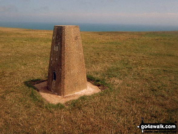
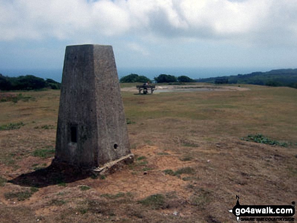
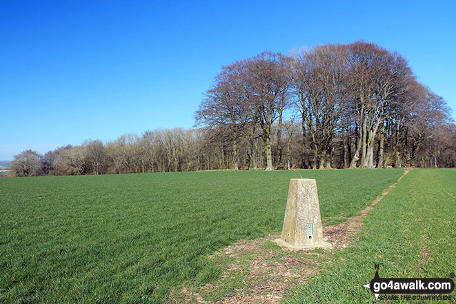
OS Trig Point
To walk, climb & bag Richmond Park (Richmond Park) use this easy-to-follow walk:
See the location of Richmond Park (Richmond Park) and walks up it on a google MapRichmond Park (Richmond Park) is on interactive maps:
OS Explorer (Orange Covers):
OS Landranger (Pink Covers): 176
|
2. Bembridge Down
104m (341ft)
Bridget
We hope to have walks that climb & bag Bembridge Down very soon
See the location of Bembridge Down and walks up it on a google MapBembridge Down is on interactive maps:
OS Explorer (Orange Covers): OL29
OS Landranger (Pink Covers): 196
|
3. The Folly (Nore Folly)
112m (368ft)
Bridget
OS Trig Point
To walk, climb & bag The Folly (Nore Folly) use either of these easy-to-follow walks:
See the location of The Folly (Nore Folly) and walks up it on a google MapThe Folly (Nore Folly) is on interactive maps:
OS Explorer (Orange Covers): OL10
OS Landranger (Pink Covers): 197
|
4. Halnaker Hill
127m (417ft)
Bridget
OS Trig Point
To walk, climb & bag Halnaker Hill use this easy-to-follow walk:
See the location of Halnaker Hill and walks up it on a google MapHalnaker Hill is on interactive maps:
OS Explorer (Orange Covers): OL10
OS Landranger (Pink Covers): 197
|
5. Pipers Wait
133m (436ft)
Bridget
Pipers Wait is the highest point The New Forest National Park.
We hope to have walks that climb & bag Pipers Wait very soon
See the location of Pipers Wait and walks up it on a google MapPipers Wait is on interactive maps:
OS Explorer (Orange Covers): OL22
OS Landranger (Pink Covers): 184
|
6. Arreton Down
135m (443ft)
Bridget
OS Trig Point
We hope to have walks that climb & bag Arreton Down very soon
See the location of Arreton Down and walks up it on a google MapArreton Down is on interactive maps:
OS Explorer (Orange Covers): OL29
OS Landranger (Pink Covers): 196
|
7. Tennyson Down
147m (482ft)
Bridget
OS Trig Point
To walk, climb & bag Tennyson Down use this easy-to-follow walk:
See the location of Tennyson Down and walks up it on a google MapTennyson Down is on interactive maps:
OS Explorer (Orange Covers): OL29
OS Landranger (Pink Covers): 196
|
8. Flexham Park (Bedham Hill)
151m (508ft)
Bridget
OS Trig Point
We hope to have walks that climb & bag Flexham Park (Bedham Hill) very soon
See the location of Flexham Park (Bedham Hill) and walks up it on a google MapFlexham Park (Bedham Hill) is on interactive maps:
OS Explorer (Orange Covers): OL34
OS Landranger (Pink Covers): 197
|
9. Beachy Head
163m (535ft)
Bridget
OS Trig Point
To walk, climb & bag Beachy Head use any of these easy-to-follow walks:
See the location of Beachy Head and walks up it on a google MapBeachy Head is on interactive maps:
OS Explorer (Orange Covers): OL25
OS Landranger (Pink Covers): 199
|
10. Cliffe Hill
164m (538ft)
Bridget
OS Trig Point
We hope to have walks that climb & bag Cliffe Hill very soon
See the location of Cliffe Hill and walks up it on a google MapCliffe Hill is on interactive maps:
OS Explorer (Orange Covers): OL11 and
OL25
OS Landranger (Pink Covers): 198
A downloadable go4awalk.com PDF Peak Bagging Map featuring Cliffe Hill will be available soon. |
11. East Dean Hill
168m (551ft)
Bridget
OS Trig Point
To walk, climb & bag East Dean Hill use any of these easy-to-follow walks:
See the location of East Dean Hill and walks up it on a google MapEast Dean Hill is on interactive maps:
OS Explorer (Orange Covers): OL25
OS Landranger (Pink Covers): 199
|
12. Box Hill
172m (564ft)
Bridget
OS Trig Point
To walk, climb & bag Box Hill use either of these easy-to-follow walks:
See the location of Box Hill and walks up it on a google MapBox Hill is on interactive maps:
OS Explorer (Orange Covers): 146
OS Landranger (Pink Covers): 187
|
13. St Martha's Hill
175m (573ft)
Bridget
OS Trig Point
To walk, climb & bag St Martha's Hill use either of these easy-to-follow walks:
See the location of St Martha's Hill and walks up it on a google MapSt Martha's Hill is on interactive maps:
OS Explorer (Orange Covers): 145
OS Landranger (Pink Covers): 186
A downloadable go4awalk.com PDF Peak Bagging Map featuring St Martha's Hill will be available soon. |
14. North's Seat (Fairlight Down)
175m (574ft)
Bridget
OS Trig Point
We hope to have walks that climb & bag North's Seat (Fairlight Down) very soon
See the location of North's Seat (Fairlight Down) and walks up it on a google MapNorth's Seat (Fairlight Down) is on interactive maps:
OS Explorer (Orange Covers): 124
OS Landranger (Pink Covers): 199
|
15. Cheesefoot Head (Matterley Bowl)
176m (577ft)
Bridget
OS Trig Point
The natural amphitheatre on Cheesefoot Hill (also know as Matterley Bowl) was used by General Eisenhower to address US troops prior to The WW2 D-Day Landings & various boxing matches (including a Joe Louis bout). More recently it has been a regular site for the appearance of crop circles!
To walk, climb & bag Cheesefoot Head (Matterley Bowl) use any of these easy-to-follow walks:
See the location of Cheesefoot Head (Matterley Bowl) and walks up it on a google MapCheesefoot Head (Matterley Bowl) is on interactive maps:
OS Explorer (Orange Covers): OL32
OS Landranger (Pink Covers): 185
A downloadable go4awalk.com PDF Peak Bagging Map featuring Cheesefoot Head (Matterley Bowl) will be available soon. |
16. Paddlesworth (Cheriton Hill)
188m (617ft)
OS Trig Point
We hope to have walks that climb & bag Paddlesworth (Cheriton Hill) very soon
See the location of Paddlesworth (Cheriton Hill) and walks up it on a google MapPaddlesworth (Cheriton Hill) is on interactive maps:
OS Explorer (Orange Covers): 138
OS Landranger (Pink Covers): 179 and
189
A downloadable go4awalk.com PDF Peak Bagging Map featuring Paddlesworth (Cheriton Hill) will be available soon. |
17. Steyning Round Hill
189m (620ft)
Bridget
OS Trig Point
To walk, climb & bag Steyning Round Hill use this easy-to-follow walk:
See the location of Steyning Round Hill and walks up it on a google MapSteyning Round Hill is on interactive maps:
OS Explorer (Orange Covers): OL10
OS Landranger (Pink Covers): 198
|
18. Rackham Hill
193m (633ft)
Bridget
OS Trig Point
To walk, climb & bag Rackham Hill use this easy-to-follow walk:
See the location of Rackham Hill and walks up it on a google MapRackham Hill is on interactive maps:
OS Explorer (Orange Covers): OL10
OS Landranger (Pink Covers): 197
|
19. Newmarket Hill
200m (656ft)
Bridget
We hope to have walks that climb & bag Newmarket Hill very soon
See the location of Newmarket Hill and walks up it on a google MapNewmarket Hill is on interactive maps:
OS Explorer (Orange Covers): OL11
OS Landranger (Pink Covers): 198
|
20. Thurnham Court Estate (Detling Hill)
200m (656ft)
Marilyn (169th in England, 1521st in GB)
OS Trig Point
We hope to have walks that climb & bag Thurnham Court Estate (Detling Hill) very soon
See the location of Thurnham Court Estate (Detling Hill) and walks up it on a google MapThurnham Court Estate (Detling Hill) is on interactive maps:
OS Explorer (Orange Covers): 148
OS Landranger (Pink Covers): 178 and
188
|
21. Willingdon Hill
201m (659ft)
Bridget
OS Trig Point
We hope to have walks that climb & bag Willingdon Hill very soon
See the location of Willingdon Hill and walks up it on a google MapWillingdon Hill is on interactive maps:
OS Explorer (Orange Covers): OL25
OS Landranger (Pink Covers): 199
|
22. Wolstonbury Hill
207m (679ft)
Bridget
OS Trig Point
To walk, climb & bag Wolstonbury Hill use either of these easy-to-follow walks:
See the location of Wolstonbury Hill and walks up it on a google MapWolstonbury Hill is on interactive maps:
OS Explorer (Orange Covers): OL11
OS Landranger (Pink Covers): 198
|
23. Kithurst Hill
213m (699ft)
Bridget
OS Trig Point
We hope to have walks that climb & bag Kithurst Hill very soon
See the location of Kithurst Hill and walks up it on a google MapKithurst Hill is on interactive maps:
OS Explorer (Orange Covers): OL10
121
OS Landranger (Pink Covers): 197
|
24. Brighstone Down
214m (702ft)
Marilyn (166th in England, 1507th in GB)
OS Trig Point
We hope to have walks that climb & bag Brighstone Down very soon
See the location of Brighstone Down and walks up it on a google MapBrighstone Down is on interactive maps:
OS Explorer (Orange Covers): OL29
OS Landranger (Pink Covers): 196
|
25. Wilmington Hill
214m (702ft)
Marilyn (167th in England, 1508th in GB)
OS Trig Point
To walk, climb & bag Wilmington Hill use either of these easy-to-follow walks:
See the location of Wilmington Hill and walks up it on a google MapWilmington Hill is on interactive maps:
OS Explorer (Orange Covers): OL25
OS Landranger (Pink Covers): 199
A downloadable go4awalk.com PDF Peak Bagging Map featuring Wilmington Hill will be available soon. |
26. Devil's Dyke
217m (712ft)
Bridget
OS Trig Point
We hope to have walks that climb & bag Devil's Dyke very soon
See the location of Devil's Dyke and walks up it on a google MapDevil's Dyke is on interactive maps:
OS Explorer (Orange Covers): OL11
OS Landranger (Pink Covers): 198
|
27. Firle Beacon
217m (712ft)
Marilyn (164th in England, 1502nd in GB)
OS Trig Point
To walk, climb & bag Firle Beacon use this easy-to-follow walk:
See the location of Firle Beacon and walks up it on a google MapFirle Beacon is on interactive maps:
OS Explorer (Orange Covers): OL25
OS Landranger (Pink Covers): 198
A downloadable go4awalk.com PDF Peak Bagging Map featuring Firle Beacon will be available soon. |
28. Dunley Wood (Dunley Hill)
226m (741ft)
Bridget
OS Trig Point
The OS Map marks a point 0.75km to the west as a metre higher.
We hope to have walks that climb & bag Dunley Wood (Dunley Hill) very soon
See the location of Dunley Wood (Dunley Hill) and walks up it on a google MapDunley Wood (Dunley Hill) is on interactive maps:
OS Explorer (Orange Covers): 146
OS Landranger (Pink Covers): 187
|
29. Reigate Hill
235m (771ft)
Bridget
OS Trig Point
We hope to have walks that climb & bag Reigate Hill very soon
See the location of Reigate Hill and walks up it on a google MapReigate Hill is on interactive maps:
OS Explorer (Orange Covers): 146
OS Landranger (Pink Covers): 187
|
30. Wrotham Hill (Exedown)
235m (771ft)
Bridget
OS Trig Point
We hope to have walks that climb & bag Wrotham Hill (Exedown) very soon
See the location of Wrotham Hill (Exedown) and walks up it on a google MapWrotham Hill (Exedown) is on interactive maps:
OS Explorer (Orange Covers): 188
147
OS Landranger (Pink Covers): 177
|
31. Chanctonbury Ring (Chanctonbury Hill)
238m (781ft)
Marilyn (161st in England, 1483rd in GB)
OS Trig Point
We hope to have walks that climb & bag Chanctonbury Ring (Chanctonbury Hill) very soon
See the location of Chanctonbury Ring (Chanctonbury Hill) and walks up it on a google MapChanctonbury Ring (Chanctonbury Hill) is on interactive maps:
OS Explorer (Orange Covers): 121
OS Landranger (Pink Covers): 198
A downloadable go4awalk.com PDF Peak Bagging Map featuring Chanctonbury Ring (Chanctonbury Hill) will be available soon. |
32. St Catherine's Hill (Niton Down)
239m (784ft)
Bridget
OS Trig Point
We hope to have walks that climb & bag St Catherine's Hill (Niton Down) very soon
See the location of St Catherine's Hill (Niton Down) and walks up it on a google MapSt Catherine's Hill (Niton Down) is on interactive maps:
OS Explorer (Orange Covers): OL29
OS Landranger (Pink Covers): 196
|
33. St Boniface Down (Wroxall Down)
241m (790ft)
Marilyn (160th in England, 1479th in GB)
OS Trig Point
St Boniface Down (Wroxall Down) is the highest point on The Isle of Wight.
We hope to have walks that climb & bag St Boniface Down (Wroxall Down) very soon
See the location of St Boniface Down (Wroxall Down) and walks up it on a google MapSt Boniface Down (Wroxall Down) is on interactive maps:
OS Explorer (Orange Covers): OL29
OS Landranger (Pink Covers): 196
|
34. Crowborough
242m (794ft)
Marilyn (159th in England, 1478th in GB)
OS Trig Point
We hope to have walks that climb & bag Crowborough very soon
See the location of Crowborough and walks up it on a google MapCrowborough is on interactive maps:
OS Explorer (Orange Covers): 135
OS Landranger (Pink Covers): 188
A downloadable go4awalk.com PDF Peak Bagging Map featuring Crowborough will be available soon. |
35. Warren Corner (Wheatham Hill)
246m (807ft)
Bridget
OS Trig Point
Farmland 0.5 km to the east-south-east is marked on the OS Map as higher (249m) but this is on private land.
We hope to have walks that climb & bag Warren Corner (Wheatham Hill) very soon
See the location of Warren Corner (Wheatham Hill) and walks up it on a google MapWarren Corner (Wheatham Hill) is on interactive maps:
OS Explorer (Orange Covers): OL33
OS Landranger (Pink Covers): 186
197
|
36. Ditchling Beacon
248m (813ft)
Marilyn (156th in England, 1474th in GB)
OS Trig Point
Ditchling Beacon is the highest point in the county of East Sussex.
To walk, climb & bag Ditchling Beacon use either of these easy-to-follow walks:
See the location of Ditchling Beacon and walks up it on a google MapDitchling Beacon is on interactive maps:
OS Explorer (Orange Covers): OL11
OS Landranger (Pink Covers): 198
A downloadable go4awalk.com PDF Peak Bagging Map featuring Ditchling Beacon will be available soon. |
37. Linch Ball (Linch Down)
248m (813ft)
Bridget
OS Trig Point
We hope to have walks that climb & bag Linch Ball (Linch Down) very soon
See the location of Linch Ball (Linch Down) and walks up it on a google MapLinch Ball (Linch Down) is on interactive maps:
OS Explorer (Orange Covers): OL8
120
OS Landranger (Pink Covers): 197
|
38. Toy's Hill
248m (813ft)
Bridget
We hope to have walks that climb & bag Toy's Hill very soon
See the location of Toy's Hill and walks up it on a google MapToy's Hill is on interactive maps:
OS Explorer (Orange Covers): 147
OS Landranger (Pink Covers): 188
|
39. Littleton Down
255m (836ft)
Bridget
We hope to have walks that climb & bag Littleton Down very soon
See the location of Littleton Down and walks up it on a google MapLittleton Down is on interactive maps:
OS Explorer (Orange Covers): 121
OS Landranger (Pink Covers): 197
A downloadable go4awalk.com PDF Peak Bagging Map featuring Littleton Down will be available soon. |
40. Holmbury Hill
261m (856ft)
Bridget
To walk, climb & bag Holmbury Hill use any of these easy-to-follow walks:
See the location of Holmbury Hill and walks up it on a google MapHolmbury Hill is on interactive maps:
OS Explorer (Orange Covers): 146
OS Landranger (Pink Covers): 187
|
41. Botley Hill
267m (876ft)
Marilyn (148th in England, 1436th in GB)
OS Trig Point
We hope to have walks that climb & bag Botley Hill very soon
See the location of Botley Hill and walks up it on a google MapBotley Hill is on interactive maps:
OS Explorer (Orange Covers): 146
OS Landranger (Pink Covers): 187
A downloadable go4awalk.com PDF Peak Bagging Map featuring Botley Hill will be available soon. |
42. Butser Hill
270m (886ft)
Marilyn (146th in England, 1432nd in GB)
OS Trig Point
We hope to have walks that climb & bag Butser Hill very soon
See the location of Butser Hill and walks up it on a google MapButser Hill is on interactive maps:
OS Explorer (Orange Covers): OL33 and
120
OS Landranger (Pink Covers): 197
A downloadable go4awalk.com PDF Peak Bagging Map featuring Butser Hill will be available soon. |
43. Hindhead (Gibbet Hill)
272m (892ft)
Bridget
OS Trig Point
We hope to have walks that climb & bag Hindhead (Gibbet Hill) very soon
See the location of Hindhead (Gibbet Hill) and walks up it on a google MapHindhead (Gibbet Hill) is on interactive maps:
OS Explorer (Orange Covers): OL33
OS Landranger (Pink Covers): 186
|
44. Black Down (Blackdown)
280m (918ft)
Marilyn (139th in England, 1415th in GB)
OS Trig Point
Black Down (Blackdown) is the highest point in county of West Sussex.
We hope to have walks that climb & bag Black Down (Blackdown) very soon
See the location of Black Down (Blackdown) and walks up it on a google MapBlack Down (Blackdown) is on interactive maps:
OS Explorer (Orange Covers): OL33
OS Landranger (Pink Covers): 186 and
197
A downloadable go4awalk.com PDF Peak Bagging Map featuring Black Down (Blackdown) will be available soon. |
45. Pilot Hill
286m (938ft)
Bridget
OS Trig Point
Pilot Hill is the highest point in the county of Hampshire.
We hope to have walks that climb & bag Pilot Hill very soon
See the location of Pilot Hill and walks up it on a google MapPilot Hill is on interactive maps:
OS Explorer (Orange Covers): 158
OS Landranger (Pink Covers): 174
A downloadable go4awalk.com PDF Peak Bagging Map featuring Pilot Hill will be available soon. |
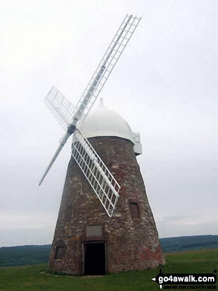
46. Leith Hill
295m (968ft)
Marilyn (135th in England, 1387th in GB)
At 994m (965ft) Leith Hill is not only the highest point in Surrey but the highest point in South East of England. On a clear day you can see 13 counties as well as St Paul's Cathedral and the English Channel from the top of the tower.
To walk, climb & bag Leith Hill use this easy-to-follow walk:
See the location of Leith Hill and walks up it on a google MapLeith Hill is on interactive maps:
OS Explorer (Orange Covers): 146
OS Landranger (Pink Covers): 187
A downloadable go4awalk.com PDF Peak Bagging Map featuring Leith Hill will be available soon. |
View these 46 Mountains, Peaks, Tops and Hills:
Is there a Mountain, Peak, Top or Hill missing from the above google map or list?
Let us know an we will add it to our database.


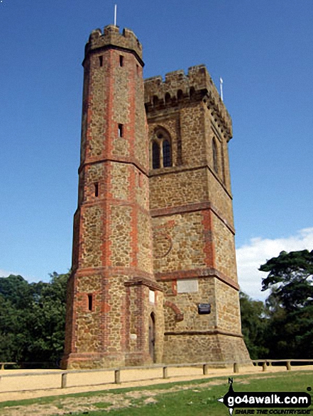 The summit of Leith Hill in The Surrey Hills


