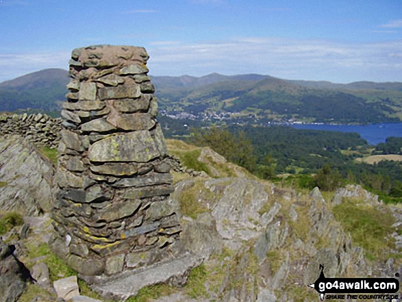
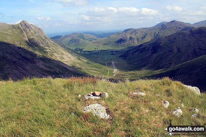
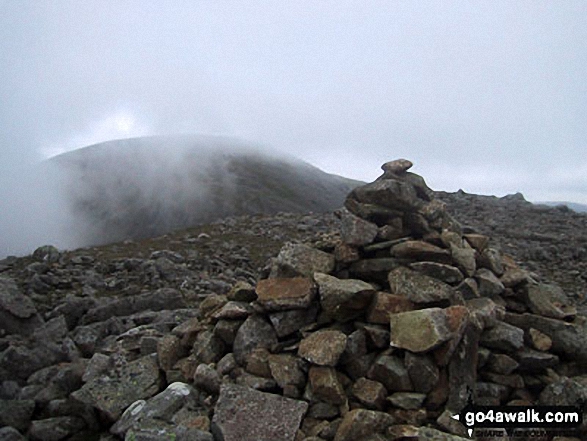
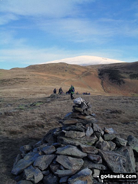
All The Mountains, Peaks, Tops and Hills in the North West region of England as a detailed list

The North West region of England comprises the traditional counties of Cheshire, Cumbria, Greater Manchester, Lancashire and Mersyside and includes The Lake District National Park, The Forest of Bowland, parts of The Yorkshire Dales National Park and parts of the Peak District National Park.


If you include all the Mountains (Hewitts), the Deweys, the Nuttalls, the Marilyns, the Bridgets (Hills) and all the Mountains, Tops, Peaks and Hills with a Trig Point on them there are 463 tops to climb, bag & conquer and the highest point is Scafell Pike at 978m (3,210ft).


Wainwright
214/0
Wainwrights
Hewitt
143/0
English
Mountains
Dewey
87/0
English
Deweys
nuttall
210/0
English
Nuttalls
Wainwright Outlying Fell
116/0
Wainwright
Outlying Fells
marilyn
81/0
English
Marilyns
Bridget
122/0
English
Bridgets
Trig Point
154/0
Trig
Points


LOG ON and RELOAD this page to show which Mountains, Peaks, Tops and Hills you have already climbed, bagged & conquered [. . . more details]


Page 15 of 16    First Previous 11 12 13 14 15 16


See this list in: Alphabetical Order‡ | Height Order
To reverse the order select the link again.


Mountain, Peak, Top or Hill:

Bagged


421. Blease Fell (Howgills)

474m (1,556ft)

  • Bridget

  • We hope to have walks that climb & bag Blease Fell (Howgills) very soon

    Google Maps Icon
    See the location of Blease Fell (Howgills) and walks up it on a google Map

    Blease Fell (Howgills) is on interactive maps:

  • OS Explorer (Orange Covers): OL19
  • OS Landranger (Pink Covers): 91

  • Blease Fell (Howgills) is on downloadable PDF you can Print or Save to your Phone:


    422. Bleaberry Fell

    590m (1,936ft)

  • Wainwright (No. 132)
  • Dewey (19th in England, 46th in England & Wales)

  • To walk, climb & bag Bleaberry Fell use either of these easy-to-follow walks:

    Google Maps Icon
    See the location of Bleaberry Fell and walks up it on a google Map

    Bleaberry Fell is on interactive maps:

  • OS Explorer (Orange Covers): OL4
  • OS Landranger (Pink Covers): 89 and 90

  • Bleaberry Fell is on downloadable PDF you can Print or Save to your Phone:

    *Version including the walk routes marked on it that you need to follow to Walk all 214 Wainwrights in just 59 walks.


    423. Blaze Fell

    242m (794ft)


    Got a good photo of
    Blaze Fell?

    Send it in and we'll publish it here.

    Photo
    Submission
    Details

  • Bridget
  • OS Trig Point

  • We hope to have walks that climb & bag Blaze Fell very soon

    Google Maps Icon
    See the location of Blaze Fell and walks up it on a google Map

    Blaze Fell is on interactive maps:

  • OS Explorer (Orange Covers): OL5
  • OS Landranger (Pink Covers): 86

  • Blaze Fell is on downloadable PDF you can Print or Save to your Phone:


    424. Blake Fell

    573m (1,881ft)

  • Wainwright (No. 139)
  • Dewey (37th in England, 82nd in England & Wales)
  • Marilyn (56th in England, 810th in GB)
  • OS Trig Point

  • To walk, climb & bag Blake Fell use any of these easy-to-follow walks:

    Google Maps Icon
    See the location of Blake Fell and walks up it on a google Map

    Blake Fell is on interactive maps:

  • OS Explorer (Orange Covers): OL4
  • OS Landranger (Pink Covers): 89

  • Blake Fell is on downloadable PDF you can Print or Save to your Phone:

    *Version including the walk routes marked on it that you need to follow to Walk all 214 Wainwrights in just 59 walks.


    425. Blackstone Edge

    472m (1,549ft)

  • Bridget
  • OS Trig Point

  • To walk, climb & bag Blackstone Edge use this easy-to-follow walk:

    Google Maps Icon
    See the location of Blackstone Edge and walks up it on a google Map

    Blackstone Edge is on interactive maps:

  • OS Explorer (Orange Covers): OL21
  • OS Landranger (Pink Covers): 110

  • Blackstone Edge is on downloadable PDF you can Print or Save to your Phone:


    426. Black Sails

    745m (2,445ft)

  • Mountain (71st in England, 125th in England & Wales)
  • Nuttall (88th in England, 153rd in England & Wales)

  • To walk, climb & bag Black Sails use any of these easy-to-follow walks:

    Google Maps Icon
    See the location of Black Sails and walks up it on a google Map

    Black Sails is on interactive maps:

  • OS Explorer (Orange Covers): OL6
  • OS Landranger (Pink Covers): 89 and 90

  • Black Sails is on downloadable PDF you can Print or Save to your Phone:

    *Version including the walk routes marked on it that you need to follow to Walk all 214 Wainwrights in just 59 walks.


    427. Black Hill (Whaley Moor)

    411m (1,348ft)


    Got a good photo of
    Black Hill (Whaley Moor)?

    Send it in and we'll publish it here.

    Photo
    Submission
    Details

  • Bridget

  • We hope to have walks that climb & bag Black Hill (Whaley Moor) very soon

    Google Maps Icon
    See the location of Black Hill (Whaley Moor) and walks up it on a google Map

    Black Hill (Whaley Moor) is on interactive maps:

  • OS Explorer (Orange Covers): OL1
  • OS Landranger (Pink Covers): 110

  • Black Hill (Whaley Moor) is on downloadable PDF you can Print or Save to your Phone:


    428. Black Fell (Haresceugh Fell)

    664m (2,179ft)

  • Mountain (131st in England, 224th in England & Wales)
  • Nuttall (176th in England, 298th in England & Wales)
  • OS Trig Point

  • To walk, climb & bag Black Fell (Haresceugh Fell) use either of these easy-to-follow walks:

    Google Maps Icon
    See the location of Black Fell (Haresceugh Fell) and walks up it on a google Map

    Black Fell (Haresceugh Fell) is on interactive maps:

  • OS Explorer (Orange Covers): OL31
  • OS Landranger (Pink Covers): 86

  • Black Fell (Haresceugh Fell) is on downloadable PDF you can Print or Save to your Phone:


    429. Black Fell (Black Crag)

    323m (1,060ft)

  • Wainwright (No. 212)
  • OS Trig Point

  • To walk, climb & bag Black Fell (Black Crag) use this easy-to-follow walk:

    Google Maps Icon
    See the location of Black Fell (Black Crag) and walks up it on a google Map

    Black Fell (Black Crag) is on interactive maps:

  • OS Explorer (Orange Covers): OL7
  • OS Landranger (Pink Covers): 90

  • Black Fell (Black Crag) is on downloadable PDF you can Print or Save to your Phone:

    *Version including the walk routes marked on it that you need to follow to Walk all 214 Wainwrights in just 59 walks.


    430. Black Crags (Langdale)

    588m (1,929ft)

  • Dewey (20th in England, 52nd in England & Wales)

  • To walk, climb & bag Black Crags (Langdale) use either of these easy-to-follow walks:

    Google Maps Icon
    See the location of Black Crags (Langdale) and walks up it on a google Map

    Black Crags (Langdale) is on interactive maps:

  • OS Explorer (Orange Covers): OL6
  • OS Landranger (Pink Covers): 89 and 90

  • Black Crags (Langdale) is on downloadable PDF you can Print or Save to your Phone:

    *Version including the walk routes marked on it that you need to follow to Walk all 214 Wainwrights in just 59 walks.


    431. Black Crag (Pillar)

    828m (2,717ft)

  • Mountain (31st in England, 60th in England & Wales)
  • Nuttall (37th in England, 69th in England & Wales)

  • To walk, climb & bag Black Crag (Pillar) use any of these easy-to-follow walks:

    Google Maps Icon
    See the location of Black Crag (Pillar) and walks up it on a google Map

    Black Crag (Pillar) is on interactive maps:

  • OS Explorer (Orange Covers): OL4
  • OS Landranger (Pink Covers): 89 and 90

  • Black Crag (Pillar) is on downloadable PDF you can Print or Save to your Phone:

    *Version including the walk routes marked on it that you need to follow to Walk all 214 Wainwrights in just 59 walks.


    432. Black Combe

    600m (1,969ft)

  • Dewey (12th in England, 25th in England & Wales)
  • Wainwright Outlying Fell (No. 2)
  • Marilyn (54th in England, 769th in GB)
  • OS Trig Point
  • A rare location in the United Kingdom where, on a clear day, you can see five countries - England, Scotland, Wales, Northern Ireland & Southern Ireland and the self-governing British Crown dependency, The Isle of Man.

    William Wordsworth claimed that the summit of Black Combe offered "the amplest range of unobstructed prospect may be seen that British ground commands."


    To walk, climb & bag Black Combe use either of these easy-to-follow walks:

    Google Maps Icon
    See the location of Black Combe and walks up it on a google Map

    Black Combe is on interactive maps:

  • OS Explorer (Orange Covers): OL6
  • OS Landranger (Pink Covers): 96

  • A downloadable go4awalk.com PDF Peak Bagging Map featuring Black Combe will be available soon.


    433. Black Brows

    268m (879ft)


    Got a good photo of
    Black Brows?

    Send it in and we'll publish it here.

    Photo
    Submission
    Details

  • Bridget

  • We hope to have walks that climb & bag Black Brows very soon

    Google Maps Icon
    See the location of Black Brows and walks up it on a google Map

    Black Brows is on interactive maps:

  • OS Explorer (Orange Covers): OL7
  • OS Landranger (Pink Covers): 96 and 97

  • 434. Birks

    624m (2,047ft)

  • Wainwright (No. 125)
  • Nuttall (222nd in England, 387th in England & Wales)

  • To walk, climb & bag Birks use any of these easy-to-follow walks:

    Google Maps Icon
    See the location of Birks and walks up it on a google Map

    Birks is on interactive maps:

  • OS Explorer (Orange Covers): OL5
  • OS Landranger (Pink Covers): 90

  • Birks is on downloadable PDF you can Print or Save to your Phone:

    *Version including the walk routes marked on it that you need to follow to Walk all 214 Wainwrights in just 59 walks.


    435. Birkhouse Moor

    718m (2,356ft)

  • Wainwright (No. 79)
  • Nuttall (110th in England, 188th in England & Wales)

  • To walk, climb & bag Birkhouse Moor use any of these easy-to-follow walks:

    Google Maps Icon
    See the location of Birkhouse Moor and walks up it on a google Map

    Birkhouse Moor is on interactive maps:

  • OS Explorer (Orange Covers): OL5
  • OS Landranger (Pink Covers): 90

  • Birkhouse Moor is on downloadable PDF you can Print or Save to your Phone:

    *Version including the walk routes marked on it that you need to follow to Walk all 214 Wainwrights in just 59 walks.


    436. Binsey

    447m (1,467ft)

  • Wainwright (No. 192)
  • Marilyn (89th in England, 1113th in GB)
  • OS Trig Point

  • To walk, climb & bag Binsey use either of these easy-to-follow walks:

    Google Maps Icon
    See the location of Binsey and walks up it on a google Map

    Binsey is on interactive maps:

  • OS Explorer (Orange Covers): OL4
  • OS Landranger (Pink Covers): 89 and 90

  • Binsey is on downloadable PDF you can Print or Save to your Phone:

    *Version including the walk routes marked on it that you need to follow to Walk all 214 Wainwrights in just 59 walks.


    437. Billinge Hill

    179m (587ft)

  • Marilyn (172nd in England, 1540th in GB)
  • OS Trig Point
  • Billinge Hill is the highest point in the county of Merseyside.


    To walk, climb & bag Billinge Hill use this easy-to-follow walk:

    Google Maps Icon
    See the location of Billinge Hill and walks up it on a google Map

    Billinge Hill is on interactive maps:

  • OS Explorer (Orange Covers): 285
  • OS Landranger (Pink Covers): 108

  • Billinge Hill is on downloadable PDF you can Print or Save to your Phone:


    438. Benty Hill

    609m (1,998ft)


    Got a good photo of
    Benty Hill?

    Send it in and we'll publish it here.

    Photo
    Submission
    Details

  • Bridget

  • To walk, climb & bag Benty Hill use this easy-to-follow walk:

    Google Maps Icon
    See the location of Benty Hill and walks up it on a google Map

    Benty Hill is on interactive maps:

  • OS Explorer (Orange Covers): OL31
  • OS Landranger (Pink Covers): 86

  • Benty Hill is on downloadable PDF you can Print or Save to your Phone:


    439. Benson Knott

    317m (1,040ft)

  • Bridget
  • OS Trig Point

  • We hope to have walks that climb & bag Benson Knott very soon

    Google Maps Icon
    See the location of Benson Knott and walks up it on a google Map

    Benson Knott is on interactive maps:

  • OS Explorer (Orange Covers): OL7
  • OS Landranger (Pink Covers): 97

  • 440. Bellbeaver Rigg (Tynehead Fell)

    620m (2,035ft)

  • Nuttall (233rd in England, 405th in England & Wales)

  • To walk, climb & bag Bellbeaver Rigg (Tynehead Fell) use any of these easy-to-follow walks:

    Google Maps Icon
    See the location of Bellbeaver Rigg (Tynehead Fell) and walks up it on a google Map

    Bellbeaver Rigg (Tynehead Fell) is on interactive maps:

  • OS Explorer (Orange Covers): OL31
  • OS Landranger (Pink Covers): 91

  • Bellbeaver Rigg (Tynehead Fell) is on downloadable PDF you can Print or Save to your Phone:


    441. Bell Crags (Watendlath Fell)

    558m (1,831ft)

  • Dewey (56th in England, 132nd in England & Wales)
  • OS Trig Point

  • We hope to have walks that climb & bag Bell Crags (Watendlath Fell) very soon

    Google Maps Icon
    See the location of Bell Crags (Watendlath Fell) and walks up it on a google Map

    Bell Crags (Watendlath Fell) is on interactive maps:

  • OS Explorer (Orange Covers): OL4
  • OS Landranger (Pink Covers): 89 and 90

  • Bell Crags (Watendlath Fell) is on downloadable PDF you can Print or Save to your Phone:

    *Version including the walk routes marked on it that you need to follow to Walk all 214 Wainwrights in just 59 walks.


    442. Beda Head (Beda Fell)

    509m (1,671ft)

  • Wainwright (No. 170)
  • Dewey (161st in England, 371st in England & Wales)

  • To walk, climb & bag Beda Head (Beda Fell) use either of these easy-to-follow walks:

    Google Maps Icon
    See the location of Beda Head (Beda Fell) and walks up it on a google Map

    Beda Head (Beda Fell) is on interactive maps:

  • OS Explorer (Orange Covers): OL5
  • OS Landranger (Pink Covers): 90

  • Beda Head (Beda Fell) is on downloadable PDF you can Print or Save to your Phone:

    *Version including the walk routes marked on it that you need to follow to Walk all 214 Wainwrights in just 59 walks.


    443. Beacon Hill (Penrith)

    286m (938ft)


    Got a good photo of
    Beacon Hill (Penrith)?

    Send it in and we'll publish it here.

    Photo
    Submission
    Details

  • Bridget
  • OS Trig Point

  • We hope to have walks that climb & bag Beacon Hill (Penrith) very soon

    Google Maps Icon
    See the location of Beacon Hill (Penrith) and walks up it on a google Map

    Beacon Hill (Penrith) is on interactive maps:

  • OS Explorer (Orange Covers): OL5
  • OS Landranger (Pink Covers): 90

  • Beacon Hill (Penrith) is on downloadable PDF you can Print or Save to your Phone:


    444. Beacon Fell (Forest of Bowland)

    266m (873ft)

  • Bridget
  • OS Trig Point

  • We hope to have walks that climb & bag Beacon Fell (Forest of Bowland) very soon

    Google Maps Icon
    See the location of Beacon Fell (Forest of Bowland) and walks up it on a google Map

    Beacon Fell (Forest of Bowland) is on interactive maps:

  • OS Explorer (Orange Covers): OL41
  • OS Landranger (Pink Covers): 103

  • Beacon Fell (Forest of Bowland) is on downloadable PDF you can Print or Save to your Phone:


    445. Baxton Fell

    469m (1,539ft)


    Got a good photo of
    Baxton Fell?

    Send it in and we'll publish it here.

    Photo
    Submission
    Details

  • Bridget

  • We hope to have walks that climb & bag Baxton Fell very soon

    Google Maps Icon
    See the location of Baxton Fell and walks up it on a google Map

    Baxton Fell is on interactive maps:

  • OS Explorer (Orange Covers): OL41
  • OS Landranger (Pink Covers): 103

  • Baxton Fell is on downloadable PDF you can Print or Save to your Phone:


    446. Baugh Fell (Tarn Rigg Hill)

    678m (2,225ft)

  • Mountain (116th in England, 196th in England & Wales)
  • Nuttall (154th in England, 262nd in England & Wales)
  • Marilyn (36th in England, 630th in GB)

  • To walk, climb & bag Baugh Fell (Tarn Rigg Hill) use this easy-to-follow walk:

    Google Maps Icon
    See the location of Baugh Fell (Tarn Rigg Hill) and walks up it on a google Map

    Baugh Fell (Tarn Rigg Hill) is on interactive maps:

  • OS Explorer (Orange Covers): OL19
  • OS Landranger (Pink Covers): 98

  • Baugh Fell (Tarn Rigg Hill) is on downloadable PDF you can Print or Save to your Phone:


    447. Base Brown

    646m (2,120ft)

  • Wainwright (No. 117)
  • Mountain (148th in England, 254th in England & Wales)
  • Nuttall (196th in England, 338th in England & Wales)

  • To walk, climb & bag Base Brown use either of these easy-to-follow walks:

    Google Maps Icon
    See the location of Base Brown and walks up it on a google Map

    Base Brown is on interactive maps:

  • OS Explorer (Orange Covers): OL4
  • OS Landranger (Pink Covers): 89 and 90

  • Base Brown is on downloadable PDF you can Print or Save to your Phone:

    *Version including the walk routes marked on it that you need to follow to Walk all 214 Wainwrights in just 59 walks.


    448. Barbon Low Fell

    438m (1,437ft)


    Got a good photo of
    Barbon Low Fell?

    Send it in and we'll publish it here.

    Photo
    Submission
    Details

  • Bridget
  • OS Trig Point

  • We hope to have walks that climb & bag Barbon Low Fell very soon

    Google Maps Icon
    See the location of Barbon Low Fell and walks up it on a google Map

    Barbon Low Fell is on interactive maps:

  • OS Explorer (Orange Covers): OL2
  • OS Landranger (Pink Covers): 97

  • 449. Bannerdale Crags

    683m (2,242ft)

  • Wainwright (No. 97)
  • Mountain (113th in England, 192nd in England & Wales)
  • Nuttall (149th in England, 251st in England & Wales)

  • To walk, climb & bag Bannerdale Crags use any of these easy-to-follow walks:

    Google Maps Icon
    See the location of Bannerdale Crags and walks up it on a google Map

    Bannerdale Crags is on interactive maps:

  • OS Explorer (Orange Covers): OL5
  • OS Landranger (Pink Covers): 90

  • Bannerdale Crags is on downloadable PDF you can Print or Save to your Phone:

    *Version including the walk routes marked on it that you need to follow to Walk all 214 Wainwrights in just 59 walks.


    450. Backstone Edge (Dufton Fell)

    699m (2,294ft)

  • Nuttall (135th in England, 222nd in England & Wales)
  • OS Trig Point

  • To walk, climb & bag Backstone Edge (Dufton Fell) use either of these easy-to-follow walks:

    Google Maps Icon
    See the location of Backstone Edge (Dufton Fell) and walks up it on a google Map

    Backstone Edge (Dufton Fell) is on interactive maps:

  • OS Explorer (Orange Covers): OL19
  • OS Landranger (Pink Covers): 91

  • Backstone Edge (Dufton Fell) is on downloadable PDF you can Print or Save to your Phone:


    Page 15 of 16    First Previous 11 12 13 14 15 16


    Is there a Mountain, Peak, Top or Hill missing from the above google map or list?

    Let us know an we will add it to our database.


    Follow go4awalk.com on Twitter Follow go4awalk.com on Facebook


    Home


    Find new Friends to go walking with

    Walk all 214 Wainwrights in just 59 Walks. Download GPS Waypoints - Great Walks you must not miss!

    Walk The Yorkshire Three Peaks Challenge Walk - All the Latest Route Information, GPS Waypoints and Split Times to keep you on Schedule

    Walk The British Three Peaks Challenge Walk - All the Latest Route Information and GPS Waypoints

    See our pick of The Best Walks in The Lake District - Great Walks you must not miss!

    Walk our pick of the Best Lake District Ridge Walks - Great Walks you must not miss!

    Walk our pick of the Best Lake District Walks to do in the rain - Great Walks you must not miss!

    Walk our pick of The Best Walks in Snowdonia - Great Walks you must not miss!

    Walk our pick of The Best Ridge Walks in Wales - Walks you must not miss!

    Walk our pick of The Best Walks in The Brecon Beacons - Great Walks you must not miss!

    Walk our pick of The Best Walks in The Yorkshire Dales - Walks you must not miss!

    Walk our pick of The Best Walks in The Peak District - Walks you must not miss!

    Walk our pick of The Best Walks in The Forest of Bowland - Walks you must not miss!

    Walk our pick of The Best Walks in Shropshire - Walks you must not miss!

    Walk our pick of The Best Walks in Cheshire - Walks you must not miss!

    Walk our pick of The Best Walks in Lancashire - Walks you must not miss!

    Not sure where to walk next? Try Peak Bagging - Great Walks you must not miss!

    Not sure where to walk next? Walk part of a National Trail - Great Walks you must not miss!

    Walks with Downloadable and Uploadable GPS Waypoint Data

    Walking Kit and Gear Tested by Walkers

    Full Site Search