The Mountains, Peaks, Tops and Hills in Scotland as a detailed list

If you count only the Murdos there are 442 tops to climb, bag & conquer and the highest point is Ben Nevis at 1,344m (4,411ft).


munro
282/0
Munros
corbett
222/0
Corbetts
graham
219/0
Grahams
donald
89/0
Donalds
murdo
442/0
Murdos
marilyn
1218/0
Scottish
Marilyns
Bridget
159/0
Scottish
Bridgets
Trig Point
659/0
Trig
Points


To see all Mountains, Peaks, Tops and Hills displayed in different ways - see the options in the left-hand column and towards the bottom of this page.


LOG ON and RELOAD this page to show which Mountains, Peaks, Tops and Hills you have already climbed, bagged & conquered [. . . more]


Page 13 of 15    First Previous 11 12 13 14 15


See this list in: Alphabetical Order | Height Order
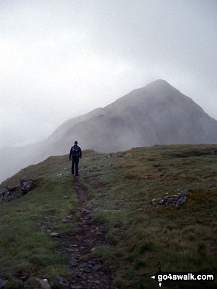
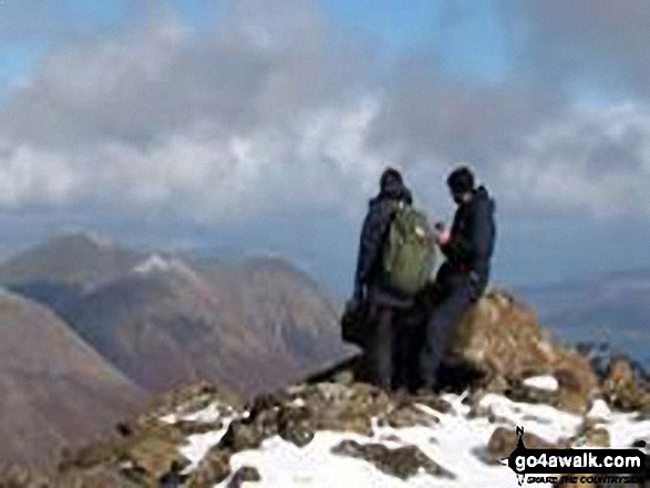
To reverse the order select the link again.


Mountain, Peak, Top or Hill:

Bagged


361. Sgurr Dubh na Da Bheinn (Sgurr Dubh Mor)

938m (3,079ft)


Got a good photo of
Sgurr Dubh na Da Bheinn (Sgurr Dubh Mor)?

Send it in and we'll publish it here.

Photo
Submission
Details

  • Murdo (361st)

  • We hope to have walks that climb & bag Sgurr Dubh na Da Bheinn (Sgurr Dubh Mor) very soon

    Google Maps Icon
    See the location of Sgurr Dubh na Da Bheinn (Sgurr Dubh Mor) and walks up it on a google Map

    Sgurr Dubh na Da Bheinn (Sgurr Dubh Mor) is on interactive maps:

  • OS Explorer (Orange Covers): 411
  • OS Landranger (Pink Covers): 32

  • A go4awalk.com Peak Bagging Map and Hill Tick List featuring Sgurr Dubh na Da Bheinn (Sgurr Dubh Mor) will be available soon.


    362. Beinn Cheathaich

    937m (3,075ft)


    Got a good photo of
    Beinn Cheathaich?

    Send it in and we'll publish it here.

    Photo
    Submission
    Details

  • Murdo (365th)
  • OS Trig Point

  • We hope to have walks that climb & bag Beinn Cheathaich very soon

    Google Maps Icon
    See the location of Beinn Cheathaich and walks up it on a google Map

    Beinn Cheathaich is on interactive maps:

  • OS Explorer (Orange Covers): 384
  • OS Landranger (Pink Covers): 51

  • A go4awalk.com Peak Bagging Map and Hill Tick List featuring Beinn Cheathaich will be available soon.


    363. Beinn Sgulaird

    937m (3,075ft)


    Got a good photo of
    Beinn Sgulaird?

    Send it in and we'll publish it here.

    Photo
    Submission
    Details

  • Munro (No. 238)
  • Murdo (363rd)
  • Marilyn (175th in Scotland, 181st in GB)

  • We hope to have walks that climb & bag Beinn Sgulaird very soon

    Google Maps Icon
    See the location of Beinn Sgulaird and walks up it on a google Map

    Beinn Sgulaird is on interactive maps:

  • OS Explorer (Orange Covers): 384
  • OS Landranger (Pink Covers): 50

  • A go4awalk.com Peak Bagging Map and Hill Tick List featuring Beinn Sgulaird will be available soon.


    364. Beinn Tarsuinn (Lochan Fada)

    937m (3,075ft)

  • Munro (No. 239)
  • Murdo (364th)
  • Marilyn (176th in Scotland, 182nd in GB)

  • We hope to have walks that climb & bag Beinn Tarsuinn (Lochan Fada) very soon

    Google Maps Icon
    See the location of Beinn Tarsuinn (Lochan Fada) and walks up it on a google Map

    Beinn Tarsuinn (Lochan Fada) is on interactive maps:

  • OS Explorer (Orange Covers): 435
  • OS Landranger (Pink Covers): 19

  • A go4awalk.com Peak Bagging Map and Hill Tick List featuring Beinn Tarsuinn (Lochan Fada) will be available soon.


    365. Sron a' Choire Ghairbh

    937m (3,075ft)


    Got a good photo of
    Sron a' Choire Ghairbh?

    Send it in and we'll publish it here.

    Photo
    Submission
    Details

  • Munro (No. 237)
  • Murdo (362nd)
  • Marilyn (177th in Scotland, 183rd in GB)

  • We hope to have walks that climb & bag Sron a' Choire Ghairbh very soon

    Google Maps Icon
    See the location of Sron a' Choire Ghairbh and walks up it on a google Map

    Sron a' Choire Ghairbh is on interactive maps:

  • OS Explorer (Orange Covers): 400
  • OS Landranger (Pink Covers): 34

  • A go4awalk.com Peak Bagging Map and Hill Tick List featuring Sron a' Choire Ghairbh will be available soon.


    366. A' Bhuidheanach Bheag

    936m (3,072ft)


    Got a good photo of
    A' Bhuidheanach Bheag?

    Send it in and we'll publish it here.

    Photo
    Submission
    Details

  • Munro (No. 240)
  • Murdo (366th)
  • OS Trig Point

  • We hope to have walks that climb & bag A' Bhuidheanach Bheag very soon

    Google Maps Icon
    See the location of A' Bhuidheanach Bheag and walks up it on a google Map

    A' Bhuidheanach Bheag is on interactive maps:

  • OS Explorer (Orange Covers): OL51
  • OS Landranger (Pink Covers): 42

  • A go4awalk.com Peak Bagging Map and Hill Tick List featuring A' Bhuidheanach Bheag will be available soon.


    367. Beinn na Lap

    935m (3,069ft)

  • Munro (No. 241)
  • Murdo (367th)
  • Marilyn (178th in Scotland, 184th in GB)

  • We hope to have walks that climb & bag Beinn na Lap very soon

    Google Maps Icon
    See the location of Beinn na Lap and walks up it on a google Map

    Beinn na Lap is on interactive maps:

  • OS Explorer (Orange Covers): OL50 and 385
  • OS Landranger (Pink Covers): 41

  • A go4awalk.com Peak Bagging Map and Hill Tick List featuring Beinn na Lap will be available soon.


    368. Sgurr a' Fionn Choire (Bruach na Frithe)

    935m (3,069ft)


    Got a good photo of
    Sgurr a' Fionn Choire (Bruach na Frithe)?

    Send it in and we'll publish it here.

    Photo
    Submission
    Details

  • Murdo (368th)

  • We hope to have walks that climb & bag Sgurr a' Fionn Choire (Bruach na Frithe) very soon

    Google Maps Icon
    See the location of Sgurr a' Fionn Choire (Bruach na Frithe) and walks up it on a google Map

    Sgurr a' Fionn Choire (Bruach na Frithe) is on interactive maps:

  • OS Explorer (Orange Covers): 411
  • OS Landranger (Pink Covers): 32

  • A go4awalk.com Peak Bagging Map and Hill Tick List featuring Sgurr a' Fionn Choire (Bruach na Frithe) will be available soon.


    369. Toman Coinich (A' Chailleach)

    935m (3,069ft)

  • Murdo (369th)

  • We hope to have walks that climb & bag Toman Coinich (A' Chailleach) very soon

    Google Maps Icon
    See the location of Toman Coinich (A' Chailleach) and walks up it on a google Map

    Toman Coinich (A' Chailleach) is on interactive maps:

  • OS Explorer (Orange Covers): 435
  • OS Landranger (Pink Covers): 20

  • A go4awalk.com Peak Bagging Map and Hill Tick List featuring Toman Coinich (A' Chailleach) will be available soon.


    370. Am Basteir

    934m (3,065ft)

  • Munro (No. 242)
  • Murdo (370th)

  • We hope to have walks that climb & bag Am Basteir very soon

    Google Maps Icon
    See the location of Am Basteir and walks up it on a google Map

    Am Basteir is on interactive maps:

  • OS Explorer (Orange Covers): 411
  • OS Landranger (Pink Covers): 32

  • A go4awalk.com Peak Bagging Map and Hill Tick List featuring Am Basteir will be available soon.


    371. Meall a' Chrasgaidh

    934m (3,065ft)


    Got a good photo of
    Meall a' Chrasgaidh?

    Send it in and we'll publish it here.

    Photo
    Submission
    Details

  • Munro (No. 243)
  • Murdo (371st)

  • We hope to have walks that climb & bag Meall a' Chrasgaidh very soon

    Google Maps Icon
    See the location of Meall a' Chrasgaidh and walks up it on a google Map

    Meall a' Chrasgaidh is on interactive maps:

  • OS Explorer (Orange Covers): 436
  • OS Landranger (Pink Covers): 20

  • A go4awalk.com Peak Bagging Map and Hill Tick List featuring Meall a' Chrasgaidh will be available soon.


    372. Sgurr an Tuill Bhain (Slioch)

    934m (3,065ft)


    Got a good photo of
    Sgurr an Tuill Bhain (Slioch)?

    Send it in and we'll publish it here.

    Photo
    Submission
    Details

  • Murdo (372nd)

  • We hope to have walks that climb & bag Sgurr an Tuill Bhain (Slioch) very soon

    Google Maps Icon
    See the location of Sgurr an Tuill Bhain (Slioch) and walks up it on a google Map

    Sgurr an Tuill Bhain (Slioch) is on interactive maps:

  • OS Explorer (Orange Covers): 433 and 435
  • OS Landranger (Pink Covers): 19

  • A go4awalk.com Peak Bagging Map and Hill Tick List featuring Sgurr an Tuill Bhain (Slioch) will be available soon.


    373. Fionn Bheinn

    933m (3,062ft)


    Got a good photo of
    Fionn Bheinn?

    Send it in and we'll publish it here.

    Photo
    Submission
    Details

  • Munro (No. 245)
  • Murdo (374th)
  • Marilyn (179th in Scotland, 185th in GB)
  • OS Trig Point

  • We hope to have walks that climb & bag Fionn Bheinn very soon

    Google Maps Icon
    See the location of Fionn Bheinn and walks up it on a google Map

    Fionn Bheinn is on interactive maps:

  • OS Explorer (Orange Covers): 435
  • OS Landranger (Pink Covers): 20

  • A go4awalk.com Peak Bagging Map and Hill Tick List featuring Fionn Bheinn will be available soon.


    374. Maol Chean-dearg

    933m (3,062ft)


    Got a good photo of
    Maol Chean-dearg?

    Send it in and we'll publish it here.

    Photo
    Submission
    Details

  • Munro (No. 244)
  • Murdo (373rd)
  • Marilyn (180th in Scotland, 186th in GB)

  • We hope to have walks that climb & bag Maol Chean-dearg very soon

    Google Maps Icon
    See the location of Maol Chean-dearg and walks up it on a google Map

    Maol Chean-dearg is on interactive maps:

  • OS Explorer (Orange Covers): 429
  • OS Landranger (Pink Covers): 25

  • A go4awalk.com Peak Bagging Map and Hill Tick List featuring Maol Chean-dearg will be available soon.


    375. The Cairnwell

    933m (3,062ft)

  • Munro (No. 246)
  • Murdo (375th)

  • To walk, climb & bag The Cairnwell use this easy to follow walk:

    Google Maps Icon
    See the location of The Cairnwell and walks up it on a google Map

    The Cairnwell is on interactive maps:

  • OS Explorer (Orange Covers): OL52
  • OS Landranger (Pink Covers): 43

  • A go4awalk.com Peak Bagging Map and Hill Tick List featuring The Cairnwell will be available soon.


    376. Meall Buidhe (Glen Lyon)

    932m (3,059ft)


    Got a good photo of
    Meall Buidhe (Glen Lyon)?

    Send it in and we'll publish it here.

    Photo
    Submission
    Details

  • Munro (No. 247)
  • Murdo (376th)
  • Marilyn (181st in Scotland, 187th in GB)

  • We hope to have walks that climb & bag Meall Buidhe (Glen Lyon) very soon

    Google Maps Icon
    See the location of Meall Buidhe (Glen Lyon) and walks up it on a google Map

    Meall Buidhe (Glen Lyon) is on interactive maps:

  • OS Explorer (Orange Covers): OL48
  • OS Landranger (Pink Covers): 51

  • A go4awalk.com Peak Bagging Map and Hill Tick List featuring Meall Buidhe (Glen Lyon) will be available soon.


    377. Beinn Chabhair

    932m (3,058ft)

  • Munro (No. 248)
  • Murdo (377th)
  • Marilyn (182nd in Scotland, 188th in GB)

  • We hope to have walks that climb & bag Beinn Chabhair very soon

    Google Maps Icon
    See the location of Beinn Chabhair and walks up it on a google Map

    Beinn Chabhair is on interactive maps:

  • OS Explorer (Orange Covers): OL39
  • OS Landranger (Pink Covers): 50 and 56

  • A go4awalk.com Peak Bagging Map and Hill Tick List featuring Beinn Chabhair will be available soon.


    378. Beinn Bhreac (Glen Derry)

    931m (3,056ft)


    Got a good photo of
    Beinn Bhreac (Glen Derry)?

    Send it in and we'll publish it here.

    Photo
    Submission
    Details

  • Munro (No. 249)
  • Murdo (378th)

  • We hope to have walks that climb & bag Beinn Bhreac (Glen Derry) very soon

    Google Maps Icon
    See the location of Beinn Bhreac (Glen Derry) and walks up it on a google Map

    Beinn Bhreac (Glen Derry) is on interactive maps:

  • OS Explorer (Orange Covers): OL57 and OL58
  • OS Landranger (Pink Covers): 43

  • A go4awalk.com Peak Bagging Map and Hill Tick List featuring Beinn Bhreac (Glen Derry) will be available soon.


    379. Beinn Fhada (Stob Coire Sgreamhach) (North East Top)

    931m (3,056ft)


    Got a good photo of
    Beinn Fhada (Stob Coire Sgreamhach) (North East Top)?

    Send it in and we'll publish it here.

    Photo
    Submission
    Details

  • Murdo (379th)

  • To walk, climb & bag Beinn Fhada (Stob Coire Sgreamhach) (North East Top) use either of these easy to follow walks:

    Google Maps Icon
    See the location of Beinn Fhada (Stob Coire Sgreamhach) (North East Top) and walks up it on a google Map

    Beinn Fhada (Stob Coire Sgreamhach) (North East Top) is on interactive maps:

  • OS Explorer (Orange Covers): 384
  • OS Landranger (Pink Covers): 41

  • A go4awalk.com Peak Bagging Map and Hill Tick List featuring Beinn Fhada (Stob Coire Sgreamhach) (North East Top) will be available soon.


    380. Ben Chonzie

    931m (3,055ft)

  • Munro (No. 250)
  • Murdo (380th)
  • Marilyn (183rd in Scotland, 190th in GB)

  • We hope to have walks that climb & bag Ben Chonzie very soon

    Google Maps Icon
    See the location of Ben Chonzie and walks up it on a google Map

    Ben Chonzie is on interactive maps:

  • OS Explorer (Orange Covers): OL47 and 379
  • OS Landranger (Pink Covers): 51 and 52

  • A go4awalk.com Peak Bagging Map and Hill Tick List featuring Ben Chonzie will be available soon.


    381. A' Chailleach (Monadhliath Mountains)

    930m (3,052ft)


    Got a good photo of
    A' Chailleach (Monadhliath Mountains)?

    Send it in and we'll publish it here.

    Photo
    Submission
    Details

  • Munro (No. 251)
  • Murdo (381st)

  • We hope to have walks that climb & bag A' Chailleach (Monadhliath Mountains) very soon

    Google Maps Icon
    See the location of A' Chailleach (Monadhliath Mountains) and walks up it on a google Map

    A' Chailleach (Monadhliath Mountains) is on interactive maps:

  • OS Explorer (Orange Covers): OL56
  • OS Landranger (Pink Covers): 35

  • A go4awalk.com Peak Bagging Map and Hill Tick List featuring A' Chailleach (Monadhliath Mountains) will be available soon.


    382. Meall Cruidh (Ben Starav)

    930m (3,052ft)


    Got a good photo of
    Meall Cruidh (Ben Starav)?

    Send it in and we'll publish it here.

    Photo
    Submission
    Details

  • Murdo (382nd)

  • We hope to have walks that climb & bag Meall Cruidh (Ben Starav) very soon

    Google Maps Icon
    See the location of Meall Cruidh (Ben Starav) and walks up it on a google Map

    Meall Cruidh (Ben Starav) is on interactive maps:

  • OS Explorer (Orange Covers): 377
  • OS Landranger (Pink Covers): 50

  • A go4awalk.com Peak Bagging Map and Hill Tick List featuring Meall Cruidh (Ben Starav) will be available soon.


    383. Sgor Choinnich (Sgor Gaibhre)

    929m (3,049ft)


    Got a good photo of
    Sgor Choinnich (Sgor Gaibhre)?

    Send it in and we'll publish it here.

    Photo
    Submission
    Details

  • Murdo (384th)

  • We hope to have walks that climb & bag Sgor Choinnich (Sgor Gaibhre) very soon

    Google Maps Icon
    See the location of Sgor Choinnich (Sgor Gaibhre) and walks up it on a google Map

    Sgor Choinnich (Sgor Gaibhre) is on interactive maps:

  • OS Explorer (Orange Covers): OL50 and 385
  • OS Landranger (Pink Covers): 42

  • A go4awalk.com Peak Bagging Map and Hill Tick List featuring Sgor Choinnich (Sgor Gaibhre) will be available soon.


    384. Sgurr nan Saighead (Sgurr Fhuaran)

    929m (3,049ft)

  • Murdo (385th)

  • We hope to have walks that climb & bag Sgurr nan Saighead (Sgurr Fhuaran) very soon

    Google Maps Icon
    See the location of Sgurr nan Saighead (Sgurr Fhuaran) and walks up it on a google Map

    Sgurr nan Saighead (Sgurr Fhuaran) is on interactive maps:

  • OS Explorer (Orange Covers): 414
  • OS Landranger (Pink Covers): 33

  • A go4awalk.com Peak Bagging Map and Hill Tick List featuring Sgurr nan Saighead (Sgurr Fhuaran) will be available soon.


    385. Tigh Mor na Seilge (Sail Chaorainn)

    929m (3,049ft)


    Got a good photo of
    Tigh Mor na Seilge (Sail Chaorainn)?

    Send it in and we'll publish it here.

    Photo
    Submission
    Details

  • Murdo (383rd)

  • We hope to have walks that climb & bag Tigh Mor na Seilge (Sail Chaorainn) very soon

    Google Maps Icon
    See the location of Tigh Mor na Seilge (Sail Chaorainn) and walks up it on a google Map

    Tigh Mor na Seilge (Sail Chaorainn) is on interactive maps:

  • OS Explorer (Orange Covers): 414
  • OS Landranger (Pink Covers): 34

  • A go4awalk.com Peak Bagging Map and Hill Tick List featuring Tigh Mor na Seilge (Sail Chaorainn) will be available soon.


    386. Bla Bheinn (Blaven)

    928m (3,046ft)

  • Munro (No. 254)
  • Murdo (388th)
  • Marilyn (184th in Scotland, 191st in GB)
  • OS Trig Point

  • We hope to have walks that climb & bag Bla Bheinn (Blaven) very soon

    Google Maps Icon
    See the location of Bla Bheinn (Blaven) and walks up it on a google Map

    Bla Bheinn (Blaven) is on interactive maps:

  • OS Explorer (Orange Covers): 411
  • OS Landranger (Pink Covers): 32

  • A go4awalk.com Peak Bagging Map and Hill Tick List featuring Bla Bheinn (Blaven) will be available soon.


    387. Glas Leathad Beag (Ben Wyvis)

    928m (3,046ft)

  • Murdo (390th)

  • To walk, climb & bag Glas Leathad Beag (Ben Wyvis) use this easy to follow walk:

    Google Maps Icon
    See the location of Glas Leathad Beag (Ben Wyvis) and walks up it on a google Map

    Glas Leathad Beag (Ben Wyvis) is on interactive maps:

  • OS Explorer (Orange Covers): 437
  • OS Landranger (Pink Covers): 20

  • A go4awalk.com Peak Bagging Map and Hill Tick List featuring Glas Leathad Beag (Ben Wyvis) will be available soon.


    388. Glas Mheall Mor (A' Bhuidheanach Bheag)

    928m (3,046ft)


    Got a good photo of
    Glas Mheall Mor (A' Bhuidheanach Bheag)?

    Send it in and we'll publish it here.

    Photo
    Submission
    Details

  • Murdo (391st)

  • We hope to have walks that climb & bag Glas Mheall Mor (A' Bhuidheanach Bheag) very soon

    Google Maps Icon
    See the location of Glas Mheall Mor (A' Bhuidheanach Bheag) and walks up it on a google Map

    Glas Mheall Mor (A' Bhuidheanach Bheag) is on interactive maps:

  • OS Explorer (Orange Covers): OL51
  • OS Landranger (Pink Covers): 42

  • A go4awalk.com Peak Bagging Map and Hill Tick List featuring Glas Mheall Mor (A' Bhuidheanach Bheag) will be available soon.


    389. Mayar

    928m (3,046ft)

  • Munro (No. 255)
  • Murdo (389th)

  • We hope to have walks that climb & bag Mayar very soon

    Google Maps Icon
    See the location of Mayar and walks up it on a google Map

    Mayar is on interactive maps:

  • OS Explorer (Orange Covers): OL53
  • OS Landranger (Pink Covers): 44

  • A go4awalk.com Peak Bagging Map and Hill Tick List featuring Mayar will be available soon.


    390. Meall nan Eun (Lorn)

    928m (3,046ft)


    Got a good photo of
    Meall nan Eun (Lorn)?

    Send it in and we'll publish it here.

    Photo
    Submission
    Details

  • Munro (No. 253)
  • Murdo (387th)
  • Marilyn (185th in Scotland, 192nd in GB)

  • We hope to have walks that climb & bag Meall nan Eun (Lorn) very soon

    Google Maps Icon
    See the location of Meall nan Eun (Lorn) and walks up it on a google Map

    Meall nan Eun (Lorn) is on interactive maps:

  • OS Explorer (Orange Covers): 377
  • OS Landranger (Pink Covers): 50

  • A go4awalk.com Peak Bagging Map and Hill Tick List featuring Meall nan Eun (Lorn) will be available soon.


    Page 13 of 15    First Previous 11 12 13 14 15


    View all 1674 Mountains, Peaks, Tops and Hills in Easter Ross and Cromarty Firth Scottish Region : Loch Leven to Connel Bridge, Strath of Orchy and Glen Lochy:


    Is there a Mountain, Peak, Top or Hill missing from the above google map or list?

    Let us know an we will add it to our database.


    Follow go4awalk.com on Twitter Follow go4awalk.com on Facebook


    Home


    Find new Friends to go walking with

    Walk all 214 Wainwrights in just 59 Walks. Download GPS Waypoints - Great Walks you must not miss!

    Walk The Yorkshire Three Peaks Challenge Walk - All the Latest Route Information, GPS Waypoints and Split Times to keep you on Schedule

    Walk The British Three Peaks Challenge Walk - All the Latest Route Information and GPS Waypoints

    See our pick of The Best Walks in The Lake District - Great Walks you must not miss!

    Walk our pick of the Best Lake District Ridge Walks - Great Walks you must not miss!

    Walk our pick of the Best Lake District Walks to do in the rain - Great Walks you must not miss!

    Walk our pick of The Best Walks in Snowdonia - Great Walks you must not miss!

    Walk our pick of The Best Ridge Walks in Wales - Walks you must not miss!

    Walk our pick of The Best Walks in The Brecon Beacons - Great Walks you must not miss!

    Walk our pick of The Best Walks in The Yorkshire Dales - Walks you must not miss!

    Walk our pick of The Best Walks in The Peak District - Walks you must not miss!

    Walk our pick of The Best Walks in The Forest of Bowland - Walks you must not miss!

    Walk our pick of The Best Walks in Shropshire - Walks you must not miss!

    Walk our pick of The Best Walks in Cheshire - Walks you must not miss!

    Walk our pick of The Best Walks in Lancashire - Walks you must not miss!

    Not sure where to walk next? Try Peak Bagging - Great Walks you must not miss!

    Not sure where to walk next? Walk part of a National Trail - Great Walks you must not miss!

    Walks with Downloadable and Uploadable GPS Waypoint Data

    Walking Kit and Gear Tested by Walkers

    Full Site Search
    Do not miss our pick of the Best Walks in Britain