The Mountains, Peaks, Tops and Hills in Scotland as a detailed list

If you count only the Murdos there are 442 tops to climb, bag & conquer and the highest point is Ben Nevis at 1,344m (4,411ft).


munro
282/0
Munros
corbett
222/0
Corbetts
graham
219/0
Grahams
donald
89/0
Donalds
murdo
442/0
Murdos
marilyn
1218/0
Scottish
Marilyns
Bridget
159/0
Scottish
Bridgets
Trig Point
659/0
Trig
Points


To see all Mountains, Peaks, Tops and Hills displayed in different ways - see the options in the left-hand column and towards the bottom of this page.


LOG ON and RELOAD this page to show which Mountains, Peaks, Tops and Hills you have already climbed, bagged & conquered [. . . more]


Page 10 of 15    Go to page: 1 2 3 4 5 6 7 8 9 10 Next Last


See this list in: Alphabetical Order | Height Order
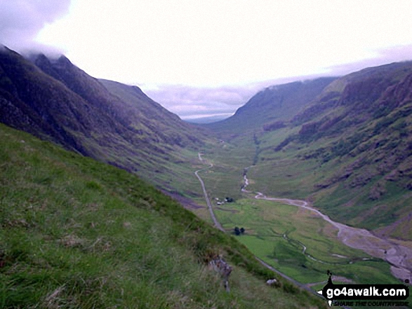
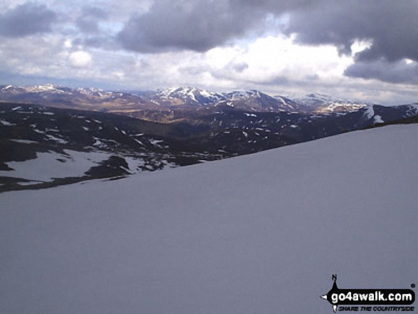
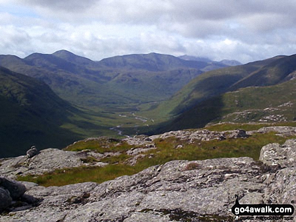
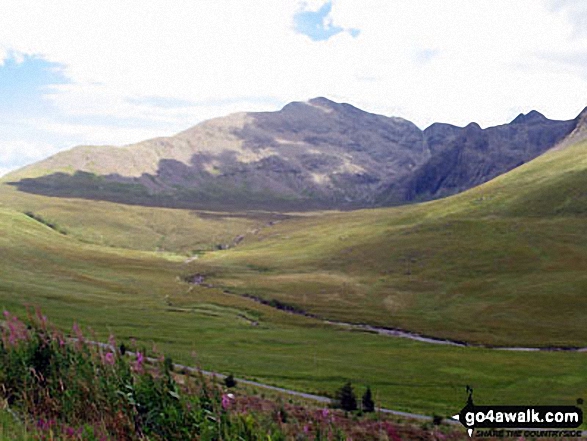
To reverse the order select the link again.


Mountain, Peak, Top or Hill:

Bagged


271. Meall Garbh (Glen Lyon)

968m (3,177ft)


Got a good photo of
Meall Garbh (Glen Lyon)?

Send it in and we'll publish it here.

Photo
Submission
Details

  • Munro (No. 186)
  • Murdo (271st)

  • We hope to have walks that climb & bag Meall Garbh (Glen Lyon) very soon

    Google Maps Icon
    See the location of Meall Garbh (Glen Lyon) and walks up it on a google Map

    Meall Garbh (Glen Lyon) is on interactive maps:

  • OS Explorer (Orange Covers): OL48 and OL49
  • OS Landranger (Pink Covers): 51

  • A go4awalk.com Peak Bagging Map and Hill Tick List featuring Meall Garbh (Glen Lyon) will be available soon.


    272. Stob an Fhuarain (Sgor na h-Ulaidh)

    968m (3,177ft)


    Got a good photo of
    Stob an Fhuarain (Sgor na h-Ulaidh)?

    Send it in and we'll publish it here.

    Photo
    Submission
    Details

  • Murdo (272nd)

  • We hope to have walks that climb & bag Stob an Fhuarain (Sgor na h-Ulaidh) very soon

    Google Maps Icon
    See the location of Stob an Fhuarain (Sgor na h-Ulaidh) and walks up it on a google Map

    Stob an Fhuarain (Sgor na h-Ulaidh) is on interactive maps:

  • OS Explorer (Orange Covers): 384
  • OS Landranger (Pink Covers): 41

  • A go4awalk.com Peak Bagging Map and Hill Tick List featuring Stob an Fhuarain (Sgor na h-Ulaidh) will be available soon.


    273. A' Mhaighdean

    967m (3,174ft)


    Got a good photo of
    A' Mhaighdean?

    Send it in and we'll publish it here.

    Photo
    Submission
    Details

  • Munro (No. 188)
  • Murdo (274th)
  • Marilyn (142nd in Scotland, 146th in GB)

  • We hope to have walks that climb & bag A' Mhaighdean very soon

    Google Maps Icon
    See the location of A' Mhaighdean and walks up it on a google Map

    A' Mhaighdean is on interactive maps:

  • OS Explorer (Orange Covers): 433 and 435
  • OS Landranger (Pink Covers): 19

  • A go4awalk.com Peak Bagging Map and Hill Tick List featuring A' Mhaighdean will be available soon.


    274. Carn na Con Dhu (Mullach na Dheiragain)

    967m (3,174ft)


    Got a good photo of
    Carn na Con Dhu (Mullach na Dheiragain)?

    Send it in and we'll publish it here.

    Photo
    Submission
    Details

  • Murdo (275th)

  • We hope to have walks that climb & bag Carn na Con Dhu (Mullach na Dheiragain) very soon

    Google Maps Icon
    See the location of Carn na Con Dhu (Mullach na Dheiragain) and walks up it on a google Map

    Carn na Con Dhu (Mullach na Dheiragain) is on interactive maps:

  • OS Explorer (Orange Covers): 414
  • OS Landranger (Pink Covers): 25

  • A go4awalk.com Peak Bagging Map and Hill Tick List featuring Carn na Con Dhu (Mullach na Dheiragain) will be available soon.


    275. Sgorr nam Fiannaidh (Aonach Eagach)

    967m (3,174ft)

  • Munro (No. 187)
  • Murdo (273rd)
  • Marilyn (143rd in Scotland, 147th in GB)
  • OS Trig Point

  • To walk, climb & bag Sgorr nam Fiannaidh (Aonach Eagach) use either of these easy to follow walks:

    Google Maps Icon
    See the location of Sgorr nam Fiannaidh (Aonach Eagach) and walks up it on a google Map

    Sgorr nam Fiannaidh (Aonach Eagach) is on interactive maps:

  • OS Explorer (Orange Covers): 384
  • OS Landranger (Pink Covers): 41

  • A go4awalk.com Peak Bagging Map and Hill Tick List featuring Sgorr nam Fiannaidh (Aonach Eagach) will be available soon.


    276. Ben More (Mull)

    966m (3,170ft)

  • Munro (No. 189)
  • Murdo (276th)
  • Marilyn (144th in Scotland, 148th in GB)
  • OS Trig Point

  • We hope to have walks that climb & bag Ben More (Mull) very soon

    Google Maps Icon
    See the location of Ben More (Mull) and walks up it on a google Map

    Ben More (Mull) is on interactive maps:

  • OS Explorer (Orange Covers): 375
  • OS Landranger (Pink Covers): 47 and 48

  • A go4awalk.com Peak Bagging Map and Hill Tick List featuring Ben More (Mull) will be available soon.


    277. Meall na Dige (Stob Binnein)

    966m (3,170ft)


    Got a good photo of
    Meall na Dige (Stob Binnein)?

    Send it in and we'll publish it here.

    Photo
    Submission
    Details

  • Murdo (277th)

  • We hope to have walks that climb & bag Meall na Dige (Stob Binnein) very soon

    Google Maps Icon
    See the location of Meall na Dige (Stob Binnein) and walks up it on a google Map

    Meall na Dige (Stob Binnein) is on interactive maps:

  • OS Explorer (Orange Covers): OL46
  • OS Landranger (Pink Covers): 51

  • A go4awalk.com Peak Bagging Map and Hill Tick List featuring Meall na Dige (Stob Binnein) will be available soon.


    278. Sron an Isean (Stob Diamh)

    966m (3,170ft)


    Got a good photo of
    Sron an Isean (Stob Diamh)?

    Send it in and we'll publish it here.

    Photo
    Submission
    Details

  • Murdo (278th)

  • We hope to have walks that climb & bag Sron an Isean (Stob Diamh) very soon

    Google Maps Icon
    See the location of Sron an Isean (Stob Diamh) and walks up it on a google Map

    Sron an Isean (Stob Diamh) is on interactive maps:

  • OS Explorer (Orange Covers): 377
  • OS Landranger (Pink Covers): 50

  • A go4awalk.com Peak Bagging Map and Hill Tick List featuring Sron an Isean (Stob Diamh) will be available soon.


    279. Sgurr na Banachdich

    965m (3,167ft)

  • Munro (No. 190)
  • Murdo (279th)

  • We hope to have walks that climb & bag Sgurr na Banachdich very soon

    Google Maps Icon
    See the location of Sgurr na Banachdich and walks up it on a google Map

    Sgurr na Banachdich is on interactive maps:

  • OS Explorer (Orange Covers): 411
  • OS Landranger (Pink Covers): 32

  • A go4awalk.com Peak Bagging Map and Hill Tick List featuring Sgurr na Banachdich will be available soon.


    280. Sgurr nan Gillean (Knight's Peak)

    964m (3,163ft)

  • Munro (No. 191)
  • Murdo (280th)
  • Marilyn (145th in Scotland, 149th in GB)

  • We hope to have walks that climb & bag Sgurr nan Gillean (Knight's Peak) very soon

    Google Maps Icon
    See the location of Sgurr nan Gillean (Knight's Peak) and walks up it on a google Map

    Sgurr nan Gillean (Knight's Peak) is on interactive maps:

  • OS Explorer (Orange Covers): 411
  • OS Landranger (Pink Covers): 32

  • A go4awalk.com Peak Bagging Map and Hill Tick List featuring Sgurr nan Gillean (Knight's Peak) will be available soon.


    281. Carn a' Chlamain

    963m (3,161ft)

  • Munro (No. 192)
  • Murdo (281st)
  • Marilyn (146th in Scotland, 150th in GB)

  • We hope to have walks that climb & bag Carn a' Chlamain very soon

    Google Maps Icon
    See the location of Carn a' Chlamain and walks up it on a google Map

    Carn a' Chlamain is on interactive maps:

  • OS Explorer (Orange Covers): OL51
  • OS Landranger (Pink Covers): 43

  • A go4awalk.com Peak Bagging Map and Hill Tick List featuring Carn a' Chlamain will be available soon.


    282. Sgurr a' Bhuic (Aonach Beag)

    963m (3,161ft)


    Got a good photo of
    Sgurr a' Bhuic (Aonach Beag)?

    Send it in and we'll publish it here.

    Photo
    Submission
    Details

  • Murdo (283rd)

  • We hope to have walks that climb & bag Sgurr a' Bhuic (Aonach Beag) very soon

    Google Maps Icon
    See the location of Sgurr a' Bhuic (Aonach Beag) and walks up it on a google Map

    Sgurr a' Bhuic (Aonach Beag) is on interactive maps:

  • OS Explorer (Orange Covers): 392
  • OS Landranger (Pink Covers): 41

  • A go4awalk.com Peak Bagging Map and Hill Tick List featuring Sgurr a' Bhuic (Aonach Beag) will be available soon.


    283. Sgurr Choinnich Beag

    963m (3,161ft)


    Got a good photo of
    Sgurr Choinnich Beag?

    Send it in and we'll publish it here.

    Photo
    Submission
    Details

  • Murdo (284th)

  • We hope to have walks that climb & bag Sgurr Choinnich Beag very soon

    Google Maps Icon
    See the location of Sgurr Choinnich Beag and walks up it on a google Map

    Sgurr Choinnich Beag is on interactive maps:

  • OS Explorer (Orange Covers): 392
  • OS Landranger (Pink Covers): 41

  • A go4awalk.com Peak Bagging Map and Hill Tick List featuring Sgurr Choinnich Beag will be available soon.


    284. Sgurr nan Fhir Duibhe (Beinn Eighe)

    963m (3,161ft)


    Got a good photo of
    Sgurr nan Fhir Duibhe (Beinn Eighe)?

    Send it in and we'll publish it here.

    Photo
    Submission
    Details

  • Murdo (285th)

  • We hope to have walks that climb & bag Sgurr nan Fhir Duibhe (Beinn Eighe) very soon

    Google Maps Icon
    See the location of Sgurr nan Fhir Duibhe (Beinn Eighe) and walks up it on a google Map

    Sgurr nan Fhir Duibhe (Beinn Eighe) is on interactive maps:

  • OS Explorer (Orange Covers): 433
  • OS Landranger (Pink Covers): 25

  • A go4awalk.com Peak Bagging Map and Hill Tick List featuring Sgurr nan Fhir Duibhe (Beinn Eighe) will be available soon.


    285. Sgurr Thuilm (Glen Pean)

    963m (3,161ft)


    Got a good photo of
    Sgurr Thuilm (Glen Pean)?

    Send it in and we'll publish it here.

    Photo
    Submission
    Details

  • Munro (No. 193)
  • Murdo (282nd)
  • Marilyn (147th in Scotland, 151st in GB)

  • We hope to have walks that climb & bag Sgurr Thuilm (Glen Pean) very soon

    Google Maps Icon
    See the location of Sgurr Thuilm (Glen Pean) and walks up it on a google Map

    Sgurr Thuilm (Glen Pean) is on interactive maps:

  • OS Explorer (Orange Covers): 398
  • OS Landranger (Pink Covers): 40

  • A go4awalk.com Peak Bagging Map and Hill Tick List featuring Sgurr Thuilm (Glen Pean) will be available soon.


    286. Ben Klibreck (Meall nan Con)

    962m (3,157ft)


    Got a good photo of
    Ben Klibreck (Meall nan Con)?

    Send it in and we'll publish it here.

    Photo
    Submission
    Details

  • Munro (No. 194)
  • Murdo (286th)
  • Marilyn (148th in Scotland, 152nd in GB)
  • OS Trig Point

  • We hope to have walks that climb & bag Ben Klibreck (Meall nan Con) very soon

    Google Maps Icon
    See the location of Ben Klibreck (Meall nan Con) and walks up it on a google Map

    Ben Klibreck (Meall nan Con) is on interactive maps:

  • OS Explorer (Orange Covers): 443 and 448
  • OS Landranger (Pink Covers): 16

  • A go4awalk.com Peak Bagging Map and Hill Tick List featuring Ben Klibreck (Meall nan Con) will be available soon.


    287. Gaor Bheinn (Gulvain) (South Top)

    962m (3,157ft)


    Got a good photo of
    Gaor Bheinn (Gulvain) (South Top)?

    Send it in and we'll publish it here.

    Photo
    Submission
    Details

  • Murdo (289th)
  • OS Trig Point

  • We hope to have walks that climb & bag Gaor Bheinn (Gulvain) (South Top) very soon

    Google Maps Icon
    See the location of Gaor Bheinn (Gulvain) (South Top) and walks up it on a google Map

    Gaor Bheinn (Gulvain) (South Top) is on interactive maps:

  • OS Explorer (Orange Covers): 398 and 399
  • OS Landranger (Pink Covers): 40

  • A go4awalk.com Peak Bagging Map and Hill Tick List featuring Gaor Bheinn (Gulvain) (South Top) will be available soon.


    288. Sgorr Ruadh

    962m (3,157ft)


    Got a good photo of
    Sgorr Ruadh?

    Send it in and we'll publish it here.

    Photo
    Submission
    Details

  • Munro (No. 195)
  • Murdo (287th)
  • Marilyn (149th in Scotland, 153rd in GB)

  • We hope to have walks that climb & bag Sgorr Ruadh very soon

    Google Maps Icon
    See the location of Sgorr Ruadh and walks up it on a google Map

    Sgorr Ruadh is on interactive maps:

  • OS Explorer (Orange Covers): 429
  • OS Landranger (Pink Covers): 25

  • A go4awalk.com Peak Bagging Map and Hill Tick List featuring Sgorr Ruadh will be available soon.


    289. Sgurr a'Dubh Doire (Beinn Fhada/Ben Attow)

    962m (3,157ft)


    Got a good photo of
    Sgurr a'Dubh Doire (Beinn Fhada/Ben Attow)?

    Send it in and we'll publish it here.

    Photo
    Submission
    Details

  • Murdo (288th)

  • We hope to have walks that climb & bag Sgurr a'Dubh Doire (Beinn Fhada/Ben Attow) very soon

    Google Maps Icon
    See the location of Sgurr a'Dubh Doire (Beinn Fhada/Ben Attow) and walks up it on a google Map

    Sgurr a'Dubh Doire (Beinn Fhada/Ben Attow) is on interactive maps:

  • OS Explorer (Orange Covers): 414
  • OS Landranger (Pink Covers): 33

  • A go4awalk.com Peak Bagging Map and Hill Tick List featuring Sgurr a'Dubh Doire (Beinn Fhada/Ben Attow) will be available soon.


    290. Carn na Criche (Sgurr Mor)

    961m (3,154ft)


    Got a good photo of
    Carn na Criche (Sgurr Mor)?

    Send it in and we'll publish it here.

    Photo
    Submission
    Details

  • Murdo (290th)

  • We hope to have walks that climb & bag Carn na Criche (Sgurr Mor) very soon

    Google Maps Icon
    See the location of Carn na Criche (Sgurr Mor) and walks up it on a google Map

    Carn na Criche (Sgurr Mor) is on interactive maps:

  • OS Explorer (Orange Covers): 436
  • OS Landranger (Pink Covers): 20

  • A go4awalk.com Peak Bagging Map and Hill Tick List featuring Carn na Criche (Sgurr Mor) will be available soon.


    291. Beinn nan Aighenan

    960m (3,151ft)

  • Munro (No. 196)
  • Murdo (291st)
  • Marilyn (150th in Scotland, 154th in GB)

  • We hope to have walks that climb & bag Beinn nan Aighenan very soon

    Google Maps Icon
    See the location of Beinn nan Aighenan and walks up it on a google Map

    Beinn nan Aighenan is on interactive maps:

  • OS Explorer (Orange Covers): 377
  • OS Landranger (Pink Covers): 50

  • A go4awalk.com Peak Bagging Map and Hill Tick List featuring Beinn nan Aighenan will be available soon.


    292. Ben More Assynt (South Top)

    960m (3,151ft)


    Got a good photo of
    Ben More Assynt (South Top)?

    Send it in and we'll publish it here.

    Photo
    Submission
    Details

  • Murdo (295th)

  • We hope to have walks that climb & bag Ben More Assynt (South Top) very soon

    Google Maps Icon
    See the location of Ben More Assynt (South Top) and walks up it on a google Map

    Ben More Assynt (South Top) is on interactive maps:

  • OS Explorer (Orange Covers): 442
  • OS Landranger (Pink Covers): 15

  • A go4awalk.com Peak Bagging Map and Hill Tick List featuring Ben More Assynt (South Top) will be available soon.


    293. Stob a' Choire Odhair (Ladhar Bheinn)

    960m (3,151ft)


    Got a good photo of
    Stob a' Choire Odhair (Ladhar Bheinn)?

    Send it in and we'll publish it here.

    Photo
    Submission
    Details

  • Murdo (293rd)

  • We hope to have walks that climb & bag Stob a' Choire Odhair (Ladhar Bheinn) very soon

    Google Maps Icon
    See the location of Stob a' Choire Odhair (Ladhar Bheinn) and walks up it on a google Map

    Stob a' Choire Odhair (Ladhar Bheinn) is on interactive maps:

  • OS Explorer (Orange Covers): 413
  • OS Landranger (Pink Covers): 33

  • A go4awalk.com Peak Bagging Map and Hill Tick List featuring Stob a' Choire Odhair (Ladhar Bheinn) will be available soon.


    294. Stob Cadha Gobhlach (An Teallach)

    960m (3,151ft)


    Got a good photo of
    Stob Cadha Gobhlach (An Teallach)?

    Send it in and we'll publish it here.

    Photo
    Submission
    Details

  • Murdo (294th)

  • We hope to have walks that climb & bag Stob Cadha Gobhlach (An Teallach) very soon

    Google Maps Icon
    See the location of Stob Cadha Gobhlach (An Teallach) and walks up it on a google Map

    Stob Cadha Gobhlach (An Teallach) is on interactive maps:

  • OS Explorer (Orange Covers): 435
  • OS Landranger (Pink Covers): 19

  • A go4awalk.com Peak Bagging Map and Hill Tick List featuring Stob Cadha Gobhlach (An Teallach) will be available soon.


    295. Stuc an Lochain

    960m (3,151ft)


    Got a good photo of
    Stuc an Lochain?

    Send it in and we'll publish it here.

    Photo
    Submission
    Details

  • Munro (No. 197)
  • Murdo (292nd)
  • Marilyn (151st in Scotland, 155th in GB)

  • We hope to have walks that climb & bag Stuc an Lochain very soon

    Google Maps Icon
    See the location of Stuc an Lochain and walks up it on a google Map

    Stuc an Lochain is on interactive maps:

  • OS Explorer (Orange Covers): OL48
  • OS Landranger (Pink Covers): 51

  • A go4awalk.com Peak Bagging Map and Hill Tick List featuring Stuc an Lochain will be available soon.


    296. Beinn Fhionnlaidh (Glen Creran)

    959m (3,147ft)


    Got a good photo of
    Beinn Fhionnlaidh (Glen Creran)?

    Send it in and we'll publish it here.

    Photo
    Submission
    Details

  • Munro (No. 199)
  • Murdo (297th)
  • Marilyn (152nd in Scotland, 156th in GB)
  • OS Trig Point

  • We hope to have walks that climb & bag Beinn Fhionnlaidh (Glen Creran) very soon

    Google Maps Icon
    See the location of Beinn Fhionnlaidh (Glen Creran) and walks up it on a google Map

    Beinn Fhionnlaidh (Glen Creran) is on interactive maps:

  • OS Explorer (Orange Covers): 384
  • OS Landranger (Pink Covers): 50

  • A go4awalk.com Peak Bagging Map and Hill Tick List featuring Beinn Fhionnlaidh (Glen Creran) will be available soon.


    297. Meall Glas (Glen Lochay)

    959m (3,147ft)

  • Munro (No. 198)
  • Murdo (296th)
  • Marilyn (153rd in Scotland, 157th in GB)

  • We hope to have walks that climb & bag Meall Glas (Glen Lochay) very soon

    Google Maps Icon
    See the location of Meall Glas (Glen Lochay) and walks up it on a google Map

    Meall Glas (Glen Lochay) is on interactive maps:

  • OS Explorer (Orange Covers): OL48
  • OS Landranger (Pink Covers): 51

  • A go4awalk.com Peak Bagging Map and Hill Tick List featuring Meall Glas (Glen Lochay) will be available soon.


    298. Stob Garbh (Cruach Ardrain)

    959m (3,147ft)


    Got a good photo of
    Stob Garbh (Cruach Ardrain)?

    Send it in and we'll publish it here.

    Photo
    Submission
    Details

  • Murdo (298th)

  • We hope to have walks that climb & bag Stob Garbh (Cruach Ardrain) very soon

    Google Maps Icon
    See the location of Stob Garbh (Cruach Ardrain) and walks up it on a google Map

    Stob Garbh (Cruach Ardrain) is on interactive maps:

  • OS Explorer (Orange Covers): OL39
  • OS Landranger (Pink Covers): 51

  • A go4awalk.com Peak Bagging Map and Hill Tick List featuring Stob Garbh (Cruach Ardrain) will be available soon.


    299. Bruach na Frithe

    958m (3,144ft)

  • Munro (No. 201)
  • Murdo (300th)
  • OS Trig Point

  • We hope to have walks that climb & bag Bruach na Frithe very soon

    Google Maps Icon
    See the location of Bruach na Frithe and walks up it on a google Map

    Bruach na Frithe is on interactive maps:

  • OS Explorer (Orange Covers): 411
  • OS Landranger (Pink Covers): 32

  • A go4awalk.com Peak Bagging Map and Hill Tick List featuring Bruach na Frithe will be available soon.


    300. Buachaille Etive Beag (Stob Dubh)

    958m (3,144ft)

  • Munro (No. 200)
  • Murdo (299th)
  • Marilyn (154th in Scotland, 158th in GB)

  • To walk, climb & bag Buachaille Etive Beag (Stob Dubh) use any of these easy to follow walks:

    Google Maps Icon
    See the location of Buachaille Etive Beag (Stob Dubh) and walks up it on a google Map

    Buachaille Etive Beag (Stob Dubh) is on interactive maps:

  • OS Explorer (Orange Covers): 384
  • OS Landranger (Pink Covers): 41

  • A go4awalk.com Peak Bagging Map and Hill Tick List featuring Buachaille Etive Beag (Stob Dubh) will be available soon.


    Page 10 of 15    Go to page: 1 2 3 4 5 6 7 8 9 10 Next Last


    View all 1674 Mountains, Peaks, Tops and Hills in Glen Coe Scottish Region : Loch Leven to Connel Bridge, Strath of Orchy and Glen Lochy:


    Is there a Mountain, Peak, Top or Hill missing from the above google map or list?

    Let us know an we will add it to our database.


    Do not miss our pick of the Best Walks in Britain


    Follow go4awalk.com on Twitter Follow go4awalk.com on Facebook


    Home


    Find new Friends to go walking with

    Walk all 214 Wainwrights in just 59 Walks. Download GPS Waypoints - Great Walks you must not miss!

    Walk The Yorkshire Three Peaks Challenge Walk - All the Latest Route Information, GPS Waypoints and Split Times to keep you on Schedule

    Walk The British Three Peaks Challenge Walk - All the Latest Route Information and GPS Waypoints

    See our pick of The Best Walks in The Lake District - Great Walks you must not miss!

    Walk our pick of the Best Lake District Ridge Walks - Great Walks you must not miss!

    Walk our pick of the Best Lake District Walks to do in the rain - Great Walks you must not miss!

    Walk our pick of The Best Walks in Snowdonia - Great Walks you must not miss!

    Walk our pick of The Best Ridge Walks in Wales - Walks you must not miss!

    Walk our pick of The Best Walks in The Brecon Beacons - Great Walks you must not miss!

    Walk our pick of The Best Walks in The Yorkshire Dales - Walks you must not miss!

    Walk our pick of The Best Walks in The Peak District - Walks you must not miss!

    Walk our pick of The Best Walks in The Forest of Bowland - Walks you must not miss!

    Walk our pick of The Best Walks in Shropshire - Walks you must not miss!

    Walk our pick of The Best Walks in Cheshire - Walks you must not miss!

    Walk our pick of The Best Walks in Lancashire - Walks you must not miss!

    Not sure where to walk next? Try Peak Bagging - Great Walks you must not miss!

    Not sure where to walk next? Walk part of a National Trail - Great Walks you must not miss!

    Walks with Downloadable and Uploadable GPS Waypoint Data

    Walking Kit and Gear Tested by Walkers

    Full Site Search
    Do not miss our pick of the Best Walks in Britain