The Isle of Man - a fully detailed list of all the Mountains, Peaks, Tops and Hills (Page 4 of 41)
If you count only the Marilyns there are 1218 tops to climb, bag & conquer and the highest point is Ben Nevis at 1,344m (4,411ft).
To see these Mountains, Peaks, Tops and Hills displayed in different ways - see the options in the left-hand column and towards the bottom of this page.
LOG ON and RELOAD this page to show which Mountains, Peaks, Tops and Hills you have already climbed, bagged & conquered [. . . more details]
See this list in: Alphabetical Order
| Height Order‡
To reverse the order select the link again.
Mountain, Peak, Top or Hill:
Bagged
91. Beinn Bheoil
1,019m (3,344ft)
Beinn Bheoil is on interactive maps:
A downloadable go4awalk.com PDF Peak Bagging Map featuring Beinn Bheoil will be available soon. |
92. Mullach Coire Mhic Fhearchair
1,018m (3,341ft)
Send it in and we'll publish it here.
Mullach Coire Mhic Fhearchair is on interactive maps:
A downloadable go4awalk.com PDF Peak Bagging Map featuring Mullach Coire Mhic Fhearchair will be available soon. |
93. Garbh Chioch Mhor
1,013m (3,325ft)
Garbh Chioch Mhor is on interactive maps:
A downloadable go4awalk.com PDF Peak Bagging Map featuring Garbh Chioch Mhor will be available soon. |
94. Beinn Ime
1,011m (3,318ft)
See the location of Beinn Ime and walks up it on a google Map Beinn Ime is on interactive maps:
A downloadable go4awalk.com PDF Peak Bagging Map featuring Beinn Ime will be available soon. |
95. The Saddle (Glenshiel)
1,011m (3,318ft)
The Saddle (Glenshiel) is on interactive maps:
A downloadable go4awalk.com PDF Peak Bagging Map featuring The Saddle (Glenshiel) will be available soon. |
96. Ruadh-stac Mor (Beinn Eighe)
1,010m (3,315ft)
Ruadh-stac Mor (Beinn Eighe) is on interactive maps:
A downloadable go4awalk.com PDF Peak Bagging Map featuring Ruadh-stac Mor (Beinn Eighe) will be available soon. |
97. Sgurr an Doire Leathain
1,010m (3,315ft)
Send it in and we'll publish it here.
Sgurr an Doire Leathain is on interactive maps:
A downloadable go4awalk.com PDF Peak Bagging Map featuring Sgurr an Doire Leathain will be available soon. |
98. Sgurr Eilde Mor
1,010m (3,315ft)
Sgurr Eilde Mor is on interactive maps:
A downloadable go4awalk.com PDF Peak Bagging Map featuring Sgurr Eilde Mor will be available soon. |
99. Beinn Udlamain
1,010m (3,314ft)
Beinn Udlamain is on interactive maps:
A downloadable go4awalk.com PDF Peak Bagging Map featuring Beinn Udlamain will be available soon. |
100. Beinn Dearg (The Tarf and Tilt Hills)
1,008m (3,308ft)
Send it in and we'll publish it here.
Beinn Dearg (The Tarf and Tilt Hills) is on interactive maps:
A downloadable go4awalk.com PDF Peak Bagging Map featuring Beinn Dearg (The Tarf and Tilt Hills) will be available soon. |
101. An Sgarsoch
1,006m (3,302ft)
An Sgarsoch is on interactive maps:
A downloadable go4awalk.com PDF Peak Bagging Map featuring An Sgarsoch will be available soon. |
102. Beinn Fhionnlaidh (West Benula Forest)
1,005m (3,298ft)
Send it in and we'll publish it here.
Beinn Fhionnlaidh (West Benula Forest) is on interactive maps:
A downloadable go4awalk.com PDF Peak Bagging Map featuring Beinn Fhionnlaidh (West Benula Forest) will be available soon. |
103. Creag Toll a' Choin
1,005m (3,298ft)
Send it in and we'll publish it here.
Creag Toll a' Choin is on interactive maps:
|
104. Beinn an Dothaidh
1,004m (3,295ft)
Beinn an Dothaidh is on interactive maps:
A downloadable go4awalk.com PDF Peak Bagging Map featuring Beinn an Dothaidh will be available soon. |
105. Sgurr Mor (Glen Kingie)
1,003m (3,292ft)
Send it in and we'll publish it here.
Sgurr Mor (Glen Kingie) is on interactive maps:
A downloadable go4awalk.com PDF Peak Bagging Map featuring Sgurr Mor (Glen Kingie) will be available soon. |
106. Aonach Meadhoin
1,001m (3,285ft)
Aonach Meadhoin is on interactive maps:
A downloadable go4awalk.com PDF Peak Bagging Map featuring Aonach Meadhoin will be available soon. |
107. Meall Greigh
1,001m (3,285ft)
Meall Greigh is on interactive maps:
A downloadable go4awalk.com PDF Peak Bagging Map featuring Meall Greigh will be available soon. |
108. Sgorr Dhonuill (Beinn a' Bheithir)
1,001m (3,285ft)
See the location of Sgorr Dhonuill (Beinn a' Bheithir) and walks up it on a google Map Sgorr Dhonuill (Beinn a' Bheithir) is on interactive maps:
A downloadable go4awalk.com PDF Peak Bagging Map featuring Sgorr Dhonuill (Beinn a' Bheithir) will be available soon. |
109. Sgurr Breac
999m (3,279ft)
Sgurr Breac is on interactive maps:
A downloadable go4awalk.com PDF Peak Bagging Map featuring Sgurr Breac will be available soon. |
110. Stob Ban (Mamores)
999m (3,279ft)
Stob Ban (Mamores) is on interactive maps:
A downloadable go4awalk.com PDF Peak Bagging Map featuring Stob Ban (Mamores) will be available soon. |
111. Ben More Assynt
998m (3,275ft)
Ben More Assynt is on interactive maps:
A downloadable go4awalk.com PDF Peak Bagging Map featuring Ben More Assynt will be available soon. |
112. A' Chailleach (Wester Ross)
997m (3,272ft)
A' Chailleach (Wester Ross) is on interactive maps:
A downloadable go4awalk.com PDF Peak Bagging Map featuring A' Chailleach (Wester Ross) will be available soon. |
113. Glas Bheinn Mhor (Glen Etive)
997m (3,272ft)
Glas Bheinn Mhor (Glen Etive) is on interactive maps:
A downloadable go4awalk.com PDF Peak Bagging Map featuring Glas Bheinn Mhor (Glen Etive) will be available soon. |
114. Spidean Mialach
996m (3,269ft)
Spidean Mialach is on interactive maps:
A downloadable go4awalk.com PDF Peak Bagging Map featuring Spidean Mialach will be available soon. |
115. An Caisteal (Glen Falloch)
995m (3,266ft)
See the location of An Caisteal (Glen Falloch) and walks up it on a google Map An Caisteal (Glen Falloch) is on interactive maps:
A downloadable go4awalk.com PDF Peak Bagging Map featuring An Caisteal (Glen Falloch) will be available soon. |
116. Carn an Fhidhleir (Carn Ealar)
994m (3,262ft)
Send it in and we'll publish it here.
Carn an Fhidhleir (Carn Ealar) is on interactive maps:
A downloadable go4awalk.com PDF Peak Bagging Map featuring Carn an Fhidhleir (Carn Ealar) will be available soon. |
117. Sgurr na h-Ulaidh
994m (3,262ft)
Sgurr na h-Ulaidh is on interactive maps:
A downloadable go4awalk.com PDF Peak Bagging Map featuring Sgurr na h-Ulaidh will be available soon. |
118. Sgurr na Ruaidhe
993m (3,259ft)
Sgurr na Ruaidhe is on interactive maps:
A downloadable go4awalk.com PDF Peak Bagging Map featuring Sgurr na Ruaidhe will be available soon. |
119. Spidean Coire nan Clach (Beinn Eighe)
993m (3,259ft)
Spidean Coire nan Clach (Beinn Eighe) is on interactive maps:
A downloadable go4awalk.com PDF Peak Bagging Map featuring Spidean Coire nan Clach (Beinn Eighe) will be available soon. |
120. Carn nan Gobhar (Glencannich Forest)
992m (3,256ft)
Send it in and we'll publish it here.
Carn nan Gobhar (Glencannich Forest) is on interactive maps:
A downloadable go4awalk.com PDF Peak Bagging Map featuring Carn nan Gobhar (Glencannich Forest) will be available soon. |
View these 1218 Mountains, Peaks, Tops and Hills:
- On an Interactive Google Map (loads faster)
- On an Interactive Google Map with a list of tops below it.
(makes it easier to locate a particular top) - On a Detailed List in:
Alphabetical Order | Height Order - On one page with 'yet-to-be-bagged' listed 1st & then 'already-bagged' tops listed 2nd in:
Alphabetical Order | Height Order - On one page with 'already-bagged' tops listed 1st & then 'yet-to-be-bagged' tops listed 2nd in:
Alphabetical Order | Height Order
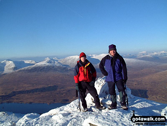
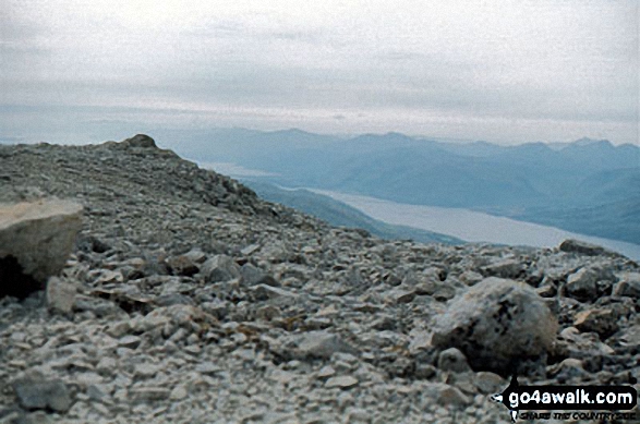 The summit of Ben Nevis in Glen Cannich to Glen CarronScotland
Photo: John Reed
Is there a Mountain, Peak, Top or Hill missing from the above google map or list?
Let us know an we will add it to our database.

