The Isle of Man - a fully detailed list of all the Mountains, Peaks, Tops and Hills (Page 11 of 41)
If you count only the Marilyns there are 1218 tops to climb, bag & conquer and the highest point is Ben Nevis at 1,344m (4,411ft).
To see these Mountains, Peaks, Tops and Hills displayed in different ways - see the options in the left-hand column and towards the bottom of this page.
LOG ON and RELOAD this page to show which Mountains, Peaks, Tops and Hills you have already climbed, bagged & conquered [. . . more details]
Page 11 of 41 First Previous 11 12 13 14 15 16 17 18 19 20 Next Last |
See this list in: Alphabetical Order
| Height Order‡
To reverse the order select the link again.
Mountain, Peak, Top or Hill:
Bagged
301. Merrick
843m (2,766ft)
Merrick is on interactive maps:
A downloadable go4awalk.com PDF Peak Bagging Map featuring Merrick will be available soon. |
302. Carn Ban (Freevater Forest)
842m (2,763ft)
Send it in and we'll publish it here.
Carn Ban (Freevater Forest) is on interactive maps:
A downloadable go4awalk.com PDF Peak Bagging Map featuring Carn Ban (Freevater Forest) will be available soon. |
303. Ben Vrackie
842m (2,762ft)
Ben Vrackie is on interactive maps:
A downloadable go4awalk.com PDF Peak Bagging Map featuring Ben Vrackie will be available soon. |
304. Beinn Mholach (Craiganour Forest)
841m (2,761ft)
Send it in and we'll publish it here.
Beinn Mholach (Craiganour Forest) is on interactive maps:
A downloadable go4awalk.com PDF Peak Bagging Map featuring Beinn Mholach (Craiganour Forest) will be available soon. |
305. Sgurr an Airgid
841m (2,760ft)
Sgurr an Airgid is on interactive maps:
A downloadable go4awalk.com PDF Peak Bagging Map featuring Sgurr an Airgid will be available soon. |
306. Ben Rinnes
841m (2,759ft)
Ben Rinnes is on interactive maps:
A downloadable go4awalk.com PDF Peak Bagging Map featuring Ben Rinnes will be available soon. |
307. Beinn Trilleachan
840m (2,757ft)
Beinn Trilleachan is on interactive maps:
A downloadable go4awalk.com PDF Peak Bagging Map featuring Beinn Trilleachan will be available soon. |
308. Beinn Udlaidh
840m (2,757ft)
Beinn Udlaidh is on interactive maps:
A downloadable go4awalk.com PDF Peak Bagging Map featuring Beinn Udlaidh will be available soon. |
309. Broad Law
840m (2,757ft)
Broad Law is on interactive maps:
A downloadable go4awalk.com PDF Peak Bagging Map featuring Broad Law will be available soon. |
310. Sgurr Gaorsaic
839m (2,754ft)
Sgurr Gaorsaic is on interactive maps:
A downloadable go4awalk.com PDF Peak Bagging Map featuring Sgurr Gaorsaic will be available soon. |
311. Carn Chuinneag
839m (2,753ft)
Carn Chuinneag is on interactive maps:
A downloadable go4awalk.com PDF Peak Bagging Map featuring Carn Chuinneag will be available soon. |
312. Meall na h-Eilde
838m (2,750ft)
Meall na h-Eilde is on interactive maps:
A downloadable go4awalk.com PDF Peak Bagging Map featuring Meall na h-Eilde will be available soon. |
313. Meallan nan Uan
838m (2,750ft)
Meallan nan Uan is on interactive maps:
A downloadable go4awalk.com PDF Peak Bagging Map featuring Meallan nan Uan will be available soon. |
314. Sron a' Choire Chnapanich
837m (2,747ft)
Send it in and we'll publish it here.
Sron a' Choire Chnapanich is on interactive maps:
A downloadable go4awalk.com PDF Peak Bagging Map featuring Sron a' Choire Chnapanich will be available soon. |
315. Sgurr Cos na Breachd-laoidh
835m (2,740ft)
Send it in and we'll publish it here.
Sgurr Cos na Breachd-laoidh is on interactive maps:
A downloadable go4awalk.com PDF Peak Bagging Map featuring Sgurr Cos na Breachd-laoidh will be available soon. |
316. Carn Dearg (Glen Roy)
834m (2,737ft)
Send it in and we'll publish it here.
Carn Dearg (Glen Roy) is on interactive maps:
A downloadable go4awalk.com PDF Peak Bagging Map featuring Carn Dearg (Glen Roy) will be available soon. |
317. Creag nan Gabhar
834m (2,737ft)
Creag nan Gabhar is on interactive maps:
A downloadable go4awalk.com PDF Peak Bagging Map featuring Creag nan Gabhar will be available soon. |
318. Beinn Dearg (Glen Lyon)
830m (2,724ft)
Send it in and we'll publish it here.
Beinn Dearg (Glen Lyon) is on interactive maps:
A downloadable go4awalk.com PDF Peak Bagging Map featuring Beinn Dearg (Glen Lyon) will be available soon. |
319. Brown Cow Hill
829m (2,721ft)
Brown Cow Hill is on interactive maps:
A downloadable go4awalk.com PDF Peak Bagging Map featuring Brown Cow Hill will be available soon. |
320. Carn Mor (Loch Morar)
829m (2,721ft)
Send it in and we'll publish it here.
Carn Mor (Loch Morar) is on interactive maps:
A downloadable go4awalk.com PDF Peak Bagging Map featuring Carn Mor (Loch Morar) will be available soon. |
321. An Dun
827m (2,714ft)
An Dun is on interactive maps:
A downloadable go4awalk.com PDF Peak Bagging Map featuring An Dun will be available soon. |
322. Beinn Tarsuinn (Arran)
826m (2,710ft)
Send it in and we'll publish it here.
Beinn Tarsuinn (Arran) is on interactive maps:
A downloadable go4awalk.com PDF Peak Bagging Map featuring Beinn Tarsuinn (Arran) will be available soon. |
323. Geal-charn Mor
824m (2,704ft)
Geal-charn Mor is on interactive maps:
A downloadable go4awalk.com PDF Peak Bagging Map featuring Geal-charn Mor will be available soon. |
324. Benvane
821m (2,695ft)
Benvane is on interactive maps:
A downloadable go4awalk.com PDF Peak Bagging Map featuring Benvane will be available soon. |
325. Geal Charn (Eastern Cairngorms)
821m (2,695ft)
Send it in and we'll publish it here.
Geal Charn (Eastern Cairngorms) is on interactive maps:
A downloadable go4awalk.com PDF Peak Bagging Map featuring Geal Charn (Eastern Cairngorms) will be available soon. |
326. White Coomb
821m (2,695ft)
White Coomb is on interactive maps:
A downloadable go4awalk.com PDF Peak Bagging Map featuring White Coomb will be available soon. |
327. Beinn Dearg Bheag
820m (2,691ft)
Beinn Dearg Bheag is on interactive maps:
A downloadable go4awalk.com PDF Peak Bagging Map featuring Beinn Dearg Bheag will be available soon. |
328. Carn na Drochaide
818m (2,685ft)
Carn na Drochaide is on interactive maps:
A downloadable go4awalk.com PDF Peak Bagging Map featuring Carn na Drochaide will be available soon. |
329. Sgorr na Diollaid
818m (2,685ft)
Sgorr na Diollaid is on interactive maps:
A downloadable go4awalk.com PDF Peak Bagging Map featuring Sgorr na Diollaid will be available soon. |
330. Beinn Chaorach (Strath Fillan)
818m (2,684ft)
Send it in and we'll publish it here.
Beinn Chaorach (Strath Fillan) is on interactive maps:
A downloadable go4awalk.com PDF Peak Bagging Map featuring Beinn Chaorach (Strath Fillan) will be available soon. |
Page 11 of 41 First Previous 11 12 13 14 15 16 17 18 19 20 Next Last |
View these 1218 Mountains, Peaks, Tops and Hills:
- On an Interactive Google Map (loads faster)
- On an Interactive Google Map with a list of tops below it.
(makes it easier to locate a particular top) - On a Detailed List in:
Alphabetical Order | Height Order - On one page with 'yet-to-be-bagged' listed 1st & then 'already-bagged' tops listed 2nd in:
Alphabetical Order | Height Order - On one page with 'already-bagged' tops listed 1st & then 'yet-to-be-bagged' tops listed 2nd in:
Alphabetical Order | Height Order
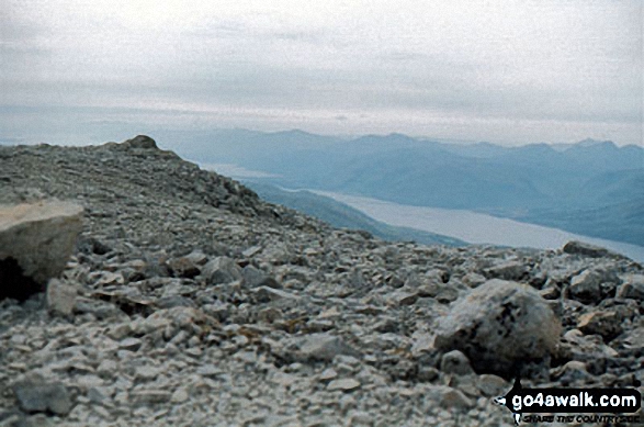
 The summit of Ben Nevis in The River Tay to Rannoch MoorScotland
Photo: John Reed
Is there a Mountain, Peak, Top or Hill missing from the above google map or list?
Let us know an we will add it to our database.


