The Isle of Man - a fully detailed list of all the Mountains, Peaks, Tops and Hills (Page 35 of 41)
If you count only the Marilyns there are 1218 tops to climb, bag & conquer and the highest point is Ben Nevis at 1,344m (4,411ft).
To see these Mountains, Peaks, Tops and Hills displayed in different ways - see the options in the left-hand column and towards the bottom of this page.
LOG ON and RELOAD this page to show which Mountains, Peaks, Tops and Hills you have already climbed, bagged & conquered [. . . more details]
Page 35 of 41 First Previous 31 32 33 34 35 36 37 38 39 40 Next Last |
See this list in: Alphabetical Order
| Height Order‡
To reverse the order select the link again.
Mountain, Peak, Top or Hill:
Bagged
1021. Sithean Mor (Sidhean Mor) (Wester Ross)
383m (1,256ft)
Send it in and we'll publish it here.
Sithean Mor (Sidhean Mor) (Wester Ross) is on interactive maps:
A downloadable go4awalk.com PDF Peak Bagging Map featuring Sithean Mor (Sidhean Mor) (Wester Ross) will be available soon. |
1022. Hill of Tillymorgan
381m (1,250ft)
Send it in and we'll publish it here.
Hill of Tillymorgan is on interactive maps:
A downloadable go4awalk.com PDF Peak Bagging Map featuring Hill of Tillymorgan will be available soon. |
1023. Cnoc an t-Sabhail (Strath Rory)
380m (1,247ft)
Send it in and we'll publish it here.
Cnoc an t-Sabhail (Strath Rory) is on interactive maps:
A downloadable go4awalk.com PDF Peak Bagging Map featuring Cnoc an t-Sabhail (Strath Rory) will be available soon. |
1024. Cruach na Seilcheig (Argyll)
380m (1,247ft)
Send it in and we'll publish it here.
Cruach na Seilcheig (Argyll) is on interactive maps:
A downloadable go4awalk.com PDF Peak Bagging Map featuring Cruach na Seilcheig (Argyll) will be available soon. |
1025. Dumglow
379m (1,244ft)
Dumglow is on interactive maps:
A downloadable go4awalk.com PDF Peak Bagging Map featuring Dumglow will be available soon. |
1026. Beinn Chreagach (Brolass)
379m (1,243ft)
Send it in and we'll publish it here.
Beinn Chreagach (Brolass) is on interactive maps:
A downloadable go4awalk.com PDF Peak Bagging Map featuring Beinn Chreagach (Brolass) will be available soon. |
1027. Cairn-mon-earn
378m (1,241ft)
Cairn-mon-earn is on interactive maps:
A downloadable go4awalk.com PDF Peak Bagging Map featuring Cairn-mon-earn will be available soon. |
1028. Cearnabhal (Kearnaval)
378m (1,241ft)
Send it in and we'll publish it here.
Cearnabhal (Kearnaval) is on interactive maps:
A downloadable go4awalk.com PDF Peak Bagging Map featuring Cearnabhal (Kearnaval) will be available soon. |
1029. Cnoc Glas (Soay)
378m (1,241ft)
Cnoc Glas (Soay) is on interactive maps:
A downloadable go4awalk.com PDF Peak Bagging Map featuring Cnoc Glas (Soay) will be available soon. |
1030. King's Seat (Sidlaw Hills)
377m (1,237ft)
King's Seat (Sidlaw Hills) is on interactive maps:
A downloadable go4awalk.com PDF Peak Bagging Map featuring King's Seat (Sidlaw Hills) will be available soon. |
1031. Corse Hill (Cunninghame)
376m (1,234ft)
Send it in and we'll publish it here.
Corse Hill (Cunninghame) is on interactive maps:
A downloadable go4awalk.com PDF Peak Bagging Map featuring Corse Hill (Cunninghame) will be available soon. |
1032. Cruachan Min
376m (1,234ft)
Cruachan Min is on interactive maps:
A downloadable go4awalk.com PDF Peak Bagging Map featuring Cruachan Min will be available soon. |
1033. Green Hill (Lowther Hills)
588m (1,229ft)
Send it in and we'll publish it here.
Green Hill (Lowther Hills) is on interactive maps:
|
1034. Stulabhal (Stulaval)
374m (1,227ft)
Send it in and we'll publish it here.
Stulabhal (Stulaval) is on interactive maps:
A downloadable go4awalk.com PDF Peak Bagging Map featuring Stulabhal (Stulaval) will be available soon. |
1035. Uisenis
374m (1,227ft)
Uisenis is on interactive maps:
A downloadable go4awalk.com PDF Peak Bagging Map featuring Uisenis will be available soon. |
1036. Ben Garrisdale
373m (1,224ft)
Ben Garrisdale is on interactive maps:
A downloadable go4awalk.com PDF Peak Bagging Map featuring Ben Garrisdale will be available soon. |
1037. Struie
373m (1,224ft)
Struie is on interactive maps:
A downloadable go4awalk.com PDF Peak Bagging Map featuring Struie will be available soon. |
1038. Knockan
372m (1,221ft)
Knockan is on interactive maps:
A downloadable go4awalk.com PDF Peak Bagging Map featuring Knockan will be available soon. |
1039. Meall a' Chaise (Strath Brora)
372m (1,220ft)
Send it in and we'll publish it here.
Meall a' Chaise (Strath Brora) is on interactive maps:
A downloadable go4awalk.com PDF Peak Bagging Map featuring Meall a' Chaise (Strath Brora) will be available soon. |
1040. Sgribhis-bheinn
371m (1,218ft)
Sgribhis-bheinn is on interactive maps:
A downloadable go4awalk.com PDF Peak Bagging Map featuring Sgribhis-bheinn will be available soon. |
1041. Carn Faire nan Con
370m (1,214ft)
Carn Faire nan Con is on interactive maps:
A downloadable go4awalk.com PDF Peak Bagging Map featuring Carn Faire nan Con will be available soon. |
1042. Arnaval
369m (1,211ft)
Arnaval is on interactive maps:
A downloadable go4awalk.com PDF Peak Bagging Map featuring Arnaval will be available soon. |
1043. A' Chruach (Loch Scammadale)
368m (1,208ft)
Send it in and we'll publish it here.
A' Chruach (Loch Scammadale) is on interactive maps:
A downloadable go4awalk.com PDF Peak Bagging Map featuring A' Chruach (Loch Scammadale) will be available soon. |
1044. Ceapabhal (Chaipaval)
368m (1,208ft)
Send it in and we'll publish it here.
Ceapabhal (Chaipaval) is on interactive maps:
A downloadable go4awalk.com PDF Peak Bagging Map featuring Ceapabhal (Chaipaval) will be available soon. |
1045. Bengray
366m (1,201ft)
Bengray is on interactive maps:
A downloadable go4awalk.com PDF Peak Bagging Map featuring Bengray will be available soon. |
1046. Meikle Balloch Hill
366m (1,201ft)
Meikle Balloch Hill is on interactive maps:
A downloadable go4awalk.com PDF Peak Bagging Map featuring Meikle Balloch Hill will be available soon. |
1047. Sgarbh Breac
364m (1,195ft)
Sgarbh Breac is on interactive maps:
A downloadable go4awalk.com PDF Peak Bagging Map featuring Sgarbh Breac will be available soon. |
1048. An Socach (Strath Shinary)
362m (1,188ft)
Send it in and we'll publish it here.
An Socach (Strath Shinary) is on interactive maps:
A downloadable go4awalk.com PDF Peak Bagging Map featuring An Socach (Strath Shinary) will be available soon. |
1049. The Fruin
361m (1,185ft)
The Fruin is on interactive maps:
A downloadable go4awalk.com PDF Peak Bagging Map featuring The Fruin will be available soon. |
1050. Conic Hill
361m (1,184ft)
See the location of Conic Hill and walks up it on a google Map Conic Hill is on interactive maps:
A downloadable go4awalk.com PDF Peak Bagging Map featuring Conic Hill will be available soon. |
Page 35 of 41 First Previous 31 32 33 34 35 36 37 38 39 40 Next Last |
View these 1218 Mountains, Peaks, Tops and Hills:
- On an Interactive Google Map (loads faster)
- On an Interactive Google Map with a list of tops below it.
(makes it easier to locate a particular top) - On a Detailed List in:
Alphabetical Order | Height Order - On one page with 'yet-to-be-bagged' listed 1st & then 'already-bagged' tops listed 2nd in:
Alphabetical Order | Height Order - On one page with 'already-bagged' tops listed 1st & then 'yet-to-be-bagged' tops listed 2nd in:
Alphabetical Order | Height Order
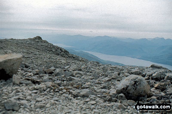
 The summit of Ben Nevis in Loch Lomond and The Trossachs to Loch TayScotland
Photo: John Reed
Is there a Mountain, Peak, Top or Hill missing from the above google map or list?
Let us know an we will add it to our database.


