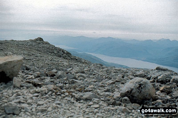
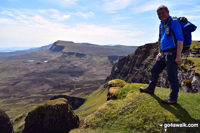
The Mountains, Peaks, Tops and Hills in Scotland as a detailed list

If you count only the Marilyns there are 1218 tops to climb, bag & conquer and the highest point is Ben Nevis at 1,344m (4,411ft).


munro
282/0
Munros
corbett
222/0
Corbetts
graham
219/0
Grahams
donald
89/0
Donalds
murdo
442/0
Murdos
marilyn
1218/0
Scottish
Marilyns
Bridget
159/0
Scottish
Bridgets
Trig Point
659/0
Trig
Points


To see all Mountains, Peaks, Tops and Hills displayed in different ways - see the options in the left-hand column and towards the bottom of this page.


LOG ON and RELOAD this page to show which Mountains, Peaks, Tops and Hills you have already climbed, bagged & conquered [. . . more]


Page 30 of 41    First Previous 21 22 23 24 25 26 27 28 29 30 Next Last


See this list in: Alphabetical Order | Height Order
To reverse the order select the link again.


Mountain, Peak, Top or Hill:

Bagged


871. Fell of Fleet

470m (1,543ft)


Got a good photo of
Fell of Fleet?

Send it in and we'll publish it here.

Photo
Submission
Details

  • Marilyn (871st in Scotland, 1050th in GB)

  • We hope to have walks that climb & bag Fell of Fleet very soon

    Google Maps Icon
    See the location of Fell of Fleet and walks up it on a google Map

    Fell of Fleet is on interactive maps:

  • OS Explorer (Orange Covers): 319
  • OS Landranger (Pink Covers): 77

  • A go4awalk.com Peak Bagging Map and Hill Tick List featuring Fell of Fleet will be available soon.


    872. Gormol

    470m (1,543ft)


    Got a good photo of
    Gormol?

    Send it in and we'll publish it here.

    Photo
    Submission
    Details

  • Marilyn (872nd in Scotland, 1051st in GB)
  • OS Trig Point

  • We hope to have walks that climb & bag Gormol very soon

    Google Maps Icon
    See the location of Gormol and walks up it on a google Map

    Gormol is on interactive maps:

  • OS Explorer (Orange Covers): 457
  • OS Landranger (Pink Covers): 13 and 14

  • A go4awalk.com Peak Bagging Map and Hill Tick List featuring Gormol will be available soon.


    873. Spartleton

    468m (1,536ft)


    Got a good photo of
    Spartleton?

    Send it in and we'll publish it here.

    Photo
    Submission
    Details

  • Marilyn (873rd in Scotland, 1054th in GB)
  • OS Trig Point

  • We hope to have walks that climb & bag Spartleton very soon

    Google Maps Icon
    See the location of Spartleton and walks up it on a google Map

    Spartleton is on interactive maps:

  • OS Explorer (Orange Covers): 345
  • OS Landranger (Pink Covers): 67

  • A go4awalk.com Peak Bagging Map and Hill Tick List featuring Spartleton will be available soon.


    874. Beinn Bhreac (Mull of Kintyre)

    468m (1,535ft)


    Got a good photo of
    Beinn Bhreac (Mull of Kintyre)?

    Send it in and we'll publish it here.

    Photo
    Submission
    Details

  • Marilyn (874th in Scotland, 1055th in GB)
  • OS Trig Point

  • We hope to have walks that climb & bag Beinn Bhreac (Mull of Kintyre) very soon

    Google Maps Icon
    See the location of Beinn Bhreac (Mull of Kintyre) and walks up it on a google Map

    Beinn Bhreac (Mull of Kintyre) is on interactive maps:

  • OS Explorer (Orange Covers): 355
  • OS Landranger (Pink Covers): 61

  • A go4awalk.com Peak Bagging Map and Hill Tick List featuring Beinn Bhreac (Mull of Kintyre) will be available soon.


    875. An Grianan (Strath Shinary)

    467m (1,533ft)


    Got a good photo of
    An Grianan (Strath Shinary)?

    Send it in and we'll publish it here.

    Photo
    Submission
    Details

  • Marilyn (875th in Scotland, 1056th in GB)

  • We hope to have walks that climb & bag An Grianan (Strath Shinary) very soon

    Google Maps Icon
    See the location of An Grianan (Strath Shinary) and walks up it on a google Map

    An Grianan (Strath Shinary) is on interactive maps:

  • OS Explorer (Orange Covers): 446
  • OS Landranger (Pink Covers): 9

  • A go4awalk.com Peak Bagging Map and Hill Tick List featuring An Grianan (Strath Shinary) will be available soon.


    876. Hill of Foudland

    467m (1,533ft)


    Got a good photo of
    Hill of Foudland?

    Send it in and we'll publish it here.

    Photo
    Submission
    Details

  • Marilyn (876th in Scotland, 1057th in GB)
  • OS Trig Point

  • We hope to have walks that climb & bag Hill of Foudland very soon

    Google Maps Icon
    See the location of Hill of Foudland and walks up it on a google Map

    Hill of Foudland is on interactive maps:

  • OS Explorer (Orange Covers): 425
  • OS Landranger (Pink Covers): 29

  • A go4awalk.com Peak Bagging Map and Hill Tick List featuring Hill of Foudland will be available soon.


    877. Meall an t-Slamain

    467m (1,533ft)


    Got a good photo of
    Meall an t-Slamain?

    Send it in and we'll publish it here.

    Photo
    Submission
    Details

  • Marilyn (877th in Scotland, 1058th in GB)

  • We hope to have walks that climb & bag Meall an t-Slamain very soon

    Google Maps Icon
    See the location of Meall an t-Slamain and walks up it on a google Map

    Meall an t-Slamain is on interactive maps:

  • OS Explorer (Orange Covers): 391 and 392
  • OS Landranger (Pink Covers): 41

  • A go4awalk.com Peak Bagging Map and Hill Tick List featuring Meall an t-Slamain will be available soon.


    878. Beinn Sgluich

    466m (1,529ft)


    Got a good photo of
    Beinn Sgluich?

    Send it in and we'll publish it here.

    Photo
    Submission
    Details

  • Marilyn (878th in Scotland, 1060th in GB)
  • OS Trig Point

  • We hope to have walks that climb & bag Beinn Sgluich very soon

    Google Maps Icon
    See the location of Beinn Sgluich and walks up it on a google Map

    Beinn Sgluich is on interactive maps:

  • OS Explorer (Orange Covers): 376
  • OS Landranger (Pink Covers): 49

  • A go4awalk.com Peak Bagging Map and Hill Tick List featuring Beinn Sgluich will be available soon.


    879. Bidein Clann Raonaild

    466m (1,529ft)


    Got a good photo of
    Bidein Clann Raonaild?

    Send it in and we'll publish it here.

    Photo
    Submission
    Details

  • Marilyn (879th in Scotland, 1061st in GB)

  • We hope to have walks that climb & bag Bidein Clann Raonaild very soon

    Google Maps Icon
    See the location of Bidein Clann Raonaild and walks up it on a google Map

    Bidein Clann Raonaild is on interactive maps:

  • OS Explorer (Orange Covers): 435
  • OS Landranger (Pink Covers): 25

  • A go4awalk.com Peak Bagging Map and Hill Tick List featuring Bidein Clann Raonaild will be available soon.


    880. Bioda Buidhe

    466m (1,529ft)

  • Marilyn (880th in Scotland, 1062nd in GB)

  • We hope to have walks that climb & bag Bioda Buidhe very soon

    Google Maps Icon
    See the location of Bioda Buidhe and walks up it on a google Map

    Bioda Buidhe is on interactive maps:

  • OS Explorer (Orange Covers): 408
  • OS Landranger (Pink Covers): 23

  • A go4awalk.com Peak Bagging Map and Hill Tick List featuring Bioda Buidhe will be available soon.


    881. Cruach Lusach (Knapdale)

    466m (1,529ft)


    Got a good photo of
    Cruach Lusach (Knapdale)?

    Send it in and we'll publish it here.

    Photo
    Submission
    Details

  • Marilyn (881st in Scotland, 1064th in GB)
  • OS Trig Point

  • We hope to have walks that climb & bag Cruach Lusach (Knapdale) very soon

    Google Maps Icon
    See the location of Cruach Lusach (Knapdale) and walks up it on a google Map

    Cruach Lusach (Knapdale) is on interactive maps:

  • OS Explorer (Orange Covers): 358
  • OS Landranger (Pink Covers): 55

  • A go4awalk.com Peak Bagging Map and Hill Tick List featuring Cruach Lusach (Knapdale) will be available soon.


    882. Middlefield Law

    466m (1,529ft)


    Got a good photo of
    Middlefield Law?

    Send it in and we'll publish it here.

    Photo
    Submission
    Details

  • Marilyn (882nd in Scotland, 1065th in GB)
  • OS Trig Point

  • We hope to have walks that climb & bag Middlefield Law very soon

    Google Maps Icon
    See the location of Middlefield Law and walks up it on a google Map

    Middlefield Law is on interactive maps:

  • OS Explorer (Orange Covers): 334
  • OS Landranger (Pink Covers): 71

  • A go4awalk.com Peak Bagging Map and Hill Tick List featuring Middlefield Law will be available soon.


    883. Beinn Lagan

    465m (1,526ft)


    Got a good photo of
    Beinn Lagan?

    Send it in and we'll publish it here.

    Photo
    Submission
    Details

  • Marilyn (883rd in Scotland, 1066th in GB)
  • OS Trig Point

  • We hope to have walks that climb & bag Beinn Lagan very soon

    Google Maps Icon
    See the location of Beinn Lagan and walks up it on a google Map

    Beinn Lagan is on interactive maps:

  • OS Explorer (Orange Covers): OL37
  • OS Landranger (Pink Covers): 56

  • A go4awalk.com Peak Bagging Map and Hill Tick List featuring Beinn Lagan will be available soon.


    884. Beinn na h-Uamha (Morvern)

    465m (1,526ft)


    Got a good photo of
    Beinn na h-Uamha (Morvern)?

    Send it in and we'll publish it here.

    Photo
    Submission
    Details

  • Marilyn (884th in Scotland, 1067th in GB)

  • We hope to have walks that climb & bag Beinn na h-Uamha (Morvern) very soon

    Google Maps Icon
    See the location of Beinn na h-Uamha (Morvern) and walks up it on a google Map

    Beinn na h-Uamha (Morvern) is on interactive maps:

  • OS Explorer (Orange Covers): 383
  • OS Landranger (Pink Covers): 49

  • A go4awalk.com Peak Bagging Map and Hill Tick List featuring Beinn na h-Uamha (Morvern) will be available soon.


    885. Feinne-bheinn Mhor

    465m (1,526ft)


    Got a good photo of
    Feinne-bheinn Mhor?

    Send it in and we'll publish it here.

    Photo
    Submission
    Details

  • Marilyn (885th in Scotland, 1068th in GB)

  • We hope to have walks that climb & bag Feinne-bheinn Mhor very soon

    Google Maps Icon
    See the location of Feinne-bheinn Mhor and walks up it on a google Map

    Feinne-bheinn Mhor is on interactive maps:

  • OS Explorer (Orange Covers): 447
  • OS Landranger (Pink Covers): 9

  • A go4awalk.com Peak Bagging Map and Hill Tick List featuring Feinne-bheinn Mhor will be available soon.


    886. Meall Chomraidh

    465m (1,526ft)


    Got a good photo of
    Meall Chomraidh?

    Send it in and we'll publish it here.

    Photo
    Submission
    Details

  • Marilyn (886th in Scotland, 1069th in GB)
  • OS Trig Point
  • Meall Chomraidh was promoted to a Marilyn in 2005


    We hope to have walks that climb & bag Meall Chomraidh very soon

    Google Maps Icon
    See the location of Meall Chomraidh and walks up it on a google Map

    Meall Chomraidh is on interactive maps:

  • OS Explorer (Orange Covers): 385
  • OS Landranger (Pink Covers): 42 and 51

  • A go4awalk.com Peak Bagging Map and Hill Tick List featuring Meall Chomraidh will be available soon.


    887. Meall na h-Eilrig

    465m (1,526ft)


    Got a good photo of
    Meall na h-Eilrig?

    Send it in and we'll publish it here.

    Photo
    Submission
    Details

  • Marilyn (887th in Scotland, 1070th in GB)
  • OS Trig Point

  • We hope to have walks that climb & bag Meall na h-Eilrig very soon

    Google Maps Icon
    See the location of Meall na h-Eilrig and walks up it on a google Map

    Meall na h-Eilrig is on interactive maps:

  • OS Explorer (Orange Covers): 431
  • OS Landranger (Pink Covers): 26

  • A go4awalk.com Peak Bagging Map and Hill Tick List featuring Meall na h-Eilrig will be available soon.


    888. Benbeoch

    464m (1,523ft)


    Got a good photo of
    Benbeoch?

    Send it in and we'll publish it here.

    Photo
    Submission
    Details

  • Marilyn (888th in Scotland, 1071st in GB)
  • OS Trig Point

  • We hope to have walks that climb & bag Benbeoch very soon

    Google Maps Icon
    See the location of Benbeoch and walks up it on a google Map

    Benbeoch is on interactive maps:

  • OS Explorer (Orange Covers): 327
  • OS Landranger (Pink Covers): 70 and 71

  • A go4awalk.com Peak Bagging Map and Hill Tick List featuring Benbeoch will be available soon.


    889. Breac-Bheinn

    464m (1,523ft)


    Got a good photo of
    Breac-Bheinn?

    Send it in and we'll publish it here.

    Photo
    Submission
    Details

  • Marilyn (889th in Scotland, 1072nd in GB)

  • We hope to have walks that climb & bag Breac-Bheinn very soon

    Google Maps Icon
    See the location of Breac-Bheinn and walks up it on a google Map

    Breac-Bheinn is on interactive maps:

  • OS Explorer (Orange Covers): 440 and 441
  • OS Landranger (Pink Covers): 20

  • A go4awalk.com Peak Bagging Map and Hill Tick List featuring Breac-Bheinn will be available soon.


    890. Tom Bailgeann

    464m (1,523ft)


    Got a good photo of
    Tom Bailgeann?

    Send it in and we'll publish it here.

    Photo
    Submission
    Details

  • Marilyn (890th in Scotland, 1073rd in GB)
  • OS Trig Point

  • We hope to have walks that climb & bag Tom Bailgeann very soon

    Google Maps Icon
    See the location of Tom Bailgeann and walks up it on a google Map

    Tom Bailgeann is on interactive maps:

  • OS Explorer (Orange Covers): 417
  • OS Landranger (Pink Covers): 26 and 35

  • A go4awalk.com Peak Bagging Map and Hill Tick List featuring Tom Bailgeann will be available soon.


    891. Beinn a' Bhraghad

    461m (1,513ft)


    Got a good photo of
    Beinn a' Bhraghad?

    Send it in and we'll publish it here.

    Photo
    Submission
    Details

  • Marilyn (891st in Scotland, 1076th in GB)
  • OS Trig Point

  • We hope to have walks that climb & bag Beinn a' Bhraghad very soon

    Google Maps Icon
    See the location of Beinn a' Bhraghad and walks up it on a google Map

    Beinn a' Bhraghad is on interactive maps:

  • OS Explorer (Orange Covers): 411
  • OS Landranger (Pink Covers): 32

  • A go4awalk.com Peak Bagging Map and Hill Tick List featuring Beinn a' Bhraghad will be available soon.


    892. Bishop Hill

    461m (1,513ft)


    Got a good photo of
    Bishop Hill?

    Send it in and we'll publish it here.

    Photo
    Submission
    Details

  • Marilyn (892nd in Scotland, 1077th in GB)

  • We hope to have walks that climb & bag Bishop Hill very soon

    Google Maps Icon
    See the location of Bishop Hill and walks up it on a google Map

    Bishop Hill is on interactive maps:

  • OS Explorer (Orange Covers): 370
  • OS Landranger (Pink Covers): 58

  • A go4awalk.com Peak Bagging Map and Hill Tick List featuring Bishop Hill will be available soon.


    893. Drummond Hill

    460m (1,510ft)


    Got a good photo of
    Drummond Hill?

    Send it in and we'll publish it here.

    Photo
    Submission
    Details

  • Marilyn (893rd in Scotland, 1078th in GB)

  • We hope to have walks that climb & bag Drummond Hill very soon

    Google Maps Icon
    See the location of Drummond Hill and walks up it on a google Map

    Drummond Hill is on interactive maps:

  • OS Explorer (Orange Covers): OL48
  • OS Landranger (Pink Covers): 51 and 52

  • A go4awalk.com Peak Bagging Map and Hill Tick List featuring Drummond Hill will be available soon.


    894. Fashven

    460m (1,510ft)


    Got a good photo of
    Fashven?

    Send it in and we'll publish it here.

    Photo
    Submission
    Details

  • Marilyn (894th in Scotland, 1079th in GB)

  • We hope to have walks that climb & bag Fashven very soon

    Google Maps Icon
    See the location of Fashven and walks up it on a google Map

    Fashven is on interactive maps:

  • OS Explorer (Orange Covers): 446
  • OS Landranger (Pink Covers): 9

  • A go4awalk.com Peak Bagging Map and Hill Tick List featuring Fashven will be available soon.


    895. Roineabhal (South Harris)

    460m (1,510ft)


    Got a good photo of
    Roineabhal (South Harris)?

    Send it in and we'll publish it here.

    Photo
    Submission
    Details

  • Marilyn (895th in Scotland, 1080th in GB)
  • OS Trig Point

  • We hope to have walks that climb & bag Roineabhal (South Harris) very soon

    Google Maps Icon
    See the location of Roineabhal (South Harris) and walks up it on a google Map

    Roineabhal (South Harris) is on interactive maps:

  • OS Explorer (Orange Covers): 455
  • OS Landranger (Pink Covers): 18

  • A go4awalk.com Peak Bagging Map and Hill Tick List featuring Roineabhal (South Harris) will be available soon.


    896. Beinn Dubh Airigh

    459m (1,506ft)


    Got a good photo of
    Beinn Dubh Airigh?

    Send it in and we'll publish it here.

    Photo
    Submission
    Details

  • Marilyn (896th in Scotland, 1082nd in GB)
  • OS Trig Point

  • We hope to have walks that climb & bag Beinn Dubh Airigh very soon

    Google Maps Icon
    See the location of Beinn Dubh Airigh and walks up it on a google Map

    Beinn Dubh Airigh is on interactive maps:

  • OS Explorer (Orange Covers): 358 and 360
  • OS Landranger (Pink Covers): 55

  • A go4awalk.com Peak Bagging Map and Hill Tick List featuring Beinn Dubh Airigh will be available soon.


    897. Cruach nan Caorach

    458m (1,503ft)


    Got a good photo of
    Cruach nan Caorach?

    Send it in and we'll publish it here.

    Photo
    Submission
    Details

  • Marilyn (897th in Scotland, 1084th in GB)
  • OS Trig Point

  • We hope to have walks that climb & bag Cruach nan Caorach very soon

    Google Maps Icon
    See the location of Cruach nan Caorach and walks up it on a google Map

    Cruach nan Caorach is on interactive maps:

  • OS Explorer (Orange Covers): 362
  • OS Landranger (Pink Covers): 55

  • A go4awalk.com Peak Bagging Map and Hill Tick List featuring Cruach nan Caorach will be available soon.


    898. Tighvein

    458m (1,503ft)


    Got a good photo of
    Tighvein?

    Send it in and we'll publish it here.

    Photo
    Submission
    Details

  • Marilyn (898th in Scotland, 1085th in GB)
  • OS Trig Point

  • We hope to have walks that climb & bag Tighvein very soon

    Google Maps Icon
    See the location of Tighvein and walks up it on a google Map

    Tighvein is on interactive maps:

  • OS Explorer (Orange Covers): 361
  • OS Landranger (Pink Covers): 69

  • A go4awalk.com Peak Bagging Map and Hill Tick List featuring Tighvein will be available soon.


    899. Carn Fiaclach

    457m (1,500ft)


    Got a good photo of
    Carn Fiaclach?

    Send it in and we'll publish it here.

    Photo
    Submission
    Details

  • Marilyn (899th in Scotland, 1086th in GB)

  • We hope to have walks that climb & bag Carn Fiaclach very soon

    Google Maps Icon
    See the location of Carn Fiaclach and walks up it on a google Map

    Carn Fiaclach is on interactive maps:

  • OS Explorer (Orange Covers): 415
  • OS Landranger (Pink Covers): 25

  • A go4awalk.com Peak Bagging Map and Hill Tick List featuring Carn Fiaclach will be available soon.


    900. Carn nam Bad

    457m (1,500ft)


    Got a good photo of
    Carn nam Bad?

    Send it in and we'll publish it here.

    Photo
    Submission
    Details

  • Marilyn (900th in Scotland, 1087th in GB)

  • We hope to have walks that climb & bag Carn nam Bad very soon

    Google Maps Icon
    See the location of Carn nam Bad and walks up it on a google Map

    Carn nam Bad is on interactive maps:

  • OS Explorer (Orange Covers): 431
  • OS Landranger (Pink Covers): 26

  • A go4awalk.com Peak Bagging Map and Hill Tick List featuring Carn nam Bad will be available soon.


    Page 30 of 41    First Previous 21 22 23 24 25 26 27 28 29 30 Next Last


    View all 1674 Mountains, Peaks, Tops and Hills in Scottish Region : Glen Cannich to Glen Carron:


    Is there a Mountain, Peak, Top or Hill missing from the above google map or list?

    Let us know an we will add it to our database.


    Follow go4awalk.com on Twitter Follow go4awalk.com on Facebook


    Home


    Find new Friends to go walking with

    Walk all 214 Wainwrights in just 59 Walks. Download GPS Waypoints - Great Walks you must not miss!

    Walk The Yorkshire Three Peaks Challenge Walk - All the Latest Route Information, GPS Waypoints and Split Times to keep you on Schedule

    Walk The British Three Peaks Challenge Walk - All the Latest Route Information and GPS Waypoints

    See our pick of The Best Walks in The Lake District - Great Walks you must not miss!

    Walk our pick of the Best Lake District Ridge Walks - Great Walks you must not miss!

    Walk our pick of the Best Lake District Walks to do in the rain - Great Walks you must not miss!

    Walk our pick of The Best Walks in Snowdonia - Great Walks you must not miss!

    Walk our pick of The Best Ridge Walks in Wales - Walks you must not miss!

    Walk our pick of The Best Walks in The Brecon Beacons - Great Walks you must not miss!

    Walk our pick of The Best Walks in The Yorkshire Dales - Walks you must not miss!

    Walk our pick of The Best Walks in The Peak District - Walks you must not miss!

    Walk our pick of The Best Walks in The Forest of Bowland - Walks you must not miss!

    Walk our pick of The Best Walks in Shropshire - Walks you must not miss!

    Walk our pick of The Best Walks in Cheshire - Walks you must not miss!

    Walk our pick of The Best Walks in Lancashire - Walks you must not miss!

    Not sure where to walk next? Try Peak Bagging - Great Walks you must not miss!

    Not sure where to walk next? Walk part of a National Trail - Great Walks you must not miss!

    Walks with Downloadable and Uploadable GPS Waypoint Data

    Walking Kit and Gear Tested by Walkers

    Full Site Search