The Isle of Man - a fully detailed list of all the Mountains, Peaks, Tops and Hills (Page 34 of 41)
If you count only the Marilyns there are 1218 tops to climb, bag & conquer and the highest point is Ben Nevis at 1,344m (4,411ft).
To see these Mountains, Peaks, Tops and Hills displayed in different ways - see the options in the left-hand column and towards the bottom of this page.
LOG ON and RELOAD this page to show which Mountains, Peaks, Tops and Hills you have already climbed, bagged & conquered [. . . more details]
Page 34 of 41 First Previous 31 32 33 34 35 36 37 38 39 40 Next Last |
See this list in: Alphabetical Order
| Height Order‡
To reverse the order select the link again.
Mountain, Peak, Top or Hill:
Bagged
991. Cnoc na Maoile
402m (1,319ft)
Cnoc na Maoile is on interactive maps:
A downloadable go4awalk.com PDF Peak Bagging Map featuring Cnoc na Maoile will be available soon. |
992. Craigendarroch
402m (1,319ft)
Craigendarroch is on interactive maps:
A downloadable go4awalk.com PDF Peak Bagging Map featuring Craigendarroch will be available soon. |
993. Duncolm
401m (1,316ft)
Duncolm is on interactive maps:
A downloadable go4awalk.com PDF Peak Bagging Map featuring Duncolm will be available soon. |
994. Craig of Monievreckie
400m (1,313ft)
Send it in and we'll publish it here.
Craig of Monievreckie is on interactive maps:
A downloadable go4awalk.com PDF Peak Bagging Map featuring Craig of Monievreckie will be available soon. |
995. Knap of Trowieglen
399m (1,310ft)
Knap of Trowieglen is on interactive maps:
A downloadable go4awalk.com PDF Peak Bagging Map featuring Knap of Trowieglen will be available soon. |
996. Bennan
398m (1,306ft)
Bennan is on interactive maps:
A downloadable go4awalk.com PDF Peak Bagging Map featuring Bennan will be available soon. |
997. Bleabhal (Bleaval)
398m (1,306ft)
Bleabhal (Bleaval) is on interactive maps:
A downloadable go4awalk.com PDF Peak Bagging Map featuring Bleabhal (Bleaval) will be available soon. |
998. Dirrington Great Law
398m (1,306ft)
Send it in and we'll publish it here.
Dirrington Great Law is on interactive maps:
A downloadable go4awalk.com PDF Peak Bagging Map featuring Dirrington Great Law will be available soon. |
999. Beinn Mheadhonach (Lewis)
397m (1,303ft)
Send it in and we'll publish it here.
Beinn Mheadhonach (Lewis) is on interactive maps:
A downloadable go4awalk.com PDF Peak Bagging Map featuring Beinn Mheadhonach (Lewis) will be available soon. |
1000. Sgreadan Hill
397m (1,303ft)
Sgreadan Hill is on interactive maps:
A downloadable go4awalk.com PDF Peak Bagging Map featuring Sgreadan Hill will be available soon. |
1001. Glas Bheinn (Loch Alsh)
397m (1,302ft)
Send it in and we'll publish it here.
Glas Bheinn (Loch Alsh) is on interactive maps:
A downloadable go4awalk.com PDF Peak Bagging Map featuring Glas Bheinn (Loch Alsh) will be available soon. |
1002. Mullach na Carn (Scalpay)
396m (1,300ft)
Send it in and we'll publish it here.
Mullach na Carn (Scalpay) is on interactive maps:
A downloadable go4awalk.com PDF Peak Bagging Map featuring Mullach na Carn (Scalpay) will be available soon. |
1003. Cnoc Corr Guinie
396m (1,299ft)
Cnoc Corr Guinie is on interactive maps:
A downloadable go4awalk.com PDF Peak Bagging Map featuring Cnoc Corr Guinie will be available soon. |
1004. Bad a' Chreamha
395m (1,296ft)
Bad a' Chreamha is on interactive maps:
A downloadable go4awalk.com PDF Peak Bagging Map featuring Bad a' Chreamha will be available soon. |
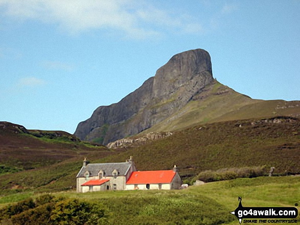
1005. An Sgurr (Eigg)
393m (1,290ft)
An Sgurr (Eigg) is on interactive maps:
A downloadable go4awalk.com PDF Peak Bagging Map featuring An Sgurr (Eigg) will be available soon. |
1006. Sithean Bhealaich Chumhaing
393m (1,289ft)
Send it in and we'll publish it here.
Sithean Bhealaich Chumhaing is on interactive maps:
A downloadable go4awalk.com PDF Peak Bagging Map featuring Sithean Bhealaich Chumhaing will be available soon. |
1007. Torlum
393m (1,289ft)
Torlum is on interactive maps:
A downloadable go4awalk.com PDF Peak Bagging Map featuring Torlum will be available soon. |
1008. An Sgurr (Loch Kishorn)
392m (1,287ft)
Send it in and we'll publish it here.
An Sgurr (Loch Kishorn) is on interactive maps:
A downloadable go4awalk.com PDF Peak Bagging Map featuring An Sgurr (Loch Kishorn) will be available soon. |
1009. Bishop Forest Hill
392m (1,287ft)
Bishop Forest Hill is on interactive maps:
A downloadable go4awalk.com PDF Peak Bagging Map featuring Bishop Forest Hill will be available soon. |
1010. Bengairn
391m (1,283ft)
Bengairn is on interactive maps:
A downloadable go4awalk.com PDF Peak Bagging Map featuring Bengairn will be available soon. |
1011. An Coileach (Isle of Harris)
389m (1,277ft)
Send it in and we'll publish it here.
An Coileach (Isle of Harris) is on interactive maps:
A downloadable go4awalk.com PDF Peak Bagging Map featuring An Coileach (Isle of Harris) will be available soon. |
1012. Meall Innis an Loichel
388m (1,273ft)
Send it in and we'll publish it here.
Meall Innis an Loichel is on interactive maps:
A downloadable go4awalk.com PDF Peak Bagging Map featuring Meall Innis an Loichel will be available soon. |
1013. Creag nam Fiadh
387m (1,270ft)
Creag nam Fiadh is on interactive maps:
A downloadable go4awalk.com PDF Peak Bagging Map featuring Creag nam Fiadh will be available soon. |
1014. Biod Mor
384m (1,260ft)
Biod Mor is on interactive maps:
A downloadable go4awalk.com PDF Peak Bagging Map featuring Biod Mor will be available soon. |
1015. Heabhal (Barra)
384m (1,260ft)
Heabhal (Barra) is on interactive maps:
A downloadable go4awalk.com PDF Peak Bagging Map featuring Heabhal (Barra) will be available soon. |
1016. Heileasbhal Mor
384m (1,260ft)
Heileasbhal Mor is on interactive maps:
A downloadable go4awalk.com PDF Peak Bagging Map featuring Heileasbhal Mor will be available soon. |
1017. Mullach an Eilein (Boreray)
384m (1,260ft)
Send it in and we'll publish it here.
Mullach an Eilein (Boreray) is on interactive maps:
A downloadable go4awalk.com PDF Peak Bagging Map featuring Mullach an Eilein (Boreray) will be available soon. |
1018. The Slate
384m (1,260ft)
The Slate is on interactive maps:
A downloadable go4awalk.com PDF Peak Bagging Map featuring The Slate will be available soon. |
1019. Deadh Choimhead
383m (1,257ft)
Deadh Choimhead is on interactive maps:
A downloadable go4awalk.com PDF Peak Bagging Map featuring Deadh Choimhead will be available soon. |
1020. Pibble Hill
383m (1,257ft)
Pibble Hill is on interactive maps:
A downloadable go4awalk.com PDF Peak Bagging Map featuring Pibble Hill will be available soon. |
Page 34 of 41 First Previous 31 32 33 34 35 36 37 38 39 40 Next Last |
View these 1218 Mountains, Peaks, Tops and Hills:
- On an Interactive Google Map (loads faster)
- On an Interactive Google Map with a list of tops below it.
(makes it easier to locate a particular top) - On a Detailed List in:
Alphabetical Order | Height Order - On one page with 'yet-to-be-bagged' listed 1st & then 'already-bagged' tops listed 2nd in:
Alphabetical Order | Height Order - On one page with 'already-bagged' tops listed 1st & then 'yet-to-be-bagged' tops listed 2nd in:
Alphabetical Order | Height Order
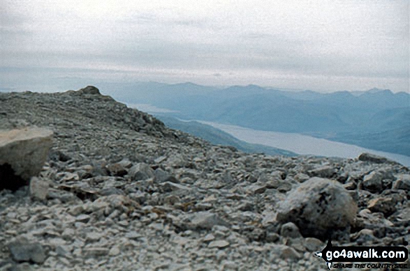 The summit of Ben Nevis in The Southern UplandsScotland
Photo: John Reed
Is there a Mountain, Peak, Top or Hill missing from the above google map or list?
Let us know an we will add it to our database.

