The Mountains, Peaks, Tops and Hills in Scotland as a detailed list
If you count only the Marilyns there are 1218 tops to climb, bag & conquer and the highest point is Ben Nevis at 1,344m (4,411ft).
To see all Mountains, Peaks, Tops and Hills displayed in different ways - see the options in the left-hand column and towards the bottom of this page.
LOG ON and RELOAD this page to show which Mountains, Peaks, Tops and Hills you have already climbed, bagged & conquered [. . . more]
Page 31 of 41 First Previous 31 32 33 34 35 36 37 38 39 40 Next Last |
See this list in: Alphabetical Order
| Height Order‡
To reverse the order select the link again.
Mountain, Peak, Top or Hill:
Bagged
901. Cairnharrow
457m (1,499ft)
Cairnharrow is on interactive maps:
A go4awalk.com Peak Bagging Map and Hill Tick List featuring Cairnharrow will be available soon. |
902. Creag na Criche
456m (1,499ft)
Creag na Criche is on interactive maps:
A go4awalk.com Peak Bagging Map and Hill Tick List featuring Creag na Criche will be available soon. |
903. Beinn na Duatharach
456m (1,497ft)
Send it in and we'll publish it here.
Beinn na Duatharach is on interactive maps:
A go4awalk.com Peak Bagging Map and Hill Tick List featuring Beinn na Duatharach will be available soon. |
904. Knock of Braemoray
456m (1,497ft)
Knock of Braemoray is on interactive maps:
A go4awalk.com Peak Bagging Map and Hill Tick List featuring Knock of Braemoray will be available soon. |
905. Lendrick Hill
456m (1,497ft)
Lendrick Hill is on interactive maps:
A go4awalk.com Peak Bagging Map and Hill Tick List featuring Lendrick Hill will be available soon. |
906. Craigowl Hill
455m (1,493ft)
Craigowl Hill is on interactive maps:
A go4awalk.com Peak Bagging Map and Hill Tick List featuring Craigowl Hill will be available soon. |
907. Beinn an Tuirc
454m (1,490ft)
Beinn an Tuirc is on interactive maps:
A go4awalk.com Peak Bagging Map and Hill Tick List featuring Beinn an Tuirc will be available soon. |
908. Beinn Conchra
453m (1,487ft)
Beinn Conchra is on interactive maps:
A go4awalk.com Peak Bagging Map and Hill Tick List featuring Beinn Conchra will be available soon. |
909. Auchtertyre Hill
452m (1,483ft)
Auchtertyre Hill is on interactive maps:
A go4awalk.com Peak Bagging Map and Hill Tick List featuring Auchtertyre Hill will be available soon. |
910. Cairn Hill (Lowther Hills)
451m (1,480ft)
Send it in and we'll publish it here.
Cairn Hill (Lowther Hills) is on interactive maps:
A go4awalk.com Peak Bagging Map and Hill Tick List featuring Cairn Hill (Lowther Hills) will be available soon. |
911. Calkin Rig (Ewe Hill)
451m (1,480ft)
Send it in and we'll publish it here.
Calkin Rig (Ewe Hill) is on interactive maps:
A go4awalk.com Peak Bagging Map and Hill Tick List featuring Calkin Rig (Ewe Hill) will be available soon. |
912. Mendick Hill
451m (1,480ft)
Mendick Hill is on interactive maps:
A go4awalk.com Peak Bagging Map and Hill Tick List featuring Mendick Hill will be available soon. |
913. Ronas Hill
450m (1,477ft)
Ronas Hill is on interactive maps:
A go4awalk.com Peak Bagging Map and Hill Tick List featuring Ronas Hill will be available soon. |
914. Caiteseal
449m (1,474ft)
Caiteseal is on interactive maps:
A go4awalk.com Peak Bagging Map and Hill Tick List featuring Caiteseal will be available soon. |
915. Cruach Scarba
449m (1,474ft)
Cruach Scarba is on interactive maps:
A go4awalk.com Peak Bagging Map and Hill Tick List featuring Cruach Scarba will be available soon. |
916. Hownam Law
449m (1,474ft)
See the location of Hownam Law and walks up it on a google Map Hownam Law is on interactive maps:
A go4awalk.com Peak Bagging Map and Hill Tick List featuring Hownam Law will be available soon. |
917. Beinn Bhreac (South Skye)
448m (1,470ft)
Send it in and we'll publish it here.
Beinn Bhreac (South Skye) is on interactive maps:
A go4awalk.com Peak Bagging Map and Hill Tick List featuring Beinn Bhreac (South Skye) will be available soon. |
918. Cairn William
448m (1,470ft)
Cairn William is on interactive maps:
A go4awalk.com Peak Bagging Map and Hill Tick List featuring Cairn William will be available soon. |
919. East Lomond
448m (1,470ft)
East Lomond is on interactive maps:
A go4awalk.com Peak Bagging Map and Hill Tick List featuring East Lomond will be available soon. |
920. Beinn Lunndaidh
447m (1,467ft)
Beinn Lunndaidh is on interactive maps:
A go4awalk.com Peak Bagging Map and Hill Tick List featuring Beinn Lunndaidh will be available soon. |
921. Blackwood Hill (Arnton Fell)
447m (1,467ft)
Send it in and we'll publish it here.
Blackwood Hill (Arnton Fell) is on interactive maps:
A go4awalk.com Peak Bagging Map and Hill Tick List featuring Blackwood Hill (Arnton Fell) will be available soon. |
922. Hill of Persie
447m (1,467ft)
Hill of Persie is on interactive maps:
A go4awalk.com Peak Bagging Map and Hill Tick List featuring Hill of Persie will be available soon. |
923. Cnoc Moy
446m (1,464ft)
Cnoc Moy is on interactive maps:
A go4awalk.com Peak Bagging Map and Hill Tick List featuring Cnoc Moy will be available soon. |
924. Stac na Cathaig
446m (1,464ft)
Stac na Cathaig is on interactive maps:
A go4awalk.com Peak Bagging Map and Hill Tick List featuring Stac na Cathaig will be available soon. |
925. Speinne Mor
446m (1,463ft)
Speinne Mor is on interactive maps:
A go4awalk.com Peak Bagging Map and Hill Tick List featuring Speinne Mor will be available soon. |
926. Ben Lee
445m (1,460ft)
Ben Lee is on interactive maps:
A go4awalk.com Peak Bagging Map and Hill Tick List featuring Ben Lee will be available soon. |
927. Dun Caan (Raasay)
444m (1,457ft)
Dun Caan (Raasay) is on interactive maps:
A go4awalk.com Peak Bagging Map and Hill Tick List featuring Dun Caan (Raasay) will be available soon. |
928. Laggan (Creag Ghlas Laggan - Fionn Bhealach)
444m (1,457ft)
Send it in and we'll publish it here.
Laggan (Creag Ghlas Laggan - Fionn Bhealach) is on interactive maps:
A go4awalk.com Peak Bagging Map and Hill Tick List featuring Laggan (Creag Ghlas Laggan - Fionn Bhealach) will be available soon. |
929. Beinn Bhreac (Jura)
441m (1,447ft)
Send it in and we'll publish it here.
Beinn Bhreac (Jura) is on interactive maps:
A go4awalk.com Peak Bagging Map and Hill Tick List featuring Beinn Bhreac (Jura) will be available soon. |
930. Sgurr Bhuidhe
440m (1,444ft)
Sgurr Bhuidhe is on interactive maps:
A go4awalk.com Peak Bagging Map and Hill Tick List featuring Sgurr Bhuidhe will be available soon. |
Page 31 of 41 First Previous 31 32 33 34 35 36 37 38 39 40 Next Last |
View all 1674 Mountains, Peaks, Tops and Hills in Scottish Region : Glen Shiel to Glenfinnan and Loch Eil:
- On an Interactive Google Map (loads faster)
- On an Interactive Google Map with a list of tops below it (makes it easier to locate a particular top)
- On a Detailed List in:
Alphabetical Order | Height Order - On one page with 'yet-to-be-bagged' listed 1st & then 'already-bagged' tops listed 2nd in:
Alphabetical Order | Height Order (must be logged on) - On one page with 'already-bagged' tops listed 1st & then 'yet-to-be-bagged' tops listed 2nd in:
Alphabetical Order | Height Order (must be logged on)
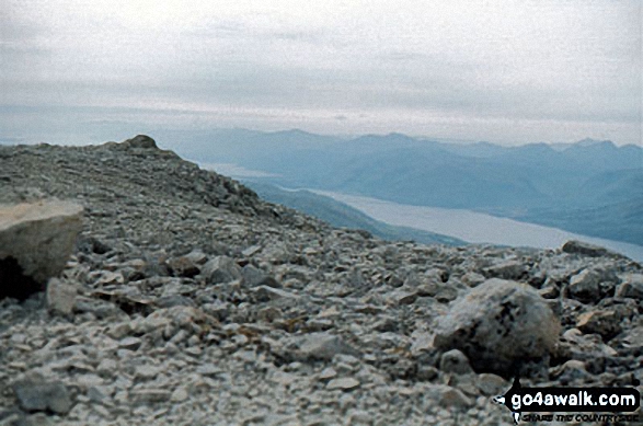
 The summit of Ben Nevis, the highest point in Glen Shiel to Glenfinnan and Loch EilScotland
Photo: John Reed
Is there a Mountain, Peak, Top or Hill missing from the above google map or list?
Let us know an we will add it to our database.


