The Isle of Man - a fully detailed list of all the Mountains, Peaks, Tops and Hills
The Isle of Man is defined as the area of the crown dependency of The Isle of Man and includes The Isle of Man itself, Calf of Man, St Michael's Isle or Fort Island, St Patrick's Isle, Kitterland, St Mary's Isle and Chicken Rock.
If you include the Deweys, the Marilyns and all the Mountains, Tops, Peaks and Hills with a Trig Point on them there are 6 tops to climb, bag & conquer and the highest point is Snaefell at 621m (2,038ft).
To see these Mountains, Peaks, Tops and Hills displayed in different ways - see the options in the left-hand column and towards the bottom of this page.
![]() Your Personal Bagging Record for The Isle of Man
Your Personal Bagging Record for The Isle of Man
LOG ON and RELOAD this page to show which Mountains, Peaks, Tops and Hills you have already climbed, bagged & conquered [. . . more details]
See this list in: Alphabetical Order
| Height Order‡
To reverse the order select the link again.
Mountain, Peak, Top or Hill:
Bagged

![]()
1. Snaefell
621m (2,038ft)
Snaefell is on interactive maps:
|

![]()
2. North Barrule
565m (1,854ft)
North Barrule is on interactive maps:
|
![]()
3. Slieau Freoaghane
488m (1,601ft)
Slieau Freoaghane is on interactive maps:
|
![]()
4. South Barrule
483m (1,585ft)
South Barrule is on interactive maps:
|
![]()
5. Bradda Hill
230m (754ft)
Bradda Hill is on interactive maps:
|

![]()
6. Mull Hill
169m (554ft)
Mull Hill is on interactive maps:
|
View these 6 tops:
- On an Interactive Google Map with a list of tops below it
- On a Detailed List
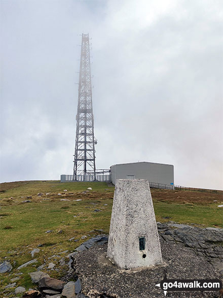 Snaefell in Isle of Man
Photo: Mark Davidson
Is there a Mountain, Peak, Top or Hill missing from the above google map or list?
Let us know an we will add it to our database.

To contribute to go4awalk.com or to contact us about anything at all - see Talk To Us.
For help see Help.
go4awalk.com and go4awalk.co.uk are registered trademarks of TMDH Limited.
Copyright © 2000-2026 TMDH Limited. All rights reserved.
Copyright Terms & Conditions Privacy Statement
A - Z Walks Home Log On/Accounts Photo Gallery Walk Ideas and Collections Fell Facts Hill Skills Walking Questions and Answers Your Stories News Competitions Product Reviews/Gear Tests Walking Gear Guides Peaks and Mountains Peak Bagging Find New Walking Friends Camping GPS Waypoints for Walking Contents Walk Search Talk To Us go4awalk.com Help Free Example Walks Newsletter