   |
Vital Statistics:
| Length: | 15¼mls (24.5km) |
| Ascent: | 4,841ft (1,475m) |
| Time: | 10½hrs |
| Grade: |  |
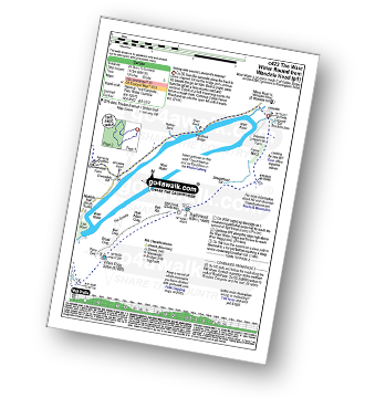
Route outline for walk c423:
Wasdale Head - (National Trust Campsite) - Wast Water - Lingmell Gill - Illgill Head - Whin Rigg - Greathall Gill - Low Wood - Lund Bridge - Woodhow Farm - Woodhow Tarn - Scale Farm - Tosh Tarn - Gill Farm - Gill Beck - Buckbarrow - Cold Well - Nether Wasdale Common - Seatallan - Windscale Hows - Middle Fell (Wasdale) - Greendale Farm - Nether Beck - Overbeck Bridge - Wasdale Head - Wast Water.
Points of Interest/Notes on this walk:
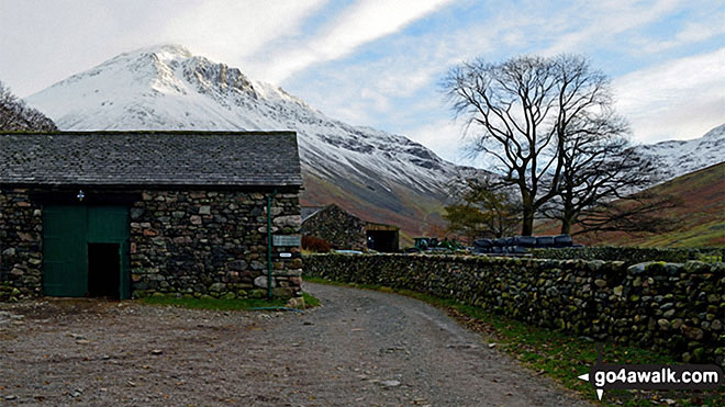
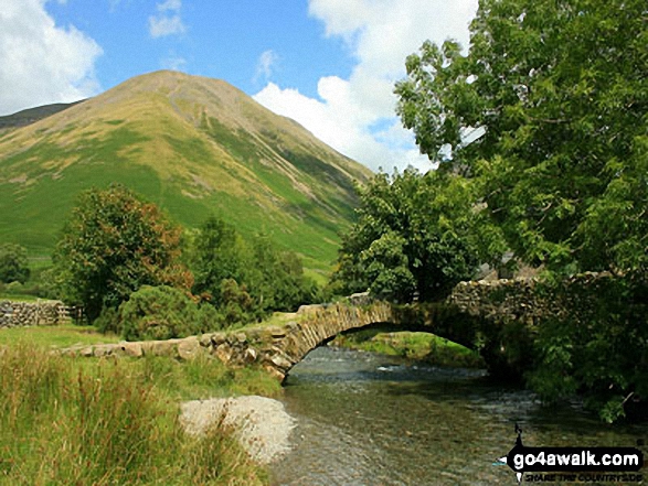
Wasdale Head is a tiny hamlet of agricultural fields and dwellings that claims to be home of the highest mountain in England (Scafell Pike), the deepest lake (Wast Water), the smallest church (Church of St Olaf) and the biggest liar (Will Ritson). There is an excellent National Trust Campsite and a fine pub - the Wasdale Inn - which claims to be the birthplace of British rock climbing. There is also a large free parking area for visitors.
Peaks, Summits and Tops reached on this walk:
 1 English Mountain |
 5 Wainwrights |
 1 English Nuttall |
 3 English Deweys |
 0 Wainwright Outlying Fells |
 2 Marilyns |
 0 Bridgets |
Peak Bagging Statistics for this walk:
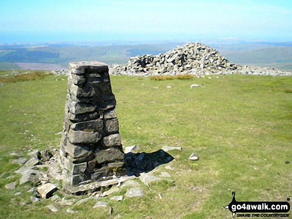
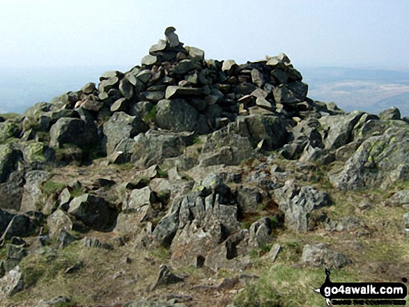
The highest point of this walk is Seatallan at 692m (2271ft). Seatallan is classified as an English Mountain (Hewitt) (109th highest in England, 180th highest in England & Wales) and a Wainwright (No. 94).
Seatallan is also known as an English Nuttall (143rd highest in England, 234th highest in England & Wales) and an English Marilyn (34th highest in England, 611th highest in the UK).
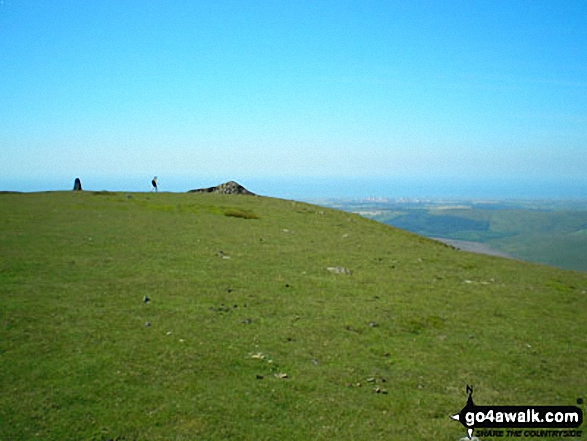
The summit of Seatallan is marked by an Ordnance Survey Trig Point.
Completing this walk will also take you to the top of Illgill Head at 609m (1997ft). Illgill Head is classified as an Wainwright (No. 129).
Illgill Head is also known as an English Dewey (2nd highest in England, 4th in England & Wales) and an English Marilyn (52nd highest in England, 757th highest in the UK).
You will also reach the summit of Middle Fell (Wasdale) at 582m (1910ft). Middle Fell (Wasdale) is classified as an Wainwright (No. 135).
Middle Fell (Wasdale) is also known as an English Dewey (27th highest in England, 65th in England & Wales)
Along the way you will also bag:
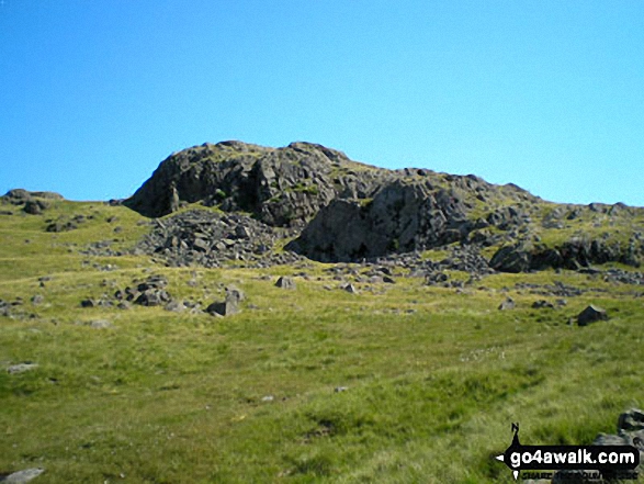
- Whin Rigg at 535m (1756ft). Whin Rigg is classified as a Wainwright (No. 156) and an English Dewey (103rd highest in England, 239th highest in England & Wales)
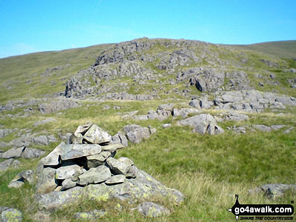
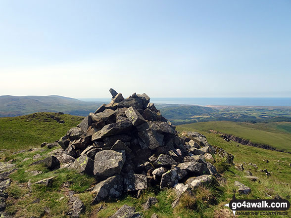
- Buckbarrow at 405m (1329ft). Buckbarrow is classified as a Wainwright (No. 200)
You can find more walks near this one on these unique free-to-access Interactive Walk Planning Maps: (click/TAP to select)
1:25,000 scale OS Explorer Map (the ones with orange/yellow covers):
1:50,000 scale OS Landranger Map (the ones with pink/magenta covers):
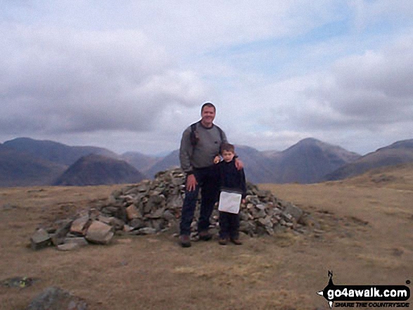
Some Photos and Pictures from Walk c423 The Wast Water Round from Wasdale Head, Wast Water
In no particular order . . .
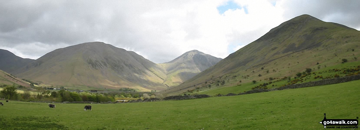
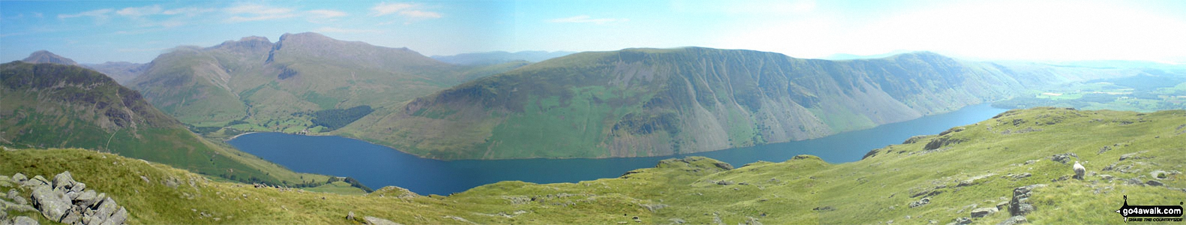
Yewbarrow (left), the shoulder of Kirk Fell, Great Gable (centre) and Lingmoor Fell (right) from Wast Water
Lingmell (far right), Scafel Pike, Mickledore, Sca Fell and Illgill Head (centre right) from across Overbeck Bridge, Wast Water

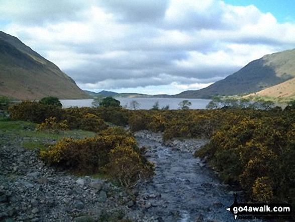
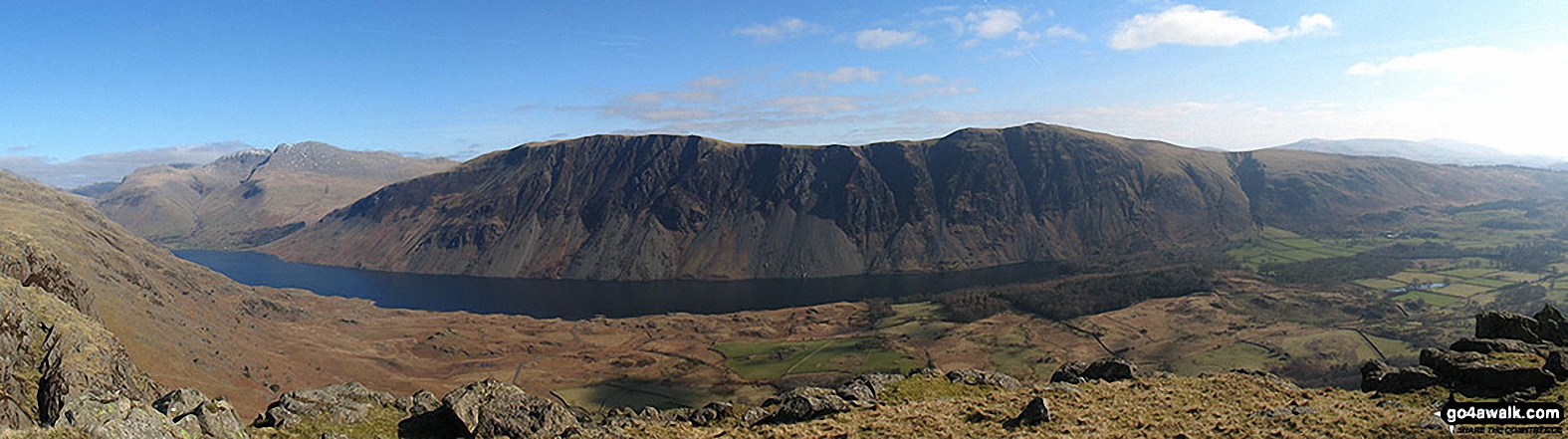
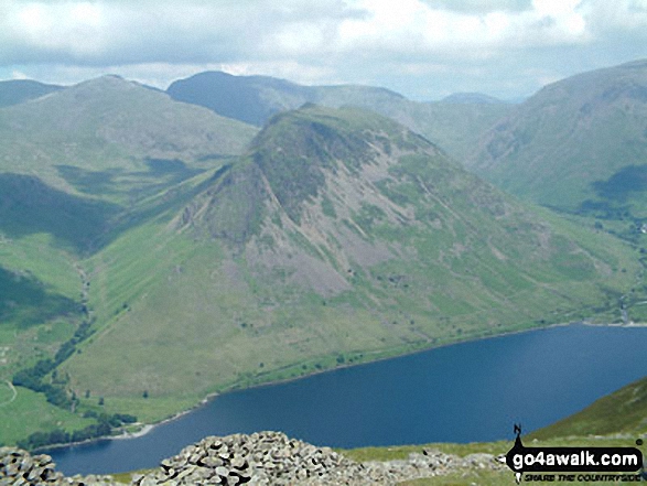
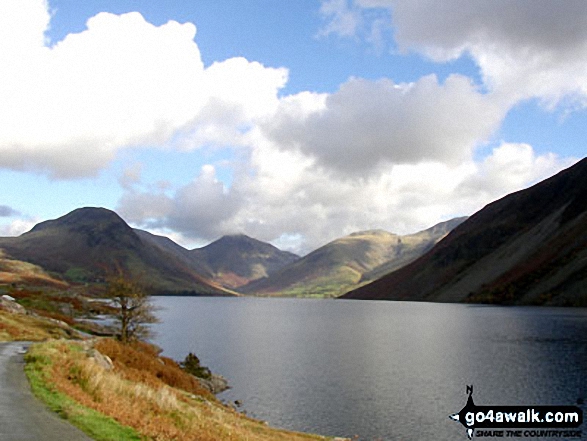
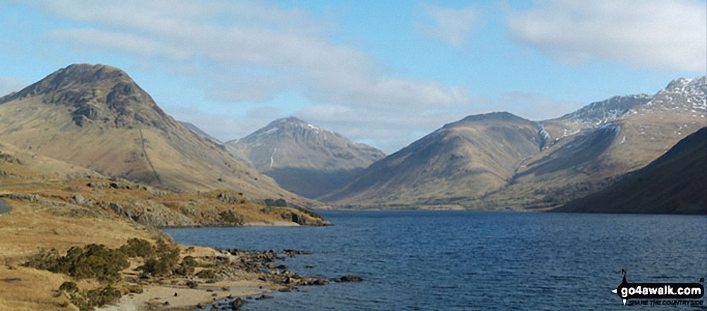
Red Pike (centre left), Pillar, Yewbarrow (centre), Kirk Fell & Great Gable (right) beyond Wast Water from Whin Rigg
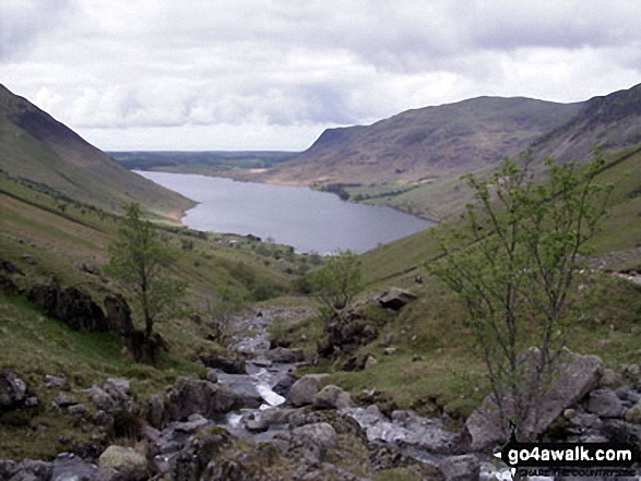
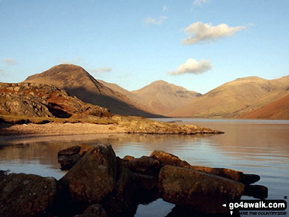
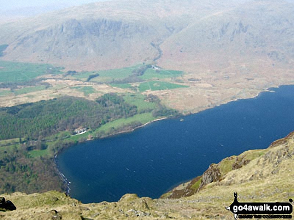
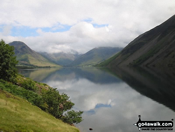
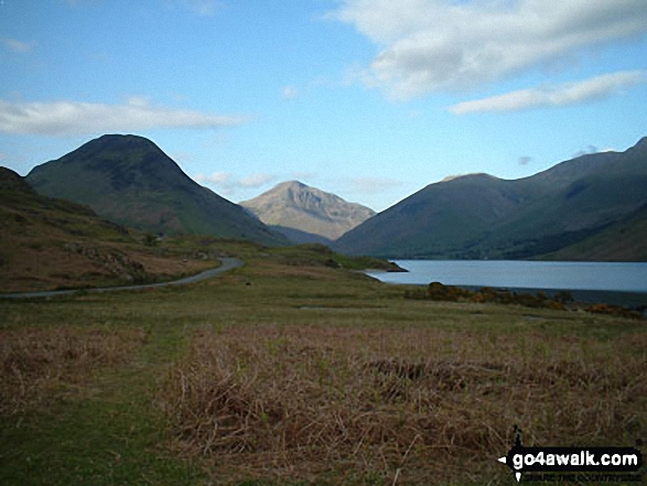
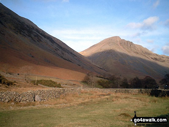
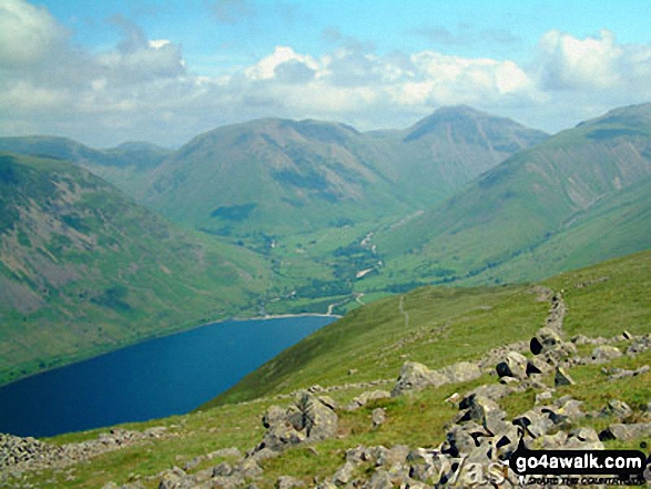
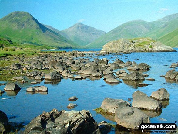
Wast Water from Lingmell Gill on the way up Scafell Pike. The fell to the right is Middle Fell
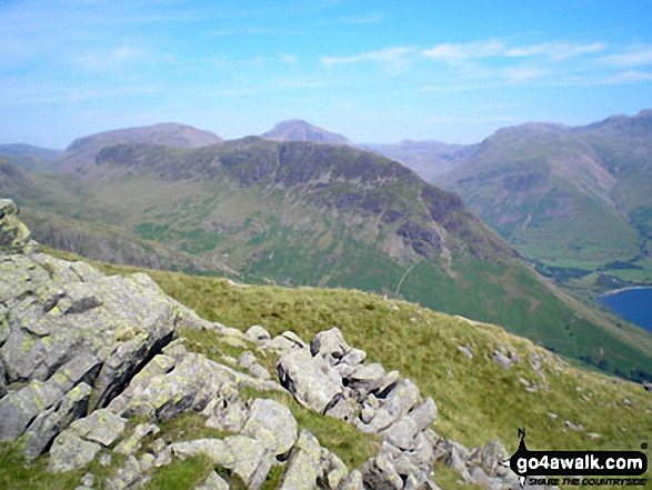
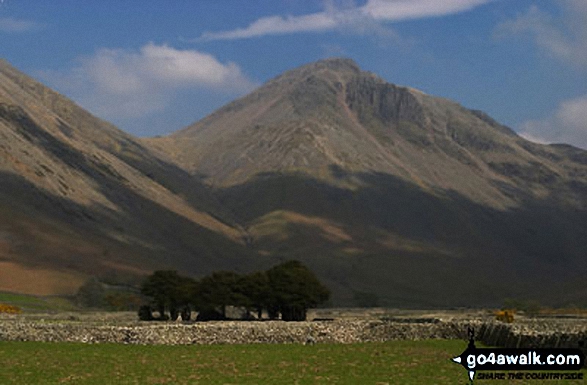
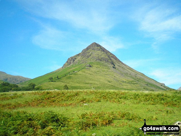
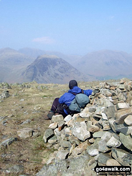
Yewbarrow with Kirk Fell, Great Gable and Lingmell beyond from Middle Fell (Wasdale)
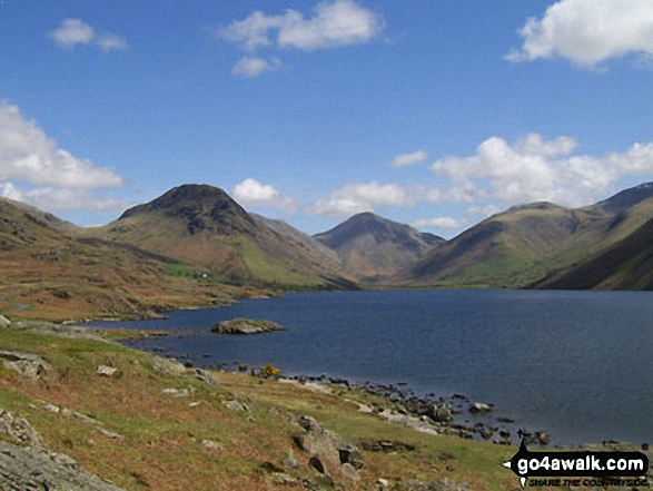
Yewbarrow, Great Gable, Lingmell and the shoulder of Scafell Pike from Wast Water
Wasdale Head featuring Yewbarrow (left), Great Gable (centre), Lingmell (right) and the lower slopes of Scafell Pike (right) from across Wast Water
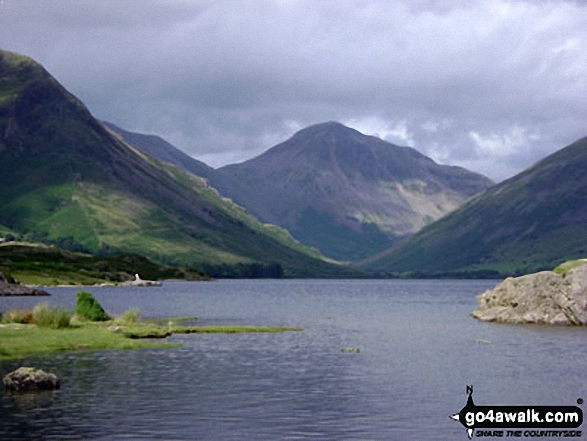
Kirk Fell (left), Great Gable (centre) and Lingmell from across Wast Water

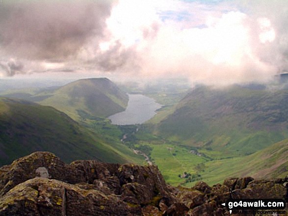
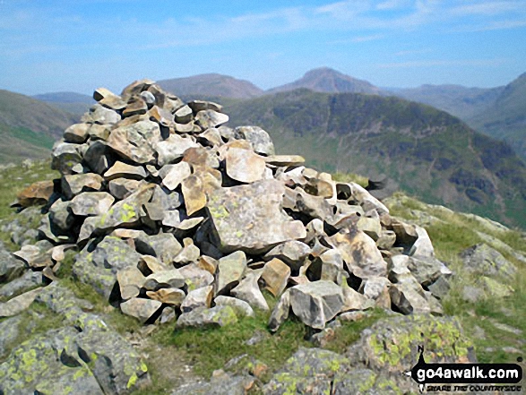
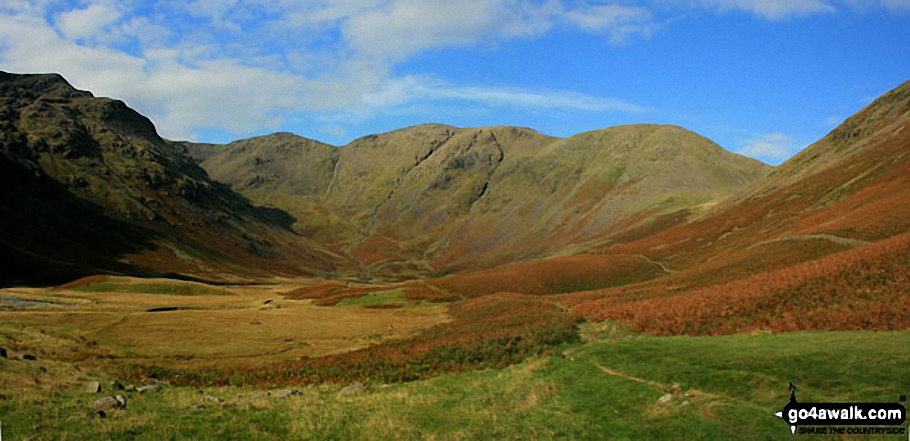
The Wasdale Valley featuring Lingmell (left), Illgill Head and Whin Rigg (left of centre in the distance), Wast Water (centre) and Yewbarrow (right) from near Westmorland Cairn on the summit of Great Gable
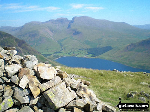
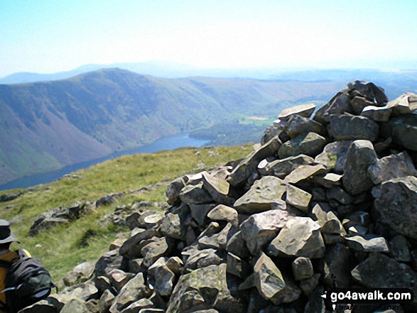
Wast Water and The Scafell Massif from the summit of Middle Fell (Wasdale)
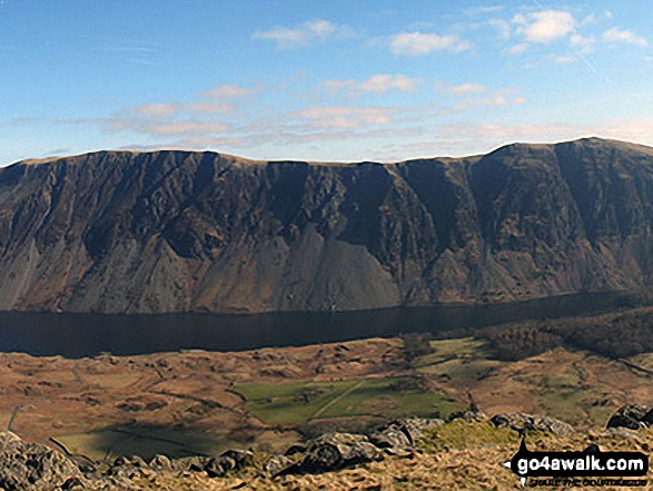
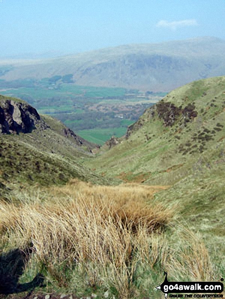
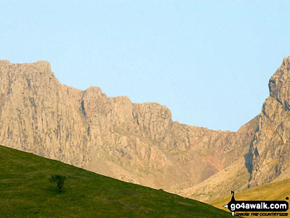
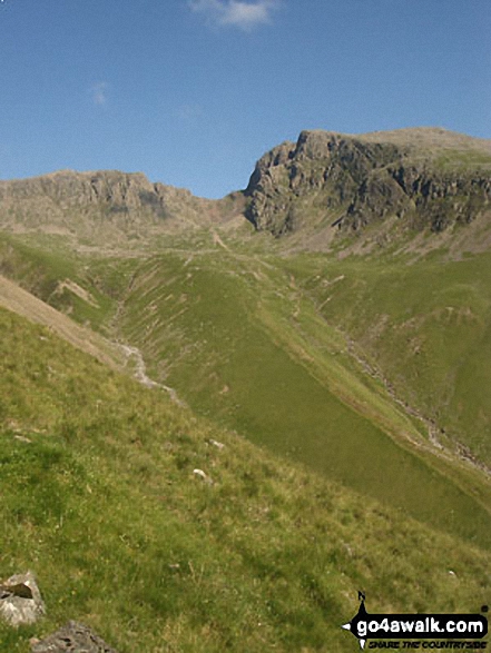
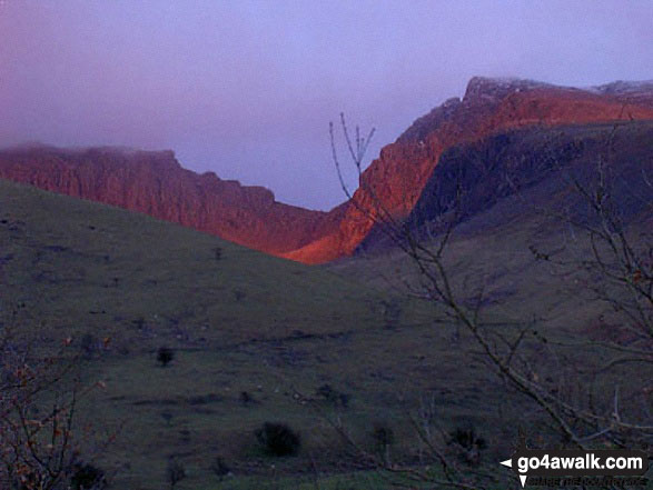
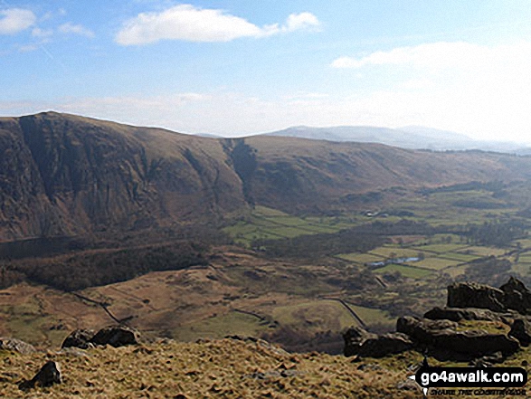
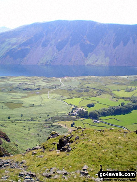
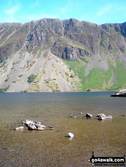
Illgill Head (left) and Whin Rigg (right) above the Wast Water screes from Buckbarrow
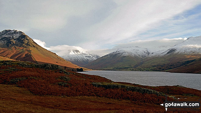
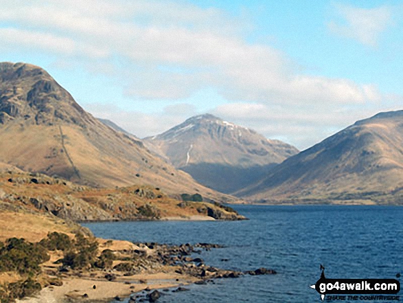
Snow capping Yewbarrow (left) Great Gable (centre) Lingmell and Scafell Pike surround Wast Water from near Overbeck Bridge, Wasdale
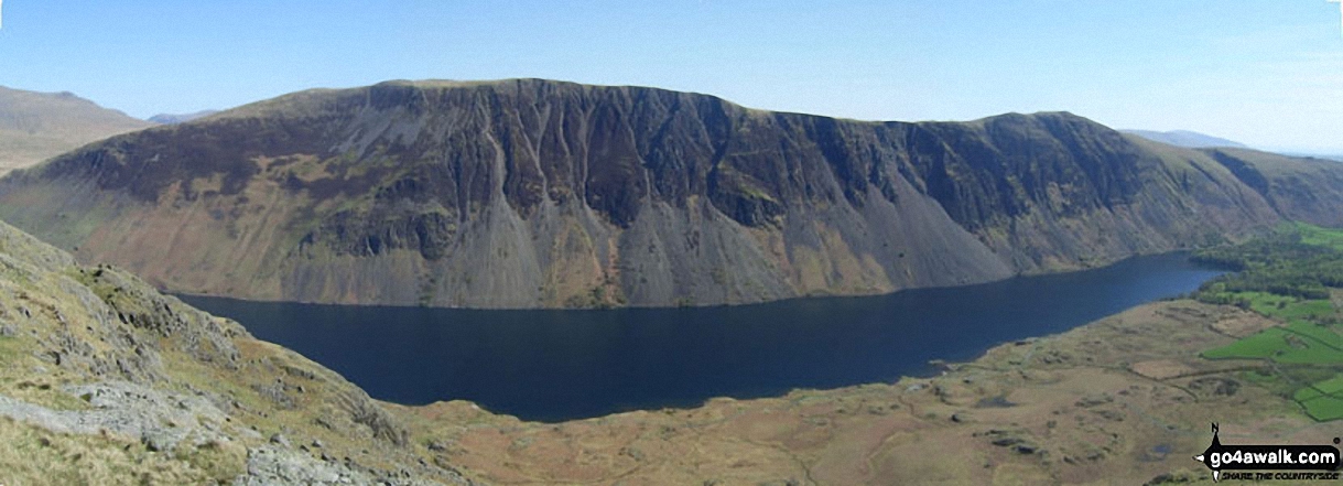
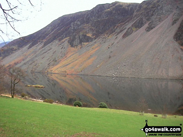
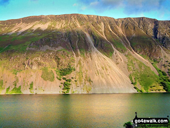
Wast Water with the Scafel Massive (far left- featuring Ling Mell, Great End, Broad Crag, Ill Crag, Scafell Pike, Symonds Knott and Sca Fell) and Illgill Head (centre) and Whin Rigg (centre right) above the Wast Water screes from Buckbarrow
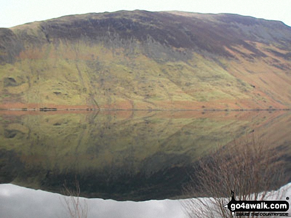
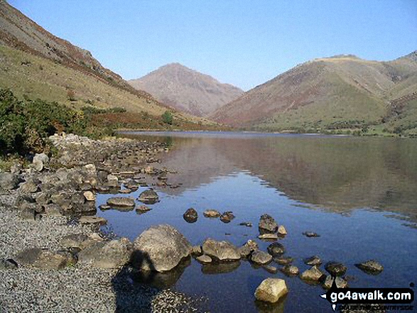
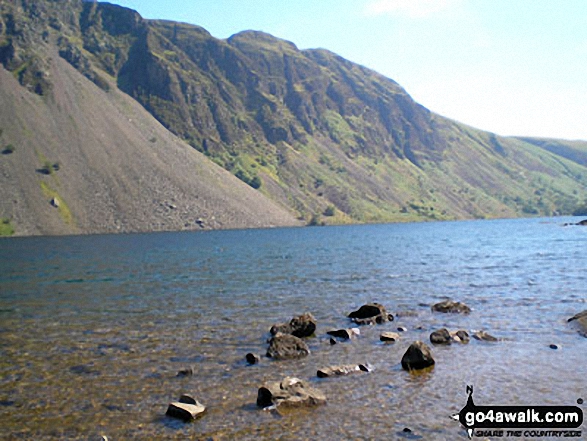
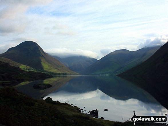
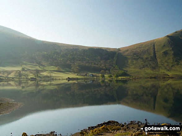
Yewbarrow (left), Great Gable (in cloud centre), Lingmell (centre right) and the Wast Water screes (right) reflected in Wast Water

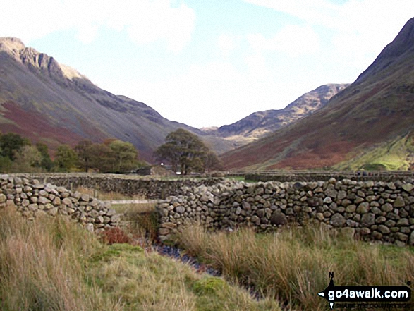
Wast Water and Wasdale Head from the lower slopes of Great Gable and Kirk Fell
Yewbarrow (left) Great Gable (centre) and Lingmell (right) from across Wast Water in Wasdale

*Kirk Fell (left), Great Gable (centre) Lingmell, Scafell Pike (partially hidden) and Illgill Head across Wast Water
Yewbarrow (left), Great Gable (centre in cloud), Lingmell and the shoulder or Scafell Pike (right) from across Wast Water

*Kirk Fell (left), Great Gable (centre) Lingmell, Scafell Pike (partially hidden) and Illgill Head across Wast Water
Yewbarrow (now conquered!) from the road to the National Trust Camp Site at Wasdale where we were staying
Wasdale Head featuring Yewbarrow (left), Great Gable (centre) and Lingmell (right) from across Wast Water
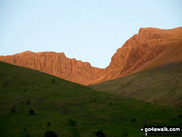
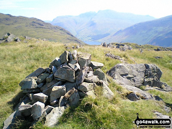
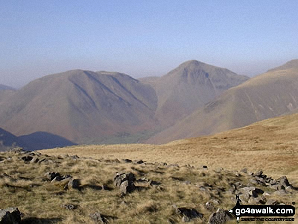
Black Crag (Pillar), Wind Gap, Pillar and Looking Stead (Pillar) above Mosedale from Wasdale Head
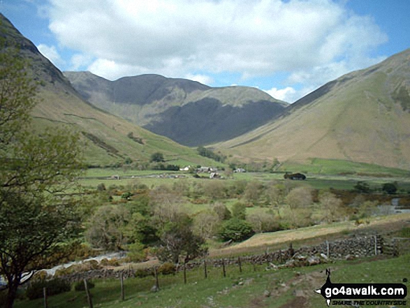
Wasdale Head with Pillar beyond from the lower slopes of Lingmell & Scafell Pike
Yewbarrow (left), Kirk Fell (partially hidden), Great Gable (centre) Lingmell, Scafell Pike (partially hidden) and Illgill Head (right) from across Wast Water
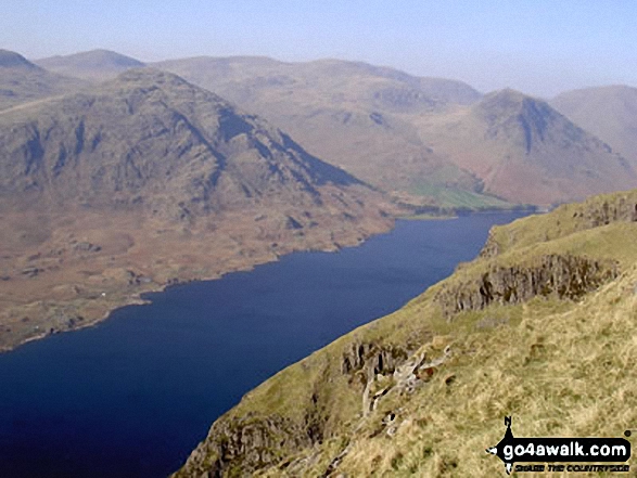
Wast Water, Yewbarrow (left), Kirk Fell (centre left), Great Gable (centre right) and Lingmell Fell (right) from Illgill Head
Yewbarrow (left), Great Gable and Lingmell (right) and Scafell Pike (far right) from Wast Water
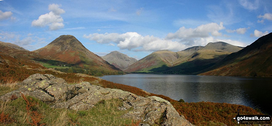
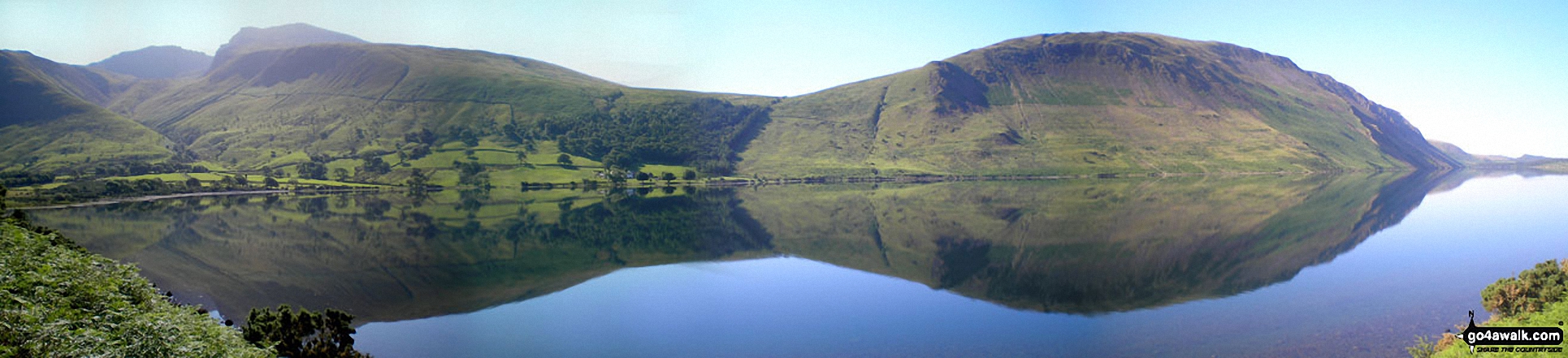
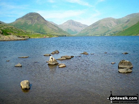
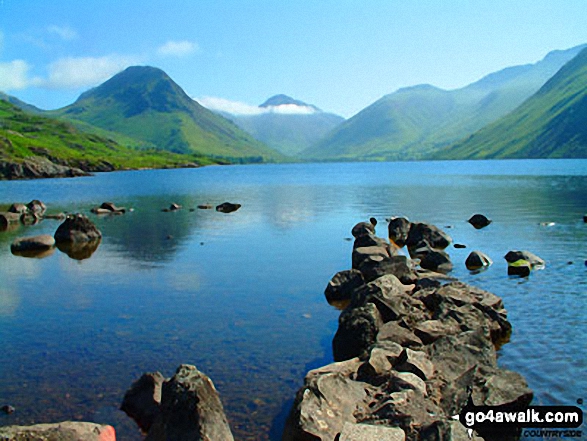
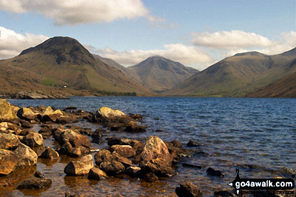
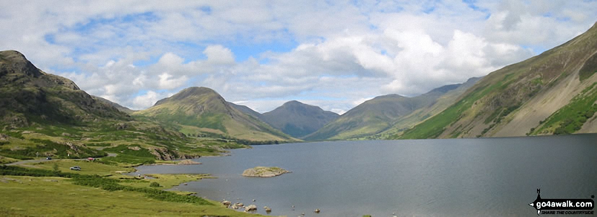
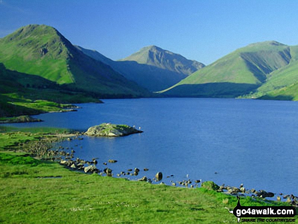
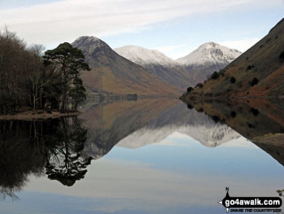
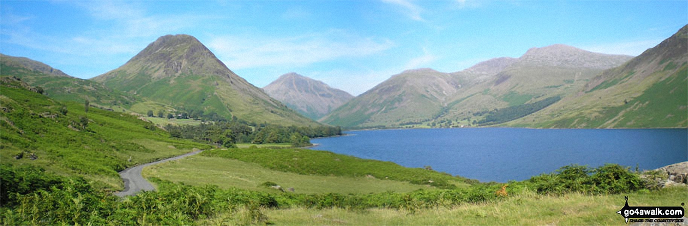
Britain's Favourite View - Yewbarrow, Great Gable, Lingmell, Great End, Sca Fell and the shoulder of Illgill Head (far right) from Wast Water

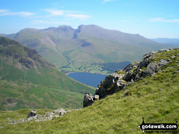
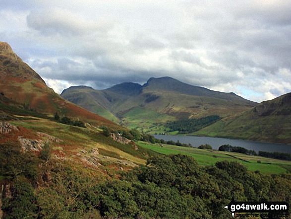
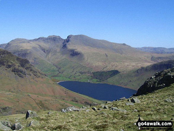
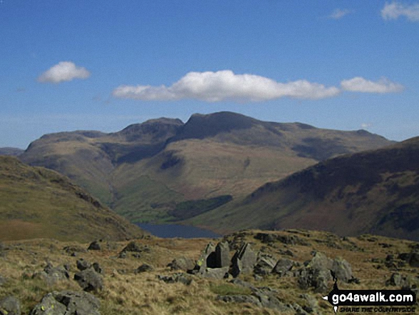
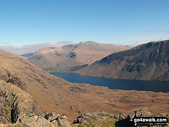
Lingmell, Scafell Pike, Mickledore and Sca Fell above Wast Water from near Middle Fell (Wasdale)
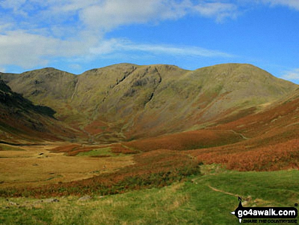
Black Grag (Pillar), Wind Gap, Pillar and Looking Stead (Pillar) above Mosedale from Wasdale Head
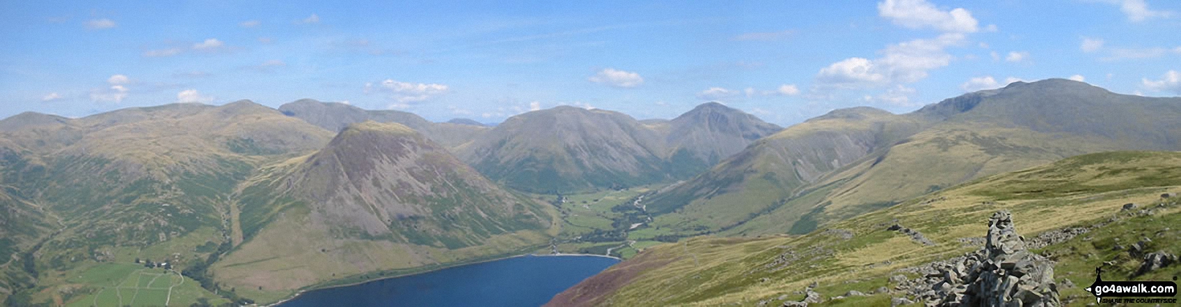
*From Left to right: Caw Fell, Seatallan, Red Pike, Pillar, Yewbarrow, Kirk Fell, Great Gable, Lingmell and Sca Fell and Wast Water (foreground) from Illgill Head (NB. Scafell Pike is largely hidden behind Sca Fell)
Wasdale Head featuring Yewbarrow (left), the shoulder of Kirk Fell, Great Gable (centre) and Lingmell (right) from across Wast Water
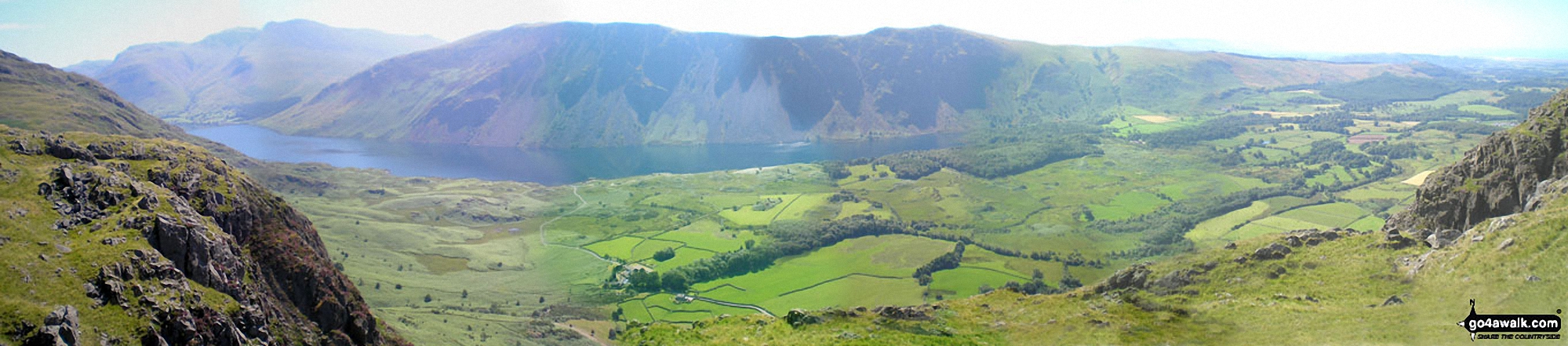
The Scafell Massif, Illgill Head, Whin Rigg and the Wast Water Screes from Buckbarrow
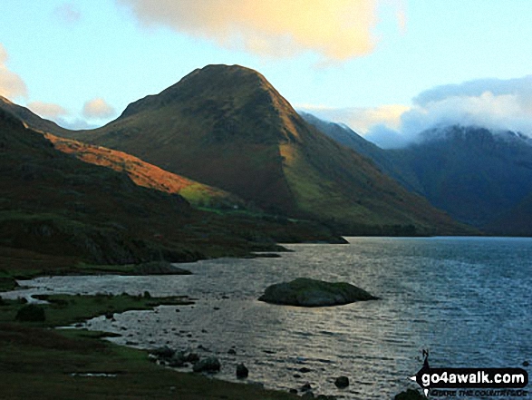
Looking NE up Wast Water to featuring Yewbarrow (left), Kirk Fell and Great Gable (right) from near Lund Bridge
Yewbarrow, Great Gable, Lingmell, Scafell Pike and Sca Fell from Wast Water
The Scafel Massive featuring Ling Mell, Great End, Broad Crag, Ill Crag, Scafell Pike, Symonds Knott and Sca Fell above Wast Water from Buckbarrow
Yewbarrow, Wasdale Head, Wast Water, Lingmell, Scafell Pike, Mickledore and Sca Fell, Illgill Head and Whin Rigg from below Middle Fell (Wasdale)
Send us your photographs and pictures from your walks and hikes
We would love to see your photographs and pictures from walk c423 The Wast Water Round from Wasdale Head, Wast Water. Send them in to us as email attachments (configured for any computer) along with your name and where the picture was taken to:
and we shall do our best to publish them.
(Guide Resolution = 300dpi. At least = 660 pixels (wide) x 440 pixels (high).)

You can also submit photos from walk c423 The Wast Water Round from Wasdale Head, Wast Water via our Facebook Page.
NB. Please indicate where each photo was taken.

To contribute to go4awalk.com or to contact us about anything at all - see Talk To Us. For help see Help.
go4awalk.com and go4awalk.co.uk are registered trademarks of TMDH Limited.
Copyright © 2000-2025 TMDH Limited. All rights reserved.
Copyright Terms & Conditions Privacy Statement
A - Z Walks Home Log On/Accounts Photo Gallery Walk Ideas and Collections Fell Facts Hill Skills Walking Questions and Answers Your Stories News Competitions Product Reviews/Gear Tests Walking Gear Guides Peaks and Mountains Peak Bagging Find New Walking Friends Camping GPS Waypoints for Walking Contents Walk Search Talk To Us go4awalk.com Help Free Example Walks Newsletter


