
![]()
High Hartsop Dodd
519m (1703ft)
The Eastern Fells, The Lake District, Cumbria, England
You can find High Hartsop Dodd & all the walks that climb it on these unique free-to-access Interactive Walk Planning Maps: (click/TAP to select)
1:25,000 scale OS Explorer Maps (the ones with orange/yellow covers):
1:50,000 scale OS Landranger Map (the ones with pink/magenta covers):
See High Hartsop Dodd and the surrounding tops on our free-to-access 'Google Style' Peak Bagging Maps:
See High Hartsop Dodd and the surrounding tops on our downloadable PDF Peak Bagging Maps:
*Walk & bag all 35 Wainwrights in The Eastern Fells area of The Lake District in just 8 easy-to-follow circular walks.
*This version is marked with the walk routes you need to follow to Walk all 214 Wainwrights in just 59 walks. Click here for more information.
NB: Whether you print off a copy on to paper or download it to your phone, these PDF Peak Baggers Maps will prove incredibly useful when your are up there on the tops and you cannot get a phone signal!
   |
|---|
Vital Statistics:
| Length: | 7ml (11km) |
|---|---|
| Ascent: | 2,737ft (834m) |
| Time: | 5.25hrs |
| Grade: |  (Moderate) (Moderate) |
Route Summary:
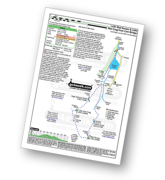
Cow Bridge - Brothers Water - Hartsop Hall - Kirkstone Beck - Caiston Beck - Middle Dodd - Red Screes - Scandale Pass - Little Hart Crag - High Hartsop Dodd - Caiston Beck - Cow Bridge - Brothers Water.
|
|---|
Vital Statistics:
| Length: | 7.75ml (12.5km) |
|---|---|
| Ascent: | 2,800ft (853m) |
| Time: | 5.75hrs |
| Grade: | (Moderate) |
Route Summary:
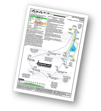
Cow Bridge Car Park - Brothers Water - Hartsop Hall - Kirkstone Beck - High Hartsop Dodd - Little Hart Crag - Dove Crag - Hart Crag - Blake Brow - Hartsop Above How - Hoggill Brow - Gale Crag - Bleaberry Knott - Cockley How - Cow Bridge
|
|---|
Vital Statistics:
| Length: | 13.75ml (22km) |
|---|---|
| Ascent: | 5,501ft (1,676m) |
| Time: | 10½ hrs |
| Grade: |  (Very Hard) (Very Hard) |
Route Summary:
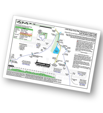
Cow Bridge Car Park - Brothers Water - Hartsop - Hartsop Dodd - Caudale Moor - Stony Cove Pike (Caudale Moor) - Caudale Head - Pike How - St Raven's Edge - The Kirkstone Pass - Red Screes - Smallthwaite Band - Middle Dodd - Scandale Pass - Little Hart Crag - High Hartsop Dodd - Little Hart Crag - Scandale Head - Dove Crag - Hart Crag - Blake Brow - Hartsop Above How - Hoggill Brow - Gale Crag - Bleaberry Knott - Cockley How - Cow Bridge
 Fellow go4awalkers who have already walked, climbed, summited & bagged High Hartsop Dodd
James Hughes walked up High Hartsop Dodd on June 2nd, 2024 [from/via/route] Red Screes & Little Hart Crag from Cow Bridge c351 - From Brotherswater Inn [weather] Clear - Post walk pint in Brotherswater Inn... stiff climb up Middle Dodd, meander down to Little Hart Crag passing group of older walkers.
Kate Peacock climbed High Hartsop Dodd on July 5th, 2024 [from/via/route] From Cow Bridge free car park [with] Me, Sheila & Skye [weather] Cloudy & windy, had to layer up however no rain. Underfoot was slippy
Angeline Grieveson bagged High Hartsop Dodd on November 20th, 2022 [with] Dotty
John Ramsbottom hiked High Hartsop Dodd on October 24th, 2022 [from/via/route] walk c351 [with] Lola/ Skratch [weather] dry/ windy
Steve Cookson summited High Hartsop Dodd on April 21st, 2022 [from/via/route] C351 from Brothers Water. [with] Gillie [weather] Sunny but windy.
Ian Ashton conquered High Hartsop Dodd on April 2nd, 2022 [with] Solo
Richard Marchant scaled High Hartsop Dodd on April 3rd, 2022 [from/via/route] Parked at Cow Bridge & walked along Brothers Water to Hartsop Hall then on to the North edge of High Hartsop Dodd & on to Little Hart Crag, across to Red Screes & back down to the car over Middle Dodd. [with] On my own [weather] Sunny, Clear & dry but very cold & Frosty
Christine Shepherd walked up High Hartsop Dodd on March 1st, 2010 [from/via/route] Walked from Cow Bridge Car Park using walk c333 'The Dovedale Round' [with] On my own [weather] Bright but very cold with deep snow on the ground. - This was the first peak of a wonderful day's walking in the snow. I nearly didn't make it though as a herd of bulls tried to block my way at the bottom. I had to climb over their feeding trough!Bagged again doing The Dovedale Round anti clockwise 10.07.2021 & again on 2.4.22.
Mr M A Blanchard climbed High Hartsop Dodd on April 2nd, 2022 [weather] Sunny
Martin Hartshorne bagged High Hartsop Dodd on March 21st, 2022 [with] finley [weather] Clear breeze cold on top
To add (or remove) your name and experiences on this page - Log On and edit your Personal Mountain Bagging Record
. . . [see more walk reports]
More Photographs & Pictures of views from, on or of High Hartsop Dodd
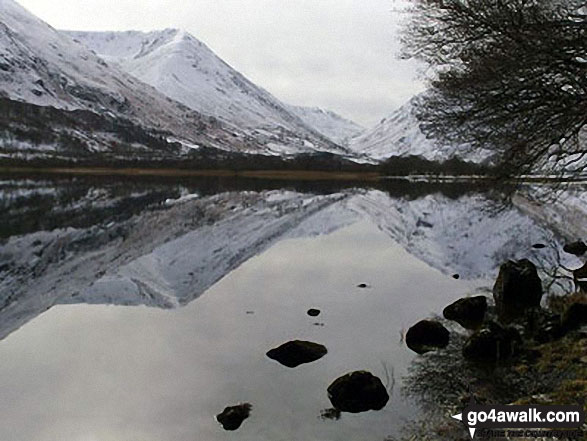
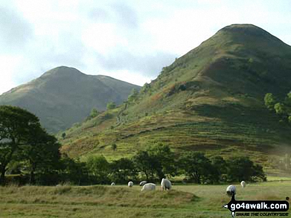
The lower slopes of Hartsop Dodd (left), Caudale Head, The Kirkstone Pass and High Hartsop Dodd (right, behind the tree) reflected in Brothers Water in the snow
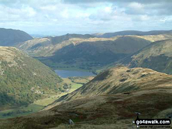
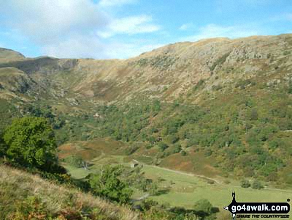
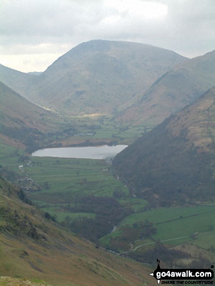
The Brothers Water Valley from Kirkstone Beck on the lower slopes of High Hartsop Dodd
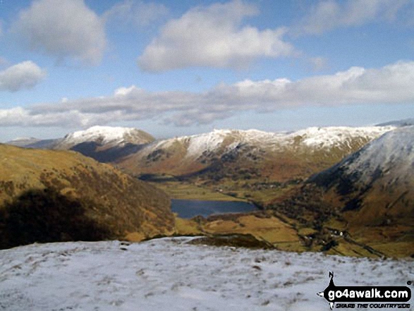
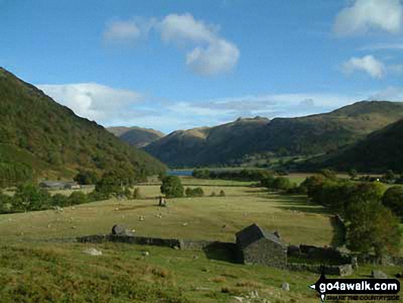
Place Fell and Angletarn Pikes above Brothers Water from High Hartsop Dodd
Send us your photographs and pictures on, of, or from High Hartsop Dodd
If you would like to add your walk photographs and pictures featuring views from, on or of High Hartsop Dodd to this page, please send them as email attachments (configured for any computer) along with your name to:
and we shall do our best to publish them.
(Guide Resolution = 300dpi. At least = 660pixels (wide) x 440 pixels (high).)

You can also submit photos via our Facebook Page.
NB. Please indicate where each photo was taken.


