
![]()
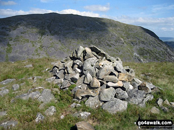
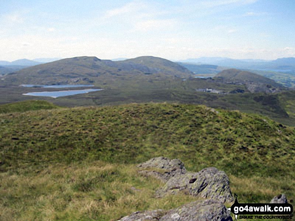
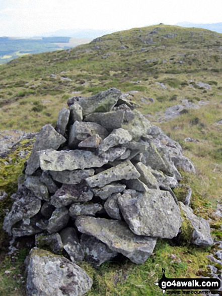
Manod Bach
511m (1677ft)
The Molewyns Area, Snowdonia, Gwynedd, Wales
Tap/mouse over a coloured circle (1-3 easy walks, 4-6 moderate walks, 7-9 hard walks) and click to select.
Not familiar with this top?
   |
|---|
Vital Statistics:
| Length: | 9.5mls (15km) |
|---|---|
| Ascent: | 2,914ft (888m) |
| Time: | 6½ hrs |
| Grade: |  (Hard) (Hard) |
Route Summary:
Blaenau Ffestiniog - Trefeini - Maen-offeren Quarry - Moel Bowydd - Moel Penamnen - Foel-fras (Moel Penamnen) - Cwt-y-bugail Quarry - Manod Mawr (North Top) - Graig-ddu Slate Quarry - Manod Mawr - Nant Dwr-oer - Manod Bach - Nant Dwr-oer - Blaenau Ffestiniog
See Manod Bach and the surrounding tops on our free-to-access 'Google Style' Peak Bagging Maps:
The Moelwyns area of Snowdonia National Park
Less data - quicker to download
The Whole of Snowdonia National Park
More data - might take a little longer to download
See Manod Bach and the surrounding tops on our downloadable Peak Bagging Map in PDF format:

NB: Whether you print off a copy or download it to your phone, this PDF Peak Baggers' Map might prove incredibly useful when your are up there on the tops and you cannot get a phone signal.
You can find Manod Bach & all the walks that climb it on these unique free-to-access Interactive Walk Planning Maps:
1:25,000 scale OS Explorer Map (orange/yellow covers):
1:50,000 scale OS Landranger Map (pink/magenta covers):
 Fellow go4awalkers who have already walked, climbed, summited & bagged Manod Bach
Mark Davidson walked up Manod Bach on July 12th, 2011 [from/via/route] Walk gw170 Moel Penamnen & Manod Mawr from Blaenau Ffestiniog [with] Alone [weather] Nice & sunny - The route instructions print out for this walk were excellent!
To add (or remove) your name and experiences on this page - Log On and edit your Personal Mountain Bagging Record
More Photographs & Pictures of views from, on or of Manod Bach
Send us your photographs and pictures on, of, or from Manod Bach
If you would like to add your walk photographs and pictures featuring views from, on or of Manod Bach to this page, please send them as email attachments (configured for any computer) along with your name to:
and we shall do our best to publish them.
(Guide Resolution = 300dpi. At least = 660pixels (wide) x 440 pixels (high).)

You can also submit photos via our Facebook Page.
NB. Please indicate where each photo was taken and whether you wish us to credit your photos with a Username or your First Name/Last Name.
Not familiar with this top?


