
![]()
Dunmallard Hill (Dunmallet)
240m (788ft)
The Eastern Fells, The Lake District, Cumbria, England
Tap/mouse over a coloured circle (1-3 easy walks, 4-6 moderate walks, 7-9 hard walks) and click to select.
Not familiar with this top?
You can walk/hike to the top of Dunmallard Hill (Dunmallet) by using this easy‑to‑follow route map:
Walk c429 Dunmallard Hill (Dunmallet) from Pooley Bridge
Quick leg stretcher before breakfast
   |
|---|
Vital Statistics:
| Length: | 1.5mls (2.5km) |
|---|---|
| Ascent: | 351ft (107m) |
| Time: | 1 hrs |
| Grade: |  (Easy) (Easy) |
Route Summary:
Pooley Bridge - Dunmallet Woods - Dunmallard Hill (Dunmallet) - River Eamont - Pooley Bridge
See Dunmallard Hill (Dunmallet) and the surrounding tops on our free-to-access 'Google Style' Peak Bagging Maps:
The Eastern Fells of The Lake District National Park
Less data - quicker to download
The Whole of The Lake District National Park
More data - might take a little longer to download
See Dunmallard Hill (Dunmallet) and the surrounding tops on our unique, downloadable, PDF Peak Bagging Maps:

NB: Whether you print off a copy or download it to your phone, these PDF Peak Baggers' Maps might prove incredibly useful when your are up there on the tops and you cannot get a phone signal.
*This version is marked with the walk routes you need to follow to Walk all 214 Wainwrights in just 59 walks.
You can find Dunmallard Hill (Dunmallet) & all the walks that climb it on these unique free-to-access Interactive Walk Planning Maps:
1:25,000 scale OS Explorer Map (orange/yellow covers):
1:50,000 scale OS Landranger Map (pink/magenta covers):
 Fellow go4awalkers who have already walked, climbed, scaled, summited, hiked & bagged Dunmallard Hill (Dunmallet)
Mark Davidson walked up Dunmallard Hill (Dunmallet) on February 15th, 2006 [with] Alone [weather] Bit grey - but OK
Christine Shepherd climbed it on March 29th, 2016 [from/via/route] Walked from Pooley Bridge [with] On my own. [weather] Sunshine & showers - A gentle leg stretch after driving to Pooley Bridge from Leeds. Only half an hour up & down so glad I had planned something else after lunch.
Nick Dobson bagged it on March 7th, 2015 [from/via/route] Hill Croft [with] Margaret & Ralph [weather] overcast
Ray O'hara hiked Dunmallard Hill (Dunmallet) on February 23rd, 2014 [from/via/route] Pooley Bridge [weather] Horizontal rain, ground was very wet & difficult to get traction on in places
Dave Gay summited on June 2nd, 2012 [from/via/route] afternoon walk from Waterside Campsite [with] Jessica
Jane Chiarello conquered it during September, 2011 [with] Adrian Thooughgood
David Hallam, Peter Thwaites, Louise Sandwith and David Preston have all walked, climbed & bagged Dunmallard Hill (Dunmallet).
To add (or remove) your name and experiences on this page - Log On and edit your Personal Mountain Bagging Record
More Photographs & Pictures of views from, on, or of, Dunmallard Hill (Dunmallet)
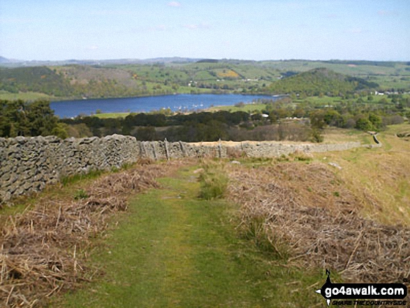
Ullswater and Dunmallard Hill (Dunmallet) (the tree covered hump on the right) from the path up to Arthur's Pike via Barton Fell from Park Foot
Send us your photographs and pictures on, of, or from Dunmallard Hill (Dunmallet)
If you would like to add your walk photographs and pictures to this page, please send them as email attachments (configured for any computer) along with your name to:
and we shall do our best to publish them.
(Guide Resolution = 300dpi. At least = 660pixels (wide) x 440 pixels (high).)

You can also submit photos via our Facebook Page.
NB. Please indicate where each photo was taken and whether you wish us to credit your photos with a Username or your First Name/Last Name.


