All The Mountains, Peaks, Tops and Hills in Scottish Region 21: Buchan, Formartine and Strathbogie as a detailed list
Scottish Region 21: Buchan, Formartine and Strathbogie region is the area enclosed by an imaginary line connecting:
- Spey Bay to Fraserburgh via the Moray Firth, Cullen, Banff and Rosehearty to the North
- Fraserburgh to Aberdeen via the North Sea and Peterhead to the East
- Aberdeen to Ballater via the A93 through Peterculter, Banchory and Aboyne to the South
- Ballater to Grantown-on-Spey via the A939 to the South West
- Grantown-on-Spey to Spey Bay via the River Spey, Belleheiglash, Charlestown of Aberlour and Rothes to the West
If you count only the Marilyns there are 36 tops to climb, bag & conquer and the highest point is Morven (Cairngorms) at 871m (2,859ft).
To see all Mountains, Peaks, Tops and Hills displayed in different ways - see the options in the left-hand column and towards the bottom of this page.
LOG ON and RELOAD this page to show which Mountains, Peaks, Tops and Hills you have already climbed, bagged & conquered [. . . more]
Page 1 of 2 Go to page: 1 2 |
See this list in: Alphabetical Order‡
| Height Order
To reverse the order select the link again.
Mountain, Peak, Top or Hill:
Bagged
1. Waughton Hill
234m (768ft)
Waughton Hill is on interactive maps:
A go4awalk.com Peak Bagging Map and Hill Tick List featuring Waughton Hill will be available soon. |
2. The Buck (Strathbogie)
721m (2,366ft)
Send it in and we'll publish it here.
The Buck (Strathbogie) is on interactive maps:
A go4awalk.com Peak Bagging Map and Hill Tick List featuring The Buck (Strathbogie) will be available soon. |
3. The Bochel
491m (1,611ft)
The Bochel is on interactive maps:
A go4awalk.com Peak Bagging Map and Hill Tick List featuring The Bochel will be available soon. |
4. Tap o' Noth
563m (1,848ft)
Tap o' Noth is on interactive maps:
A go4awalk.com Peak Bagging Map and Hill Tick List featuring Tap o' Noth will be available soon. |
5. Pressendye
619m (2,031ft)
Pressendye is on interactive maps:
A go4awalk.com Peak Bagging Map and Hill Tick List featuring Pressendye will be available soon. |
6. Oxen Craig (Bennachie)
529m (1,736ft)
Send it in and we'll publish it here.
Oxen Craig (Bennachie) is on interactive maps:
A go4awalk.com Peak Bagging Map and Hill Tick List featuring Oxen Craig (Bennachie) will be available soon. |
7. Morven (Cairngorms)
871m (2,859ft)
Send it in and we'll publish it here.
Morven (Cairngorms) is on interactive maps:
A go4awalk.com Peak Bagging Map and Hill Tick List featuring Morven (Cairngorms) will be available soon. |
8. Mona Gowan
749m (2,458ft)
Mona Gowan is on interactive maps:
A go4awalk.com Peak Bagging Map and Hill Tick List featuring Mona Gowan will be available soon. |
9. Millstone Hill
409m (1,342ft)
Millstone Hill is on interactive maps:
A go4awalk.com Peak Bagging Map and Hill Tick List featuring Millstone Hill will be available soon. |
10. Meikle Conval
571m (1,874ft)
Meikle Conval is on interactive maps:
A go4awalk.com Peak Bagging Map and Hill Tick List featuring Meikle Conval will be available soon. |
11. Meikle Balloch Hill
366m (1,201ft)
Meikle Balloch Hill is on interactive maps:
A go4awalk.com Peak Bagging Map and Hill Tick List featuring Meikle Balloch Hill will be available soon. |
12. Lord Arthur's Hill
518m (1,700ft)
Lord Arthur's Hill is on interactive maps:
A go4awalk.com Peak Bagging Map and Hill Tick List featuring Lord Arthur's Hill will be available soon. |
13. Little Conval
552m (1,814ft)
Little Conval is on interactive maps:
A go4awalk.com Peak Bagging Map and Hill Tick List featuring Little Conval will be available soon. |
14. Ladylea Hill
609m (1,998ft)
Ladylea Hill is on interactive maps:
A go4awalk.com Peak Bagging Map and Hill Tick List featuring Ladylea Hill will be available soon. |
15. Knockan
372m (1,221ft)
Knockan is on interactive maps:
A go4awalk.com Peak Bagging Map and Hill Tick List featuring Knockan will be available soon. |
16. Knock Hill
430m (1,411ft)
Knock Hill is on interactive maps:
A go4awalk.com Peak Bagging Map and Hill Tick List featuring Knock Hill will be available soon. |
17. Hill of Tillymorgan
381m (1,250ft)
Send it in and we'll publish it here.
Hill of Tillymorgan is on interactive maps:
A go4awalk.com Peak Bagging Map and Hill Tick List featuring Hill of Tillymorgan will be available soon. |
18. Hill of Foudland
467m (1,533ft)
Hill of Foudland is on interactive maps:
A go4awalk.com Peak Bagging Map and Hill Tick List featuring Hill of Foudland will be available soon. |
19. Hill of Fare
471m (1,546ft)
Hill of Fare is on interactive maps:
A go4awalk.com Peak Bagging Map and Hill Tick List featuring Hill of Fare will be available soon. |
20. Fourman Hill
344m (1,129ft)
Fourman Hill is on interactive maps:
A go4awalk.com Peak Bagging Map and Hill Tick List featuring Fourman Hill will be available soon. |
21. Creagan a' Chaise
722m (2,370ft)
Creagan a' Chaise is on interactive maps:
A go4awalk.com Peak Bagging Map and Hill Tick List featuring Creagan a' Chaise will be available soon. |
22. Craiglich
476m (1,562ft)
Craiglich is on interactive maps:
A go4awalk.com Peak Bagging Map and Hill Tick List featuring Craiglich will be available soon. |
23. Craigendarroch
402m (1,319ft)
Craigendarroch is on interactive maps:
A go4awalk.com Peak Bagging Map and Hill Tick List featuring Craigendarroch will be available soon. |
24. Corryhabbie Hill
781m (2,563ft)
Corryhabbie Hill is on interactive maps:
A go4awalk.com Peak Bagging Map and Hill Tick List featuring Corryhabbie Hill will be available soon. |
25. Cook's Cairn
755m (2,478ft)
Cook's Cairn is on interactive maps:
A go4awalk.com Peak Bagging Map and Hill Tick List featuring Cook's Cairn will be available soon. |
26. Coiliochbhar Hill
533m (1,749ft)
Coiliochbhar Hill is on interactive maps:
A go4awalk.com Peak Bagging Map and Hill Tick List featuring Coiliochbhar Hill will be available soon. |
27. Carn Mor (Ladder Hills)
804m (2,639ft)
Send it in and we'll publish it here.
Carn Mor (Ladder Hills) is on interactive maps:
A go4awalk.com Peak Bagging Map and Hill Tick List featuring Carn Mor (Ladder Hills) will be available soon. |
28. Carn Daimh
570m (1,871ft)
Carn Daimh is on interactive maps:
A go4awalk.com Peak Bagging Map and Hill Tick List featuring Carn Daimh will be available soon. |
29. Carn a Ghille Chearr (Cromdale)
710m (2,330ft)
Send it in and we'll publish it here.
Carn a Ghille Chearr (Cromdale) is on interactive maps:
A go4awalk.com Peak Bagging Map and Hill Tick List featuring Carn a Ghille Chearr (Cromdale) will be available soon. |
30. Cairn William
448m (1,470ft)
Cairn William is on interactive maps:
A go4awalk.com Peak Bagging Map and Hill Tick List featuring Cairn William will be available soon. |
Page 1 of 2 Go to page: 1 2 |
View all 42 Mountains, Peaks, Tops and Hills in Scottish Region 21: Buchan, Formartine and Strathbogie:
- On an Interactive Google Map (loads faster)
- On an Interactive Google Map with a list of tops below it (makes it easier to locate a particular top)
- On a Detailed List in:
Alphabetical Order | Height Order - On one page with 'yet-to-be-bagged' listed 1st & then 'already-bagged' tops listed 2nd in:
Alphabetical Order | Height Order (must be logged on) - On one page with 'already-bagged' tops listed 1st & then 'yet-to-be-bagged' tops listed 2nd in:
Alphabetical Order | Height Order (must be logged on)
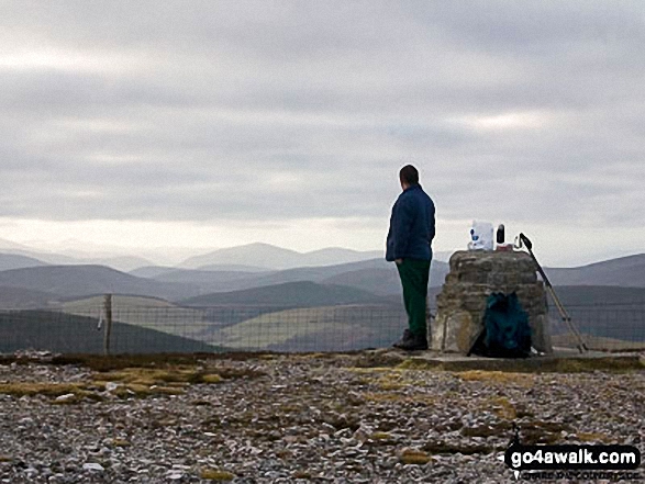
 Morven (Cairngorms) in Buchan, Formartine and Strathbogie
Photo: Beth Loft
Is there a Mountain, Peak, Top or Hill missing from the above google map or list?
Let us know an we will add it to our database.


