All The Mountains, Peaks, Tops and Hills in The Isle of Mull, Scottish Region 17: The Inner Hebrides (Western Isles) as a detailed list
If you count only the Marilyns there are 27 tops to climb, bag & conquer and the highest point is Ben More (Mull) at 966m (3,170ft).
To see all Mountains, Peaks, Tops and Hills displayed in different ways - see the options in the left-hand column and towards the bottom of this page.
![]() Your Personal Bagging Record for The Isle of Mull, Scottish Region 17: The Inner Hebrides (Western Isles)
Your Personal Bagging Record for The Isle of Mull, Scottish Region 17: The Inner Hebrides (Western Isles)
LOG ON and RELOAD this page to show which Mountains, Peaks, Tops and Hills you have already climbed, bagged & conquered [. . . more]
See this list in: Alphabetical Order
| Height Order‡
To reverse the order select the link again.
Mountain, Peak, Top or Hill:
Bagged

![]()
1. Ben More (Mull)
966m (3,170ft)
Ben More (Mull) is on interactive maps:
A go4awalk.com Peak Bagging Map and Hill Tick List featuring Ben More (Mull) will be available soon. |
![]()
2. Dun da Ghaoithe
766m (2,514ft)
Dun da Ghaoithe is on interactive maps:
A go4awalk.com Peak Bagging Map and Hill Tick List featuring Dun da Ghaoithe will be available soon. |
![]()
3. Beinn Talaidh
761m (2,498ft)
Beinn Talaidh is on interactive maps:
A go4awalk.com Peak Bagging Map and Hill Tick List featuring Beinn Talaidh will be available soon. |
![]()
4. Sgurr Dearg (Mull)
741m (2,432ft)
Sgurr Dearg (Mull) is on interactive maps:
A go4awalk.com Peak Bagging Map and Hill Tick List featuring Sgurr Dearg (Mull) will be available soon. |
![]()
5. Ben Buie
717m (2,353ft)
Ben Buie is on interactive maps:
A go4awalk.com Peak Bagging Map and Hill Tick List featuring Ben Buie will be available soon. |
![]()
6. Corra-bheinn
705m (2,313ft)
Corra-bheinn is on interactive maps:
A go4awalk.com Peak Bagging Map and Hill Tick List featuring Corra-bheinn will be available soon. |
![]()
7. Beinn Fhada (Mull)
702m (2,304ft)
Beinn Fhada (Mull) is on interactive maps:
A go4awalk.com Peak Bagging Map and Hill Tick List featuring Beinn Fhada (Mull) will be available soon. |
![]()
8. Creach-Beinn
698m (2,291ft)
Creach-Beinn is on interactive maps:
A go4awalk.com Peak Bagging Map and Hill Tick List featuring Creach-Beinn will be available soon. |
![]()
9. Cruach Choireadail
618m (2,028ft)
Cruach Choireadail is on interactive maps:
A go4awalk.com Peak Bagging Map and Hill Tick List featuring Cruach Choireadail will be available soon. |
![]()
10. Beinn a' Ghraig
591m (1,940ft)
Beinn a' Ghraig is on interactive maps:
A go4awalk.com Peak Bagging Map and Hill Tick List featuring Beinn a' Ghraig will be available soon. |
![]()
11. Coirc Bheinn
561m (1,841ft)
Coirc Bheinn is on interactive maps:
A go4awalk.com Peak Bagging Map and Hill Tick List featuring Coirc Bheinn will be available soon. |
![]()
12. Beinn na Sreine
521m (1,710ft)
Beinn na Sreine is on interactive maps:
A go4awalk.com Peak Bagging Map and Hill Tick List featuring Beinn na Sreine will be available soon. |
![]()
13. Beinn na Croise
503m (1,651ft)
Beinn na Croise is on interactive maps:
A go4awalk.com Peak Bagging Map and Hill Tick List featuring Beinn na Croise will be available soon. |
![]()
14. Healabhal Bheag (Macleod's Table South)
489m (1,604ft)
Healabhal Bheag (Macleod's Table South) is on interactive maps:
A go4awalk.com Peak Bagging Map and Hill Tick List featuring Healabhal Bheag (Macleod's Table South) will be available soon. |
![]()
15. Healabhal Mhor (Macleod's Table North)
471m (1,545ft)
Healabhal Mhor (Macleod's Table North) is on interactive maps:
A go4awalk.com Peak Bagging Map and Hill Tick List featuring Healabhal Mhor (Macleod's Table North) will be available soon. |
![]()
16. Beinn na Duatharach
456m (1,497ft)
Send it in and we'll publish it here.
Beinn na Duatharach is on interactive maps:
A go4awalk.com Peak Bagging Map and Hill Tick List featuring Beinn na Duatharach will be available soon. |
![]()
17. Speinne Mor
446m (1,463ft)
Speinne Mor is on interactive maps:
A go4awalk.com Peak Bagging Map and Hill Tick List featuring Speinne Mor will be available soon. |
![]()
18. Beinn na Drise
424m (1,392ft)
Beinn na Drise is on interactive maps:
A go4awalk.com Peak Bagging Map and Hill Tick List featuring Beinn na Drise will be available soon. |
![]()
19. Beinn Bhuidhe (Beinn nan Lus)
413m (1,355ft)
Send it in and we'll publish it here.
Beinn Bhuidhe (Beinn nan Lus) is on interactive maps:
A go4awalk.com Peak Bagging Map and Hill Tick List featuring Beinn Bhuidhe (Beinn nan Lus) will be available soon. |
![]()
20. Druim Fada (Mull)
405m (1,329ft)
Druim Fada (Mull) is on interactive maps:
A go4awalk.com Peak Bagging Map and Hill Tick List featuring Druim Fada (Mull) will be available soon. |
![]()
21. Beinn Chreagach (Brolass)
379m (1,243ft)
Send it in and we'll publish it here.
Beinn Chreagach (Brolass) is on interactive maps:
A go4awalk.com Peak Bagging Map and Hill Tick List featuring Beinn Chreagach (Brolass) will be available soon. |
![]()
22. Cruachan Min
376m (1,234ft)
Cruachan Min is on interactive maps:
A go4awalk.com Peak Bagging Map and Hill Tick List featuring Cruachan Min will be available soon. |
![]()
23. Maol Ban
338m (1,109ft)
Maol Ban is on interactive maps:
A go4awalk.com Peak Bagging Map and Hill Tick List featuring Maol Ban will be available soon. |
![]()
24. Creachan Mor
331m (1,086ft)
Creachan Mor is on interactive maps:
A go4awalk.com Peak Bagging Map and Hill Tick List featuring Creachan Mor will be available soon. |
![]()
25. 'S Airde Beinn
295m (968ft)
'S Airde Beinn is on interactive maps:
A go4awalk.com Peak Bagging Map and Hill Tick List featuring 'S Airde Beinn will be available soon. |
![]()
26. Tom nam Fitheach
275m (903ft)
Tom nam Fitheach is on interactive maps:
A go4awalk.com Peak Bagging Map and Hill Tick List featuring Tom nam Fitheach will be available soon. |
![]()
27. Carn Ban (Mull)
248m (814ft)
Carn Ban (Mull) is on interactive maps:
A go4awalk.com Peak Bagging Map and Hill Tick List featuring Carn Ban (Mull) will be available soon. |
View all 28 Mountains, Peaks, Tops and Hills in The Isle of Mull, Scottish Region 17: The Inner Hebrides (Western Isles):
- On an Interactive Google Map (loads faster)
- On an Interactive Google Map with a list of tops below it (makes it easier to locate a particular top)
- On a Detailed List in:
Alphabetical Order | Height Order - On one page with 'yet-to-be-bagged' listed 1st & then 'already-bagged' tops listed 2nd in:
Alphabetical Order | Height Order (must be logged on) - On one page with 'already-bagged' tops listed 1st & then 'yet-to-be-bagged' tops listed 2nd in:
Alphabetical Order | Height Order (must be logged on)
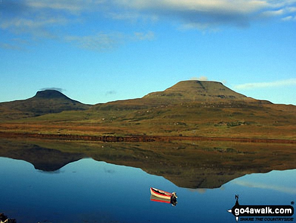
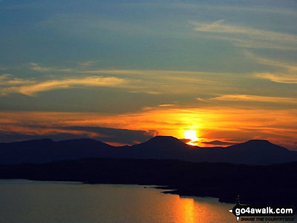
 Ben More (Mull) in The Inner Hebrides (Western Isles)
Photo: Dave Gilchrist
Is there a Mountain, Peak, Top or Hill missing from the above google map or list?
Let us know an we will add it to our database.
To contribute to go4awalk.com or to contact us about anything at all - see Talk To Us.
For help see Help.
go4awalk.com and go4awalk.co.uk are registered trademarks of TMDH Limited.
Copyright © 2000-2025 TMDH Limited. All rights reserved.
Copyright Terms & Conditions Privacy Statement
A - Z Walks Home Log On/Accounts Photo Gallery Walk Ideas and Collections Fell Facts Hill Skills Walking Questions and Answers Your Stories News Competitions Product Reviews/Gear Tests Walking Gear Guides Peaks and Mountains Peak Bagging Find New Walking Friends Camping GPS Waypoints for Walking Contents Walk Search Talk To Us go4awalk.com Help Free Example Walks Newsletter


