A fully detailed list of all the Mountains, Peaks, Tops and Hills in Scottish Region 16: Assynt and The Far North (Page 3 of 3)
Scottish Region 16: Assynt and The Far North region is the area enclosed by an imaginary line connecting:
- Cape Wrath to John o' Groats via Durness, Loch Eriboll, Kyle of Tongue, Portskerra, Thurso and Dunnet to the North
- John o' Groats to Dornoch via Wick, Dunbeath and Helmsdale to the South East
- Dornoch to Rhue Lighthouse via Dornich Firth, the A949, Inveran, the A837, Linsidemore, Doune, Langwell, Oykel Bridge, Loubcroy, Ledmore, the A835, Elphin and Strathcanaird to the South
- Rhue Lighthouse to Cape Wrath to the North West
If you count only the Marilyns there are 84 tops to climb, bag & conquer and the highest point is Ben More Assynt at 998m (3,275ft).
To see these Mountains, Peaks, Tops and Hills displayed in different ways - see the options in the left-hand column and towards the bottom of this page.
LOG ON and RELOAD this page to show which Mountains, Peaks, Tops and Hills you have already climbed, bagged & conquered [. . . more details]
See this list in: Alphabetical Order
| Height Order‡
To reverse the order select the link again.
Mountain, Peak, Top or Hill:
Bagged
61. Fashven
460m (1,510ft)
Fashven is on interactive maps:
A downloadable go4awalk.com PDF Peak Bagging Map featuring Fashven will be available soon. |
62. Beinn Lunndaidh
447m (1,467ft)
Beinn Lunndaidh is on interactive maps:
A downloadable go4awalk.com PDF Peak Bagging Map featuring Beinn Lunndaidh will be available soon. |
63. Cnoc an Liath-bhaid Mhoir
434m (1,424ft)
Send it in and we'll publish it here.
Cnoc an Liath-bhaid Mhoir is on interactive maps:
A downloadable go4awalk.com PDF Peak Bagging Map featuring Cnoc an Liath-bhaid Mhoir will be available soon. |
64. Beinn Dearg (Cape Wrath)
424m (1,390ft)
Send it in and we'll publish it here.
Beinn Dearg (Cape Wrath) is on interactive maps:
A downloadable go4awalk.com PDF Peak Bagging Map featuring Beinn Dearg (Cape Wrath) will be available soon. |
65. Braigh na h-Eaglaise
424m (1,390ft)
Send it in and we'll publish it here.
Braigh na h-Eaglaise is on interactive maps:
A downloadable go4awalk.com PDF Peak Bagging Map featuring Braigh na h-Eaglaise will be available soon. |
66. Meall Meadhonach (Loch Eriboll)
423m (1,388ft)
Send it in and we'll publish it here.
Meall Meadhonach (Loch Eriboll) is on interactive maps:
A downloadable go4awalk.com PDF Peak Bagging Map featuring Meall Meadhonach (Loch Eriboll) will be available soon. |
67. Beinn Dubhain
417m (1,369ft)
Beinn Dubhain is on interactive maps:
A downloadable go4awalk.com PDF Peak Bagging Map featuring Beinn Dubhain will be available soon. |
68. Meadie Ridge
414m (1,358ft)
Meadie Ridge is on interactive maps:
A downloadable go4awalk.com PDF Peak Bagging Map featuring Meadie Ridge will be available soon. |
69. Ben Hutig
408m (1,339ft)
Ben Hutig is on interactive maps:
A downloadable go4awalk.com PDF Peak Bagging Map featuring Ben Hutig will be available soon. |
70. Creag Thoraraidh
405m (1,329ft)
Creag Thoraraidh is on interactive maps:
A downloadable go4awalk.com PDF Peak Bagging Map featuring Creag Thoraraidh will be available soon. |
71. Cnoc na Maoile
402m (1,319ft)
Cnoc na Maoile is on interactive maps:
A downloadable go4awalk.com PDF Peak Bagging Map featuring Cnoc na Maoile will be available soon. |
72. Creag nam Fiadh
387m (1,270ft)
Creag nam Fiadh is on interactive maps:
A downloadable go4awalk.com PDF Peak Bagging Map featuring Creag nam Fiadh will be available soon. |
73. Meall a' Chaise (Strath Brora)
372m (1,220ft)
Send it in and we'll publish it here.
Meall a' Chaise (Strath Brora) is on interactive maps:
A downloadable go4awalk.com PDF Peak Bagging Map featuring Meall a' Chaise (Strath Brora) will be available soon. |
74. Sgribhis-bheinn
371m (1,218ft)
Sgribhis-bheinn is on interactive maps:
A downloadable go4awalk.com PDF Peak Bagging Map featuring Sgribhis-bheinn will be available soon. |
75. An Socach (Strath Shinary)
362m (1,188ft)
Send it in and we'll publish it here.
An Socach (Strath Shinary) is on interactive maps:
A downloadable go4awalk.com PDF Peak Bagging Map featuring An Socach (Strath Shinary) will be available soon. |
76. Cnoc an Daimh Mor
357m (1,171ft)
Cnoc an Daimh Mor is on interactive maps:
A downloadable go4awalk.com PDF Peak Bagging Map featuring Cnoc an Daimh Mor will be available soon. |
77. Beinn Domhnaill
349m (1,145ft)
Beinn Domhnaill is on interactive maps:
A downloadable go4awalk.com PDF Peak Bagging Map featuring Beinn Domhnaill will be available soon. |
78. Creag a' Ghobhair
346m (1,136ft)
Creag a' Ghobhair is on interactive maps:
A downloadable go4awalk.com PDF Peak Bagging Map featuring Creag a' Ghobhair will be available soon. |
79. Meall nan Clach Ruadha
335m (1,099ft)
Send it in and we'll publish it here.
Meall nan Clach Ruadha is on interactive maps:
A downloadable go4awalk.com PDF Peak Bagging Map featuring Meall nan Clach Ruadha will be available soon. |
80. Ghlas-bheinn
332m (1,090ft)
Ghlas-bheinn is on interactive maps:
A downloadable go4awalk.com PDF Peak Bagging Map featuring Ghlas-bheinn will be available soon. |
81. Meall Dola
323m (1,060ft)
Meall Dola is on interactive maps:
A downloadable go4awalk.com PDF Peak Bagging Map featuring Meall Dola will be available soon. |
82. Beinn Akie
288m (945ft)
Beinn Akie is on interactive maps:
A downloadable go4awalk.com PDF Peak Bagging Map featuring Beinn Akie will be available soon. |
83. Creag an Amalaidh
261m (856ft)
Creag an Amalaidh is on interactive maps:
A downloadable go4awalk.com PDF Peak Bagging Map featuring Creag an Amalaidh will be available soon. |
84. Meall an Fheadain
203m (666ft)
Meall an Fheadain is on interactive maps:
A downloadable go4awalk.com PDF Peak Bagging Map featuring Meall an Fheadain will be available soon. |
View these 84 Mountains, Peaks, Tops and Hills:
- On an Interactive Google Map (loads faster)
- On an Interactive Google Map with a list of tops below it.
(makes it easier to locate a particular top) - On a Detailed List in:
Alphabetical Order | Height Order - On one page with 'yet-to-be-bagged' listed 1st & then 'already-bagged' tops listed 2nd in:
Alphabetical Order | Height Order - On one page with 'already-bagged' tops listed 1st & then 'yet-to-be-bagged' tops listed 2nd in:
Alphabetical Order | Height Order
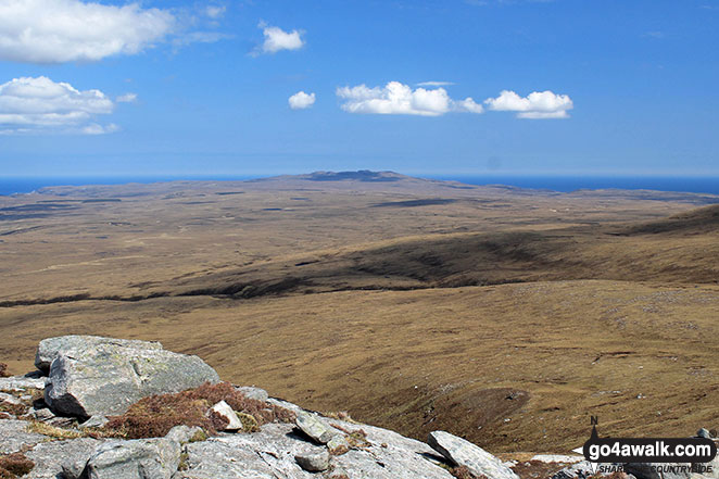
 Ben More Assynt in Assynt and The Far North
Photo: Elizabeth Maitland
Is there a Mountain, Peak, Top or Hill missing from the above google map or list?
Let us know an we will add it to our database.


