All The Mountains, Peaks, Tops and Hills in Scottish Region 12: Glen Cannich to Glen Carron as a detailed list
Scottish Region 12: Glen Cannich to Glen Carron region is the area enclosed by an imaginary line connecting:
- Kyle of Lochalsh to Loch Luichart via Inner Sound, Loch Carron, Strathcarron, Glen Carron, Achnashellach Station, Achnasheeh Station, Strath Bran and Loch Luichart to the North West
- Loch Luichart to The Moray Firth via Strath Conon, Muir of Ord and Beauly Firth to the North East
- The Moray Firth to Drumnadrochit via Loch Ness to the South East
- Drumnadrochit to Kyle of Lochalsh via Glen Urquart, Cannich, Glen Cannich, Loch Mullardoch, Loch an Droma, Strath Duilleach, Loch na Leitreach, Glen Elchaig, Killilan, Sallachy, Loch Long and Loch Alsh to the South
If you count only the Marilyns there are 46 tops to climb, bag & conquer and the highest point is Sgurr na Lapaich (Loch Mullardoch) at 1,150m (3,774ft).
To see all Mountains, Peaks, Tops and Hills displayed in different ways - see the options in the left-hand column and towards the bottom of this page.
![]() Your Personal Bagging Record for Scottish Region 12: Glen Cannich to Glen Carron
Your Personal Bagging Record for Scottish Region 12: Glen Cannich to Glen Carron
LOG ON and RELOAD this page to show which Mountains, Peaks, Tops and Hills you have already climbed, bagged & conquered in Scottish Region 12: Glen Cannich to Glen Carron - and which ones you have yet to visit. Furthermore, since you can also access your Personal Mountain & Hill Bagging Record via go4awalk Mobile you can quickly & easily record, edit and view your achievements - whether you are at home/work on your desktop computer or in the pub/at the top of a mountain with your Mobile Phone. (You can even download your Personal Mountain & Hill Bagging Record as a .csv file for importing into and saving with spreadsheet software like Excel or NeoOffice!) [ . . . less]
Page 1 of 2 Go to page: 1 2 |
See this list in: Alphabetical Order
| Height Order‡
To reverse the order select the link again.
Mountain, Peak, Top or Hill:
Bagged

![]()
1. Sgurr na Lapaich (Loch Mullardoch)
1,150m (3,774ft)
Send it in and we'll publish it here.
Sgurr na Lapaich (Loch Mullardoch) is on interactive maps:
A go4awalk.com Peak Bagging Map and Hill Tick List featuring Sgurr na Lapaich (Loch Mullardoch) will be available soon. |
![]()
2. An Riabhachan
1,129m (3,705ft)
An Riabhachan is on interactive maps:
A go4awalk.com Peak Bagging Map and Hill Tick List featuring An Riabhachan will be available soon. |
![]()
3. Sgurr a' Choire Ghlais
1,083m (3,554ft)
Send it in and we'll publish it here.
Sgurr a' Choire Ghlais is on interactive maps:
A go4awalk.com Peak Bagging Map and Hill Tick List featuring Sgurr a' Choire Ghlais will be available soon. |
![]()
4. An Socach (Loch Mullardoch)
1,069m (3,508ft)
Send it in and we'll publish it here.
An Socach (Loch Mullardoch) is on interactive maps:
A go4awalk.com Peak Bagging Map and Hill Tick List featuring An Socach (Loch Mullardoch) will be available soon. |
![]()
5. Sgurr a' Chaorachain (West Monar Forest)
1,053m (3,456ft)
Send it in and we'll publish it here.
Sgurr a' Chaorachain (West Monar Forest) is on interactive maps:
A go4awalk.com Peak Bagging Map and Hill Tick List featuring Sgurr a' Chaorachain (West Monar Forest) will be available soon. |
![]()
6. Creag Toll a' Choin
1,005m (3,298ft)
Send it in and we'll publish it here.
Creag Toll a' Choin is on interactive maps:
|
![]()
7. Sgurr na Ruaidhe
993m (3,259ft)
Sgurr na Ruaidhe is on interactive maps:
A go4awalk.com Peak Bagging Map and Hill Tick List featuring Sgurr na Ruaidhe will be available soon. |
![]()
8. Carn nan Gobhar (Glencannich Forest)
992m (3,256ft)
Send it in and we'll publish it here.
Carn nan Gobhar (Glencannich Forest) is on interactive maps:
A go4awalk.com Peak Bagging Map and Hill Tick List featuring Carn nan Gobhar (Glencannich Forest) will be available soon. |
![]()
9. Lurg Mhor
986m (3,236ft)
Lurg Mhor is on interactive maps:
A go4awalk.com Peak Bagging Map and Hill Tick List featuring Lurg Mhor will be available soon. |
![]()
10. Bidein a' Choire Sheasgaich
945m (3,101ft)
Bidein a' Choire Sheasgaich is on interactive maps:
A go4awalk.com Peak Bagging Map and Hill Tick List featuring Bidein a' Choire Sheasgaich will be available soon. |
![]()
11. Moruisg
928m (3,046ft)
Moruisg is on interactive maps:
A go4awalk.com Peak Bagging Map and Hill Tick List featuring Moruisg will be available soon. |
![]()
12. Sgurr nan Ceannaichean
913m (2,997ft)
Send it in and we'll publish it here.
Sgurr nan Ceannaichean is on interactive maps:
A go4awalk.com Peak Bagging Map and Hill Tick List featuring Sgurr nan Ceannaichean will be available soon. |
![]()
13. Aonach Buidhe
899m (2,951ft)
Aonach Buidhe is on interactive maps:
A go4awalk.com Peak Bagging Map and Hill Tick List featuring Aonach Buidhe will be available soon. |
![]()
14. Sguman Coinntich
879m (2,885ft)
Sguman Coinntich is on interactive maps:
A go4awalk.com Peak Bagging Map and Hill Tick List featuring Sguman Coinntich will be available soon. |
![]()
15. Sgurr a' Mhuilinn
879m (2,884ft)
Sgurr a' Mhuilinn is on interactive maps:
A go4awalk.com Peak Bagging Map and Hill Tick List featuring Sgurr a' Mhuilinn will be available soon. |
![]()
16. Faochaig
868m (2,849ft)
Faochaig is on interactive maps:
A go4awalk.com Peak Bagging Map and Hill Tick List featuring Faochaig will be available soon. |
![]()
17. Beinn Tharsuinn (West Monar Forest)
863m (2,832ft)
Send it in and we'll publish it here.
Beinn Tharsuinn (West Monar Forest) is on interactive maps:
A go4awalk.com Peak Bagging Map and Hill Tick List featuring Beinn Tharsuinn (West Monar Forest) will be available soon. |
![]()
18. Beinn a' Bha' ach Ard
862m (2,829ft)
Send it in and we'll publish it here.
Beinn a' Bha' ach Ard is on interactive maps:
A go4awalk.com Peak Bagging Map and Hill Tick List featuring Beinn a' Bha' ach Ard will be available soon. |
![]()
19. Sgurr na Feartaig
862m (2,829ft)
Sgurr na Feartaig is on interactive maps:
A go4awalk.com Peak Bagging Map and Hill Tick List featuring Sgurr na Feartaig will be available soon. |
![]()
20. Bac an Eich
849m (2,786ft)
Bac an Eich is on interactive maps:
A go4awalk.com Peak Bagging Map and Hill Tick List featuring Bac an Eich will be available soon. |
![]()
21. Meallan nan Uan
838m (2,750ft)
Meallan nan Uan is on interactive maps:
A go4awalk.com Peak Bagging Map and Hill Tick List featuring Meallan nan Uan will be available soon. |
![]()
22. Sgorr na Diollaid
818m (2,685ft)
Sgorr na Diollaid is on interactive maps:
A go4awalk.com Peak Bagging Map and Hill Tick List featuring Sgorr na Diollaid will be available soon. |
![]()
23. An Sidhean
814m (2,672ft)
An Sidhean is on interactive maps:
A go4awalk.com Peak Bagging Map and Hill Tick List featuring An Sidhean will be available soon. |
![]()
24. Beinn Dronaig
797m (2,616ft)
Beinn Dronaig is on interactive maps:
A go4awalk.com Peak Bagging Map and Hill Tick List featuring Beinn Dronaig will be available soon. |
![]()
25. An Cruachan (Loch Monar)
705m (2,313ft)
Send it in and we'll publish it here.
An Cruachan (Loch Monar) is on interactive maps:
A go4awalk.com Peak Bagging Map and Hill Tick List featuring An Cruachan (Loch Monar) will be available soon. |
![]()
26. Beinn na Muice
695m (2,281ft)
Beinn na Muice is on interactive maps:
A go4awalk.com Peak Bagging Map and Hill Tick List featuring Beinn na Muice will be available soon. |
![]()
27. Meall na Faochaig
680m (2,232ft)
Meall na Faochaig is on interactive maps:
A go4awalk.com Peak Bagging Map and Hill Tick List featuring Meall na Faochaig will be available soon. |
![]()
28. Carn na Breabaig
679m (2,228ft)
Carn na Breabaig is on interactive maps:
A go4awalk.com Peak Bagging Map and Hill Tick List featuring Carn na Breabaig will be available soon. |
![]()
29. Carn Gorm (Strathglass)
677m (2,222ft)
Send it in and we'll publish it here.
Carn Gorm (Strathglass) is on interactive maps:
A go4awalk.com Peak Bagging Map and Hill Tick List featuring Carn Gorm (Strathglass) will be available soon. |
![]()
30. Carn na Coinnich
673m (2,209ft)
Carn na Coinnich is on interactive maps:
A go4awalk.com Peak Bagging Map and Hill Tick List featuring Carn na Coinnich will be available soon. |
Page 1 of 2 Go to page: 1 2 |
View all 61 Mountains, Peaks, Tops and Hills in Scottish Region 12: Glen Cannich to Glen Carron:
- On an Interactive Google Map (loads faster)
- On an Interactive Google Map with a list of tops below it (makes it easier to locate a particular top)
- On a Detailed List in:
Alphabetical Order | Height Order - On one page with 'yet-to-be-bagged' listed 1st & then 'already-bagged' tops listed 2nd in:
Alphabetical Order | Height Order (must be logged on) - On one page with 'already-bagged' tops listed 1st & then 'yet-to-be-bagged' tops listed 2nd in:
Alphabetical Order | Height Order (must be logged on)
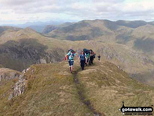
 Sgurr na Lapaich (Loch Mullardoch) in Glen Cannich to Glen Carron
Photo: Ross Macdonald
Is there a Mountain, Peak, Top or Hill missing from the above google map or list?
Let us know an we will add it to our database.

To contribute to go4awalk.com or to contact us about anything at all - see Talk To Us.
For help see Help.
go4awalk.com and go4awalk.co.uk are registered trademarks of TMDH Limited.
Copyright © 2000-2025 TMDH Limited. All rights reserved.
Copyright Terms & Conditions Privacy Statement
A - Z Walks Home Log On/Accounts Photo Gallery Walk Ideas and Collections Fell Facts Hill Skills Walking Questions and Answers Your Stories News Competitions Product Reviews/Gear Tests Walking Gear Guides Peaks and Mountains Peak Bagging Find New Walking Friends Camping GPS Waypoints for Walking Contents Walk Search Talk To Us go4awalk.com Help Free Example Walks Newsletter


