All The Mountains, Peaks, Tops and Hills in Scottish Region 7: The East Mounth - Glen Shee and Mount Keen to Montrose as a detailed list
Scottish Region 7: The East Mounth - Glen Shee and Mount Keen to Montrose region is the area enclosed by an imaginary line connecting:
- Braemar to Aberdeen via the A93 through Ballater, Aboyne, Banchory and Peterculter to the North
- Aberdeen to Stonehaven via the North Sea to the East
- Stonehaven to Blairgowrie and Rattray via the A926 through Laurencekirk, Brechin, Kirriemuir & Alyth to the South East
- Blairgowrie and Rattray to Braemar via the A9 through Bridge of Cally, Cray, Spittal of Glenshee, and Glen Shee to the West
If you include the Marilyns, the Bridgets (Hills) and all the Mountains, Tops, Peaks and Hills with a Trig Point on them there are 40 tops to climb, bag & conquer and the highest point is Lochnagar (Cac Carn Beag) at 1,155m (3,791ft).
To see all Mountains, Peaks, Tops and Hills displayed in different ways - see the options in the left-hand column and towards the bottom of this page.
LOG ON and RELOAD this page to show which Mountains, Peaks, Tops and Hills you have already climbed, bagged & conquered [. . . more]
Page 1 of 2 Go to page:
1 2 |
See this list in: Alphabetical Order
| Height Order‡
To reverse the order select the link again.
Mountain, Peak, Top or Hill:
Bagged
1. Lochnagar (Cac Carn Beag)
1,155m (3,791ft)
Munro (No. 20)
Murdo (28th)
Marilyn (16th in Scotland, 16th in GB)
OS Trig Point
We hope to have walks that climb & bag Lochnagar (Cac Carn Beag) very soon
See the location of Lochnagar (Cac Carn Beag) and walks up it on a google MapLochnagar (Cac Carn Beag) is on interactive maps:
OS Explorer (Orange Covers): OL53
OS Landranger (Pink Covers): 44
A go4awalk.com Peak Bagging Map and Hill Tick List featuring Lochnagar (Cac Carn Beag) will be available soon. |
2. Glas Maol
1,068m (3,505ft)
Munro (No. 69)
Murdo (94th)
Marilyn (54th in Scotland, 55th in GB)
OS Trig Point
We hope to have walks that climb & bag Glas Maol very soon
See the location of Glas Maol and walks up it on a google MapGlas Maol is on interactive maps:
OS Explorer (Orange Covers): OL52
OS Landranger (Pink Covers): 43
A go4awalk.com Peak Bagging Map and Hill Tick List featuring Glas Maol will be available soon. |
3. Driesh
947m (3,108ft)
Munro (No. 219)
Murdo (329th)
OS Trig Point
We hope to have walks that climb & bag Driesh very soon
See the location of Driesh and walks up it on a google MapDriesh is on interactive maps:
OS Explorer (Orange Covers): OL53
OS Landranger (Pink Covers): 44
A go4awalk.com Peak Bagging Map and Hill Tick List featuring Driesh will be available soon. |
4. Mount Keen
939m (3,082ft)
Munro (No. 234)
Murdo (355th)
Marilyn (174th in Scotland, 180th in GB)
OS Trig Point
We hope to have walks that climb & bag Mount Keen very soon
See the location of Mount Keen and walks up it on a google MapMount Keen is on interactive maps:
OS Explorer (Orange Covers): OL54
OS Landranger (Pink Covers): 44
A go4awalk.com Peak Bagging Map and Hill Tick List featuring Mount Keen will be available soon. |
5. The Goet (Ben Tirran)
896m (2,941ft)
Corbett (28th)
Marilyn (231st in Scotland, 243rd in GB)
OS Trig Point
We hope to have walks that climb & bag The Goet (Ben Tirran) very soon
See the location of The Goet (Ben Tirran) and walks up it on a google MapThe Goet (Ben Tirran) is on interactive maps:
OS Explorer (Orange Covers): OL53
OS Landranger (Pink Covers): 44
A go4awalk.com Peak Bagging Map and Hill Tick List featuring The Goet (Ben Tirran) will be available soon. |
6. Conachcraig
865m (2,839ft)
Corbett (68th)
Marilyn (272nd in Scotland, 291st in GB)
We hope to have walks that climb & bag Conachcraig very soon
See the location of Conachcraig and walks up it on a google MapConachcraig is on interactive maps:
OS Explorer (Orange Covers): OL53
OS Landranger (Pink Covers): 44
A go4awalk.com Peak Bagging Map and Hill Tick List featuring Conachcraig will be available soon. |
7. Creag nan Gabhar
834m (2,737ft)
Corbett (113th)
Marilyn (317th in Scotland, 340th in GB)
We hope to have walks that climb & bag Creag nan Gabhar very soon
See the location of Creag nan Gabhar and walks up it on a google MapCreag nan Gabhar is on interactive maps:
OS Explorer (Orange Covers): OL52
OS Landranger (Pink Covers): 43
A go4awalk.com Peak Bagging Map and Hill Tick List featuring Creag nan Gabhar will be available soon. |
8. Monamenach
807m (2,649ft)
Corbett (147th)
Marilyn (351st in Scotland, 379th in GB)
We hope to have walks that climb & bag Monamenach very soon
See the location of Monamenach and walks up it on a google MapMonamenach is on interactive maps:
OS Explorer (Orange Covers): OL52 and
OL53
OS Landranger (Pink Covers): 43
A go4awalk.com Peak Bagging Map and Hill Tick List featuring Monamenach will be available soon. |
9. Mount Battock
778m (2,553ft)
Corbett (193rd)
Marilyn (397th in Scotland, 433rd in GB)
We hope to have walks that climb & bag Mount Battock very soon
See the location of Mount Battock and walks up it on a google MapMount Battock is on interactive maps:
OS Explorer (Orange Covers): OL54
OS Landranger (Pink Covers): 44
A go4awalk.com Peak Bagging Map and Hill Tick List featuring Mount Battock will be available soon. |
10. Finbracks
756m (2,480ft)
Bridget
We hope to have walks that climb & bag Finbracks very soon
See the location of Finbracks and walks up it on a google MapFinbracks is on interactive maps:
OS Explorer (Orange Covers): 389
OS Landranger (Pink Covers): 44
|
11. Mount Blair
744m (2,442ft)
Graham (18th)
Marilyn (446th in Scotland, 493rd in GB)
OS Trig Point
We hope to have walks that climb & bag Mount Blair very soon
See the location of Mount Blair and walks up it on a google MapMount Blair is on interactive maps:
OS Explorer (Orange Covers): OL52
OS Landranger (Pink Covers): 43
A go4awalk.com Peak Bagging Map and Hill Tick List featuring Mount Blair will be available soon. |
12. Hill of Cat
742m (2,434ft)
Bridget
OS Trig Point
We hope to have walks that climb & bag Hill of Cat very soon
See the location of Hill of Cat and walks up it on a google MapHill of Cat is on interactive maps:
OS Explorer (Orange Covers): OL54
OS Landranger (Pink Covers): 44
|
13. Badandun Hill
740m (2,429ft)
Graham (30th)
Marilyn (456th in Scotland, 503rd in GB)
OS Trig Point
We hope to have walks that climb & bag Badandun Hill very soon
See the location of Badandun Hill and walks up it on a google MapBadandun Hill is on interactive maps:
OS Explorer (Orange Covers): OL53
OS Landranger (Pink Covers): 44
A go4awalk.com Peak Bagging Map and Hill Tick List featuring Badandun Hill will be available soon. |
14. Hill of Glansie
726m (2,382ft)
Bridget
OS Trig Point
We hope to have walks that climb & bag Hill of Glansie very soon
See the location of Hill of Glansie and walks up it on a google MapHill of Glansie is on interactive maps:
OS Explorer (Orange Covers): 389
OS Landranger (Pink Covers): 44
|
15. Fasheilach
721m (2,366ft)
Bridget
OS Trig Point
We hope to have walks that climb & bag Fasheilach very soon
See the location of Fasheilach and walks up it on a google MapFasheilach is on interactive maps:
OS Explorer (Orange Covers): OL53
OS Landranger (Pink Covers): 44
|
16. Hunt Hill
705m (2,314ft)
Graham (90th)
Marilyn (516th in Scotland, 578th in GB)
We hope to have walks that climb & bag Hunt Hill very soon
See the location of Hunt Hill and walks up it on a google MapHunt Hill is on interactive maps:
OS Explorer (Orange Covers): OL53
OS Landranger (Pink Covers): 44
A go4awalk.com Peak Bagging Map and Hill Tick List featuring Hunt Hill will be available soon. |
17. Mealna Letter (Duchray Hill)
702m (2,304ft)
Graham (97th)
Marilyn (525th in Scotland, 590th in GB)
We hope to have walks that climb & bag Mealna Letter (Duchray Hill) very soon
See the location of Mealna Letter (Duchray Hill) and walks up it on a google MapMealna Letter (Duchray Hill) is on interactive maps:
OS Explorer (Orange Covers): OL52
OS Landranger (Pink Covers): 43
A go4awalk.com Peak Bagging Map and Hill Tick List featuring Mealna Letter (Duchray Hill) will be available soon. |
18. Hill of Wirren
678m (2,225ft)
Graham (133rd)
Marilyn (561st in Scotland, 635th in GB)
OS Trig Point
We hope to have walks that climb & bag Hill of Wirren very soon
See the location of Hill of Wirren and walks up it on a google MapHill of Wirren is on interactive maps:
OS Explorer (Orange Covers): 389
OS Landranger (Pink Covers): 44
A go4awalk.com Peak Bagging Map and Hill Tick List featuring Hill of Wirren will be available soon. |
19. Cat Law
671m (2,202ft)
Graham (144th)
Marilyn (570th in Scotland, 649th in GB)
OS Trig Point
We hope to have walks that climb & bag Cat Law very soon
See the location of Cat Law and walks up it on a google MapCat Law is on interactive maps:
OS Explorer (Orange Covers): OL53
OS Landranger (Pink Covers): 44
A go4awalk.com Peak Bagging Map and Hill Tick List featuring Cat Law will be available soon. |
20. Cairn Caidloch
648m (2,126ft)
Bridget
OS Trig Point
We hope to have walks that climb & bag Cairn Caidloch very soon
See the location of Cairn Caidloch and walks up it on a google MapCairn Caidloch is on interactive maps:
OS Explorer (Orange Covers): OL54
OS Landranger (Pink Covers): 44
|
21. East Wirren
639m (2,097ft)
Bridget
OS Trig Point
We hope to have walks that climb & bag East Wirren very soon
See the location of East Wirren and walks up it on a google MapEast Wirren is on interactive maps:
OS Explorer (Orange Covers): 389
OS Landranger (Pink Covers): 44
|
22. Peter Hill
618m (2,028ft)
Bridget
OS Trig Point
We hope to have walks that climb & bag Peter Hill very soon
See the location of Peter Hill and walks up it on a google MapPeter Hill is on interactive maps:
OS Explorer (Orange Covers): OL54
OS Landranger (Pink Covers): 44
|
23. Corwharn
609m (1,998ft)
Marilyn (647th in Scotland, 755th in GB)
Corwharn was surveyed in 2014 and discovered to be only 609m high so has been demoted from a Graham and becomes a Bridget
We hope to have walks that climb & bag Corwharn very soon
See the location of Corwharn and walks up it on a google MapCorwharn is on interactive maps:
OS Explorer (Orange Covers): OL53
OS Landranger (Pink Covers): 44
A go4awalk.com Peak Bagging Map and Hill Tick List featuring Corwharn will be available soon. |
24. Pannanich Hill
601m (1,972ft)
Bridget
OS Trig Point
We hope to have walks that climb & bag Pannanich Hill very soon
See the location of Pannanich Hill and walks up it on a google MapPannanich Hill is on interactive maps:
OS Explorer (Orange Covers): OL53
OS Landranger (Pink Covers): 37 or
44
|
25. The Coyles of Muick
601m (1,972ft)
Marilyn (658th in Scotland, 768th in GB)
We hope to have walks that climb & bag The Coyles of Muick very soon
See the location of The Coyles of Muick and walks up it on a google MapThe Coyles of Muick is on interactive maps:
OS Explorer (Orange Covers): OL53
OS Landranger (Pink Covers): 44
A go4awalk.com Peak Bagging Map and Hill Tick List featuring The Coyles of Muick will be available soon. |
26. Clachnaben
579m (1,900ft)
Bridget
OS Trig Point
We hope to have walks that climb & bag Clachnaben very soon
See the location of Clachnaben and walks up it on a google MapClachnaben is on interactive maps:
OS Explorer (Orange Covers): OL54
OS Landranger (Pink Covers): 45
|
27. Crock
554m (1,817ft)
Marilyn (733rd in Scotland, 863rd in GB)
We hope to have walks that climb & bag Crock very soon
See the location of Crock and walks up it on a google MapCrock is on interactive maps:
OS Explorer (Orange Covers): OL53
OS Landranger (Pink Covers): 44
A go4awalk.com Peak Bagging Map and Hill Tick List featuring Crock will be available soon. |
28. Meall Mor (Glen Shee)
551m (1,808ft)
Marilyn (737th in Scotland, 869th in GB)
We hope to have walks that climb & bag Meall Mor (Glen Shee) very soon
See the location of Meall Mor (Glen Shee) and walks up it on a google MapMeall Mor (Glen Shee) is on interactive maps:
OS Explorer (Orange Covers): OL52 and
381
OS Landranger (Pink Covers): 43
A go4awalk.com Peak Bagging Map and Hill Tick List featuring Meall Mor (Glen Shee) will be available soon. |
29. Sturdy Hill
544m (1,785ft)
Bridget
OS Trig Point
We hope to have walks that climb & bag Sturdy Hill very soon
See the location of Sturdy Hill and walks up it on a google MapSturdy Hill is on interactive maps:
OS Explorer (Orange Covers): OL54
OS Landranger (Pink Covers): 44
|
30. Kerloch
534m (1,753ft)
Marilyn (763rd in Scotland, 908th in GB)
OS Trig Point
We hope to have walks that climb & bag Kerloch very soon
See the location of Kerloch and walks up it on a google MapKerloch is on interactive maps:
OS Explorer (Orange Covers): 396
OS Landranger (Pink Covers): 45
A go4awalk.com Peak Bagging Map and Hill Tick List featuring Kerloch will be available soon. |
Page 1 of 2 Go to page:
1 2 |
View all 56 Mountains, Peaks, Tops and Hills in Scottish Region 7: The East Mounth - Glen Shee and Mount Keen to Montrose:
Is there a Mountain, Peak, Top or Hill missing from the above google map or list?
Let us know an we will add it to our database.
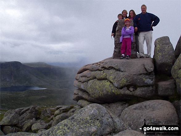 The summit of Lochnagar (Cac Carn Beag), the highest point in The East Mounth - Glen Shee and Mount Keen to Montrose
