All the Little Hills with a Big, Big View as a detailed list
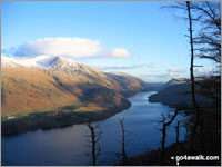
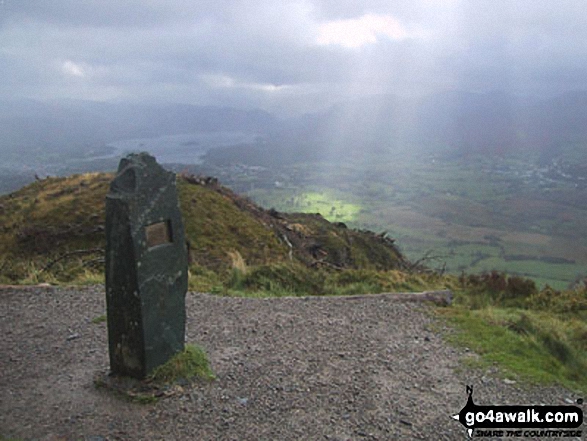
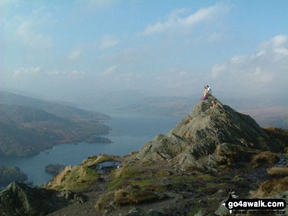
Thirlmere from the summit of Raven Crag
Photo: Ron Anderson
Not everyone wants to walk up huge mountains all of the time.
Indeed, some of Britain's smaller hills offer just as good a view, take less energy to conquer and are not so likely to be shrouded in mist when you get to the summit.
Which, to be honest, would be a bonus!
If you have children and want to take them for a walk, then some of the UK's smaller hills are the perfect way to get your kids smitten by the walking bug and enjoy a healthy day out in the English, Scottish or Welsh countryside.
So here are suggestions for some hills in England, Scotland and Wales with great views that all the family can enjoy.
On our ![]() Facebook and
Facebook and ![]() Twitter Pages we have been regularly suggesting Little Hills with Big, Big Views for a while now. However, not everyone has access to Facebook or Twitter so here's a list of all of them.
Twitter Pages we have been regularly suggesting Little Hills with Big, Big Views for a while now. However, not everyone has access to Facebook or Twitter so here's a list of all of them.
It is not a definitive list - but a growing one. If you have a suggestion for a Little Hill with a Big, Big View that you think all those Mums, Dads, Aunties, Uncles, Boys, Girls, Grandads, Grandmas and the whole the family out there would enjoy walking - then let us know and we will try and add it our our collection.
Oh - and don't forget to upload your photos to our ![]() Facebook Wall so we can everyone see them. Enjoy . . .
Facebook Wall so we can everyone see them. Enjoy . . .
If you include all the Little Hills with Big, Big Views that are also Wainwrights, Deweys, Wainwright Outlying Fells, Marilyns, Bridgets (Hills) and all the Mountains, Tops, Peaks and Hills with a Trig Point on them there are 102 tops to climb, bag & conquer and the highest point is Tudhope Hill at 599m (1,966ft).
To see all Mountains, Peaks, Tops and Hills displayed in different ways - see the options in the left-hand column and towards the bottom of this page.
LOG ON and RELOAD this page to show which Mountains, Peaks, Tops and Hills you have already climbed, bagged & conquered [. . . more]
See this list in: Alphabetical Order
| Height Order‡
To reverse the order select the link again.
Mountain, Peak, Top or Hill:
Bagged
31. Pole Bank (Long Mynd)
516m (1,693ft)
See the location of Pole Bank (Long Mynd) and walks up it on a google Map Pole Bank (Long Mynd) is on interactive maps:
Pole Bank (Long Mynd) is on Peak Bagging Map and Hill Tick List: |
32. Oliver Hill
513m (1,684ft)
See the location of Oliver Hill and walks up it on a google Map Oliver Hill is on interactive maps:
Oliver Hill is on Peak Bagging Map and Hill Tick List: |
33. Whoap
511m (1,677ft)
See the location of Whoap and walks up it on a google Map Whoap is on interactive maps:
Whoap is on Peak Bagging Map and Hill Tick List: *Version including the walk routes marked on it that you need to follow to Walk all 214 Wainwrights in just 59 walks. |
34. Paddy's Pole (Fair Snape Fell)
510m (1,673ft)
See the location of Paddy's Pole (Fair Snape Fell) and walks up it on a google Map Paddy's Pole (Fair Snape Fell) is on interactive maps:
Paddy's Pole (Fair Snape Fell) is on Peak Bagging Map and Hill Tick List: |
35. Cracoe Fell
507m (1,663ft)
See the location of Cracoe Fell and walks up it on a google Map Cracoe Fell is on interactive maps:
Cracoe Fell is on Peak Bagging Map and Hill Tick List: |
36. Shutlingsloe
506m (1,660ft)
See the location of Shutlingsloe and walks up it on a google Map Shutlingsloe is on interactive maps:
Shutlingsloe is on Peak Bagging Map and Hill Tick List: |
37. The Roaches
505m (1,657ft)
See the location of The Roaches and walks up it on a google Map The Roaches is on interactive maps:
The Roaches is on Peak Bagging Map and Hill Tick List: |
38. Dodd (Skiddaw)
502m (1,647ft)
See the location of Dodd (Skiddaw) and walks up it on a google Map Dodd (Skiddaw) is on interactive maps:
Dodd (Skiddaw) is on Peak Bagging Map and Hill Tick List: *Version including the walk routes marked on it that you need to follow to Walk all 214 Wainwrights in just 59 walks. |
39. Mynydd Rhyd-galed
502m (1,647ft)
See the location of Mynydd Rhyd-galed and walks up it on a google Map Mynydd Rhyd-galed is on interactive maps:
Mynydd Rhyd-galed is on Peak Bagging Map and Hill Tick List: |
40. Kisdon
499m (1,638ft)
See the location of Kisdon and walks up it on a google Map Kisdon is on interactive maps:
Kisdon is on Peak Bagging Map and Hill Tick List: |
41. Calver Hill
487m (1,598ft)
See the location of Calver Hill and walks up it on a google Map Calver Hill is on interactive maps:
Calver Hill is on Peak Bagging Map and Hill Tick List: |
42. Skirrid Fawr (Ysgyryd Fawr)
486m (1,595ft)
See the location of Skirrid Fawr (Ysgyryd Fawr) and walks up it on a google Map Skirrid Fawr (Ysgyryd Fawr) is on interactive maps:
Skirrid Fawr (Ysgyryd Fawr) is on Peak Bagging Map and Hill Tick List: |
43. Wansfell Pike
482m (1,582ft)
See the location of Wansfell Pike and walks up it on a google Map Wansfell Pike is on interactive maps:
Wansfell Pike is on Peak Bagging Map and Hill Tick List: *Version including the walk routes marked on it that you need to follow to Walk all 214 Wainwrights in just 59 walks. |
44. Mabbin Crag
482m (1,581ft)
See the location of Mabbin Crag and walks up it on a google Map Mabbin Crag is on interactive maps:
A go4awalk.com Peak Bagging Map and Hill Tick List featuring Mabbin Crag will be available soon. |
45. Dufton Pike
481m (1,579ft)
See the location of Dufton Pike and walks up it on a google Map Dufton Pike is on interactive maps:
Dufton Pike is on Peak Bagging Map and Hill Tick List: |
46. Gowbarrow Fell (Airy Crag)
481m (1,579ft)
See the location of Gowbarrow Fell (Airy Crag) and walks up it on a google Map Gowbarrow Fell (Airy Crag) is on interactive maps:
Gowbarrow Fell (Airy Crag) is on Peak Bagging Map and Hill Tick List: *Version including the walk routes marked on it that you need to follow to Walk all 214 Wainwrights in just 59 walks. |
47. Addlebrough
477m (1,565ft)
See the location of Addlebrough and walks up it on a google Map Addlebrough is on interactive maps:
A go4awalk.com Peak Bagging Map and Hill Tick List featuring Addlebrough will be available soon. |
48. Lose Hill (Ward's Piece)
476m (1,562ft)
See the location of Lose Hill (Ward's Piece) and walks up it on a google Map Lose Hill (Ward's Piece) is on interactive maps:
Lose Hill (Ward's Piece) is on Peak Bagging Map and Hill Tick List: |
49. Fremington Edge
473m (1,552ft)
See the location of Fremington Edge and walks up it on a google Map Fremington Edge is on interactive maps:
Fremington Edge is on Peak Bagging Map and Hill Tick List: |
50. Mount Famine
473m (1,552ft)
See the location of Mount Famine and walks up it on a google Map Mount Famine is on interactive maps:
Mount Famine is on Peak Bagging Map and Hill Tick List: |
51. Blackstone Edge
472m (1,549ft)
See the location of Blackstone Edge and walks up it on a google Map Blackstone Edge is on interactive maps:
Blackstone Edge is on Peak Bagging Map and Hill Tick List: |
52. Whinfell Beacon
472m (1,549ft)
See the location of Whinfell Beacon and walks up it on a google Map Whinfell Beacon is on interactive maps:
A go4awalk.com Peak Bagging Map and Hill Tick List featuring Whinfell Beacon will be available soon. |
53. Winhill Pike (Win Hill)
462m (1,516ft)
See the location of Winhill Pike (Win Hill) and walks up it on a google Map Winhill Pike (Win Hill) is on interactive maps:
Winhill Pike (Win Hill) is on Peak Bagging Map and Hill Tick List: |
54. Raven Crag (Thirlmere)
461m (1,513ft)
See the location of Raven Crag (Thirlmere) and walks up it on a google Map Raven Crag (Thirlmere) is on interactive maps:
Raven Crag (Thirlmere) is on Peak Bagging Map and Hill Tick List: *Version including the walk routes marked on it that you need to follow to Walk all 214 Wainwrights in just 59 walks. |
55. High Neb (Stanage Edge)
458m (1,503ft)
See the location of High Neb (Stanage Edge) and walks up it on a google Map High Neb (Stanage Edge) is on interactive maps:
High Neb (Stanage Edge) is on Peak Bagging Map and Hill Tick List: |
56. Ben A'an
454m (1,490ft)
See the location of Ben A'an and walks up it on a google Map Ben A'an is on interactive maps:
A go4awalk.com Peak Bagging Map and Hill Tick List featuring Ben A'an will be available soon. |
57. Ashway Rocks
452m (1,483ft)
See the location of Ashway Rocks and walks up it on a google Map Ashway Rocks is on interactive maps:
Ashway Rocks is on Peak Bagging Map and Hill Tick List: |
58. Cat Bells (Catbells)
451m (1,480ft)
See the location of Cat Bells (Catbells) and walks up it on a google Map Cat Bells (Catbells) is on interactive maps:
Cat Bells (Catbells) is on Peak Bagging Map and Hill Tick List: *Version including the walk routes marked on it that you need to follow to Walk all 214 Wainwrights in just 59 walks. |
59. Chinley Churn
451m (1,480ft)
See the location of Chinley Churn and walks up it on a google Map Chinley Churn is on interactive maps:
|
60. Great Dove Stone Rocks
450m (1,477ft)
See the location of Great Dove Stone Rocks and walks up it on a google Map Great Dove Stone Rocks is on interactive maps:
Great Dove Stone Rocks is on Peak Bagging Map and Hill Tick List: |
View all 0 Mountains, Peaks, Tops and Hills in Little Hills with a Big, Big ViewThe Peak District:
- On an Interactive Google Map (loads faster)
- On an Interactive Google Map with a list of tops below it (makes it easier to locate a particular top)
- On a Detailed List in:
Alphabetical Order | Height Order - On one page with 'yet-to-be-bagged' listed 1st & then 'already-bagged' tops listed 2nd in:
Alphabetical Order | Height Order (must be logged on) - On one page with 'already-bagged' tops listed 1st & then 'yet-to-be-bagged' tops listed 2nd in:
Alphabetical Order | Height Order (must be logged on)
Is there a Mountain, Peak, Top or Hill missing from the above google map or list?
Let us know an we will add it to our database.

