All The Mountains, Peaks, Tops and Hills in the West Midlands region of England as a detailed list
The West Midlands region of England comprises the traditional counties of Herefordshire, Shropshire, Staffordshire, Warwickshire, West Midlands, Worcestershire and parts of the Peak District National Park.
If you include all the Mountains (Hewitts), the Deweys, the Nuttalls and the Marilyns there are 36 tops to climb, bag & conquer and the highest point is Bleaklow Head (Bleaklow Hill) at 633m (2,077ft).
When logged on, you can mark each Mountain, Peak, Top or Hill as 'bagged' by either:
- if you opt to display the tops in this area using a google map, click or tap on its symbol on the map below. This will open a text window. Click or tap on the 'Record [mountain name] as Bagged, Climbed & Conquered' link towards the bottom of the text window, or
- if you opt to display the tops in this area as a list, click or tap on the red 'not yet' symbol to the right of the name of each 'top'
Either method will open a new page where you can complete all your details such as:
- when you bagged the Mountain, Peak, Top or Hill;
- which route you took
- who you went with
- what the weather was like
- any other comment that will remind you of the day
Once you have completed your details and click or tap the submit button, you will automatically return to this page and the top you bagged will show with a green tick.
NB. None of the above fields are 'mandatory' - you can leave them blank if you wish.
NNB. You also have the option whether to display your peak bagging exploits to other users of this site or keep them private so only you can see them when you are logged on.
Furthermore, since you can also access your Personal Mountain & Hill Bagging Record via go4awalk Mobile you can quickly & easily record, edit and view your achievements - whether you are at home/work on your desktop computer or in the pub/at the top of a mountain with your Mobile Phone. (You can even download your Personal Mountain & Hill Bagging Record as a .csv file for importing into and saving with spreadsheet software like Excel or NeoOffice!)
This facility costs one credit to initially access your personal bagging record. Once accessed, all other interactions, such as recording other Mountains, Peaks, Tops and Hills as 'bagged' or altering an existing bagging record, are free.
Click REGISTER to register and purchase credits.
LOG ON and RELOAD this page to show which Mountains, Peaks, Tops and Hills you have already climbed, bagged & conquered. [ . . . remove this text]
See this list in: Alphabetical Order
| Height Order‡
To reverse the order select the link again.
Mountain, Peak, Top or Hill:
Bagged
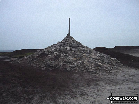
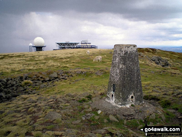
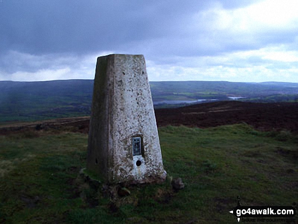
1. Bleaklow Head (Bleaklow Hill)
633m (2,077ft)
Mountain (159th in England, 271st in England & Wales)
Nuttall (212th in England, 364th in England & Wales)
To walk, climb & bag Bleaklow Head (Bleaklow Hill) use any of these easy to follow walks:
See the location of Bleaklow Head (Bleaklow Hill) and walks up it on a google MapBleaklow Head (Bleaklow Hill) is on interactive maps:
OS Explorer (Orange Covers): OL1
OS Landranger (Pink Covers): 110
Bleaklow Head (Bleaklow Hill) is on downloadable PDF you can Print or Save to your Phone:
|
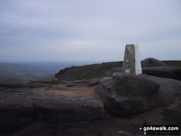
2. Higher Shelf Stones
622m (2,041ft)
Nuttall (229th in England, 398th in England & Wales)
OS Trig Point
To walk, climb & bag Higher Shelf Stones use any of these easy to follow walks:
See the location of Higher Shelf Stones and walks up it on a google MapHigher Shelf Stones is on interactive maps:
OS Explorer (Orange Covers): OL1
OS Landranger (Pink Covers): 110
Higher Shelf Stones is on downloadable PDF you can Print or Save to your Phone:
|
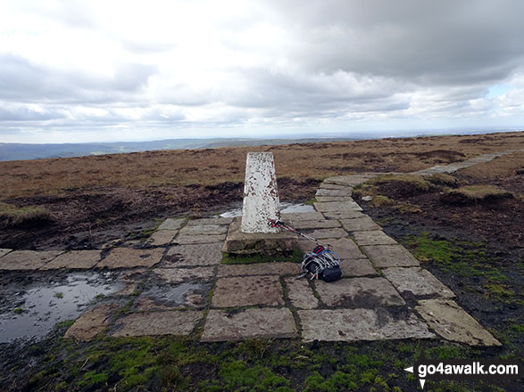
3. Brown Knoll (Edale)
569m (1,867ft)
Dewey (41st in England, 91st in England & Wales)
OS Trig Point
To walk, climb & bag Brown Knoll (Edale) use any of these easy to follow walks:
See the location of Brown Knoll (Edale) and walks up it on a google MapBrown Knoll (Edale) is on interactive maps:
OS Explorer (Orange Covers): OL1
OS Landranger (Pink Covers): 110
Brown Knoll (Edale) is on downloadable PDF you can Print or Save to your Phone:
|
4. Axe Edge (Axe Edge Moor)
551m (1,808ft)
Dewey (69th in England, 159th in England & Wales)
OS Trig Point
To walk, climb & bag Axe Edge (Axe Edge Moor) use this easy to follow walk:
See the location of Axe Edge (Axe Edge Moor) and walks up it on a google MapAxe Edge (Axe Edge Moor) is on interactive maps:
OS Explorer (Orange Covers): OL24
OS Landranger (Pink Covers): 119
Axe Edge (Axe Edge Moor) is on downloadable PDF you can Print or Save to your Phone:
|
5. Lord's Seat (Rushup Edge)
546m (1,791ft)
Dewey (80th in England, 184th in England & Wales)
To walk, climb & bag Lord's Seat (Rushup Edge) use any of these easy to follow walks:
See the location of Lord's Seat (Rushup Edge) and walks up it on a google MapLord's Seat (Rushup Edge) is on interactive maps:
OS Explorer (Orange Covers): OL1
OS Landranger (Pink Covers): 110
Lord's Seat (Rushup Edge) is on downloadable PDF you can Print or Save to your Phone:
|
6. Featherbed Top (Featherbed Moss)
544m (1,785ft)
Dewey (85th in England, 196th in England & Wales)
To walk, climb & bag Featherbed Top (Featherbed Moss) use either of these easy to follow walks:
See the location of Featherbed Top (Featherbed Moss) and walks up it on a google MapFeatherbed Top (Featherbed Moss) is on interactive maps:
OS Explorer (Orange Covers): OL1
OS Landranger (Pink Covers): 110
Featherbed Top (Featherbed Moss) is on downloadable PDF you can Print or Save to your Phone:
|
7. Mill Hill (Ashop Head)
544m (1,785ft)
Dewey (86th in England, 197th in England & Wales)
To walk, climb & bag Mill Hill (Ashop Head) use any of these easy to follow walks:
See the location of Mill Hill (Ashop Head) and walks up it on a google MapMill Hill (Ashop Head) is on interactive maps:
OS Explorer (Orange Covers): OL1
OS Landranger (Pink Covers): 109
Mill Hill (Ashop Head) is on downloadable PDF you can Print or Save to your Phone:
|
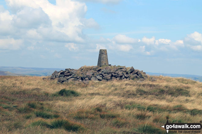
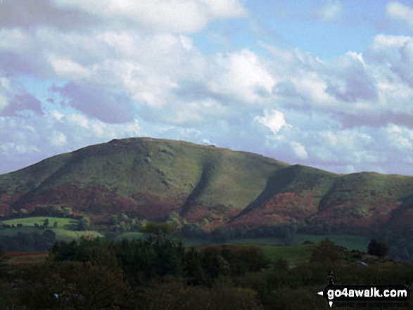
8. Brown Clee Hill (Abdon Burf)
540m (1,772ft)
Dewey (93rd in England, 212th in England & Wales)
Marilyn (66th in England, 895th in GB)
OS Trig Point
Brown Clee Hill (Abdon Burf) is the highest point in the county of Shropshire
To walk, climb & bag Brown Clee Hill (Abdon Burf) use this easy to follow walk:
See the location of Brown Clee Hill (Abdon Burf) and walks up it on a google MapBrown Clee Hill (Abdon Burf) is on interactive maps:
OS Explorer (Orange Covers): 217
OS Landranger (Pink Covers): 137 and
138
Brown Clee Hill (Abdon Burf) is on downloadable PDF you can Print or Save to your Phone:
|
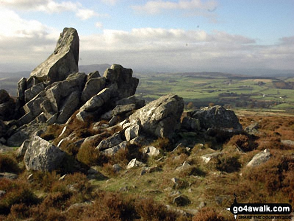
9. Stiperstones (Manstone Rock)
536m (1,759ft)
Dewey (101st in England, 234th in England & Wales)
Marilyn (68th in England, 904th in GB)
OS Trig Point
To walk, climb & bag Stiperstones (Manstone Rock) use either of these easy to follow walks:
See the location of Stiperstones (Manstone Rock) and walks up it on a google MapStiperstones (Manstone Rock) is on interactive maps:
OS Explorer (Orange Covers): 217
OS Landranger (Pink Covers): 137
Stiperstones (Manstone Rock) is on downloadable PDF you can Print or Save to your Phone:
|
10. Titterstone Clee Hill
533m (1,749ft)
Dewey (106th in England, 247th in England & Wales)
Marilyn (69th in England, 912th in GB)
OS Trig Point
To walk, climb & bag Titterstone Clee Hill use this easy to follow walk:
See the location of Titterstone Clee Hill and walks up it on a google MapTitterstone Clee Hill is on interactive maps:
OS Explorer (Orange Covers): 217
OS Landranger (Pink Covers): 137 and
138
Titterstone Clee Hill is on downloadable PDF you can Print or Save to your Phone:
|
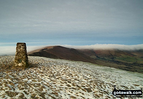
11. Mam Tor
517m (1,696ft)
Dewey (145th in England, 334th in England & Wales)
OS Trig Point
To walk, climb & bag Mam Tor use any of these easy to follow walks:
See the location of Mam Tor and walks up it on a google MapMam Tor is on interactive maps:
OS Explorer (Orange Covers): OL1
OS Landranger (Pink Covers): 110
Mam Tor is on downloadable PDF you can Print or Save to your Phone:
|
12. Pole Bank (Long Mynd)
516m (1,693ft)
Dewey (149th in England, 341st in England & Wales)
Marilyn (74th in England, 948th in GB)
OS Trig Point
To walk, climb & bag Pole Bank (Long Mynd) use this easy to follow walk:
See the location of Pole Bank (Long Mynd) and walks up it on a google MapPole Bank (Long Mynd) is on interactive maps:
OS Explorer (Orange Covers): 217
OS Landranger (Pink Covers): 137
Pole Bank (Long Mynd) is on downloadable PDF you can Print or Save to your Phone:
|
13. Oliver Hill
513m (1,684ft)
Dewey (154th in England, 354th in England & Wales)
To walk, climb & bag Oliver Hill use any of these easy to follow walks:
See the location of Oliver Hill and walks up it on a google MapOliver Hill is on interactive maps:
OS Explorer (Orange Covers): OL24
OS Landranger (Pink Covers): 119
Oliver Hill is on downloadable PDF you can Print or Save to your Phone:
|
14. Brown Clee Hill (Clee Burf)
508m (1,667ft)
Dewey (165th in England, 381st in England & Wales)
To walk, climb & bag Brown Clee Hill (Clee Burf) use this easy to follow walk:
See the location of Brown Clee Hill (Clee Burf) and walks up it on a google MapBrown Clee Hill (Clee Burf) is on interactive maps:
OS Explorer (Orange Covers): 217
OS Landranger (Pink Covers): 137
Brown Clee Hill (Clee Burf) is on downloadable PDF you can Print or Save to your Phone:
|
15. Black Edge (Combs Moss)
507m (1,663ft)
Dewey (169th in England, 391st in England & Wales)
OS Trig Point
To walk, climb & bag Black Edge (Combs Moss) use this easy to follow walk:
See the location of Black Edge (Combs Moss) and walks up it on a google MapBlack Edge (Combs Moss) is on interactive maps:
OS Explorer (Orange Covers): OL24
OS Landranger (Pink Covers): 119
Black Edge (Combs Moss) is on downloadable PDF you can Print or Save to your Phone:
|
16. Combs Head (Combs Moss)
503m (1,650ft)
Dewey (174th in England, 407th in England & Wales)
To walk, climb & bag Combs Head (Combs Moss) use this easy to follow walk:
See the location of Combs Head (Combs Moss) and walks up it on a google MapCombs Head (Combs Moss) is on interactive maps:
OS Explorer (Orange Covers): OL24
OS Landranger (Pink Covers): 119
Combs Head (Combs Moss) is on downloadable PDF you can Print or Save to your Phone:
|
17. Caer Caradoc Hill
459m (1,506ft)
Marilyn (84th in England, 1083rd in GB)
To walk, climb & bag Caer Caradoc Hill use any of these easy to follow walks:
See the location of Caer Caradoc Hill and walks up it on a google MapCaer Caradoc Hill is on interactive maps:
OS Explorer (Orange Covers): 217
OS Landranger (Pink Covers): 137 and
138
Caer Caradoc Hill is on downloadable PDF you can Print or Save to your Phone:
|
18. Heath Mynd
452m (1,483ft)
Marilyn (88th in England, 1100th in GB)
OS Trig Point
We hope to have walks that climb & bag Heath Mynd very soon
See the location of Heath Mynd and walks up it on a google MapHeath Mynd is on interactive maps:
OS Explorer (Orange Covers): 216
OS Landranger (Pink Covers): 137
Heath Mynd is on downloadable PDF you can Print or Save to your Phone:
|
19. Hergest Ridge
426m (1,398ft)
Marilyn (92nd in England, 1151st in GB)
OS Trig Point
We hope to have walks that climb & bag Hergest Ridge very soon
See the location of Hergest Ridge and walks up it on a google MapHergest Ridge is on interactive maps:
OS Explorer (Orange Covers): 201
OS Landranger (Pink Covers): 148
|
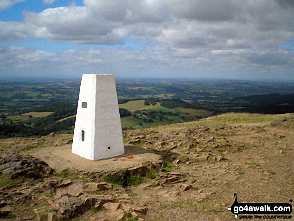
20. Malvern (Worcestershire Beacon)
425m (1,395ft)
Marilyn (93rd in England, 1152nd in GB)
OS Trig Point
Malvern (Worcestershire Beacon) is the highest point in the county of Worcestershire.
To walk, climb & bag Malvern (Worcestershire Beacon) use this easy to follow walk:
See the location of Malvern (Worcestershire Beacon) and walks up it on a google MapMalvern (Worcestershire Beacon) is on interactive maps:
OS Explorer (Orange Covers): 190
OS Landranger (Pink Covers): 150
A downloadable go4awalk.com PDF Peak Bagging Map featuring Malvern (Worcestershire Beacon) will be available soon. |
21. The Wrekin
407m (1,335ft)
Marilyn (96th in England, 1193rd in GB)
OS Trig Point
To walk, climb & bag The Wrekin use this easy to follow walk:
See the location of The Wrekin and walks up it on a google MapThe Wrekin is on interactive maps:
OS Explorer (Orange Covers): 242
OS Landranger (Pink Covers): 127
The Wrekin is on downloadable PDF you can Print or Save to your Phone:
|
22. Bradnor Hill
391m (1,283ft)
Marilyn (99th in England, 1225th in GB)
We hope to have walks that climb & bag Bradnor Hill very soon
See the location of Bradnor Hill and walks up it on a google MapBradnor Hill is on interactive maps:
OS Explorer (Orange Covers): 201
OS Landranger (Pink Covers): 148
|
23. Gun (Staffordshire)
385m (1,264ft)
Marilyn (102nd in England, 1232nd in GB)
OS Trig Point
To walk, climb & bag Gun (Staffordshire) use any of these easy to follow walks:
See the location of Gun (Staffordshire) and walks up it on a google MapGun (Staffordshire) is on interactive maps:
OS Explorer (Orange Covers): OL24
OS Landranger (Pink Covers): 118
Gun (Staffordshire) is on downloadable PDF you can Print or Save to your Phone:
|
24. High Vinnalls
375m (1,230ft)
Marilyn (103rd in England, 1258th in GB)
We hope to have walks that climb & bag High Vinnalls very soon
See the location of High Vinnalls and walks up it on a google MapHigh Vinnalls is on interactive maps:
OS Explorer (Orange Covers): 203
OS Landranger (Pink Covers): 137 and
138 and
148
|
25. Garway Hill
366m (1,201ft)
Marilyn (104th in England, 1275th in GB)
OS Trig Point
We hope to have walks that climb & bag Garway Hill very soon
See the location of Garway Hill and walks up it on a google MapGarway Hill is on interactive maps:
OS Explorer (Orange Covers): 189
OS Landranger (Pink Covers): 161
|
26. Burrow (Shropshire)
358m (1,174ft)
Marilyn (105th in England, 1284th in GB)
We hope to have walks that climb & bag Burrow (Shropshire) very soon
See the location of Burrow (Shropshire) and walks up it on a google MapBurrow (Shropshire) is on interactive maps:
OS Explorer (Orange Covers): 216 and
217
OS Landranger (Pink Covers): 137
Burrow (Shropshire) is on downloadable PDF you can Print or Save to your Phone:
|
27. Callow Hill (Little Stretton)
336m (1,102ft)
Marilyn (112th in England, 1319th in GB)
OS Trig Point
To walk, climb & bag Callow Hill (Little Stretton) use either of these easy to follow walks:
See the location of Callow Hill (Little Stretton) and walks up it on a google MapCallow Hill (Little Stretton) is on interactive maps:
OS Explorer (Orange Covers): 217
OS Landranger (Pink Covers): 137 and
138
Callow Hill (Little Stretton) is on downloadable PDF you can Print or Save to your Phone:
|
28. Wapley Hill
329m (1,079ft)
Marilyn (118th in England, 1332nd in GB)
We hope to have walks that climb & bag Wapley Hill very soon
See the location of Wapley Hill and walks up it on a google MapWapley Hill is on interactive maps:
OS Explorer (Orange Covers): 201
OS Landranger (Pink Covers): 137 and
148 and
149
|
29. Shobdon Hill
326m (1,069ft)
Marilyn (120th in England, 1339th in GB)
OS Trig Point
We hope to have walks that climb & bag Shobdon Hill very soon
See the location of Shobdon Hill and walks up it on a google MapShobdon Hill is on interactive maps:
OS Explorer (Orange Covers): 201
OS Landranger (Pink Covers): 137 and
148 and
149
|
30. View Edge (Weo Edge)
321m (1,054ft)
Marilyn (123rd in England, 1345th in GB)
To walk, climb & bag View Edge (Weo Edge) use either of these easy to follow walks:
See the location of View Edge (Weo Edge) and walks up it on a google MapView Edge (Weo Edge) is on interactive maps:
OS Explorer (Orange Covers): 217
OS Landranger (Pink Covers): 137
View Edge (Weo Edge) is on downloadable PDF you can Print or Save to your Phone:
|
31. Walton Hill
316m (1,037ft)
Marilyn (126th in England, 1354th in GB)
OS Trig Point
We hope to have walks that climb & bag Walton Hill very soon
See the location of Walton Hill and walks up it on a google MapWalton Hill is on interactive maps:
OS Explorer (Orange Covers): 219
OS Landranger (Pink Covers): 139
|
32. Bredon Hill
299m (981ft)
Marilyn (131st in England, 1378th in GB)
We hope to have walks that climb & bag Bredon Hill very soon
See the location of Bredon Hill and walks up it on a google MapBredon Hill is on interactive maps:
OS Explorer (Orange Covers): 190
OS Landranger (Pink Covers): 150
|
33. Burton Hill
294m (964ft)
Marilyn (136th in England, 1389th in GB)
OS Trig Point
We hope to have walks that climb & bag Burton Hill very soon
See the location of Burton Hill and walks up it on a google MapBurton Hill is on interactive maps:
OS Explorer (Orange Covers): 201
OS Landranger (Pink Covers): 148 and
149
|
34. Aconbury Hill (Aconbury Camp)
276m (905ft)
Marilyn (143rd in England, 1424th in GB)
OS Trig Point
We hope to have walks that climb & bag Aconbury Hill (Aconbury Camp) very soon
See the location of Aconbury Hill (Aconbury Camp) and walks up it on a google MapAconbury Hill (Aconbury Camp) is on interactive maps:
OS Explorer (Orange Covers): 189
OS Landranger (Pink Covers): 149
|
35. Seager Hill (Bunker's Hill)
272m (892ft)
Marilyn (145th in England, 1431st in GB)
OS Trig Point
We hope to have walks that climb & bag Seager Hill (Bunker's Hill) very soon
See the location of Seager Hill (Bunker's Hill) and walks up it on a google MapSeager Hill (Bunker's Hill) is on interactive maps:
OS Explorer (Orange Covers): 189
OS Landranger (Pink Covers): 149
|
36. Hegdon Hill (Lower Hegdon)
254m (833ft)
Marilyn (152nd in England, 1458th in GB)
OS Trig Point
We hope to have walks that climb & bag Hegdon Hill (Lower Hegdon) very soon
See the location of Hegdon Hill (Lower Hegdon) and walks up it on a google MapHegdon Hill (Lower Hegdon) is on interactive maps:
OS Explorer (Orange Covers): 202
OS Landranger (Pink Covers): 149
|
Is there a Mountain, Peak, Top or Hill missing from the above google map or list?
Let us know an we will add it to our database.