The Mountains, Peaks, Tops and Hills in Scotland as a detailed list

If you count only the Murdos there are 442 tops to climb, bag & conquer and the highest point is Ben Nevis at 1,344m (4,411ft).


munro
282/0
Munros
corbett
222/0
Corbetts
graham
219/0
Grahams
donald
89/0
Donalds
murdo
442/0
Murdos
marilyn
1218/0
Scottish
Marilyns
Bridget
159/0
Scottish
Bridgets
Trig Point
659/0
Trig
Points


To see all Mountains, Peaks, Tops and Hills displayed in different ways - see the options in the left-hand column and towards the bottom of this page.


LOG ON and RELOAD this page to show which Mountains, Peaks, Tops and Hills you have already climbed, bagged & conquered [. . . more]


Page 7 of 15    Go to page: 1 2 3 4 5 6 7 8 9 10 Next Last


See this list in: Alphabetical Order | Height Order
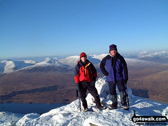
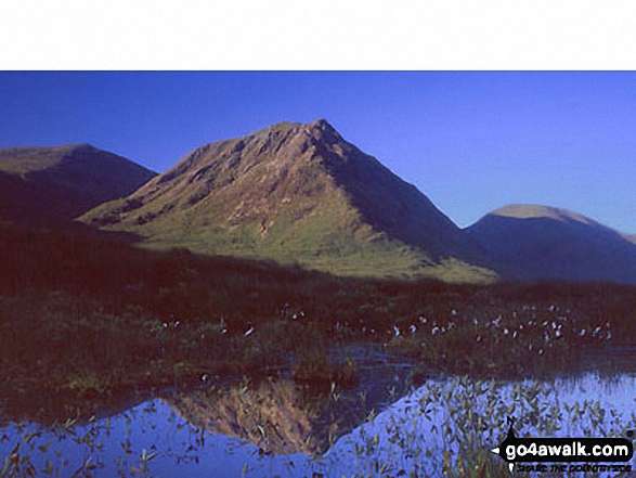
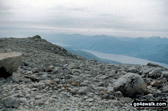
To reverse the order select the link again.


Mountain, Peak, Top or Hill:

Bagged


181. Creag Toll a' Choin

1,005m (3,298ft)


Got a good photo of
Creag Toll a' Choin?

Send it in and we'll publish it here.

Photo
Submission
Details

  • Murdo (0)
  • Marilyn (103rd in Scotland, 105th in GB)
  • After a survey in June 2014, Creag Toll a' Choin became the local Marilyn and Murdo since it is the highest point but Maoile Lunndaidh, 700m to the NE, remains the local Munro for the time being


    We hope to have walks that climb & bag Creag Toll a' Choin very soon

    Google Maps Icon
    See the location of Creag Toll a' Choin and walks up it on a google Map

    Creag Toll a' Choin is on interactive maps:

  • OS Explorer (Orange Covers): 430
  • OS Landranger (Pink Covers): 25

  • 182. Beinn an Dothaidh

    1,004m (3,295ft)

  • Munro (No. 129)
  • Murdo (182nd)
  • Marilyn (104th in Scotland, 106th in GB)

  • We hope to have walks that climb & bag Beinn an Dothaidh very soon

    Google Maps Icon
    See the location of Beinn an Dothaidh and walks up it on a google Map

    Beinn an Dothaidh is on interactive maps:

  • OS Explorer (Orange Covers): 377
  • OS Landranger (Pink Covers): 50

  • A go4awalk.com Peak Bagging Map and Hill Tick List featuring Beinn an Dothaidh will be available soon.


    183. Meall a' Bharr (Carn Mairg)

    1,004m (3,295ft)


    Got a good photo of
    Meall a' Bharr (Carn Mairg)?

    Send it in and we'll publish it here.

    Photo
    Submission
    Details

  • Murdo (185th)

  • We hope to have walks that climb & bag Meall a' Bharr (Carn Mairg) very soon

    Google Maps Icon
    See the location of Meall a' Bharr (Carn Mairg) and walks up it on a google Map

    Meall a' Bharr (Carn Mairg) is on interactive maps:

  • OS Explorer (Orange Covers): OL48 and OL49
  • OS Landranger (Pink Covers): 51

  • A go4awalk.com Peak Bagging Map and Hill Tick List featuring Meall a' Bharr (Carn Mairg) will be available soon.


    184. Sgurr an Lochain (Glen Shiel)

    1,004m (3,295ft)

  • Munro (No. 130)
  • Murdo (183rd)

  • We hope to have walks that climb & bag Sgurr an Lochain (Glen Shiel) very soon

    Google Maps Icon
    See the location of Sgurr an Lochain (Glen Shiel) and walks up it on a google Map

    Sgurr an Lochain (Glen Shiel) is on interactive maps:

  • OS Explorer (Orange Covers): 414
  • OS Landranger (Pink Covers): 33

  • A go4awalk.com Peak Bagging Map and Hill Tick List featuring Sgurr an Lochain (Glen Shiel) will be available soon.


    185. The Devil's Point

    1,004m (3,295ft)

  • Munro (No. 131)
  • Murdo (184th)

  • To walk, climb & bag The Devil's Point use this easy to follow walk:

    Google Maps Icon
    See the location of The Devil's Point and walks up it on a google Map

    The Devil's Point is on interactive maps:

  • OS Explorer (Orange Covers): OL57
  • OS Landranger (Pink Covers): 36 and 43

  • A go4awalk.com Peak Bagging Map and Hill Tick List featuring The Devil's Point will be available soon.


    186. Beinn Achaladair (South Top)

    1,003m (3,293ft)


    Got a good photo of
    Beinn Achaladair (South Top)?

    Send it in and we'll publish it here.

    Photo
    Submission
    Details

  • Murdo (186th)

  • We hope to have walks that climb & bag Beinn Achaladair (South Top) very soon

    Google Maps Icon
    See the location of Beinn Achaladair (South Top) and walks up it on a google Map

    Beinn Achaladair (South Top) is on interactive maps:

  • OS Explorer (Orange Covers): 377
  • OS Landranger (Pink Covers): 50

  • A go4awalk.com Peak Bagging Map and Hill Tick List featuring Beinn Achaladair (South Top) will be available soon.


    187. Sgurr Mor (Glen Kingie)

    1,003m (3,292ft)


    Got a good photo of
    Sgurr Mor (Glen Kingie)?

    Send it in and we'll publish it here.

    Photo
    Submission
    Details

  • Munro (No. 132)
  • Murdo (187th)
  • Marilyn (105th in Scotland, 107th in GB)

  • We hope to have walks that climb & bag Sgurr Mor (Glen Kingie) very soon

    Google Maps Icon
    See the location of Sgurr Mor (Glen Kingie) and walks up it on a google Map

    Sgurr Mor (Glen Kingie) is on interactive maps:

  • OS Explorer (Orange Covers): 398
  • OS Landranger (Pink Covers): 33 and 40

  • A go4awalk.com Peak Bagging Map and Hill Tick List featuring Sgurr Mor (Glen Kingie) will be available soon.


    188. Sail Chaorainn

    1,002m (3,289ft)


    Got a good photo of
    Sail Chaorainn?

    Send it in and we'll publish it here.

    Photo
    Submission
    Details

  • Munro (No. 133)
  • Murdo (188th)

  • We hope to have walks that climb & bag Sail Chaorainn very soon

    Google Maps Icon
    See the location of Sail Chaorainn and walks up it on a google Map

    Sail Chaorainn is on interactive maps:

  • OS Explorer (Orange Covers): 414
  • OS Landranger (Pink Covers): 34

  • A go4awalk.com Peak Bagging Map and Hill Tick List featuring Sail Chaorainn will be available soon.


    189. Sgurr na Carnach

    1,002m (3,289ft)


    Got a good photo of
    Sgurr na Carnach?

    Send it in and we'll publish it here.

    Photo
    Submission
    Details

  • Munro (No. 134)
  • Murdo (189th)

  • We hope to have walks that climb & bag Sgurr na Carnach very soon

    Google Maps Icon
    See the location of Sgurr na Carnach and walks up it on a google Map

    Sgurr na Carnach is on interactive maps:

  • OS Explorer (Orange Covers): 414
  • OS Landranger (Pink Covers): 33

  • A go4awalk.com Peak Bagging Map and Hill Tick List featuring Sgurr na Carnach will be available soon.


    190. Aonach Meadhoin

    1,001m (3,285ft)

  • Munro (No. 136)
  • Murdo (191st)
  • Marilyn (106th in Scotland, 108th in GB)

  • We hope to have walks that climb & bag Aonach Meadhoin very soon

    Google Maps Icon
    See the location of Aonach Meadhoin and walks up it on a google Map

    Aonach Meadhoin is on interactive maps:

  • OS Explorer (Orange Covers): 414
  • OS Landranger (Pink Covers): 33

  • A go4awalk.com Peak Bagging Map and Hill Tick List featuring Aonach Meadhoin will be available soon.


    191. Carn na Coire Mheadhoin (Sail Chaorainn)

    1,001m (3,285ft)


    Got a good photo of
    Carn na Coire Mheadhoin (Sail Chaorainn)?

    Send it in and we'll publish it here.

    Photo
    Submission
    Details

  • Murdo (193rd)

  • We hope to have walks that climb & bag Carn na Coire Mheadhoin (Sail Chaorainn) very soon

    Google Maps Icon
    See the location of Carn na Coire Mheadhoin (Sail Chaorainn) and walks up it on a google Map

    Carn na Coire Mheadhoin (Sail Chaorainn) is on interactive maps:

  • OS Explorer (Orange Covers): 414
  • OS Landranger (Pink Covers): 34

  • A go4awalk.com Peak Bagging Map and Hill Tick List featuring Carn na Coire Mheadhoin (Sail Chaorainn) will be available soon.


    192. Meall Greigh

    1,001m (3,285ft)

  • Munro (No. 135)
  • Murdo (190th)
  • Marilyn (107th in Scotland, 109th in GB)

  • We hope to have walks that climb & bag Meall Greigh very soon

    Google Maps Icon
    See the location of Meall Greigh and walks up it on a google Map

    Meall Greigh is on interactive maps:

  • OS Explorer (Orange Covers): OL48
  • OS Landranger (Pink Covers): 51

  • A go4awalk.com Peak Bagging Map and Hill Tick List featuring Meall Greigh will be available soon.


    193. Sgor an Iubhair (Sgurr a' Mhaim)

    1,001m (3,285ft)


    Got a good photo of
    Sgor an Iubhair (Sgurr a' Mhaim)?

    Send it in and we'll publish it here.

    Photo
    Submission
    Details

  • Murdo (194th)

  • We hope to have walks that climb & bag Sgor an Iubhair (Sgurr a' Mhaim) very soon

    Google Maps Icon
    See the location of Sgor an Iubhair (Sgurr a' Mhaim) and walks up it on a google Map

    Sgor an Iubhair (Sgurr a' Mhaim) is on interactive maps:

  • OS Explorer (Orange Covers): 392
  • OS Landranger (Pink Covers): 41

  • A go4awalk.com Peak Bagging Map and Hill Tick List featuring Sgor an Iubhair (Sgurr a' Mhaim) will be available soon.


    194. Sgorr Dhonuill (Beinn a' Bheithir)

    1,001m (3,285ft)

  • Munro (No. 137)
  • Murdo (192nd)
  • Marilyn (108th in Scotland, 110th in GB)

  • To walk, climb & bag Sgorr Dhonuill (Beinn a' Bheithir) use this easy to follow walk:

    Google Maps Icon
    See the location of Sgorr Dhonuill (Beinn a' Bheithir) and walks up it on a google Map

    Sgorr Dhonuill (Beinn a' Bheithir) is on interactive maps:

  • OS Explorer (Orange Covers): 384
  • OS Landranger (Pink Covers): 41

  • A go4awalk.com Peak Bagging Map and Hill Tick List featuring Sgorr Dhonuill (Beinn a' Bheithir) will be available soon.


    195. Beinn nan Eachan (Meall nan Tarmachan)

    1,000m (3,282ft)

  • Murdo (195th)

  • We hope to have walks that climb & bag Beinn nan Eachan (Meall nan Tarmachan) very soon

    Google Maps Icon
    See the location of Beinn nan Eachan (Meall nan Tarmachan) and walks up it on a google Map

    Beinn nan Eachan (Meall nan Tarmachan) is on interactive maps:

  • OS Explorer (Orange Covers): OL48
  • OS Landranger (Pink Covers): 51

  • A go4awalk.com Peak Bagging Map and Hill Tick List featuring Beinn nan Eachan (Meall nan Tarmachan) will be available soon.


    196. Sgurr Breac

    999m (3,279ft)

  • Munro (No. 139)
  • Murdo (197th)
  • Marilyn (109th in Scotland, 112th in GB)

  • We hope to have walks that climb & bag Sgurr Breac very soon

    Google Maps Icon
    See the location of Sgurr Breac and walks up it on a google Map

    Sgurr Breac is on interactive maps:

  • OS Explorer (Orange Covers): 435 and 436
  • OS Landranger (Pink Covers): 19 and 20

  • A go4awalk.com Peak Bagging Map and Hill Tick List featuring Sgurr Breac will be available soon.


    197. Sgurr Choinnich

    999m (3,279ft)

  • Munro (No. 140)
  • Murdo (198th)

  • We hope to have walks that climb & bag Sgurr Choinnich very soon

    Google Maps Icon
    See the location of Sgurr Choinnich and walks up it on a google Map

    Sgurr Choinnich is on interactive maps:

  • OS Explorer (Orange Covers): 429
  • OS Landranger (Pink Covers): 25

  • A go4awalk.com Peak Bagging Map and Hill Tick List featuring Sgurr Choinnich will be available soon.


    198. Stob Ban (Mamores)

    999m (3,279ft)

  • Munro (No. 138)
  • Murdo (196th)
  • Marilyn (110th in Scotland, 113th in GB)

  • We hope to have walks that climb & bag Stob Ban (Mamores) very soon

    Google Maps Icon
    See the location of Stob Ban (Mamores) and walks up it on a google Map

    Stob Ban (Mamores) is on interactive maps:

  • OS Explorer (Orange Covers): 392
  • OS Landranger (Pink Covers): 41

  • A go4awalk.com Peak Bagging Map and Hill Tick List featuring Stob Ban (Mamores) will be available soon.


    199. Beinn Challuim (South Top)

    998m (3,275ft)

  • Murdo (202nd)

  • We hope to have walks that climb & bag Beinn Challuim (South Top) very soon

    Google Maps Icon
    See the location of Beinn Challuim (South Top) and walks up it on a google Map

    Beinn Challuim (South Top) is on interactive maps:

  • OS Explorer (Orange Covers): OL39 and OL48 and 377
  • OS Landranger (Pink Covers): 50 and 51

  • A go4awalk.com Peak Bagging Map and Hill Tick List featuring Beinn Challuim (South Top) will be available soon.


    200. Ben More Assynt

    998m (3,275ft)

  • Munro (No. 141)
  • Murdo (199th)
  • Marilyn (111th in Scotland, 114th in GB)

  • We hope to have walks that climb & bag Ben More Assynt very soon

    Google Maps Icon
    See the location of Ben More Assynt and walks up it on a google Map

    Ben More Assynt is on interactive maps:

  • OS Explorer (Orange Covers): 442
  • OS Landranger (Pink Covers): 15

  • A go4awalk.com Peak Bagging Map and Hill Tick List featuring Ben More Assynt will be available soon.


    201. Broad Cairn

    998m (3,275ft)


    Got a good photo of
    Broad Cairn?

    Send it in and we'll publish it here.

    Photo
    Submission
    Details

  • Munro (No. 142)
  • Murdo (200th)

  • We hope to have walks that climb & bag Broad Cairn very soon

    Google Maps Icon
    See the location of Broad Cairn and walks up it on a google Map

    Broad Cairn is on interactive maps:

  • OS Explorer (Orange Covers): OL53
  • OS Landranger (Pink Covers): 44

  • A go4awalk.com Peak Bagging Map and Hill Tick List featuring Broad Cairn will be available soon.


    202. Creag a' Chaorainn (Sgurr nan Conbhairean)

    998m (3,275ft)


    Got a good photo of
    Creag a' Chaorainn (Sgurr nan Conbhairean)?

    Send it in and we'll publish it here.

    Photo
    Submission
    Details

  • Murdo (204th)

  • We hope to have walks that climb & bag Creag a' Chaorainn (Sgurr nan Conbhairean) very soon

    Google Maps Icon
    See the location of Creag a' Chaorainn (Sgurr nan Conbhairean) and walks up it on a google Map

    Creag a' Chaorainn (Sgurr nan Conbhairean) is on interactive maps:

  • OS Explorer (Orange Covers): 414
  • OS Landranger (Pink Covers): 34

  • A go4awalk.com Peak Bagging Map and Hill Tick List featuring Creag a' Chaorainn (Sgurr nan Conbhairean) will be available soon.


    203. Meall Dubhag (Sgor Gaoith)

    998m (3,275ft)


    Got a good photo of
    Meall Dubhag (Sgor Gaoith)?

    Send it in and we'll publish it here.

    Photo
    Submission
    Details

  • Murdo (203rd)

  • We hope to have walks that climb & bag Meall Dubhag (Sgor Gaoith) very soon

    Google Maps Icon
    See the location of Meall Dubhag (Sgor Gaoith) and walks up it on a google Map

    Meall Dubhag (Sgor Gaoith) is on interactive maps:

  • OS Explorer (Orange Covers): OL57
  • OS Landranger (Pink Covers): 35

  • A go4awalk.com Peak Bagging Map and Hill Tick List featuring Meall Dubhag (Sgor Gaoith) will be available soon.


    204. Stob Diamh

    998m (3,275ft)

  • Munro (No. 143)
  • Murdo (201st)

  • To walk, climb & bag Stob Diamh use this easy to follow walk:

    Google Maps Icon
    See the location of Stob Diamh and walks up it on a google Map

    Stob Diamh is on interactive maps:

  • OS Explorer (Orange Covers): 377
  • OS Landranger (Pink Covers): 50

  • A go4awalk.com Peak Bagging Map and Hill Tick List featuring Stob Diamh will be available soon.


    205. A' Chailleach (Wester Ross)

    997m (3,272ft)

  • Munro (No. 145)
  • Murdo (206th)
  • Marilyn (112th in Scotland, 115th in GB)

  • We hope to have walks that climb & bag A' Chailleach (Wester Ross) very soon

    Google Maps Icon
    See the location of A' Chailleach (Wester Ross) and walks up it on a google Map

    A' Chailleach (Wester Ross) is on interactive maps:

  • OS Explorer (Orange Covers): 435
  • OS Landranger (Pink Covers): 19

  • A go4awalk.com Peak Bagging Map and Hill Tick List featuring A' Chailleach (Wester Ross) will be available soon.


    206. Glas Bheinn Mhor (Glen Etive)

    997m (3,272ft)

  • Munro (No. 144)
  • Murdo (205th)
  • Marilyn (113th in Scotland, 116th in GB)

  • We hope to have walks that climb & bag Glas Bheinn Mhor (Glen Etive) very soon

    Google Maps Icon
    See the location of Glas Bheinn Mhor (Glen Etive) and walks up it on a google Map

    Glas Bheinn Mhor (Glen Etive) is on interactive maps:

  • OS Explorer (Orange Covers): 377
  • OS Landranger (Pink Covers): 50

  • A go4awalk.com Peak Bagging Map and Hill Tick List featuring Glas Bheinn Mhor (Glen Etive) will be available soon.


    207. Mullach Cadha Rainich (Mam Sodhail)

    996m (3,269ft)


    Got a good photo of
    Mullach Cadha Rainich (Mam Sodhail)?

    Send it in and we'll publish it here.

    Photo
    Submission
    Details

  • Murdo (209th)

  • We hope to have walks that climb & bag Mullach Cadha Rainich (Mam Sodhail) very soon

    Google Maps Icon
    See the location of Mullach Cadha Rainich (Mam Sodhail) and walks up it on a google Map

    Mullach Cadha Rainich (Mam Sodhail) is on interactive maps:

  • OS Explorer (Orange Covers): 414
  • OS Landranger (Pink Covers): 25

  • A go4awalk.com Peak Bagging Map and Hill Tick List featuring Mullach Cadha Rainich (Mam Sodhail) will be available soon.


    208. Spidean Mialach

    996m (3,269ft)


    Got a good photo of
    Spidean Mialach?

    Send it in and we'll publish it here.

    Photo
    Submission
    Details

  • Munro (No. 146)
  • Murdo (207th)
  • Marilyn (114th in Scotland, 117th in GB)

  • We hope to have walks that climb & bag Spidean Mialach very soon

    Google Maps Icon
    See the location of Spidean Mialach and walks up it on a google Map

    Spidean Mialach is on interactive maps:

  • OS Explorer (Orange Covers): 414
  • OS Landranger (Pink Covers): 33

  • A go4awalk.com Peak Bagging Map and Hill Tick List featuring Spidean Mialach will be available soon.


    209. Stob a' Ghlais Choire (Creise)

    996m (3,269ft)

  • Murdo (208th)

  • To walk, climb & bag Stob a' Ghlais Choire (Creise) use either of these easy to follow walks:

    Google Maps Icon
    See the location of Stob a' Ghlais Choire (Creise) and walks up it on a google Map

    Stob a' Ghlais Choire (Creise) is on interactive maps:

  • OS Explorer (Orange Covers): 384
  • OS Landranger (Pink Covers): 41

  • A go4awalk.com Peak Bagging Map and Hill Tick List featuring Stob a' Ghlais Choire (Creise) will be available soon.


    210. An Caisteal (Glen Falloch)

    995m (3,266ft)

  • Munro (No. 147)
  • Murdo (210th)
  • Marilyn (115th in Scotland, 118th in GB)

  • To walk, climb & bag An Caisteal (Glen Falloch) use this easy to follow walk:

    Google Maps Icon
    See the location of An Caisteal (Glen Falloch) and walks up it on a google Map

    An Caisteal (Glen Falloch) is on interactive maps:

  • OS Explorer (Orange Covers): OL39
  • OS Landranger (Pink Covers): 50 and 55

  • A go4awalk.com Peak Bagging Map and Hill Tick List featuring An Caisteal (Glen Falloch) will be available soon.


    Page 7 of 15    Go to page: 1 2 3 4 5 6 7 8 9 10 Next Last


    View all 1674 Mountains, Peaks, Tops and Hills in The Crianlarich Hills Scottish Region : Loch Lomond and The Trossachs to Loch Tay:


    Is there a Mountain, Peak, Top or Hill missing from the above google map or list?

    Let us know an we will add it to our database.


    Do not miss our pick of the Best Walks in Britain


    Follow go4awalk.com on Twitter Follow go4awalk.com on Facebook


    Home


    Find new Friends to go walking with

    Walk all 214 Wainwrights in just 59 Walks. Download GPS Waypoints - Great Walks you must not miss!

    Walk The Yorkshire Three Peaks Challenge Walk - All the Latest Route Information, GPS Waypoints and Split Times to keep you on Schedule

    Walk The British Three Peaks Challenge Walk - All the Latest Route Information and GPS Waypoints

    See our pick of The Best Walks in The Lake District - Great Walks you must not miss!

    Walk our pick of the Best Lake District Ridge Walks - Great Walks you must not miss!

    Walk our pick of the Best Lake District Walks to do in the rain - Great Walks you must not miss!

    Walk our pick of The Best Walks in Snowdonia - Great Walks you must not miss!

    Walk our pick of The Best Ridge Walks in Wales - Walks you must not miss!

    Walk our pick of The Best Walks in The Brecon Beacons - Great Walks you must not miss!

    Walk our pick of The Best Walks in The Yorkshire Dales - Walks you must not miss!

    Walk our pick of The Best Walks in The Peak District - Walks you must not miss!

    Walk our pick of The Best Walks in The Forest of Bowland - Walks you must not miss!

    Walk our pick of The Best Walks in Shropshire - Walks you must not miss!

    Walk our pick of The Best Walks in Cheshire - Walks you must not miss!

    Walk our pick of The Best Walks in Lancashire - Walks you must not miss!

    Not sure where to walk next? Try Peak Bagging - Great Walks you must not miss!

    Not sure where to walk next? Walk part of a National Trail - Great Walks you must not miss!

    Walks with Downloadable and Uploadable GPS Waypoint Data

    Walking Kit and Gear Tested by Walkers

    Full Site Search