The Mountains, Peaks, Tops and Hills in Scotland as a detailed list

If you count only the Murdos there are 442 tops to climb, bag & conquer and the highest point is Ben Nevis at 1,344m (4,411ft).


munro
282/0
Munros
corbett
222/0
Corbetts
graham
219/0
Grahams
donald
89/0
Donalds
murdo
442/0
Murdos
marilyn
1218/0
Scottish
Marilyns
Bridget
159/0
Scottish
Bridgets
Trig Point
659/0
Trig
Points


To see all Mountains, Peaks, Tops and Hills displayed in different ways - see the options in the left-hand column and towards the bottom of this page.


LOG ON and RELOAD this page to show which Mountains, Peaks, Tops and Hills you have already climbed, bagged & conquered [. . . more]


Page 5 of 15    Go to page: 1 2 3 4 5 6 7 8 9 10 Next Last


See this list in: Alphabetical Order | Height Order
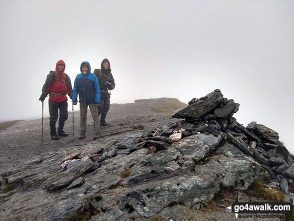
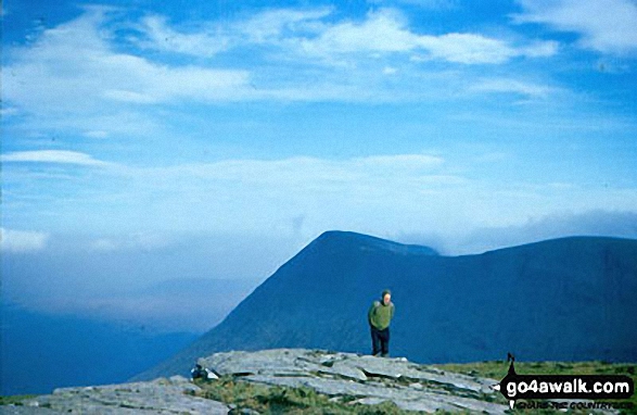
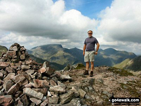
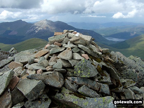
To reverse the order select the link again.


Mountain, Peak, Top or Hill:

Bagged


121. Carn an t-Sagairt Beag

1,044m (3,426ft)


Got a good photo of
Carn an t-Sagairt Beag?

Send it in and we'll publish it here.

Photo
Submission
Details

  • Murdo (123rd)

  • We hope to have walks that climb & bag Carn an t-Sagairt Beag very soon

    Google Maps Icon
    See the location of Carn an t-Sagairt Beag and walks up it on a google Map

    Carn an t-Sagairt Beag is on interactive maps:

  • OS Explorer (Orange Covers): OL53
  • OS Landranger (Pink Covers): 44

  • A go4awalk.com Peak Bagging Map and Hill Tick List featuring Carn an t-Sagairt Beag will be available soon.


    122. Meall nan Tarmachan

    1,044m (3,426ft)

  • Munro (No. 90)
  • Murdo (122nd)
  • Marilyn (68th in Scotland, 70th in GB)

  • We hope to have walks that climb & bag Meall nan Tarmachan very soon

    Google Maps Icon
    See the location of Meall nan Tarmachan and walks up it on a google Map

    Meall nan Tarmachan is on interactive maps:

  • OS Explorer (Orange Covers): OL48
  • OS Landranger (Pink Covers): 51

  • A go4awalk.com Peak Bagging Map and Hill Tick List featuring Meall nan Tarmachan will be available soon.


    123. Stob Coir an Albannaich

    1,044m (3,426ft)

  • Munro (No. 89)
  • Murdo (121st)
  • Marilyn (69th in Scotland, 71st in GB)

  • We hope to have walks that climb & bag Stob Coir an Albannaich very soon

    Google Maps Icon
    See the location of Stob Coir an Albannaich and walks up it on a google Map

    Stob Coir an Albannaich is on interactive maps:

  • OS Explorer (Orange Covers): 377
  • OS Landranger (Pink Covers): 50

  • A go4awalk.com Peak Bagging Map and Hill Tick List featuring Stob Coir an Albannaich will be available soon.


    124. Beinn a' Chaorainn (North Top)

    1,043m (3,423ft)


    Got a good photo of
    Beinn a' Chaorainn (North Top)?

    Send it in and we'll publish it here.

    Photo
    Submission
    Details

  • Murdo (124th)

  • We hope to have walks that climb & bag Beinn a' Chaorainn (North Top) very soon

    Google Maps Icon
    See the location of Beinn a' Chaorainn (North Top) and walks up it on a google Map

    Beinn a' Chaorainn (North Top) is on interactive maps:

  • OS Explorer (Orange Covers): OL55 and 400
  • OS Landranger (Pink Covers): 34

  • A go4awalk.com Peak Bagging Map and Hill Tick List featuring Beinn a' Chaorainn (North Top) will be available soon.


    125. Carn Mairg

    1,041m (3,417ft)


    Got a good photo of
    Carn Mairg?

    Send it in and we'll publish it here.

    Photo
    Submission
    Details

  • Munro (No. 91)
  • Murdo (125th)
  • Marilyn (70th in Scotland, 72nd in GB)

  • We hope to have walks that climb & bag Carn Mairg very soon

    Google Maps Icon
    See the location of Carn Mairg and walks up it on a google Map

    Carn Mairg is on interactive maps:

  • OS Explorer (Orange Covers): OL48 and OL49
  • OS Landranger (Pink Covers): 42 and 51

  • A go4awalk.com Peak Bagging Map and Hill Tick List featuring Carn Mairg will be available soon.


    126. Na Gruagaichean (North West Top)

    1,041m (3,417ft)

  • Murdo (126th)

  • We hope to have walks that climb & bag Na Gruagaichean (North West Top) very soon

    Google Maps Icon
    See the location of Na Gruagaichean (North West Top) and walks up it on a google Map

    Na Gruagaichean (North West Top) is on interactive maps:

  • OS Explorer (Orange Covers): 392
  • OS Landranger (Pink Covers): 41

  • A go4awalk.com Peak Bagging Map and Hill Tick List featuring Na Gruagaichean (North West Top) will be available soon.


    127. Stuc Mor (Sgurr nan Ceathreamhnan)

    1,041m (3,417ft)


    Got a good photo of
    Stuc Mor (Sgurr nan Ceathreamhnan)?

    Send it in and we'll publish it here.

    Photo
    Submission
    Details

  • Murdo (127th)

  • We hope to have walks that climb & bag Stuc Mor (Sgurr nan Ceathreamhnan) very soon

    Google Maps Icon
    See the location of Stuc Mor (Sgurr nan Ceathreamhnan) and walks up it on a google Map

    Stuc Mor (Sgurr nan Ceathreamhnan) is on interactive maps:

  • OS Explorer (Orange Covers): 414
  • OS Landranger (Pink Covers): 25

  • A go4awalk.com Peak Bagging Map and Hill Tick List featuring Stuc Mor (Sgurr nan Ceathreamhnan) will be available soon.


    128. An Riabhachan (West Top)

    1,040m (3,413ft)


    Got a good photo of
    An Riabhachan (West Top)?

    Send it in and we'll publish it here.

    Photo
    Submission
    Details

  • Murdo (129th)

  • We hope to have walks that climb & bag An Riabhachan (West Top) very soon

    Google Maps Icon
    See the location of An Riabhachan (West Top) and walks up it on a google Map

    An Riabhachan (West Top) is on interactive maps:

  • OS Explorer (Orange Covers): 429 and 430
  • OS Landranger (Pink Covers): 25

  • A go4awalk.com Peak Bagging Map and Hill Tick List featuring An Riabhachan (West Top) will be available soon.


    129. Sgurr na Ciche

    1,040m (3,413ft)


    Got a good photo of
    Sgurr na Ciche?

    Send it in and we'll publish it here.

    Photo
    Submission
    Details

  • Munro (No. 92)
  • Murdo (128th)
  • Marilyn (71st in Scotland, 73rd in GB)
  • OS Trig Point

  • We hope to have walks that climb & bag Sgurr na Ciche very soon

    Google Maps Icon
    See the location of Sgurr na Ciche and walks up it on a google Map

    Sgurr na Ciche is on interactive maps:

  • OS Explorer (Orange Covers): 398
  • OS Landranger (Pink Covers): 33 and 40

  • A go4awalk.com Peak Bagging Map and Hill Tick List featuring Sgurr na Ciche will be available soon.


    130. Meall Ghaordaidh

    1,039m (3,410ft)

  • Munro (No. 93)
  • Murdo (130th)
  • Marilyn (72nd in Scotland, 74th in GB)
  • OS Trig Point

  • We hope to have walks that climb & bag Meall Ghaordaidh very soon

    Google Maps Icon
    See the location of Meall Ghaordaidh and walks up it on a google Map

    Meall Ghaordaidh is on interactive maps:

  • OS Explorer (Orange Covers): OL48
  • OS Landranger (Pink Covers): 51

  • A go4awalk.com Peak Bagging Map and Hill Tick List featuring Meall Ghaordaidh will be available soon.


    131. Beinn Achaladair

    1,038m (3,407ft)

  • Munro (No. 94)
  • Murdo (131st)
  • Marilyn (73rd in Scotland, 75th in GB)

  • We hope to have walks that climb & bag Beinn Achaladair very soon

    Google Maps Icon
    See the location of Beinn Achaladair and walks up it on a google Map

    Beinn Achaladair is on interactive maps:

  • OS Explorer (Orange Covers): 377
  • OS Landranger (Pink Covers): 50

  • A go4awalk.com Peak Bagging Map and Hill Tick List featuring Beinn Achaladair will be available soon.


    132. Carn a' Mhaim

    1,037m (3,403ft)

  • Munro (No. 95)
  • Murdo (132nd)
  • Marilyn (74th in Scotland, 76th in GB)

  • We hope to have walks that climb & bag Carn a' Mhaim very soon

    Google Maps Icon
    See the location of Carn a' Mhaim and walks up it on a google Map

    Carn a' Mhaim is on interactive maps:

  • OS Explorer (Orange Covers): OL57
  • OS Landranger (Pink Covers): 36 and 43

  • A go4awalk.com Peak Bagging Map and Hill Tick List featuring Carn a' Mhaim will be available soon.


    133. Sgurr a' Bhealaich Dheirg

    1,036m (3,400ft)

  • Munro (No. 96)
  • Murdo (133rd)
  • Marilyn (75th in Scotland, 77th in GB)

  • We hope to have walks that climb & bag Sgurr a' Bhealaich Dheirg very soon

    Google Maps Icon
    See the location of Sgurr a' Bhealaich Dheirg and walks up it on a google Map

    Sgurr a' Bhealaich Dheirg is on interactive maps:

  • OS Explorer (Orange Covers): 414
  • OS Landranger (Pink Covers): 33

  • A go4awalk.com Peak Bagging Map and Hill Tick List featuring Sgurr a' Bhealaich Dheirg will be available soon.


    134. Sgurr na Lapaich (Loch Affric)

    1,036m (3,400ft)


    Got a good photo of
    Sgurr na Lapaich (Loch Affric)?

    Send it in and we'll publish it here.

    Photo
    Submission
    Details

  • Murdo (134th)

  • We hope to have walks that climb & bag Sgurr na Lapaich (Loch Affric) very soon

    Google Maps Icon
    See the location of Sgurr na Lapaich (Loch Affric) and walks up it on a google Map

    Sgurr na Lapaich (Loch Affric) is on interactive maps:

  • OS Explorer (Orange Covers): 414 and 415
  • OS Landranger (Pink Covers): 25

  • A go4awalk.com Peak Bagging Map and Hill Tick List featuring Sgurr na Lapaich (Loch Affric) will be available soon.


    135. Gleouraich

    1,035m (3,397ft)

  • Munro (No. 97)
  • Murdo (135th)
  • Marilyn (76th in Scotland, 78th in GB)
  • OS Trig Point

  • We hope to have walks that climb & bag Gleouraich very soon

    Google Maps Icon
    See the location of Gleouraich and walks up it on a google Map

    Gleouraich is on interactive maps:

  • OS Explorer (Orange Covers): 414
  • OS Landranger (Pink Covers): 33

  • A go4awalk.com Peak Bagging Map and Hill Tick List featuring Gleouraich will be available soon.


    136. Carn Dearg (Loch Pattack)

    1,034m (3,394ft)

  • Munro (No. 98)
  • Murdo (136th)
  • Marilyn (77th in Scotland, 79th in GB)

  • We hope to have walks that climb & bag Carn Dearg (Loch Pattack) very soon

    Google Maps Icon
    See the location of Carn Dearg (Loch Pattack) and walks up it on a google Map

    Carn Dearg (Loch Pattack) is on interactive maps:

  • OS Explorer (Orange Covers): OL50
  • OS Landranger (Pink Covers): 42

  • A go4awalk.com Peak Bagging Map and Hill Tick List featuring Carn Dearg (Loch Pattack) will be available soon.


    137. Am Bodach (Mamores)

    1,032m (3,387ft)

  • Munro (No. 99)
  • Murdo (137th)
  • Marilyn (78th in Scotland, 80th in GB)

  • We hope to have walks that climb & bag Am Bodach (Mamores) very soon

    Google Maps Icon
    See the location of Am Bodach (Mamores) and walks up it on a google Map

    Am Bodach (Mamores) is on interactive maps:

  • OS Explorer (Orange Covers): 392
  • OS Landranger (Pink Covers): 41

  • A go4awalk.com Peak Bagging Map and Hill Tick List featuring Am Bodach (Mamores) will be available soon.


    138. Beinn Fhada/Ben Attow

    1,032m (3,387ft)


    Got a good photo of
    Beinn Fhada/Ben Attow?

    Send it in and we'll publish it here.

    Photo
    Submission
    Details

  • Munro (No. 100)
  • Murdo (138th)
  • Marilyn (79th in Scotland, 81st in GB)
  • OS Trig Point

  • We hope to have walks that climb & bag Beinn Fhada/Ben Attow very soon

    Google Maps Icon
    See the location of Beinn Fhada/Ben Attow and walks up it on a google Map

    Beinn Fhada/Ben Attow is on interactive maps:

  • OS Explorer (Orange Covers): 414
  • OS Landranger (Pink Covers): 33

  • A go4awalk.com Peak Bagging Map and Hill Tick List featuring Beinn Fhada/Ben Attow will be available soon.


    139. Creag Ghorm a' Bhealaich (Sgurr Fhuar-thuill)

    1,030m (3,380ft)


    Got a good photo of
    Creag Ghorm a' Bhealaich (Sgurr Fhuar-thuill)?

    Send it in and we'll publish it here.

    Photo
    Submission
    Details

  • Murdo (139th)

  • We hope to have walks that climb & bag Creag Ghorm a' Bhealaich (Sgurr Fhuar-thuill) very soon

    Google Maps Icon
    See the location of Creag Ghorm a' Bhealaich (Sgurr Fhuar-thuill) and walks up it on a google Map

    Creag Ghorm a' Bhealaich (Sgurr Fhuar-thuill) is on interactive maps:

  • OS Explorer (Orange Covers): 430
  • OS Landranger (Pink Covers): 25

  • A go4awalk.com Peak Bagging Map and Hill Tick List featuring Creag Ghorm a' Bhealaich (Sgurr Fhuar-thuill) will be available soon.


    140. Ben Oss

    1,029m (3,377ft)


    Got a good photo of
    Ben Oss?

    Send it in and we'll publish it here.

    Photo
    Submission
    Details

  • Munro (No. 101)
  • Murdo (140th)
  • Marilyn (80th in Scotland, 82nd in GB)

  • We hope to have walks that climb & bag Ben Oss very soon

    Google Maps Icon
    See the location of Ben Oss and walks up it on a google Map

    Ben Oss is on interactive maps:

  • OS Explorer (Orange Covers): OL39 and 377
  • OS Landranger (Pink Covers): 50

  • A go4awalk.com Peak Bagging Map and Hill Tick List featuring Ben Oss will be available soon.


    141. Carn an Righ

    1,029m (3,377ft)


    Got a good photo of
    Carn an Righ?

    Send it in and we'll publish it here.

    Photo
    Submission
    Details

  • Munro (No. 103)
  • Murdo (142nd)
  • Marilyn (81st in Scotland, 83rd in GB)

  • We hope to have walks that climb & bag Carn an Righ very soon

    Google Maps Icon
    See the location of Carn an Righ and walks up it on a google Map

    Carn an Righ is on interactive maps:

  • OS Explorer (Orange Covers): OL52
  • OS Landranger (Pink Covers): 43

  • A go4awalk.com Peak Bagging Map and Hill Tick List featuring Carn an Righ will be available soon.


    142. Carn Gorm (Glen Lyon)

    1,029m (3,377ft)


    Got a good photo of
    Carn Gorm (Glen Lyon)?

    Send it in and we'll publish it here.

    Photo
    Submission
    Details

  • Munro (No. 102)
  • Murdo (141st)
  • Marilyn (82nd in Scotland, 84th in GB)
  • OS Trig Point

  • We hope to have walks that climb & bag Carn Gorm (Glen Lyon) very soon

    Google Maps Icon
    See the location of Carn Gorm (Glen Lyon) and walks up it on a google Map

    Carn Gorm (Glen Lyon) is on interactive maps:

  • OS Explorer (Orange Covers): OL48 and OL49
  • OS Landranger (Pink Covers): 42 and 51

  • A go4awalk.com Peak Bagging Map and Hill Tick List featuring Carn Gorm (Glen Lyon) will be available soon.


    143. Meall Coire Choille-rais (Creag Meagaidh)

    1,028m (3,374ft)


    Got a good photo of
    Meall Coire Choille-rais (Creag Meagaidh)?

    Send it in and we'll publish it here.

    Photo
    Submission
    Details

  • Murdo (143rd)

  • We hope to have walks that climb & bag Meall Coire Choille-rais (Creag Meagaidh) very soon

    Google Maps Icon
    See the location of Meall Coire Choille-rais (Creag Meagaidh) and walks up it on a google Map

    Meall Coire Choille-rais (Creag Meagaidh) is on interactive maps:

  • OS Explorer (Orange Covers): OL55
  • OS Landranger (Pink Covers): 34

  • A go4awalk.com Peak Bagging Map and Hill Tick List featuring Meall Coire Choille-rais (Creag Meagaidh) will be available soon.


    144. Sgor Iutharn (Geal-charn)

    1,028m (3,374ft)


    Got a good photo of
    Sgor Iutharn (Geal-charn)?

    Send it in and we'll publish it here.

    Photo
    Submission
    Details

  • Murdo (144th)

  • We hope to have walks that climb & bag Sgor Iutharn (Geal-charn) very soon

    Google Maps Icon
    See the location of Sgor Iutharn (Geal-charn) and walks up it on a google Map

    Sgor Iutharn (Geal-charn) is on interactive maps:

  • OS Explorer (Orange Covers): OL50
  • OS Landranger (Pink Covers): 42

  • A go4awalk.com Peak Bagging Map and Hill Tick List featuring Sgor Iutharn (Geal-charn) will be available soon.


    145. Sgurr a' Mhaoraich

    1,027m (3,371ft)


    Got a good photo of
    Sgurr a' Mhaoraich?

    Send it in and we'll publish it here.

    Photo
    Submission
    Details

  • Munro (No. 104)
  • Murdo (145th)
  • Marilyn (83rd in Scotland, 85th in GB)

  • We hope to have walks that climb & bag Sgurr a' Mhaoraich very soon

    Google Maps Icon
    See the location of Sgurr a' Mhaoraich and walks up it on a google Map

    Sgurr a' Mhaoraich is on interactive maps:

  • OS Explorer (Orange Covers): 414
  • OS Landranger (Pink Covers): 33

  • A go4awalk.com Peak Bagging Map and Hill Tick List featuring Sgurr a' Mhaoraich will be available soon.


    146. Sgurr na Ciste Duibhe

    1,027m (3,371ft)


    Got a good photo of
    Sgurr na Ciste Duibhe?

    Send it in and we'll publish it here.

    Photo
    Submission
    Details

  • Munro (No. 105)
  • Murdo (146th)
  • Marilyn (84th in Scotland, 86th in GB)

  • We hope to have walks that climb & bag Sgurr na Ciste Duibhe very soon

    Google Maps Icon
    See the location of Sgurr na Ciste Duibhe and walks up it on a google Map

    Sgurr na Ciste Duibhe is on interactive maps:

  • OS Explorer (Orange Covers): 414
  • OS Landranger (Pink Covers): 33

  • A go4awalk.com Peak Bagging Map and Hill Tick List featuring Sgurr na Ciste Duibhe will be available soon.


    147. Meall Garbh (Meall nan Tarmachan)

    1,026m (3,367ft)

  • Murdo (147th)

  • We hope to have walks that climb & bag Meall Garbh (Meall nan Tarmachan) very soon

    Google Maps Icon
    See the location of Meall Garbh (Meall nan Tarmachan) and walks up it on a google Map

    Meall Garbh (Meall nan Tarmachan) is on interactive maps:

  • OS Explorer (Orange Covers): OL48
  • OS Landranger (Pink Covers): 51

  • A go4awalk.com Peak Bagging Map and Hill Tick List featuring Meall Garbh (Meall nan Tarmachan) will be available soon.


    148. Beinn Challuim

    1,025m (3,364ft)

  • Munro (No. 106)
  • Murdo (148th)
  • Marilyn (85th in Scotland, 87th in GB)

  • We hope to have walks that climb & bag Beinn Challuim very soon

    Google Maps Icon
    See the location of Beinn Challuim and walks up it on a google Map

    Beinn Challuim is on interactive maps:

  • OS Explorer (Orange Covers): OL48 and 377
  • OS Landranger (Pink Covers): 50

  • A go4awalk.com Peak Bagging Map and Hill Tick List featuring Beinn Challuim will be available soon.


    149. Sgorr Dhearg (Beinn a' Bheithir)

    1,024m (3,361ft)

  • Munro (No. 107)
  • Murdo (149th)
  • Marilyn (86th in Scotland, 88th in GB)
  • OS Trig Point

  • To walk, climb & bag Sgorr Dhearg (Beinn a' Bheithir) use this easy to follow walk:

    Google Maps Icon
    See the location of Sgorr Dhearg (Beinn a' Bheithir) and walks up it on a google Map

    Sgorr Dhearg (Beinn a' Bheithir) is on interactive maps:

  • OS Explorer (Orange Covers): 384
  • OS Landranger (Pink Covers): 41

  • A go4awalk.com Peak Bagging Map and Hill Tick List featuring Sgorr Dhearg (Beinn a' Bheithir) will be available soon.


    150. Mullach an Rathain (Liathach)

    1,023m (3,357ft)

  • Munro (No. 108)
  • Murdo (150th)
  • Marilyn (87th in Scotland, 89th in GB)
  • OS Trig Point

  • We hope to have walks that climb & bag Mullach an Rathain (Liathach) very soon

    Google Maps Icon
    See the location of Mullach an Rathain (Liathach) and walks up it on a google Map

    Mullach an Rathain (Liathach) is on interactive maps:

  • OS Explorer (Orange Covers): 433
  • OS Landranger (Pink Covers): 25

  • A go4awalk.com Peak Bagging Map and Hill Tick List featuring Mullach an Rathain (Liathach) will be available soon.


    Page 5 of 15    Go to page: 1 2 3 4 5 6 7 8 9 10 Next Last


    View all 1674 Mountains, Peaks, Tops and Hills in The Glen Creran Hills Scottish Region : The Achnashellach and Torridon Hills:


    Is there a Mountain, Peak, Top or Hill missing from the above google map or list?

    Let us know an we will add it to our database.


    Follow go4awalk.com on Twitter Follow go4awalk.com on Facebook


    Home


    Find new Friends to go walking with

    Walk all 214 Wainwrights in just 59 Walks. Download GPS Waypoints - Great Walks you must not miss!

    Walk The Yorkshire Three Peaks Challenge Walk - All the Latest Route Information, GPS Waypoints and Split Times to keep you on Schedule

    Walk The British Three Peaks Challenge Walk - All the Latest Route Information and GPS Waypoints

    See our pick of The Best Walks in The Lake District - Great Walks you must not miss!

    Walk our pick of the Best Lake District Ridge Walks - Great Walks you must not miss!

    Walk our pick of the Best Lake District Walks to do in the rain - Great Walks you must not miss!

    Walk our pick of The Best Walks in Snowdonia - Great Walks you must not miss!

    Walk our pick of The Best Ridge Walks in Wales - Walks you must not miss!

    Walk our pick of The Best Walks in The Brecon Beacons - Great Walks you must not miss!

    Walk our pick of The Best Walks in The Yorkshire Dales - Walks you must not miss!

    Walk our pick of The Best Walks in The Peak District - Walks you must not miss!

    Walk our pick of The Best Walks in The Forest of Bowland - Walks you must not miss!

    Walk our pick of The Best Walks in Shropshire - Walks you must not miss!

    Walk our pick of The Best Walks in Cheshire - Walks you must not miss!

    Walk our pick of The Best Walks in Lancashire - Walks you must not miss!

    Not sure where to walk next? Try Peak Bagging - Great Walks you must not miss!

    Not sure where to walk next? Walk part of a National Trail - Great Walks you must not miss!

    Walks with Downloadable and Uploadable GPS Waypoint Data

    Walking Kit and Gear Tested by Walkers

    Full Site Search
    Do not miss our pick of the Best Walks in Britain