Scotland - a fully detailed list of all the Mountains, Peaks, Tops and Hills (Page 3 of 15)
If you count only the Murdos there are 442 tops to climb, bag & conquer and the highest point is Ben Nevis at 1,344m (4,411ft).
To see these Mountains, Peaks, Tops and Hills displayed in different ways - see the options in the left-hand column and towards the bottom of this page.
LOG ON and RELOAD this page to show which Mountains, Peaks, Tops and Hills you have already climbed, bagged & conquered [. . . more details]
See this list in: Alphabetical Order
| Height Order‡
To reverse the order select the link again.
Mountain, Peak, Top or Hill:
Bagged
61. Stob Coire nam Beith (Bidean nam Bian)
1,107m (3,633ft)
Send it in and we'll publish it here.
See the location of Stob Coire nam Beith (Bidean nam Bian) and walks up it on a google Map Stob Coire nam Beith (Bidean nam Bian) is on interactive maps:
A downloadable go4awalk.com PDF Peak Bagging Map featuring Stob Coire nam Beith (Bidean nam Bian) will be available soon. |
62. Caisteil
1,106m (3,630ft)
Caisteil is on interactive maps:
A downloadable go4awalk.com PDF Peak Bagging Map featuring Caisteil will be available soon. |
63. Stob a' Choire Mheadhoin
1,105m (3,627ft)
Send it in and we'll publish it here.
Stob a' Choire Mheadhoin is on interactive maps:
A downloadable go4awalk.com PDF Peak Bagging Map featuring Stob a' Choire Mheadhoin will be available soon. |
64. Stob Dearg (Taynuilt Peak)
1,104m (3,623ft)
Send it in and we'll publish it here.
See the location of Stob Dearg (Taynuilt Peak) and walks up it on a google Map Stob Dearg (Taynuilt Peak) is on interactive maps:
A downloadable go4awalk.com PDF Peak Bagging Map featuring Stob Dearg (Taynuilt Peak) will be available soon. |
65. Beinn Ghlas (Breadalbane)
1,103m (3,620ft)
Beinn Ghlas (Breadalbane) is on interactive maps:
A downloadable go4awalk.com PDF Peak Bagging Map featuring Beinn Ghlas (Breadalbane) will be available soon. |
66. Beinn Eibhinn
1,102m (3,617ft)
Beinn Eibhinn is on interactive maps:
A downloadable go4awalk.com PDF Peak Bagging Map featuring Beinn Eibhinn will be available soon. |
67. Mullach Fraoch-choire
1,102m (3,617ft)
Send it in and we'll publish it here.
Mullach Fraoch-choire is on interactive maps:
A downloadable go4awalk.com PDF Peak Bagging Map featuring Mullach Fraoch-choire will be available soon. |
68. Creise
1,100m (3,610ft)
See the location of Creise and walks up it on a google Map Creise is on interactive maps:
A downloadable go4awalk.com PDF Peak Bagging Map featuring Creise will be available soon. |
69. Clach Leathad (Creise)
1,099m (3,607ft)
See the location of Clach Leathad (Creise) and walks up it on a google Map Clach Leathad (Creise) is on interactive maps:
A downloadable go4awalk.com PDF Peak Bagging Map featuring Clach Leathad (Creise) will be available soon. |
70. Sgurr a' Mhaim
1,099m (3,607ft)
Sgurr a' Mhaim is on interactive maps:
A downloadable go4awalk.com PDF Peak Bagging Map featuring Sgurr a' Mhaim will be available soon. |
71. Sgurr nan Clachan Geala (Sgurr na Lapaich)
1,095m (3,594ft)
Send it in and we'll publish it here.
Sgurr nan Clachan Geala (Sgurr na Lapaich) is on interactive maps:
A downloadable go4awalk.com PDF Peak Bagging Map featuring Sgurr nan Clachan Geala (Sgurr na Lapaich) will be available soon. |
72. Sgurr Choinnich Mor
1,094m (3,591ft)
Sgurr Choinnich Mor is on interactive maps:
A downloadable go4awalk.com PDF Peak Bagging Map featuring Sgurr Choinnich Mor will be available soon. |
73. Sgurr nan Clach Geala
1,093m (3,587ft)
Send it in and we'll publish it here.
Sgurr nan Clach Geala is on interactive maps:
A downloadable go4awalk.com PDF Peak Bagging Map featuring Sgurr nan Clach Geala will be available soon. |
74. Bynack More
1,090m (3,577ft)
See the location of Bynack More and walks up it on a google Map Bynack More is on interactive maps:
A downloadable go4awalk.com PDF Peak Bagging Map featuring Bynack More will be available soon. |
75. Stob Ghabhar
1,090m (3,577ft)
See the location of Stob Ghabhar and walks up it on a google Map Stob Ghabhar is on interactive maps:
A downloadable go4awalk.com PDF Peak Bagging Map featuring Stob Ghabhar will be available soon. |
76. Beinn a' Chlachair
1,087m (3,568ft)
Beinn a' Chlachair is on interactive maps:
A downloadable go4awalk.com PDF Peak Bagging Map featuring Beinn a' Chlachair will be available soon. |
77. Beinn Dearg (The Ullapool Hills)
1,084m (3,558ft)
Send it in and we'll publish it here.
Beinn Dearg (The Ullapool Hills) is on interactive maps:
A downloadable go4awalk.com PDF Peak Bagging Map featuring Beinn Dearg (The Ullapool Hills) will be available soon. |
78. Beinn a' Chaorainn (Cairngorms)
1,083m (3,554ft)
Send it in and we'll publish it here.
Beinn a' Chaorainn (Cairngorms) is on interactive maps:
A downloadable go4awalk.com PDF Peak Bagging Map featuring Beinn a' Chaorainn (Cairngorms) will be available soon. |
79. Cuidhe Crom (Lochnagar)
1,083m (3,554ft)
Send it in and we'll publish it here.
Cuidhe Crom (Lochnagar) is on interactive maps:
A downloadable go4awalk.com PDF Peak Bagging Map featuring Cuidhe Crom (Lochnagar) will be available soon. |
80. Schiehallion
1,083m (3,554ft)
Schiehallion is on interactive maps:
A downloadable go4awalk.com PDF Peak Bagging Map featuring Schiehallion will be available soon. |
81. Sgurr a' Choire Ghlais
1,083m (3,554ft)
Send it in and we'll publish it here.
Sgurr a' Choire Ghlais is on interactive maps:
A downloadable go4awalk.com PDF Peak Bagging Map featuring Sgurr a' Choire Ghlais will be available soon. |
82. Beinn a' Chreachain (Loch Lyon)
1,081m (3,548ft)
Send it in and we'll publish it here.
Beinn a' Chreachain (Loch Lyon) is on interactive maps:
A downloadable go4awalk.com PDF Peak Bagging Map featuring Beinn a' Chreachain (Loch Lyon) will be available soon. |
83. Stob Coire Easain (The Grey Corries)
1,080m (3,545ft)
Send it in and we'll publish it here.
Stob Coire Easain (The Grey Corries) is on interactive maps:
A downloadable go4awalk.com PDF Peak Bagging Map featuring Stob Coire Easain (The Grey Corries) will be available soon. |
84. Beinn Heasgarnich (Beinn Sheasgarnaich)
1,078m (3,538ft)
Beinn Heasgarnich (Beinn Sheasgarnaich) is on interactive maps:
A downloadable go4awalk.com PDF Peak Bagging Map featuring Beinn Heasgarnich (Beinn Sheasgarnaich) will be available soon. |
85. Ben Starav
1,078m (3,538ft)
Ben Starav is on interactive maps:
A downloadable go4awalk.com PDF Peak Bagging Map featuring Ben Starav will be available soon. |
86. Beinn Dorain (Beinn na Caillich)
1,076m (3,531ft)
Beinn Dorain (Beinn na Caillich) is on interactive maps:
A downloadable go4awalk.com PDF Peak Bagging Map featuring Beinn Dorain (Beinn na Caillich) will be available soon. |
87. Stuc Bheag (Sgurr nan Ceathreamhnan)
1,075m (3,528ft)
Send it in and we'll publish it here.
Stuc Bheag (Sgurr nan Ceathreamhnan) is on interactive maps:
A downloadable go4awalk.com PDF Peak Bagging Map featuring Stuc Bheag (Sgurr nan Ceathreamhnan) will be available soon. |
88. An Tudair (Mam Sodhail)
1,074m (3,525ft)
Send it in and we'll publish it here.
An Tudair (Mam Sodhail) is on interactive maps:
A downloadable go4awalk.com PDF Peak Bagging Map featuring An Tudair (Mam Sodhail) will be available soon. |
89. Stob Coire Sgreamhach
1,072m (3,518ft)
See the location of Stob Coire Sgreamhach and walks up it on a google Map Stob Coire Sgreamhach is on interactive maps:
A downloadable go4awalk.com PDF Peak Bagging Map featuring Stob Coire Sgreamhach will be available soon. |
90. Puist Coire Ardair (Creag Meagaidh)
1,071m (3,515ft)
Send it in and we'll publish it here.
Puist Coire Ardair (Creag Meagaidh) is on interactive maps:
A downloadable go4awalk.com PDF Peak Bagging Map featuring Puist Coire Ardair (Creag Meagaidh) will be available soon. |
View these 442 Mountains, Peaks, Tops and Hills:
- On an Interactive Google Map (loads faster)
- On an Interactive Google Map with a list of tops below it.
(makes it easier to locate a particular top) - On a Detailed List in:
Alphabetical Order | Height Order - On one page with 'yet-to-be-bagged' listed 1st & then 'already-bagged' tops listed 2nd in:
Alphabetical Order | Height Order - On one page with 'already-bagged' tops listed 1st & then 'yet-to-be-bagged' tops listed 2nd in:
Alphabetical Order | Height Order
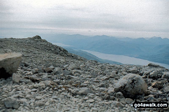 The summit of Ben Nevis in The Glen Roy & Monadhliath MountainsScotland
Photo: John Reed
Is there a Mountain, Peak, Top or Hill missing from the above google map or list?
Let us know an we will add it to our database.

