The Isle of Man - a fully detailed list of all the Mountains, Peaks, Tops and Hills (Page 17 of 41)
If you count only the Marilyns there are 1218 tops to climb, bag & conquer and the highest point is Ben Nevis at 1,344m (4,411ft).
To see these Mountains, Peaks, Tops and Hills displayed in different ways - see the options in the left-hand column and towards the bottom of this page.
LOG ON and RELOAD this page to show which Mountains, Peaks, Tops and Hills you have already climbed, bagged & conquered [. . . more details]
Page 17 of 41 First Previous 11 12 13 14 15 16 17 18 19 20 Next Last |
See this list in: Alphabetical Order
| Height Order‡
To reverse the order select the link again.
Mountain, Peak, Top or Hill:
Bagged
481. Mullach Coire nan Geur-oirean
727m (2,386ft)
Send it in and we'll publish it here.
Mullach Coire nan Geur-oirean is on interactive maps:
A downloadable go4awalk.com PDF Peak Bagging Map featuring Mullach Coire nan Geur-oirean will be available soon. |
482. Mam Hael (Beinn Bhreac)
726m (2,382ft)
Send it in and we'll publish it here.
Mam Hael (Beinn Bhreac) is on interactive maps:
A downloadable go4awalk.com PDF Peak Bagging Map featuring Mam Hael (Beinn Bhreac) will be available soon. |
483. Beinn a' Chearcaill
725m (2,379ft)
Send it in and we'll publish it here.
Beinn a' Chearcaill is on interactive maps:
A downloadable go4awalk.com PDF Peak Bagging Map featuring Beinn a' Chearcaill will be available soon. |
484. Meall nan Damh (Cona Glen)
723m (2,373ft)
Send it in and we'll publish it here.
Meall nan Damh (Cona Glen) is on interactive maps:
A downloadable go4awalk.com PDF Peak Bagging Map featuring Meall nan Damh (Cona Glen) will be available soon. |
485. Creagan a' Chaise
722m (2,370ft)
Creagan a' Chaise is on interactive maps:
A downloadable go4awalk.com PDF Peak Bagging Map featuring Creagan a' Chaise will be available soon. |
486. Meall Mheinnidh
722m (2,370ft)
Meall Mheinnidh is on interactive maps:
A downloadable go4awalk.com PDF Peak Bagging Map featuring Meall Mheinnidh will be available soon. |
487. Ben Cleuch
721m (2,366ft)
Ben Cleuch is on interactive maps:
A downloadable go4awalk.com PDF Peak Bagging Map featuring Ben Cleuch will be available soon. |
488. Ben Stack
721m (2,366ft)
Ben Stack is on interactive maps:
A downloadable go4awalk.com PDF Peak Bagging Map featuring Ben Stack will be available soon. |
489. Mullach Buidhe (Arran)
721m (2,366ft)
Mullach Buidhe (Arran) is on interactive maps:
A downloadable go4awalk.com PDF Peak Bagging Map featuring Mullach Buidhe (Arran) will be available soon. |
490. Stob Mhic Bheathain
721m (2,366ft)
Send it in and we'll publish it here.
Stob Mhic Bheathain is on interactive maps:
A downloadable go4awalk.com PDF Peak Bagging Map featuring Stob Mhic Bheathain will be available soon. |
491. The Buck (Strathbogie)
721m (2,366ft)
Send it in and we'll publish it here.
The Buck (Strathbogie) is on interactive maps:
A downloadable go4awalk.com PDF Peak Bagging Map featuring The Buck (Strathbogie) will be available soon. |
492. Meall Buidhe (Glen Ogle)
719m (2,360ft)
Send it in and we'll publish it here.
Meall Buidhe (Glen Ogle) is on interactive maps:
A downloadable go4awalk.com PDF Peak Bagging Map featuring Meall Buidhe (Glen Ogle) will be available soon. |
493. The Storr
719m (2,360ft)
See the location of The Storr and walks up it on a google Map The Storr is on interactive maps:
A downloadable go4awalk.com PDF Peak Bagging Map featuring The Storr will be available soon. |
494. An Stac (South Morar)
718m (2,356ft)
Send it in and we'll publish it here.
An Stac (South Morar) is on interactive maps:
A downloadable go4awalk.com PDF Peak Bagging Map featuring An Stac (South Morar) will be available soon. |
495. Ben Buie
717m (2,353ft)
Ben Buie is on interactive maps:
A downloadable go4awalk.com PDF Peak Bagging Map featuring Ben Buie will be available soon. |
496. Lamachan Hill
717m (2,353ft)
Lamachan Hill is on interactive maps:
A downloadable go4awalk.com PDF Peak Bagging Map featuring Lamachan Hill will be available soon. |
497. Beinn Mheadhonach (Loch Etive)
715m (2,347ft)
Send it in and we'll publish it here.
Beinn Mheadhonach (Loch Etive) is on interactive maps:
A downloadable go4awalk.com PDF Peak Bagging Map featuring Beinn Mheadhonach (Loch Etive) will be available soon. |
498. Cnap Chaochan Aitinn
715m (2,347ft)
Send it in and we'll publish it here.
Cnap Chaochan Aitinn is on interactive maps:
A downloadable go4awalk.com PDF Peak Bagging Map featuring Cnap Chaochan Aitinn will be available soon. |
499. Beinn Chaorach (Glen Luss)
713m (2,340ft)
Beinn Chaorach (Glen Luss) is on interactive maps:
A downloadable go4awalk.com PDF Peak Bagging Map featuring Beinn Chaorach (Glen Luss) will be available soon. |
500. Creag Mhor (Ben Armine Forest)
713m (2,340ft)
Send it in and we'll publish it here.
Creag Mhor (Ben Armine Forest) is on interactive maps:
A downloadable go4awalk.com PDF Peak Bagging Map featuring Creag Mhor (Ben Armine Forest) will be available soon. |
501. Creag Ruadh (Glen Lednock)
712m (2,336ft)
Send it in and we'll publish it here.
Creag Ruadh (Glen Lednock) is on interactive maps:
A downloadable go4awalk.com PDF Peak Bagging Map featuring Creag Ruadh (Glen Lednock) will be available soon. |
502. Beinn nan Ramh
711m (2,334ft)
Beinn nan Ramh is on interactive maps:
A downloadable go4awalk.com PDF Peak Bagging Map featuring Beinn nan Ramh will be available soon. |
503. Cairnsmore of Fleet
711m (2,334ft)
Cairnsmore of Fleet is on interactive maps:
A downloadable go4awalk.com PDF Peak Bagging Map featuring Cairnsmore of Fleet will be available soon. |
504. Tinto
711m (2,333ft)
Tinto is on interactive maps:
A downloadable go4awalk.com PDF Peak Bagging Map featuring Tinto will be available soon. |
505. Druim Fada (Loch Hourn)
711m (2,332ft)
Send it in and we'll publish it here.
Druim Fada (Loch Hourn) is on interactive maps:
A downloadable go4awalk.com PDF Peak Bagging Map featuring Druim Fada (Loch Hourn) will be available soon. |
506. Beinn Tharsuinn (Crom Loch)
710m (2,330ft)
Send it in and we'll publish it here.
Beinn Tharsuinn (Crom Loch) is on interactive maps:
A downloadable go4awalk.com PDF Peak Bagging Map featuring Beinn Tharsuinn (Crom Loch) will be available soon. |
507. Carn a Ghille Chearr (Cromdale)
710m (2,330ft)
Send it in and we'll publish it here.
Carn a Ghille Chearr (Cromdale) is on interactive maps:
A downloadable go4awalk.com PDF Peak Bagging Map featuring Carn a Ghille Chearr (Cromdale) will be available soon. |
508. Meith Bheinn
710m (2,330ft)
Meith Bheinn is on interactive maps:
A downloadable go4awalk.com PDF Peak Bagging Map featuring Meith Bheinn will be available soon. |
509. Beinn a' Mhanaich
709m (2,327ft)
Beinn a' Mhanaich is on interactive maps:
A downloadable go4awalk.com PDF Peak Bagging Map featuring Beinn a' Mhanaich will be available soon. |
510. Beinn Dearg Mhor (Skye)
709m (2,327ft)
Send it in and we'll publish it here.
Beinn Dearg Mhor (Skye) is on interactive maps:
A downloadable go4awalk.com PDF Peak Bagging Map featuring Beinn Dearg Mhor (Skye) will be available soon. |
Page 17 of 41 First Previous 11 12 13 14 15 16 17 18 19 20 Next Last |
View these 1218 Mountains, Peaks, Tops and Hills:
- On an Interactive Google Map (loads faster)
- On an Interactive Google Map with a list of tops below it.
(makes it easier to locate a particular top) - On a Detailed List in:
Alphabetical Order | Height Order - On one page with 'yet-to-be-bagged' listed 1st & then 'already-bagged' tops listed 2nd in:
Alphabetical Order | Height Order - On one page with 'already-bagged' tops listed 1st & then 'yet-to-be-bagged' tops listed 2nd in:
Alphabetical Order | Height Order
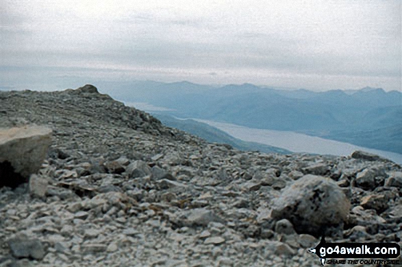 The summit of Ben Nevis in The Inner Hebrides (Western Isles)Scotland
Photo: John Reed
Is there a Mountain, Peak, Top or Hill missing from the above google map or list?
Let us know an we will add it to our database.

